more stats
1.4 miles
Distance
46 ft
Climb
-330 ft
Descent
00:07:55
Avg time
-285 ft
Altitude change
135 ft
Altitude min
423 ft
Altitude max
423 ft
Altitude start
138 ft
Altitude end
-4%
Grade
-30%
Grade max
13%
Grade min
1,280 ft
Distance climb
5,276 ft
Distance down
577 ft
Distance flat
00:07:55
Avg time

Petes Details

  • Activities
    • Mountain Bike
    • E-Bike
  • Riding Area
  • Ref Number
    #3
  • AKA
    Petes Extension
  • Difficulty Rating
  • Voted Difficulty
    Blue (1 vote)
  • Local Popularity
    100 in Mountain Biking [+]
    • 95 in E-Biking
  • Global Ranking
    #395 in Mountain Biking [+]
    • #1946 in E-Biking
  • Trail Type
    Singletrack
  • Bike Type
    AM, XC
  • Direction
    Downhill Primary
    Popular Direction Shown
  • Climb Difficulty
    Blue
  • Physical Rating
    Moderate
  • Trail Visibility
    Always easy to follow
  • eBike Allowed
    Yes up to Class 1
  • Land Owner

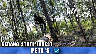
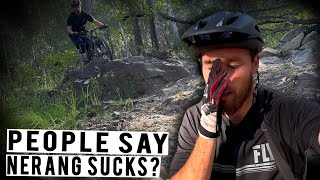
Petes has a long history and its character has changed a bit over the years. It is mostly flowy with some very modest jumps and berms in places, and retains most of this character. Since it became part of the QPWS approved trails the designated trail care body have made some changes, mainly to the lower part after the switchback near the fire road crossing. The formerly very mild jumps on this section have been made more aggressive and one has had a kicker added with a more defined gap. Watch out for it. Without the right line you'll go bush In the main though Petes has kept it's original character with some additions that many will love.

Local Trail Association
Traditionally Indigenous Territory

Recent Activity on Trail

Past Week
  • 9 rides
  • 16.1 km average
6 Months
  • 144 rides
  • 15.9 km avg distance
All
  • 3,533 rides
  • Last: Jul 2, 2026
c1c2c3c4
January
February
March
April
May
June
July
August
September
October
November
December
Status:
on Jul 4, 2026
Ideal
Avg: 4.23 (20 votes)
Your vote: 0

view (19,712)
close
3D
Trail Conditions
  • Unknown
  • Snow Groomed
  • Snow Packed
  • Snow Covered
  • Snow Cover Partial
  • Freeze/thaw Cycle
  • Icy
  • Prevalent Mud
  • Wet
  • Variable
  • Ideal
  • Dry
  • Very Dry
Trail Flow (Ridden Direction)
Trailforks scans users ridelogs to determine the most popular direction each trail is ridden. A good flowing trail network will have most trails flowing in a single direction according to their intension.
The colour categories are based on what percentage of riders are riding a trail in its intended direction.
  • > 96%
  • > 90%
  • > 80%
  • > 70%
  • > 50%
  • < 50%
  • bi-directional trail
  • no data
Trail Last Ridden
Trailforks scans ridelogs to determine the last time a trail was ridden.
  • < 2 days
  • < 1 week
  • < 2 weeks
  • < 1 month
  • < 6 months
  • > 6 months
Trail Ridden Direction
The intended direction a trail should be ridden.
  • Downhill Only
  • Downhill Primary
  • Both Directions
  • Uphill Primary
  • Uphill Only
  • One Direction
Contribute Details
Colors indicate trail is missing specified detail.
  • Description
  • Photos
  • Description & Photos
  • Videos
Trail Popularity ?
Trailforks scans ridelogs to determine which trails are ridden the most in the last 9 months. Trails are compared with nearby trails in the same city region with a possible 25 colour shades. Think of this as a heatmap, more rides = more kinetic energy = warmer colors.
  • most popular
  • popular
  • less popular
  • not popular
ATV/ORV/OHV Filter
Max Vehicle Width
inches
US Cell Coverage
Legend
cell carrier legend

Radar Time
Activity Recordings
Trailforks uses anonymized public activity data. ?
Activity Recordings
Trailforks uses anonymized public activity data. ?
Personal Heatmap
Activity Types
all / none
Options
2
Date range month
Winter Trails
Warning A routing network for winter maps does not exist. Selecting trails using the winter trails layer has been disabled.
Missing Trails
Most Popular
Least Popular
Trails are colored based on popularity. The more popular a trail is, the more red. Less popular trails trend towards green.
Jump Magnitude Heatmap
Heatmap of where riders jump on trails. Zoom in to see individual jumps, click circles to view jump details.
BC Backroad Status

Service Road Atlas is a free to use, community-driven service for viewing and creating reports on the numerous back-country service roads around B.C. and Alberta.

map legend
Slope Aspect
Direction the slope faces
Flat N NE E SE S SW W NW
Trails Deemphasized
Trails are shown in grey.
disable
Only show trails with no bike usage.
Enable
Suggested Layers
Based on selected activity type

    Save the current map location and zoom level as your default home location whenever this page is loaded.

    Save
        Directions to petes trailhead (-27.970180, 153.332310)

        Photos

        38 more »
        74 |
        Oct 12, 2025 @ 9:19pm
        Oct 12, 2025
        99 |
        Aug 6, 2020 @ 6:06am
        Aug 6, 2020
        141 |
        Aug 6, 2020 @ 6:06am
        Aug 6, 2020
        142 |
        Jul 26, 2020 @ 5:22pm
        Jul 26, 2020

        Videos

        12 more »
        youtuber PETES | Nerang MTB | RAW WEDNESDAYS
        7:53 | 317 | May 23, 2023 , Gold Coast
        youtuber Does this MTB system suck? | Nerang National Park
        10:29 | 257 | Mar 27, 2023 , Gold Coast
        Pete's - Nerang MTB Park
        8:00 | 307 | Oct 26, 2022 , Gold Coast
        Petes Trail, Nerang state forest
        7:10 | 920 | Sep 27, 2020 , Gold Coast

        Routes with this trail

        4.0 14 miles 1,734 ft 10 Loop
        This particular loop takes you out to the back of Nerang State Forest to the beautiful Lost World single...
        2.0 9 miles 1,229 ft 10
        Suggested loop while closed
        5 miles 663 ft 4
        Casuarina Up and Down Comm Games 1 Casuarina Up and Down Comm Games 1

        10 Reviews & Comments


        We hope you've been enjoying Trailforks!

        Create a FREE account to view trail comments and much more.

        • By aaroncobTF Pro & contributors
        • #49661 - 8,337 views

        Frequently Asked Questions About Petes

        Where is Petes located?
        Petes is located in Nerang National Park, Gold Coast, Australia. It is part of the Nerang National Park trail network. The trailhead is located at coordinates -27.97018, 153.33231.
        How hard is Petes?
        Petes is rated as Blue difficulty. The physical rating is Moderate. The average grade is 4%. The climb difficulty is rated Blue.
        What is the elevation gain for Petes?
        Petes has 46 ft of elevation gain. The trail has 330 ft of elevation descent. The elevation ranges from 135 ft to 423 ft.
        Is Petes a point to point trail?
        Petes is not a point to point trail. The direction is Downhill Primary. The trail type is singletrack.

        Hit the Trail

        Open in App

        Get this trail on your phone instantly.
        open trail in app

        Download Trail

        Save to wishlist, Garmin & download.
        save the trail

        Find Related Routes

        Find routes and users activities that include this trail.
        find routes for this trail

        You must enter a description before submitting.