more stats
1.1 miles
Distance
79 ft
Climb
-78 ft
Descent
00:15:21
Avg time
-1 ft
Altitude change
2,121 ft
Altitude min
2,186 ft
Altitude max
2,122 ft
Altitude start
2,123 ft
Altitude end
-11.5%
Grade max
9.9%
Grade min
2,014 ft
Distance climb
2,480 ft
Distance down
1,276 ft
Distance flat
00:15:21
Avg time

Phantom Details

  • Activities
    • Mountain Bike
    • E-Bike
    • Hike
    • Trail Running
  • Riding Area
    Gold Canyon
    , Arizona
  • Difficulty Rating
  • Voted Difficulty
    Black Diamond (1 vote)
  • Local Popularity
    90 in Mountain Biking [+]
    • 100 in E-Biking
    • 5 in Trail Running
    • 55 in Hiking
  • Global Ranking
    #6803 in Mountain Biking [+]
    • #18147 in E-Biking
    • #136381 in Trail Running
    • #96356 in Hiking
  • Trail Type
    Singletrack
  • Bike Type
    AM, XC
  • Direction
    Downhill Primary
    Popular Direction Shown
  • Climb Difficulty
    Blue
  • Physical Rating
    Moderate
  • Dogs Allowed
    Yes
  • eBike Allowed
    Yes up to Class 1
  • TTFs on Trail
    Drop, Rock Face, Rock Garden
  • Year Opened
    2016

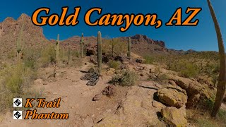
This is another great addition to the Gold Canyon trail system. One-way trail starting at the north end this trail has all the signature Gold Canyon drainage flow, but this time adds in a few more technical obstacles. This is an intermediate-advanced trail.

Local Trail Association
Traditionally Indigenous Territory

Recent Activity on Trail

Past Week
  • 0 rides
  •  
6 Months
  • 65 rides
  • 17 miles avg distance
All
  • 650 rides
  • Last: May 27, 2026
c1c2c3c4
January
February
March
April
May
June
July
August
September
October
November
December
update trails status or condition

Phantom Trail Reports

statusdatedescription
Dec 29, 2024 @ 12:10pm
Dec 29, 2024
First time on this trail. Very fun with some more technical parts.
Oct 21, 2024 @ 10:06am
Oct 21, 2024
Dec 10, 2023 @ 5:10am
Dec 10, 2023
Bit loose and sandy
Nov 5, 2023 @ 2:39am
Nov 5, 2023
Apr 3, 2023 @ 9:13pm
Apr 3, 2023
more »
Status:
on Dec 29, 2024
Dry
Avg: 4.26 (9 votes)
Your vote: 0

view (2,345)
close
3D
Trail Conditions
  • Unknown
  • Snow Groomed
  • Snow Packed
  • Snow Covered
  • Snow Cover Partial
  • Freeze/thaw Cycle
  • Icy
  • Prevalent Mud
  • Wet
  • Variable
  • Ideal
  • Dry
  • Very Dry
Trail Flow (Ridden Direction)
Trailforks scans users ridelogs to determine the most popular direction each trail is ridden. A good flowing trail network will have most trails flowing in a single direction according to their intension.
The colour categories are based on what percentage of riders are riding a trail in its intended direction.
  • > 96%
  • > 90%
  • > 80%
  • > 70%
  • > 50%
  • < 50%
  • bi-directional trail
  • no data
Trail Last Ridden
Trailforks scans ridelogs to determine the last time a trail was ridden.
  • < 2 days
  • < 1 week
  • < 2 weeks
  • < 1 month
  • < 6 months
  • > 6 months
Trail Ridden Direction
The intended direction a trail should be ridden.
  • Downhill Only
  • Downhill Primary
  • Both Directions
  • Uphill Primary
  • Uphill Only
  • One Direction
Contribute Details
Colors indicate trail is missing specified detail.
  • Description
  • Photos
  • Description & Photos
  • Videos
Trail Popularity ?
Trailforks scans ridelogs to determine which trails are ridden the most in the last 9 months. Trails are compared with nearby trails in the same city region with a possible 25 colour shades. Think of this as a heatmap, more rides = more kinetic energy = warmer colors.
  • most popular
  • popular
  • less popular
  • not popular
ATV/ORV/OHV Filter
Max Vehicle Width
inches
US Cell Coverage
Legend
cell carrier legend

Radar Time
Activity Recordings
Trailforks uses anonymized public activity data. ?
Activity Recordings
Trailforks uses anonymized public activity data. ?
Personal Heatmap
Activity Types
all / none
Options
2
Date range month
Winter Trails
Warning A routing network for winter maps does not exist. Selecting trails using the winter trails layer has been disabled.
Missing Trails
Most Popular
Least Popular
Trails are colored based on popularity. The more popular a trail is, the more red. Less popular trails trend towards green.
Jump Magnitude Heatmap
Heatmap of where riders jump on trails. Zoom in to see individual jumps, click circles to view jump details.
BC Backroad Status

Service Road Atlas is a free to use, community-driven service for viewing and creating reports on the numerous back-country service roads around B.C. and Alberta.

map legend
Slope Aspect
Direction the slope faces
Flat N NE E SE S SW W NW
Trails Deemphasized
Trails are shown in grey.
disable
Only show trails with no bike usage.
Enable
Suggested Layers
Based on selected activity type

    Save the current map location and zoom level as your default home location whenever this page is loaded.

    Save
        Directions to phantom trailhead (33.380840, -111.390990)

        Photos

        4 more »
        154 |
        May 13, 2020 @ 12:13pm
        May 13, 2020
        300 |
        Nov 26, 2019 @ 11:46am
        Nov 26, 2019
        148 |
        Nov 25, 2018 @ 7:40am
        Nov 25, 2018
        211 |
        May 5, 2017 @ 6:32am
        May 5, 2017

        Videos

        2 more »
        youtuber Best expert MTB Trail in Gold Canyon, AZ -...
        9:51 | 70 | Mar 13, 2026 , Gold Canyon
        youtuber K-Trail and Phantom
        9:51 | 75 | Mar 13, 2026 , Gold Canyon
        Phantom Pima DH run
        0:41 | 363 | Dec 5, 2015 , Gold Canyon

        Routes with this trail

        4.2 13 miles 1,188 ft 11
        Do Hoodoo and Cajones, then the rest of the stuff. Finish off with before heading out.
        4.0 30 miles 2,771 ft 56 Loop
        This is a route showcasing all of the technical trails in the trail system with the exception of portions...
        231 miles 14,197 ft 56 Loop
        This is a 5 day - 4 night 230 mile bikepacking route encompassing the popular trails of the East Valley...

        3 Reviews & Comments


        We hope you've been enjoying Trailforks!

        Create a FREE account to view trail comments and much more.

        • By schillingsworthTF Pro TRAILFORKS HTA & contributors
        • #67028 - 3,179 views

        Frequently Asked Questions About Phantom

        Where is Phantom located?
        Phantom is located in Gold Canyon, Arizona, United States. It is part of the Gold Canyon trail network. The trailhead is located at coordinates 33.38084, -111.39099.
        How hard is Phantom?
        Phantom is rated as Black Diamond difficulty. The physical rating is Moderate. The climb difficulty is rated Blue.
        What is the elevation gain for Phantom?
        Phantom has 79 ft of elevation gain. The trail has 78 ft of elevation descent. The elevation ranges from 2,121 ft to 2,186 ft.
        Is Phantom a point to point trail?
        Phantom is not a point to point trail. The direction is Downhill Primary. The trail type is singletrack.

        Hit the Trail

        Open in App

        Get this trail on your phone instantly.
        open trail in app

        Download Trail

        Save to wishlist, Garmin & download.
        save the trail

        Find Related Routes

        Find routes and users activities that include this trail.
        find routes for this trail

        You must enter a description before submitting.