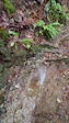
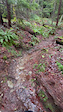
2,644 ft
Distance
28 ft
Climb
-411 ft
Descent
00:10:51
Avg time
Pointless Details
-
Activities
- Mountain Bike
- E-Bike
- Hike
- Trail Running
- Observed Trials
-
Riding AreaValleycliffe
Squamish, British Columbia -
Difficulty Rating
-
Voted DifficultyDouble Black Diamond (1 vote)
-
Trail TypeSingletrack
-
Bike TypeAM
-
DirectionDownhill PrimaryPopular direction shown
-
Climb DifficultyBlue
-
Physical RatingModerate
-
Dogs AllowedYes
-
eBike AllowedYes up to Class 1
-
TTFs on TrailBridge, Rock Face
-
Ride in RainYes
-
Global Ranking#46318 in Mountain Biking [+]
- #14111 in E-Biking
- #15287 in Trail Running
- #19406 in Hiking
- #142 in Observed Trials
-
Local Popularity60 in Mountain Biking [+]
- 80 in E-Biking
- 50 in Trail Running
- 50 in Hiking
- 65 in Observed Trials
-
Year Opened2013
-
Land OwnerDiamond Head Land Co
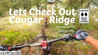
Parallels Meet Your Maker. There are a few forks on the trail, but all end in essentially the same place along The Graduate. Generally not too hard, but with a chute and rock face or two that elevates the trail just a bit beyond blue.
Access Info
Climb Sweeter The Barry to Start
Local Trail Association
-
Please consider joining or donating to the local trail association to supportdonate to earn trail karma!
trail development & maintenance.
Traditionally Indigenous Territory
More Stats for Pointless mountain bike trail trail
-
Altitude change-383 ft
-
Altitude min363 ft
-
Altitude max776 ft
-
Altitude start746 ft
-
Altitude end364 ft
-
Grade-14.5%
-
Grade max-43.9%
-
Grade min12.1%
-
Distance climb413 ft
-
Distance down2,077 ft
-
Distance flat151 ft
-
Avg time00:10:51
-
Avg reverse time00:16:07
- view trail stats
close
3D
Trail Conditions
- Unknown
- Snow Groomed
- Snow Packed
- Snow Covered
- Snow Cover Inadequate
- Freeze/thaw Cycle
- Icy
- Prevalent Mud
- Wet
- Variable
- Ideal
- Dry
- Very Dry
Trail Flow (Ridden Direction)
Trailforks scans users ridelogs to determine the most popular direction each trail is ridden. A good flowing trail network will have most trails flowing in a single direction according to their intension.
The colour categories are based on what percentage of riders are riding a trail in its intended direction.
- > 96%
- > 90%
- > 80%
- > 70%
- > 50%
- < 50%
- bi-directional trail
- no data
Trail Last Ridden
Trailforks scans ridelogs to determine the last time a trail was ridden.
- < 2 days
- < 1 week
- < 2 weeks
- < 1 month
- < 6 months
- > 6 months
Trail Ridden Direction
The intended direction a trail should be ridden.
- Downhill Only
- Downhill Primary
- Both Directions
- Uphill Primary
- Uphill Only
- One Direction
Contribute Details
Colors indicate trail is missing specified detail.
- Description
- Photos
- Description & Photos
- Videos
Trail Popularity ?
Trailforks scans ridelogs to determine which trails are ridden the most in the last 9 months.
Trails are compared with nearby trails in the same city region with a possible 25 colour shades.
Think of this as a heatmap, more rides = more kinetic energy = warmer colors.
- most popular
- popular
- less popular
- not popular
ATV/ORV/OHV Filter
Max Vehicle Width
inches
Radar Time
x
Activity Recordings
Trailforks users anonymized public ridelogs from the past 6 months.
- mountain biking recent
- mountain biking (>6 month)
- hiking (1 year)
- moto (1 year)
Activity Recordings
Trailforks users anonymized public skilogs from the past 12 months.
- Downhill Ski
- Backcountry Ski
- Nordic Ski
- Snowmobile
Winter Trails
Warning
A routing network for winter maps does not exist. Selecting trails using the winter trails layer has been disabled.
x
Missing Trails
Most Popular
Least Popular
Trails are colored based on popularity. The more popular a trail is, the more red. Less popular trails trend towards green.
Jump Magnitude Heatmap
Heatmap of where riders jump on trails. Zoom in to see individual jumps, click circles to view jump details.
Trails Deemphasized
Trails are shown in grey.
Only show trails with NO bikes.
Save the current map location and zoom level as your default home location whenever this page is loaded.
Save
Directions to pointless trailhead
(49.717650, -123.114880)
update trails status or condition
Pointless Trail Reports
view all reports »
Recent Ridelog Activity on Trail
Past Week
- 2 rides
- 4 miles avg distance
6 Months
- 119 rides
- 8 miles avg distance
All
- 1,368 rides
- Last: Sep 25, 2023
Photos
more »
Routes with this trail
Trail Products
-
SORCA Trail SupporterTrail Pass
-
99 Trials MembershipTrail Pass
5 Reviews & Comments
We hope you've been enjoying Trailforks!
Create a FREE account to view trail comments and much more.
Videos
more »
youtuber

8:23 |
917 |
Sep 23, 2019 , Squamish
Nearby Trails
- Omt1 92 ft
- Spencer's Big Gay Ride 95 ft
- Meet Yer Maker 98 ft
- For Angie 190 ft
- The Reaper 315 ft
- By seatoskyrider
& contributors
- #38890 - 5,083 views
- subscribe
- login to download gpx or kml files.