


Open in App
Get this trail on your phone instantly.

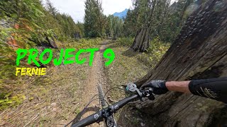
This is a ride of different sections. Start by staying right from the top unless you want some serious drops as you head down through the forest. You quickly hit the river wash-out area, with various options in terms of trail. Lots of rocks, little drops and river-bed type riding.
The lines in the washout area are now defined by coloured rocks. The right hand line, Pink, is the easiest, without much for drops. The center line, yellow is slower with some techy rock rolls and rock drops. The Yellow line will rejoin with the right hand, Orange, line. The Orange line is fast, but also has some rock drops. Pick your own flavour.
Once out of that you hit a super flowy section through a cut block with lefts and rights that brings you to the power line. Caution as there are some unmarked jumps and gaps in this section - all have ride-a-rounds. Head straight across the powerline and you have a short uphill section that takes you to the roller coaster - little flat sections followed by sudden downs. Super -fun and exhilarating. Watch out for the Lazy Lizard crossing further down - many people now jump onto that to complete the down.
In July 2025 the trail had a significant amount of work which added some trail features, including gap jumps that are unmarked. As always, a preride is highly recommended.
Via Project 9 access trail - look for a yellow gate on your left of the Island Lake Road, Project 9 signs on a post next to it.
| c1 | c2 | c3 | c4 |
|---|---|---|---|
January | February | March | April |
May | June | July | August |
September | October | November | December |

Service Road Atlas is a free to use, community-driven service for viewing and creating reports on the numerous back-country service roads around B.C. and Alberta.
Save the current map location and zoom level as your default home location whenever this page is loaded.
SaveWe hope you've been enjoying Trailforks!
Create a FREE account to view trail comments and much more.
You must enter a description before submitting.

