

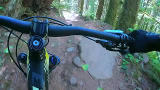



more stats
1.5 miles
Distance
122 ft
Climb
-244 ft
Descent
00:17:48
Avg time
-122 ft
Altitude change
2,101 ft
Altitude min
2,320 ft
Altitude max
2,281 ft
Altitude start
2,159 ft
Altitude end
-1.5%
Grade
-15.3%
Grade max
11.9%
Grade min
3,176 ft
Distance climb
3,842 ft
Distance down
1,047 ft
Distance flat
00:17:48
Avg time

Quid Pro Flow Details

  • Activities
    • Mountain Bike
    • Trail Running
  • Riding Area
    Sandy Ridge
    Sandy, Oregon
  • Difficulty Rating
  • Voted Difficulty
    Black Diamond (8 votes)
  • Local Popularity
    65 in Mountain Biking [+]
    • 5 in Trail Running
  • Global Ranking
    #79665 in Mountain Biking [+]
    • #213977 in Trail Running
  • State Ranking
    #805 in Mountain Biking · Oregon [+]
    • #3,256 in Trail Running
  • Trail Type
    Singletrack
  • Direction
    Downhill Primary
    Popular Direction Shown
  • Dogs Allowed
    Yes
  • TTFs on Trail
    Berm, Jump, Rock Garden
  • Land Owner

No community description for Quid Pro Flow trail has been added yet!

AI Generated Description

Quid Pro Flow is a 2 mile moderately popular black diamond difficulty singletrack trail located near Sandy Oregon. This mountain bike primary trail can be used downhill primary. It features berm, jump and rock garden. On average it takes 17 minutes to complete this trail.

Tags
BermsJumpsRock gardens

Trail Supporters

Local Trail Association

Traditionally Indigenous Territory

Recent Activity on Trail

Past Week
  • 0 rides
  •  
6 Months
  • 54 rides
  • 15 miles avg distance
All
  • 691 rides
  • Last: Nov 1, 2026
c1c2c3c4
January
February
March
April
May
June
July
August
September
October
November
December
Status:
on Nov 1, 2026
Ideal
Avg: 3.53 (40 votes)
Your vote: 0

view (3,528)
close
      Directions to quid-pro-flow trailhead (45.396300, -122.026160)

      Photos

      6 more »
      mtb
      85 |
      Dec 2, 2024 @ 9:49am
      Dec 2, 2024
      mtb
      569 |
      Apr 13, 2017 @ 7:49pm
      Apr 13, 2017
      mtb
      1,043 |
      Aug 22, 2013 @ 10:24pm
      Aug 22, 2013
      report
      mtb
      169 |
      May 6, 2023 @ 4:28pm
      May 6, 2023

      Videos

      11 more »
      youtuber Communication Breakdown to Quid Pro Flow -...
      mtb
      4:47 | 1559 | Oct 3, 2018 , Sandy
      Film Study: Quid Pro Flow - Sandy Ridge
      mtb
      8:26 | 460 | Aug 26, 2024 , Sandy
      sandy ridge part 1
      mtb
      10:21 | 405 | Mar 7, 2022 , Sandy
      Sandy Ridge - Downhill Highlights (Quid Pro...
      mtb
      12:38 | 244 | Sep 27, 2021 , Sandy

      Trail Lists

      Routes with this trail

      9 miles • 1,658 ft • 7 • Loop •
      evo Trailgate Sandy Ridge Thriller Route 2025
      ★ 2.5 • 14 miles • 2,941 ft • 30 • Loop •
      Two laps at Sandy Ridge hitting most of the favorite trails.
      16 miles • 3,021 ft • 13 • Point to Point •
      Good 13 or so mile ride to get to know Sandy Ridge Area!
      3.5 ★★★★★
      40 Ratings
      5 ★ 23%
      4 ★ 33%
      3 ★ 15%
      2 ★ 30%
      1 ★

      7 Reviews & Comments

      PraxisPixels PraxisPixels
      Had a great time riding this on a hardtail today. Fun technical rocky stuff at the start, and some fast berms and table tops towards the middle section. I could see the rock gardens being a slippery nightmare if it's wet. Will prob skip this one in the winter
      ccmski ccmski
      I wish I could remember to stop riding this trail. I only remember the fun parts which only account to 30% or so. If you like technical XC, then you’ll probably enjoy it more.
      chunky-tech-doctor chunky-tech-doctor
      This tail is a legit challenge there are 2 sections that are almost unridable at times but its a good 70% uphill/ flat and 30% down
      I have a video up chunky tech doctor check for sandy ridge part 1 for this trail footage

      We hope you've been enjoying Trailforks!

      Create a FREE account to view all trail reviews and much more.

      • By jerschwabTF Pro & contributors
      • #32137 - 6,661 views

      Frequently Asked Questions

      ▼ Where is Quid Pro Flow located?
      Quid Pro Flow is located in Sandy Ridge, Sandy, Oregon, United States. It is part of the Sandy Ridge trail network. The trailhead is located at coordinates 45.3963, -122.02616.
      ▼ How hard is Quid Pro Flow?
      Quid Pro Flow is rated as Black Diamond difficulty. The average grade is 1.5%.
      ▼ What is the elevation gain for Quid Pro Flow?
      Quid Pro Flow has 122 ft of elevation gain. The trail has 244 ft of elevation descent. The elevation ranges from 2,101 ft to 2,320 ft.
      ▼ Is Quid Pro Flow a point to point trail?
      Quid Pro Flow is not a point to point trail. The direction is Downhill Primary. The trail type is singletrack.
      ▼ How long is Quid Pro Flow?
      Quid Pro Flow is 1.5 miles long. The trail type is singletrack.
      ▼ Are dogs allowed on Quid Pro Flow?
      Yes, dogs are allowed on Quid Pro Flow. Please keep dogs on a leash where required and clean up after them.
      ▼ How do I access Quid Pro Flow? Where is the closest parking trailhead?
      The closest parking and trailhead locations to Quid Pro Flow are: View all parking locations in the area.
      ▼ How long does it take to ride Quid Pro Flow?
      Based on recorded activities, it takes an average of 18 minutes to ride Quid Pro Flow. The trail is 1.5 miles long. Actual times will vary based on fitness level, conditions, and pace. View recent activity logs for more details.
      ▼ How busy is Quid Pro Flow?
      Quid Pro Flow is a moderately popular trail. There have been 3,552 recorded activities on this trail. The trail has received 3,528 check-ins. View recent activity on this trail.

      Hit the Trail

      Open in App

      Get this trail on your phone instantly.

      open trail in app

      Download Trail

      Save to wishlist, Garmin & download.
      save the trail

      Find Related Routes

      Find routes and users activities that include this trail.
      find routes for this trail

      You must enter a description before submitting.