
more stats
6.0 miles
Distance
545 ft
Climb
-1,299 ft
Descent
01:08:08
Avg time
-753 ft
Altitude change
4,982 ft
Altitude min
6,219 ft
Altitude max
5,736 ft
Altitude start
4,984 ft
Altitude end
-2.4%
Grade
-51.7%
Grade max
22.5%
Grade min
2 miles
Distance climb
3 miles
Distance down
1,611 ft
Distance flat
01:08:08
Avg time

Rye Spur Details

  • Activities
    • Mountain Bike
    • E-Bike
    • Winter Fat Bike
    • Horse
    • Hike
    • Trail Running
  • Riding Area
    Brown Mountain
    Klamath Falls, Oregon
  • Difficulty Rating
  • Local Popularity
    40 in Mountain Biking [+]
    • 35 in E-Biking
    • 5 in Trail Running
    • 5 in Hiking
    • 5 in Horseback
    • 5 in Winter Fat Biking
  • Global Ranking
    #108302 in Mountain Biking [+]
    • #111268 in Trail Running
    • #131299 in Hiking
    • #786 in Horseback
  • Hiking SAC Scale
    T1 Hiking
  • Trail Type
    Singletrack
  • Bike Type
    AM, XC, Fat
  • Direction
    Both Directions
    Popular Direction Shown
  • Climb Difficulty
    Blue
  • Physical Rating
    Moderate
  • Trail Visibility
    Always easy to follow
  • Family Friendly
    Yes
  • Dogs Allowed
    Yes
  • eBike Allowed
    Yes up to Class 1
  • Ride in Rain
    Yes

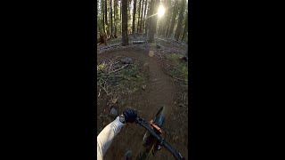
Fun trail, if you enjoy deep pine loam, this ride is for you From 4 Mile Lake it's a gradual 700 vert foot climb, only difficult in places because of the loam, sticks, & pine cones. Then you can enjoy a magnificent view from the top of the ridge before a pretty consistently fast & furious downhill. Multi-use so watch out for hikers & horses, and try not to get a stick in your wheel!

Access Info

You can ride or drive up 4 Mile Lake Rd from Hwy 140 just across from Lake of the Woods. If you ride up you can turn right off the road onto the Cascade Canal double-track for the last half of the climb. I wouldn't recommend climblng the trail, it's a little too soft for the steepness...

Trail Supporters
Local Trail Association

Recent Activity on Trail

Past Week
  • 0 rides
  •  
6 Months
  • 5 rides
  • 26 miles avg distance
All
  • 28 rides
  • Last: Sep 9, 2026
c1c2c3c4
January
February
March
April
May
June
July
August
September
October
November
December
update trails status or condition

Rye Spur Trail Reports

statusdatedescription
May 17, 2026 @ 4:17pm (America/Los_Angeles)
May 17, 2026
clear of all trees and logs
Aug 3, 2025 @ 9:56am
Aug 3, 2025
Jul 3, 2024 @ 6:41am
Jul 3, 2024
Watch out for the mosquitoes. They are heavy this time of year. All trees have been removed.
Jun 23, 2024 @ 2:08am
Jun 23, 2024
May 27, 2024 @ 4:27pm
May 27, 2024
Can’t comment on the trail but we drive up the road to potentially ride down and the road was full of recently cleared deadfall and lots of snow...
more »
Status:
on May 17, 2026
Ideal
Avg: 3.84 (7 votes)
Your vote: 0

view (179)
close
      Directions to rye-spur trailhead (42.454990, -122.242370)

      Photos

      98 more »
      mtb
      165 |
      Jul 5, 2021 @ 4:39pm
      Jul 5, 2021
      mtb
      130 |
      Jul 5, 2021 @ 4:39pm
      Jul 5, 2021
      mtb
      143 |
      Jul 5, 2021 @ 4:39pm
      Jul 5, 2021
      mtb
      128 |
      May 30, 2021 @ 10:45am
      May 30, 2021

      Videos

      2 more »
      Rye Spur Trail Full Descent
      mtb
      8:31 | 240 | Aug 10, 2023 , Klamath Falls
      Rye Spur Trail Descent 090213
      mtb
      1068 | Jun 19, 2014 , Klamath Falls
      3.7 ★★★★★
      7 Ratings
      5 ★ 43%
      4 ★ 29%
      3 ★
      2 ★ 14%
      1 ★ 14%

      7 Reviews & Comments

      duotoasty duotoasty
      Gave this a shot yesterday (Northbound), but couldn't make it past the initial switchbacks, on account of fitness/skill and equipment. The trail surface seemed fine, with clusters of medium-sized rocks providing variety. A tree crew had definitely been through recently to clear large fallen logs (half a dozen in the short distance I rode), but left behind a lot of loose debris.

      I took a spill on my way back down—couldn't find a safe line with my 26" wheels and the front just stopped cold after a little drop. Fell again in the parking lot when my bike sank into the feather-light volcanic soil; I'm sure the forest service guys eating lunch in their truck had a good laugh!

      Cooled off by heading a little ways up Fourmile Road, but turned around before reaching the canal. From the base of Fourmile, I took the Power Line connector road back to Rye Spur trailhead, and had my *third* spill. The rest of the ride (on High Lakes and Aspen/Lodge) was nice and smooth.
      Dfrei
      Rode up the gravel rd to 4 mile lake. Top of the trail is pretty decent. Had to cross one down tree. After the rock vista with the amazing views the trail got pretty rough. I had to keep my speed down because it was so rough and erratic. Was one more very large tree blocking the trail near the bottom. If you’re looking for a great x country type ride with beautiful views this is a good one. If you want a fast flowy descent I recommend skipping this one until the bottom gets cleaned up.
      crockpot2001
      It does not appear that there have been many comments here on this trail in the last few years. I Road this trail from four Mile Lake after peddling up the Gravel Rd., From Lake of the woods. I believe the trail might be kind of raw and beat up at the moment with a lot of work having been done to clear the trees that had fallen in the last few years in some areas. It looks like a tornado had come through. The trees are Cleared from the trail and that is much appreciated. The bottom half of this trail is where the fun descent happens but it’s kind of like riding in Erosion channel. It’s still fun and rowdy, but I don’t think the trail surface is the greatest. I’m gonna call this one and done trail.

      We hope you've been enjoying Trailforks!

      Create a FREE account to view all trail reviews and much more.

      • By ACLakeyTF Pro & contributors
      • #3696 - 6,178 views

      Frequently Asked Questions

      ▼ Where is Rye Spur located?
      Rye Spur is located in Brown Mountain, Klamath Falls, Oregon, United States. It is part of the Brown Mountain trail network. The trailhead is located at coordinates 42.45499, -122.24237.
      ▼ How hard is Rye Spur?
      Rye Spur is rated as Blue difficulty. The physical rating is Moderate. The average grade is 2.4%. The climb difficulty is rated Blue.
      ▼ What is the elevation gain for Rye Spur?
      Rye Spur has 545 ft of elevation gain. The trail has 1,299 ft of elevation descent. The elevation ranges from 4,982 ft to 6,219 ft.
      ▼ Is Rye Spur a point to point trail?
      Rye Spur is not a point to point trail. The direction is Both Directions. The trail type is singletrack.
      ▼ How long is Rye Spur?
      Rye Spur is 6.0 miles long. The trail type is singletrack.
      ▼ Are dogs allowed on Rye Spur?
      Yes, dogs are allowed on Rye Spur. Please keep dogs on a leash where required and clean up after them.
      ▼ When is the best time of year to ride Rye Spur?
      Based on activity log data, the most popular months to ride Rye Spur are:
      • September (6 activities)
      • October (2 activities)
      • May (1 activities)
      Check the reports page for current trail conditions.
      ▼ How do I access Rye Spur? Where is the closest parking trailhead?
      The closest parking and trailhead locations to Rye Spur are: View all parking locations in the area.
      ▼ How long does it take to ride Rye Spur?
      Based on recorded activities, it takes an average of 1 hour 14 minutes to ride Rye Spur. The trail is 6.0 miles long. Actual times will vary based on fitness level, conditions, and pace. View recent activity logs for more details.
      ▼ How busy is Rye Spur?
      Rye Spur is a moderately popular trail. There have been 175 recorded activities on this trail. The trail has received 179 check-ins. View recent activity on this trail.

      Hit the Trail

      Open in App

      Get this trail on your phone instantly.

      open trail in app

      Download Trail

      Save to wishlist, Garmin & download.
      save the trail

      Find Related Routes

      Find routes and users activities that include this trail.
      find routes for this trail

      You must enter a description before submitting.