more stats
1,827 ft
Distance
85 ft
Climb
-8 ft
Descent
00:03:57
Avg time
77 ft
Altitude change
1,302 ft
Altitude min
1,380 ft
Altitude max
1,302 ft
Altitude start
1,381 ft
Altitude end
4.2%
Grade
-5.2%
Grade max
16.6%
Grade min
1,040 ft
Distance climb
210 ft
Distance down
577 ft
Distance flat
00:03:57
Avg time

Scrambler Details

  • Activities
    • Mountain Bike
    • E-Bike
    • Hike
    • Trail Running
  • Riding Area
    The Hydrocut
    Kitchener-Waterloo, Ontario
  • Difficulty Rating
  • Voted Difficulty
    Blue (1 vote)
  • Local Popularity
    100 in Mountain Biking [+]
    • 95 in E-Biking
    • 90 in Trail Running
    • 100 in Hiking
  • Global Ranking
    #16036 in Mountain Biking [+]
    • #13002 in E-Biking
    • #38439 in Trail Running
    • #8237 in Hiking
  • Trail Type
    Singletrack
  • Bike Type
    XC
  • Climb Difficulty
    Black Diamond
  • Physical Rating
    Moderate
  • eBike Allowed
    Yes up to Class 1
  • Land Owner

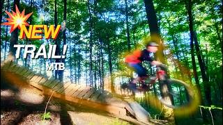
Mostly uphill with a few quick descents where it pays to carry speed into the next uphill. Scrambler has 2 steeper sections that will challenge newer riders. There is an optional rock rollover to the right of the trail on an uphill and an optional rock on to the left on the last downhill that can be rolled or jumped from.

Access Info

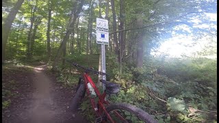
Entrance to the Pines section of Hydrocut trails from the actual hydrocut.

Trail Supporters
Local Trail Association

Recent Activity on Trail

Past Week
  • 38 rides
  • 11 miles average
6 Months
  • 304 rides
  • 12 miles avg distance
All
  • 4,956 rides
  • Last: Jul 4, 2026
c1c2c3c4
January
February
March
April
May
June
July
August
September
October
November
December
Status:
on Jun 20, 2026
Ideal
Avg: 3.89 (21 votes)
Your vote: 0

view (27,700)
close
3D
Trail Conditions
  • Unknown
  • Snow Groomed
  • Snow Packed
  • Snow Covered
  • Snow Cover Partial
  • Freeze/thaw Cycle
  • Icy
  • Prevalent Mud
  • Wet
  • Variable
  • Ideal
  • Dry
  • Very Dry
Trail Flow (Ridden Direction)
Trailforks scans users ridelogs to determine the most popular direction each trail is ridden. A good flowing trail network will have most trails flowing in a single direction according to their intension.
The colour categories are based on what percentage of riders are riding a trail in its intended direction.
  • > 96%
  • > 90%
  • > 80%
  • > 70%
  • > 50%
  • < 50%
  • bi-directional trail
  • no data
Trail Last Ridden
Trailforks scans ridelogs to determine the last time a trail was ridden.
  • < 2 days
  • < 1 week
  • < 2 weeks
  • < 1 month
  • < 6 months
  • > 6 months
Trail Ridden Direction
The intended direction a trail should be ridden.
  • Downhill Only
  • Downhill Primary
  • Both Directions
  • Uphill Primary
  • Uphill Only
  • One Direction
Contribute Details
Colors indicate trail is missing specified detail.
  • Description
  • Photos
  • Description & Photos
  • Videos
Trail Popularity ?
Trailforks scans ridelogs to determine which trails are ridden the most in the last 9 months. Trails are compared with nearby trails in the same city region with a possible 25 colour shades. Think of this as a heatmap, more rides = more kinetic energy = warmer colors.
  • most popular
  • popular
  • less popular
  • not popular
ATV/ORV/OHV Filter
Max Vehicle Width
inches
US Cell Coverage
Legend
cell carrier legend

Radar Time
Activity Recordings
Trailforks uses anonymized public activity data. ?
Activity Recordings
Trailforks uses anonymized public activity data. ?
Personal Heatmap
Activity Types
all / none
Options
2
Date range month
Winter Trails
Warning A routing network for winter maps does not exist. Selecting trails using the winter trails layer has been disabled.
Missing Trails
Most Popular
Least Popular
Trails are colored based on popularity. The more popular a trail is, the more red. Less popular trails trend towards green.
Jump Magnitude Heatmap
Heatmap of where riders jump on trails. Zoom in to see individual jumps, click circles to view jump details.
BC Backroad Status

Service Road Atlas is a free to use, community-driven service for viewing and creating reports on the numerous back-country service roads around B.C. and Alberta.

map legend
Slope Aspect
Direction the slope faces
Flat N NE E SE S SW W NW
Trails Deemphasized
Trails are shown in grey.
disable
Only show trails with no bike usage.
Enable
Suggested Layers
Based on selected activity type

    Save the current map location and zoom level as your default home location whenever this page is loaded.

    Save
        Directions to scrambler trailhead (43.428600, -80.586260)

        Photos

        5 more »
        144 |
        Aug 7, 2017 @ 7:06pm
        Aug 7, 2017
        129 |
        Aug 7, 2017 @ 7:06pm
        Aug 7, 2017
        880 |
        Oct 2, 2010 @ 9:50am
        Oct 2, 2010
        42 |
        Jan 7, 2024 @ 11:39am
        Jan 7, 2024

        Videos

        3 more »
        Clearing the uphill rock on Scrambler!
        32:34 | 11 | Jun 5, 2026 , Kitchener-Waterloo
        Scrambler
        3:53 | 236 | Nov 12, 2019 , Kitchener-Waterloo
        Scrambler, The Hydrocut
        2:58 | 338 | Aug 5, 2019 , Kitchener-Waterloo

        Trail Lists

        Routes with this trail

        3.0 13 miles 1,233 ft 22 Loop
        The most popular loop that hits all of the singletrack trails available at the Hydrocut. Frankenstein,...
        5.0 13 miles 1,222 ft 35 Loop
        The Hydrocut is running an official Time Trial this year using Strava. The course has been set. It was...
        5.0 6 miles 516 ft 23 Loop
        This route maximizes downhill trails while minimizing uphill trails. Before riding out, ride Adam's Run if...

        Reviews / Comments

        No reviews yet, be the first to write a review or ask a question.
        Use trail reports to comment on trail conditions.


        We hope you've been enjoying Trailforks!

        Create a FREE account to view trail comments and much more.

        Frequently Asked Questions About Scrambler

        Where is Scrambler located?
        Scrambler is located in The Hydrocut, Kitchener-Waterloo, Ontario, Canada. It is part of the The Hydrocut trail network. The trailhead is located at coordinates 43.4286, -80.58626.
        How hard is Scrambler?
        Scrambler is rated as Blue difficulty. The physical rating is Moderate. The average grade is 4.2%. The climb difficulty is rated Black Diamond.
        What is the elevation gain for Scrambler?
        Scrambler has 85 ft of elevation gain. The trail has 8 ft of elevation descent. The elevation ranges from 1,302 ft to 1,380 ft.
        How long is Scrambler?
        Scrambler is 1,827 ft long. The trail type is singletrack.

        Hit the Trail

        Open in App

        Get this trail on your phone instantly.
        open trail in app

        Download Trail

        Save to wishlist, Garmin & download.
        save the trail

        Find Related Routes

        Find routes and users activities that include this trail.
        find routes for this trail

        You must enter a description before submitting.