


more stats
1.6 miles
Distance
114 ft
Climb
-118 ft
Descent
00:14:29
Avg time
-5 ft
Altitude change
932 ft
Altitude min
984 ft
Altitude max
956 ft
Altitude start
951 ft
Altitude end
-0.1%
Grade
-10.4%
Grade max
10.6%
Grade min
2,743 ft
Distance climb
3,333 ft
Distance down
1,650 ft
Distance flat
00:14:29
Avg time

Section 3 Details

  • Activities
    • Mountain Bike
    • Hike
    • Trail Running
    • Snowshoe
  • Riding Area
    Palgrave Conservation Area
    Caledon, Ontario
  • Difficulty Rating
  • Voted Difficulty
    Blue (3 votes)
  • Local Popularity
    90 in Mountain Biking [+]
    • 95 in Trail Running
    • 70 in Hiking
    • 100 in Snowshoeing
  • Global Ranking
    #31373 in Mountain Biking [+]
    • #41199 in Trail Running
    • #75120 in Hiking
    • #1645 in Snowshoeing
  • Hiking SAC Scale
    T1 Hiking
  • Trail Type
    Singletrack
  • Snow Grooming
    Backcountry
  • Bike Type
    XC
  • Direction
    Both Directions
    Popular Direction Shown
  • Climb Difficulty
    Blue
  • Physical Rating
    Moderate
  • Trail Visibility
    Always easy to follow
  • Dogs Allowed
    Yes
  • eBike Allowed
  • TTFs on Trail
    Drop, Jump
  • Land Owner
    Toronto Region Conservation Authority

This trail has some great steep climbing and flow on the downhill. Recommended to start on west side (Pally Section 2) entrance. All features like the drops or jumps have easy ride bypass. The trail itself is sandy mixed with clay, usually dries fast and is well maintained.

Recent Activity on Trail

Past Week
  • 23 rides
  • 13 miles average
6 Months
  • 318 rides
  • 13 miles avg distance
All
  • 2,711 rides
  • Last: Sep 12, 2026
c1c2c3c4
January
February
March
April
May
June
July
August
September
October
November
December
Status:
on Sep 13, 2026
Dry
Avg: 4.39 (12 votes)
Your vote: 0

view (9,530)
close
      Directions to section-3-17138 trailhead (43.949560, -79.851080)

      Photos

      11 more »
      mtb
      266 |
      Aug 17, 2020 @ 10:38am
      Aug 17, 2020
      mtb
      75 |
      Oct 27, 2023 @ 7:37pm
      Oct 27, 2023
      mtb
      164 |
      Nov 22, 2020 @ 8:19am
      Nov 22, 2020
      mtb
      186 |
      Nov 22, 2020 @ 8:19am
      Nov 22, 2020

      Videos

      1 more »
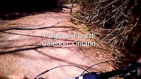
      Palgrave Forest Chest Cam v2
      mtb
      2:20 | 575 | Mar 26, 2019 , Caledon

      Routes with this trail

      5.0 11 miles 712 ft 13
      The Complete Essential Palgrave CALEDON Impossible Route, With The Best Trails. Counter Clockwise 2022....
      5.0 10 miles 791 ft 12
      Good loop of Palgrave, a taste of everyhing
      11 miles 716 ft 10 Loop
      A mostly flowy loop with some technical bits, starting from the parking on Duffy's Lane.
      4.6
      12 Ratings
      5 58%
      4 42%
      3
      2
      1

      6 Reviews & Comments

      bronx319
      This is is the most fun trail in here. Awesome berms to hold your speed. There is a fast section that leads into 4 jumps all in a row which is so much fun.

      Best flow and fun factor in palgrave.
      extremumadventura extremumadventura
      Quite a few rock features have 'changed or moved a bit, check the jumps out first.
      sdrvper sdrvper
      Probably the best section, lots of flow and some small drops and jumps.

      We hope you've been enjoying Trailforks!

      Create a FREE account to view all trail reviews and much more.

      • By hipposauceTF Pro & contributors
      • #17138 - 3,298 views

      Frequently Asked Questions

      Where is Section 3 located?
      Section 3 is located in Palgrave Conservation Area, Caledon, Ontario, Canada. It is part of the Palgrave Conservation Area trail network. The trailhead is located at coordinates 43.94956, -79.85108.
      How hard is Section 3?
      Section 3 is rated as Blue difficulty. The physical rating is Moderate. The average grade is 0.1%. The climb difficulty is rated Blue.
      What is the elevation gain for Section 3?
      Section 3 has 114 ft of elevation gain. The trail has 118 ft of elevation descent. The elevation ranges from 932 ft to 984 ft.
      Is Section 3 a point to point trail?
      Section 3 is not a point to point trail. The direction is Both Directions. The trail type is singletrack.
      How long is Section 3?
      Section 3 is 1.6 miles long. The trail type is singletrack.
      Are dogs allowed on Section 3?
      Yes, dogs are allowed on Section 3. Please keep dogs on a leash where required and clean up after them.
      When is the best time of year to ride Section 3?
      Based on activity log data, the most popular months to ride Section 3 are:
      • September (185 activities)
      • July (168 activities)
      • June (165 activities)
      Check the reports page for current trail conditions.
      How do I access Section 3? Where is the closest parking trailhead?
      The closest parking and trailhead locations to Section 3 are: View all parking locations in the area.
      How long does it take to ride Section 3?
      Based on recorded activities, it takes an average of 16 minutes to ride Section 3. The trail is 1.6 miles long. Actual times will vary based on fitness level, conditions, and pace. View recent activity logs for more details.
      How busy is Section 3?
      Section 3 is a very popular trail. There have been 9,559 recorded activities on this trail. The trail has received 9,530 check-ins. View recent activity on this trail.

      Hit the Trail

      Open in App

      Get this trail on your phone instantly.

      open trail in app

      Download Trail

      Save to wishlist, Garmin & download.
      save the trail

      Find Related Routes

      Find routes and users activities that include this trail.
      find routes for this trail

      You must enter a description before submitting.



