close
-
Layers w
- Weather Layers
- Pro
- Pro
- Pro
- Pro
- Pro
- Pro
- More Layers
- Pro
- Pro
- Pro
- Pro
-
Upgrade to

3D
Trail Conditions
- Unknown
- Snow Groomed
- Snow Packed
- Snow Covered
- Snow Cover Partial
- Freeze/thaw Cycle
- Icy
- Prevalent Mud
- Wet
- Variable
- Ideal
- Dry
- Very Dry
Trail Flow (Ridden Direction)
Trailforks scans users activity logs to determine the most popular direction each trail is ridden. A good flowing trail network will have most trails flowing in a single direction according to their intension.
The colour categories are based on what percentage of users are riding a trail in its intended direction.
The colour categories are based on what percentage of users are riding a trail in its intended direction.
- > 96%
- > 90%
- > 80%
- > 70%
- > 50%
- < 50%
- bi-directional trail
- no data
Trail Last Ridden
Trailforks scans activity logs to determine the last time a trail was ridden.
- < 2 days
- < 1 week
- < 2 weeks
- < 1 month
- < 6 months
- > 6 months
Trail Ridden Direction
The intended direction a trail should be ridden.
- Downhill Only
- Downhill Primary
- Both Directions
- Uphill Primary
- Uphill Only
- One Direction
Contribute Details
Colors indicate trail is missing specified detail.
- Description
- Photos
- Description & Photos
- Videos
Trail Popularity ?
Trailforks scans activity logs to determine which trails are ridden the most in the last 9 months.
Trails are compared with nearby trails in the same city region with a possible 25 colour shades.
Think of this as a heatmap, more activities = more kinetic energy = warmer colors.
- most popular
- popular
- less popular
- not popular
ATV/ORV/OHV Filter
Max Vehicle Width
inches
US Cell Coverage
Legend

Radar Time
Activity Recordings
Trailforks uses anonymized public activity data.
?
Activity Recordings
Trailforks uses anonymized public activity data.
?
Personal Heatmap
▶
Activity Types
all
/
none
▶
Options
2
Date range
month
–
Winter Trails
Warning
A routing network for winter maps does not exist. Selecting trails using the winter trails layer has been disabled.
Missing Trails
Most Popular
Least Popular
Trails are colored based on popularity. The more popular a trail is, the more red. Less popular trails trend towards green.
Jump Magnitude Heatmap
Heatmap of where users jump on trails. Zoom in to see individual jumps, click circles to view jump details.
BC Backroad Status
![map legend]()
Service Road Atlas is a free to use, community-driven service for viewing and creating reports on the numerous back-country service roads around B.C. and Alberta.

Slope Aspect
Direction the slope faces
Trails Deemphasized
Trails are shown in grey.
Only show trails with no bike usage.
Suggested Layers
Based on selected activity type
Save the current map location and zoom level as your default home location whenever this page is loaded.
Save
No description for Caledon has been added yet!
Login or register to submit one.
Links
Activities Click to view
- Mountain Bike
184 trails
- E-Bike
51 trails
- Gravel Bike
4 trails
- Adaptive Bike
0 trails
- Winter Fat Bike
1 trails
- Horse
6 trails
- Hike
202 trails
- Trail Running
207 trails
- Snowshoe
106 trails
- Nordic Ski
53 trails
Region Details
- 29
- 5
- 52
- 61
- 26
Region Status
Open as of Jul 12, 2026Stats
- Avg Trail Rating
- Trails (view details)
- 201
- Trails Mountain Bike
- 184
- Trails E-Bike
- 51
- Trails Gravel Bike
- 4
- Trails Winter Fat Bike
- 1
- Trails Horse
- 6
- Trails Hike
- 202
- Trails Trail Running
- 207
- Trails Snowshoe
- 106
- Trails Nordic Ski
- 53
- Total Distance
- 167 miles
- Total Descent
- 11,958 ft
- Total Vertical
- 831 ft
- Highest Trailhead
- 1,517 ft
- Reports
- 6,608
- Photos
- 263
- Completed Counter
- 92,490
Articles

Grow Cycling Foundation's Inglewood Pumptrack is Officially Open
Sep 27, 2023 from pinkbike.com
This weekend was the official opening of the Inglewood Pumptrack, thanks to the work of Grow Cycling and its founder, Eliot Jackson.
Sub Regions
-
Albion Hills
- 1
- 8
- 14
- 17
-
Bolton Camp
- 4
- 3
-
Burns and Sparks
-
Forks of the Credit Provincial Park
- 4
- 1
-
Glen Haffy Conservation Park
- 5
- 6
- 6
-
Inglewood Trails
- 7
- 6
-
Palgrave Conservation Area
- 18
- 12
- 3
-
The Estates
- 3
- 6
-
TRCA Property HR899
- 1
- 3
Popular Caledon Mountain Biking Trails
• 100 ★ 4.8 • 3,323 ft • 67 ft • 1,711 •
A fun trail for intermediate riders. Large turns with big downhills and uphills and plenty of log and root features to practice on. Ends on doubletrack heading beside the Marsh.
• 85 ★ 4.9 • 1,913 ft • 0 ft • 1,705 •
Fast, mostly downhill trail with switchbacks and wide open straightaway. Watch for road crossing half way through trail.
• 100 ★ 3.5 • 489 ft • 0 ft • 1,692 •
(Very) short descent from the lookout (formerly of the lake). Nice twisty route, quick left then right near the bottom. Slow down at end before road crossing and check for cars.
• 100 ★ 3.8 • 1,276 ft • 0 ft • 1,691 •
Witch Trail heads north-west, after a Morraine Momentum run, just head north take a right at , mainly through twisting pines, much fun with a log roller easy bypass, few berms, with some fast sections mainly 'down' with nice drops and...
• 100 ★ 4.2 • 2,241 ft • 25 ft • 1,689 •
Fun fast technical trail through The Pines with a rock garden option, rock drops, rock jump, new berms, new section, and few quick switchback climbs to hammer.
• 100 ★ 3.5 • 1,184 ft • 11 ft • 1,609 •
Flat windy section to begin, keep your momentum descending into the valley to make the exit easy. The ascent from the valley can be sandy when conditions are dry or eroded after rain, but is generally well-maintained by the park. After...
• 85 ★ 3.9 • 2,684 ft • 46 ft • 1,564 •
Fun intermediate friendly trail. Short climbs and switchbacks riding through the woods with sweet rollers to pump on with never a dull moment. Huzzah!
• 80 ★ 3.3 • 2,835 ft • 37 ft • 1,519 •
Begins with a steep curving climb, at top turn to the right, with a few rock obstacles, and rewards your power efforts once up as the trail soon turns into rolling short hills punctuated by berms and sweeping turns with a steep flowy...
Caledon Mountain Bike Routes
★ 5.0 • 15 miles • 1,335 ft • 33 • Loop •
A loop around all the main trails at Albion Hills ending with a lung-busting climb up Monster!
★ 5.0 • 11 miles • 712 ft • 13 •
The Complete Essential Palgrave CALEDON Impossible Route, With The Best Trails. Counter Clockwise 2022....
35 miles • 3,191 ft • 40 •
A really fun link up of the three trails systems, Albion Hills, Palgrave, and Glen Haffy. It has a bit of...
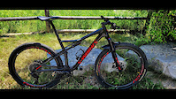
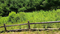
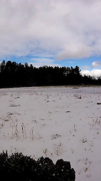
Photos of Caledon Mountain Bike
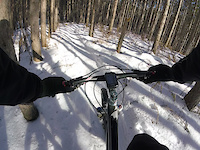
Videos of Caledon Mountain Bike
trail: Finnerty Entrance
0:20 |
8 |
Jul 15, 2025
trail: Finnerty Entrance
0:19 |
15 |
Jul 12, 2025
7:27 |
38 |
Oct 11, 2022

2:08 |
28 |
Apr 6, 2022
trail: Section 8
0:23 |
90 |
Jan 10, 2021
trail: The North Connection Main
0:33 |
51 |
Jan 10, 2021
trail: Section 7
0:48 |
44 |
Jan 10, 2021

trail: Section 3
2:20 |
575 |
Mar 26, 2019
Recent Trail Reports
Activity Feed
| username | action | type | title | date |
|---|---|---|---|---|
| LN001 | wishlist | route | activity #99705412 | Jul 21, 2026 @ 2:14pm Jul 21, 2026 |
| JordanRydGvf | comment | trail | activity #99582112 | Jul 19, 2026 @ 6:34pm Jul 19, 2026 |
| Apelvin | wishlist | route | activity #99501541 | Jul 18, 2026 @ 9:10pm Jul 18, 2026 |
| posthuma | wishlist | region | activity #99467513 | Jul 18, 2026 @ 11:10am Jul 18, 2026 |
| Mintzy | wishlist | region | activity #99366914 | Jul 17, 2026 @ 5:45am Jul 17, 2026 |
Recent Comments
| username | type | title | comment | date |
|---|---|---|---|---|
| trail | If your looking for flow trail with some... | Jul 19, 2026 @ 6:34pm Jul 19, 2026 | ||
| trail | My new favorite trail at Albion. Rode it for... | Jul 8, 2026 @ 7:29am Jul 8, 2026 | ||
| trail | I went to it about 2 months ago and the jumps... | Jul 7, 2026 @ 5:04pm Jul 7, 2026 | ||
| trail | Tree 🌳 down | Jul 5, 2026 @ 2:29pm Jul 5, 2026 | ||
| trail | Tree down | Jul 5, 2026 @ 1:51pm Jul 5, 2026 |
Local Badges
-

Top 10 Trails10 awarded -

Descent 100k Badge4 awarded -

Big Ride 30k4,012 awarded -

Epic Ride 50k1,996 awarded -

Descent 10k Badge139 awarded -

Completionist3 awarded
Activity Type Stats
| activitytype | trails | distance | descent | descent distance | total vertical | rating | global rank | state rank | photos | reports | routes | activity logs |
|---|---|---|---|---|---|---|---|---|---|---|---|---|
| Mountain Bike | 184 | 147 miles | 10,000 ft | 62 miles | 830 ft | #177 | #10 | 256 | 6,540 | 14 | 36,657 | |
| E-Bike | 51 | 29 miles | 2,740 ft | 11 miles | 308 ft | #3,458 | #61 | 3 | 5,283 | 423 | ||
| Gravel Bike | 4 | #550 | #51 | 81 | 1 | 216 | ||||||
| Winter Fat Bike | 1 | #333 | #74 | 44 | 1 | 15 | ||||||
| Horse | 6 | 3 miles | 187 ft | 1 mile | 410 ft | #2,140 | #36 | 1,327 | 2 | |||
| Hike | 202 | 164 miles | 11,683 ft | 68 miles | 830 ft | #1,026 | #25 | 3 | 6,454 | 1,156 | ||
| Trail Running | 207 | 165 miles | 11,719 ft | 68 miles | 830 ft | #819 | #14 | 6,459 | 3 | 639 | ||
| Snowshoe | 106 | 85 miles | 5,784 ft | 36 miles | 823 ft | #219 | #25 | 554 | 52 | |||
| Nordic Ski | 53 | 60 miles | 3,192 ft | 26 miles | 823 ft | #76 | #6 | 500 | 212 |
Frequently Asked Questions About Caledon
▼
What are the best places to ride in Caledon?
Caledon has 11 areas to explore for mountain biking. The top rated areas are:
▼
What are the highest rated mountain biking trails in Caledon?
The highest rated mountain biking trails in Caledon are:
- Sugar Rush (4.6/5)
- Gnarly Berms (4.5/5)
- Section 11 - The Northeast Passage SB (4.4/5)
- Section 3 (4.4/5)
- Section 2 (4.3/5)
▼
What is the best time of the year to ride in Caledon?
Based on activity log data, the most popular months to ride in Caledon are:
- June (743 activities)
- July (669 activities)
- August (631 activities)
▼
Where can I park to ride in Caledon?
There are 25 parking locations listed in Caledon. The most popular parking spots are:
- Elmview Parking Lot (The Black Loop access)
- Albion Hills Chalet Parking
- Parking Lot East
- Parking Lot West
- Parking
Activities
Trails
- By brendanjacome & contributors
- Admins: apply
- #5125 - 16,678 views
- caledon activity log | embed map of Caledon mountain bike trails | caledon mountain biking points of interest
Downloading of trail gps tracks in kml & gpx formats is enabled for Caledon.
You must login to download files.