



 Other



Open in App
Get this trail on your phone instantly.

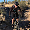
This trail has a little bit of everything. If looking for a good workout, has significantly more elevation gain than Ocotillo. Hits several high points along way with amazing views, essentially a very large rollercoaster of ups and downs. Usually more crowded with hikers and bikers near the NW and SE trailheads, in-between is pretty sparse even on days with perfect weather. Keep an eye out for hot air balloons, they pop up everywhere
| c1 | c2 | c3 | c4 |
|---|---|---|---|
January | February | March | April |
May | June | July | August |
September | October | November | December |

Service Road Atlas is a free to use, community-driven service for viewing and creating reports on the numerous back-country service roads around B.C. and Alberta.
Save the current map location and zoom level as your default home location whenever this page is loaded.
SaveWe hope you've been enjoying Trailforks!
Create a FREE account to view all trail reviews and much more.
 TRAILFORKS HTA & contributors
You must enter a description before submitting.

