more stats
1,194 ft
Distance
25 ft
Climb
-80 ft
Descent
00:05:47
Avg time
-52 ft
Altitude change
458 ft
Altitude min
539 ft
Altitude max
513 ft
Altitude start
459 ft
Altitude end
-4.4%
Grade
-23.4%
Grade max
20.9%
Grade min
295 ft
Distance climb
633 ft
Distance down
213 ft
Distance flat
00:05:47
Avg time

Splurge Details

  • Activities
    • Mountain Bike
    • E-Bike
    • Hike
    • Trail Running
  • Riding Area
    Partridge Hills
    Victoria, British Columbia
  • Difficulty Rating
  • Local Popularity
    80 in Mountain Biking [+]
    • 75 in E-Biking
    • 60 in Trail Running
    • 60 in Hiking
  • Global Ranking
    #79960 in Mountain Biking [+]
    • #56862 in E-Biking
    • #91790 in Trail Running
    • #97122 in Hiking
  • Hiking SAC Scale
    T2 Mountain Hiking
  • Trail Type
    Singletrack
  • Bike Type
    DH, AM, XC
  • Direction
    Downhill Primary
    Popular Direction Shown
  • Climb Difficulty
    Black Diamond
  • Physical Rating
    Moderate
  • Trail Visibility
    Always easy to follow
  • Dogs Allowed
    Yes
  • eBike Allowed
    Yes up to Class 1
  • Land Owner
    BC Parks

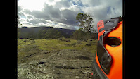
Spend a bit of energy climbing up from Urge and get rewarded with a fun way back to Partridge Parkway. Just make sure to keep right. This trail features a rock roll, steep corners and a steep dirt roll out to the parkway with no ride around for the exit roll.

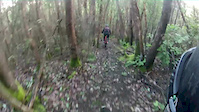
This trail was previously called "Danger Trail" as the begining is shared with the original "Danger Trail". This trail diverges south while the original trail heads north through the DnD property and eventually connects up to the now sanctioned blue section of Danger Trail.

Recent Activity on Trail

Past Week
  • 6 rides
  • 16 miles average
6 Months
  • 106 rides
  • 8 miles avg distance
All
  • 833 rides
  • Last: Jul 4, 2026
c1c2c3c4
January
February
March
April
May
June
July
August
September
October
November
December
Status:
on Jun 21, 2026
Dry
Avg: 3.99 (3 votes)
Your vote: 0

view (4,949)
close
3D
Trail Conditions
  • Unknown
  • Snow Groomed
  • Snow Packed
  • Snow Covered
  • Snow Cover Partial
  • Freeze/thaw Cycle
  • Icy
  • Prevalent Mud
  • Wet
  • Variable
  • Ideal
  • Dry
  • Very Dry
Trail Flow (Ridden Direction)
Trailforks scans users ridelogs to determine the most popular direction each trail is ridden. A good flowing trail network will have most trails flowing in a single direction according to their intension.
The colour categories are based on what percentage of riders are riding a trail in its intended direction.
  • > 96%
  • > 90%
  • > 80%
  • > 70%
  • > 50%
  • < 50%
  • bi-directional trail
  • no data
Trail Last Ridden
Trailforks scans ridelogs to determine the last time a trail was ridden.
  • < 2 days
  • < 1 week
  • < 2 weeks
  • < 1 month
  • < 6 months
  • > 6 months
Trail Ridden Direction
The intended direction a trail should be ridden.
  • Downhill Only
  • Downhill Primary
  • Both Directions
  • Uphill Primary
  • Uphill Only
  • One Direction
Contribute Details
Colors indicate trail is missing specified detail.
  • Description
  • Photos
  • Description & Photos
  • Videos
Trail Popularity ?
Trailforks scans ridelogs to determine which trails are ridden the most in the last 9 months. Trails are compared with nearby trails in the same city region with a possible 25 colour shades. Think of this as a heatmap, more rides = more kinetic energy = warmer colors.
  • most popular
  • popular
  • less popular
  • not popular
ATV/ORV/OHV Filter
Max Vehicle Width
inches
US Cell Coverage
Legend
cell carrier legend

Radar Time
Activity Recordings
Trailforks uses anonymized public activity data. ?
Activity Recordings
Trailforks uses anonymized public activity data. ?
Personal Heatmap
Activity Types
all / none
Options
2
Date range month
Winter Trails
Warning A routing network for winter maps does not exist. Selecting trails using the winter trails layer has been disabled.
Missing Trails
Most Popular
Least Popular
Trails are colored based on popularity. The more popular a trail is, the more red. Less popular trails trend towards green.
Jump Magnitude Heatmap
Heatmap of where riders jump on trails. Zoom in to see individual jumps, click circles to view jump details.
BC Backroad Status

Service Road Atlas is a free to use, community-driven service for viewing and creating reports on the numerous back-country service roads around B.C. and Alberta.

map legend
Slope Aspect
Direction the slope faces
Flat N NE E SE S SW W NW
Trails Deemphasized
Trails are shown in grey.
disable
Only show trails with no bike usage.
Enable
Suggested Layers
Based on selected activity type

    Save the current map location and zoom level as your default home location whenever this page is loaded.

    Save
        Directions to splurge trailhead (48.548010, -123.474960)

        Photos

        No photos have been added for Splurge yet, add a photo.

        Videos

        2 more »
        180226 Partridge
        4:15 | 206 | Feb 27, 2018 , Victoria
        151230 Danger Trail Branch
        8:09 | 154 | Dec 31, 2015 , Victoria

        Routes with this trail

        5 miles 1,151 ft 13
        The planned group ride route for the SIMBS July 24 2025 group ride.
        1.0 5 miles 962 ft 11
        Idea for a xc mtb race course, this part is in Partridge

        2 Reviews & Comments


        We hope you've been enjoying Trailforks!

        Create a FREE account to view trail comments and much more.

        Frequently Asked Questions About Splurge

        Where is Splurge located?
        Splurge is located in Partridge Hills, Victoria, British Columbia, Canada. It is part of the Partridge Hills trail network. The trailhead is located at coordinates 48.54801, -123.47496.
        How hard is Splurge?
        Splurge is rated as Black Diamond difficulty. The physical rating is Moderate. The average grade is 4.4%. The climb difficulty is rated Black Diamond.
        What is the elevation gain for Splurge?
        Splurge has 25 ft of elevation gain. The trail has 80 ft of elevation descent. The elevation ranges from 458 ft to 539 ft.
        Is Splurge a point to point trail?
        Splurge is not a point to point trail. The direction is Downhill Primary. The trail type is singletrack.

        Hit the Trail

        Open in App

        Get this trail on your phone instantly.
        open trail in app

        Download Trail

        Save to wishlist, Garmin & download.
        save the trail

        Find Related Routes

        Find routes and users activities that include this trail.
        find routes for this trail

        You must enter a description before submitting.