
close
3D
Trail Conditions
- Unknown
- Snow Groomed
- Snow Packed
- Snow Covered
- Snow Cover Partial
- Freeze/thaw Cycle
- Icy
- Prevalent Mud
- Wet
- Variable
- Ideal
- Dry
- Very Dry
Trail Flow (Ridden Direction)
Trailforks scans users activity logs to determine the most popular direction each trail is ridden. A good flowing trail network will have most trails flowing in a single direction according to their intension.
The colour categories are based on what percentage of users are riding a trail in its intended direction.
The colour categories are based on what percentage of users are riding a trail in its intended direction.
- > 96%
- > 90%
- > 80%
- > 70%
- > 50%
- < 50%
- bi-directional trail
- no data
Trail Last Used
Trailforks scans activity logs to determine the last time a trail was ridden.
- < 2 days
- < 1 week
- < 2 weeks
- < 1 month
- < 6 months
- > 6 months
Trail Ridden Direction
The intended direction a trail should be ridden.
- Downhill Only
- Downhill Primary
- Both Directions
- Uphill Primary
- Uphill Only
- One Direction
Contribute Details
Colors indicate trail is missing specified detail.
- Description
- Photos
- Description & Photos
- Videos
Trail Popularity ?
Trailforks scans activity logs to determine which trails are ridden the most in the last 9 months.
Trails are compared with nearby trails in the same city region with a possible 25 colour shades.
Think of this as a heatmap, more activities = more kinetic energy = warmer colors.
- most popular
- popular
- less popular
- not popular
ATV/ORV/OHV Filter
Max Vehicle Width
inches
US Cell Coverage
Legend

Radar Time
Activity Recordings
Trailforks uses anonymized public activity data.
?
Activity Recordings
Trailforks uses anonymized public activity data.
?
Winter Trails
Warning
A routing network for winter maps does not exist. Selecting trails using the winter trails layer has been disabled.
Missing Trails
Most Popular
Least Popular
Trails are colored based on popularity. The more popular a trail is, the more red. Less popular trails trend towards green.
Jump Magnitude Heatmap
Heatmap of where users jump on trails. Zoom in to see individual jumps, click circles to view jump details.
BC Backroad Status
![map legend]()
Service Road Atlas is a free to use, community-driven service for viewing and creating reports on the numerous back-country service roads around B.C. and Alberta.

Slope Aspect
Direction the slope faces
Trails Deemphasized
Trails are shown in grey.
Only show trails with no bike usage.
Suggested Layers
Based on selected activity type
Save the current map location and zoom level as your default home location whenever this page is loaded.
SaveVictoria trails and routes are listed on Trailforks with interactive trail maps, difficulty ratings, photos, and user-reported trail conditions. The Trailforks community has mapped hundreds of trails and shared thousands of photos in this region. Supported activity types include Trail Running, Hiking, Mountain Biking, E-Biking, Gravel Biking, Horseback, Winter Fat Biking and Adaptive Biking. Trails here are often faint trail, flowy and rocky. Scenery includes summits, views and ridgelines. Common trail features include rock slabs, rock gardens and drops. Many trails are family friendly. Amenities include picnic spots and restrooms. Popular destinations include Hartland Mountain Bike Park, Thetis Lake Regional Park and Partridge Hills.
This is an auto-generated description of Victoria.
Login or register to submit a custom description.
Trail info last updated
Activities Click to view
- Mountain Bike
278 trails
- E-Bike
240 trails
- Gravel Bike
81 trails
- Adaptive Bike
7 trails
- Winter Fat Bike
26 trails
- Horse
36 trails
- Hike
330 trails
- Trail Running
331 trails
Region Details
- 52
- 3
- 18
- 118
- 69
- 18
Region Status
Open as of Oct 15, 2026


Stats
- Avg Trail Rating
- Trails (view details)
- 368
- Trails Mountain Bike
- 278
- Trails E-Bike
- 240
- Trails Gravel Bike
- 81
- Trails Adaptive Bike
- 7
- Trails Winter Fat Bike
- 26
- Trails Horse
- 36
- Trails Hike
- 330
- Trails Trail Running
- 331
- Total Distance
- 169 miles
- Total Descent
- 36,237 ft
- Total Vertical
- 1,464 ft
- Highest Trailhead
- 1,467 ft
- Reports
- 15,880
- Photos
- 2,062
- Completed Counter
- 258,102
Articles
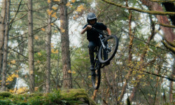
Video: Connor Hallas Balances University Exams with Vancouver Island Freeride Lines
Jun 11, 2026 from pinkbike.com
Shot between late-night study sessions and midterms, 'Study Break' follows Connor Hallas as he escapes the classroom to ride Vancouver Island’s...

Video: Mark Matthews Hits Big Jumps on a Small Bike in 'Hometown Trails'
Dec 3, 2019 from pinkbike.com
Mark highlights some of the areas he grew up riding on his 120mm Marin Hawk Hill.
Sub Regions
-
Bear Mountain
- 8
- 1
- 3
-
Francis/King Regional Park
- 1
-
Gowlland/Tod Provincial Park
- 1
-
Hartland Mountain Bike Park
- 1
- 42
- 22
- 10
-
Mt. Work Regional Park
- 1
- 5
- 13
- 3
-
Partridge Hills
- 3
- 24
- 18
- 2
-
Thetis Lake Regional Park
- 2
- 26
- 10
Popular Victoria Mountain Biking Trails
• 100 ★ 3.4 • 2,411 ft • 62 ft • 3,647 •
Easy Rider is the beginner-friendly entrance trail at Hartland.
• 100 ★ 4.1 • 879 ft • 95 ft • 3,603 •
A short climb to start your ride, or a fun downhill to end it. Substantially rerouted in 2018 by the SIMBS trail crew, to move the trail out of a seasonal watercourse.
• 100 ★ 4.5 • 2,874 ft • 9 ft • 2,623 •
Torpedo Run is Hartland's original flow trail, and remains the only trail to have been mostly machine built. A double-track blue flow trail, it has good sight lines, lots of speed and options for all levels of riders. It has undergone a...
• 100 ★ 4.6 • 1,385 ft • 3 ft • 2,518 •
SK used to be an old school trail comprised of gnarly/sketchy stunts and structures with high consequences. All the old stuff is gone save for a couple of natural features that sees little to no action. SIMBS and the trail elves have...
• 100 ★ 4.2 • 3,261 ft • 72 ft • 2,298 •
Part of a sustained descent to get to the south end of the park. Link it up with Southridge and Fun trail.
• 100 ★ 3.9 • 761 ft • 0 ft • 2,287 •
Very short trail with a few rooty challenges. Most often ridden after descending from Snakes & Ladders and Little Face. The same route can be ridden as a difficult climb.
• 90 ★ 4.2 • 3,100 ft • 20 ft • 2,230 •
WYD parallels the landfill fence and features rocks, rolls and roots. Close to bike park quality berms and engineered drops/jumps. Difficult options have intermediate options.
• 95 ★ 3.4 • 1,004 ft • 92 ft • 2,203 •
The Hartland classic switchback climbing trail. This used to be the main route up in the park, until Middle Earth was built in 2022.Still regularly ridden by those who appreciate a challenge wet or dry.
Victoria Mountain Bike Routes
★ 5.0 • 6 miles • 1,087 ft • 13 •
This loop suggestion is part of our Community Routes—a group of routes created by the community, for the...
★ 5.0 • 4 miles • 587 ft • 12 • Loop •
This loop suggestion is part of our Community Routes—a group of routes created by the community, for the...
★ 4.8 • 5 miles • 981 ft • 26 • Loop •
Pretty fantastic route around Hartland. Easily sub Snakes for Torpedo and/or Green Ribbon for Sofa if you...
★ 4.0 • 3 miles • 684 ft • 9 • Loop •
Looking for some Hartland tech? Here's a favourite loop of mine that takes you up and over to Hot Cherry...
5 miles • 574 ft • 12 •
Trails in Route: Inventive 401 m X Lower Diaphragm 453 m X Diaphragm Climb 1.1 km X Painless 499 m X Lower...
★ 3.8 • 3 miles • 353 ft • 31 • Loop •
Mostly blue route at Hartland. From the parking lot, take the regional trail to Centrefold, up Centrefold...
Photos of Victoria Mountain Bike
Videos of Victoria Mountain Bike
mtb
0:21 |
98 |
Oct 2, 2022
Recent Trail Reports
| status | trail | date | condition | info | user |
|---|---|---|---|---|---|
| Breathless | Oct 15, 2026 @ 8:25pm (America/Vancouver) Oct 15, 2026 | Very Dry | donpottermtb | ||
| Shock Treatment | Oct 11, 2026 @ 9:43am (America/Vancouver) Oct 11, 2026 | Ideal | Mikepatt14 | ||
| Kokanee Highway | Oct 11, 2026 @ 9:43am (America/Vancouver) Oct 11, 2026 | Ideal | Mikepatt14 | ||
| One Less Car | Oct 11, 2026 @ 9:43am (America/Vancouver) Oct 11, 2026 | Ideal | Mikepatt14 | ||
| Second Ave. | Oct 11, 2026 @ 9:43am (America/Vancouver) Oct 11, 2026 | Ideal | Mikepatt14 | ||
| Heads Up | Oct 11, 2026 @ 9:43am (America/Vancouver) Oct 11, 2026 | Dry | Mikepatt14 | ||
| N Trail | Oct 11, 2026 @ 9:43am (America/Vancouver) Oct 11, 2026 | Ideal | Mikepatt14 | ||
| Daryl's Dive Up | Oct 11, 2026 @ 9:43am (America/Vancouver) Oct 11, 2026 | Dry | Mikepatt14 | ||
| Daryl's Dive | Oct 11, 2026 @ 9:43am (America/Vancouver) Oct 11, 2026 | Dry | Mikepatt14 | ||
| Over Dive | Oct 11, 2026 @ 9:43am (America/Vancouver) Oct 11, 2026 | Ideal | Mikepatt14 |
Activity Feed
| username | action | type | title | date |
|---|---|---|---|---|
| meghanpw | ridden | trail | activity #106245795 | Oct 19, 2026 @ 10:15pm 13 hours |
| 000Larrabee | add | karma | activity #106195240 | Oct 19, 2026 @ 3:43am 1 day |
| i7SZu9 | wishlist | route | activity #106054367 and 1 more | Oct 17, 2026 @ 8:30am Oct 17, 2026 |
| onkea | wishlist | trail | activity #105970686 | Oct 15, 2026 @ 10:21pm Oct 15, 2026 |
| donpottermtb | add | report | activity #105968449 | Oct 15, 2026 @ 8:30pm Oct 15, 2026 |
Recent Comments
| username | type | title | comment | date |
|---|---|---|---|---|
| report | I'm so glad it turned out to be nice weather... | Sep 28, 2026 @ 12:12pm Sep 28, 2026 | ||
| report | Thank you helping clear debris off the trail... | Sep 25, 2026 @ 10:04pm Sep 25, 2026 | ||
| report | People do ride up it with regular bikes. I was... | Sep 25, 2026 @ 3:56pm Sep 25, 2026 | ||
| report | Bet you wouldn't ride up WYD without your... | Sep 21, 2026 @ 8:39pm Sep 21, 2026 | ||
| trail | All of the interesting or fun trails and... | Sep 14, 2026 @ 1:18pm Sep 14, 2026 |
Local Badges
-
SIMBS Community Routes - Beginner 372 awarded -
SIMBS Community Routes - Intermediate 381 awarded -
SIMBS Community Routes - Intermediate 17 awarded -
SIMBS Community Routes - Intermediate 28 awarded -
SIMBS Community Routes - Beginner 219 awarded -
SIMBS Community Routes - Beginner 142 awarded
Bike & Skill Parks
| name | type | city | rating |
|---|---|---|---|
| Cecilia Ravine Bike Park | skill park | Victoria | |
| Bear Mountain Jump Park & Pump Track | skill park | Victoria | |
| Technical Training Area (aka TTA) | skill park | Victoria | |
| Topaz Bike Park | skill park | Victoria | |
| Tripp Station Bike Park | skill park | Victoria |
Upcoming Local Events




Local Products

Local Trail Supporters
- SIMBS
- SIIMBS
- Fat Bastards
- Russ Hayes, Slegg Lumber/ Butler Brother Supplies Ltd, Western Equipment, Hilti Canada
Activity Type Stats
| activitytype | trails | distance | descent | descent distance | total vertical | rating | global rank | state rank | photos | reports | routes | activity logs |
|---|---|---|---|---|---|---|---|---|---|---|---|---|
| Mountain Bike | 278 | 116 miles | 25,066 ft | 49 miles | 1,394 ft | #23 | #6 | 1,996 | 15,855 | 172 | 199,873 | |
| E-Bike | 240 | 109 miles | 23,337 ft | 46 miles | 1,394 ft | #130 | #22 | 26 | 15,039 | 29 | 9,431 | |
| Gravel Bike | 81 | 53 miles | 4,180 ft | 16 miles | 1,053 ft | #98 | #7 | 5 | 1,785 | 3 | 2,202 | |
| Adaptive Bike | 7 | 4 miles | 308 ft | 1 mile | 515 ft | #659 | #20 | 143 | 5 | |||
| Winter Fat Bike | 26 | 9 miles | 1,289 ft | 3 miles | 1,017 ft | #292 | #19 | 1,051 | 6 | |||
| Horse | 36 | 23 miles | 2,480 ft | 7 miles | 1,224 ft | #243 | #15 | 2,384 | 3 | |||
| Hike | 330 | 162 miles | 31,762 ft | 64 miles | 1,463 ft | #191 | #15 | 30 | 15,453 | 1 | 9,039 | |
| Trail Running | 331 | 162 miles | 31,821 ft | 64 miles | 1,463 ft | #238 | #18 | 5 | 15,463 | 7 | 14,070 |
Frequently Asked Questions
▼
What are the best places to ride in Victoria?
Victoria has 11 areas to explore for mountain biking. The top rated areas are:
▼
What are the highest rated mountain biking trails in Victoria?
The highest rated mountain biking trails in Victoria are:
- 90s Jank (4.6/5)
- Snakes and Ladders (4.5/5)
- Sofa King (4.5/5)
- CHAINSAW (Upper) (4.4/5)
- Torpedo Run (4.4/5)
▼
What is the best time of the year to ride in Victoria?
Based on activity log data, the most popular months to ride in Victoria are:
- June (2,609 activities)
- May (2,527 activities)
- August (2,467 activities)
▼
Where can I park to ride in Victoria?
There are 37 parking locations listed in Victoria. The most popular parking spots are: View all parking and trailhead locations on the map to plan your visit.
▼
What is the longest trail in Victoria?
The longest trail in Victoria is Bubble Wrap at 3.3 km. View all trails sorted by distance.
▼
What are the best & highest rated hiking trails in Victoria?
The best hiking trails in Victoria are:
- Gold Mine Trail
- Jocelyn Hill Trail
- John's Bump
- Mt Finlayson Summit Trail
- Mt Work Summit Trail - North
▼
What are the best & highest rated trail running trails in Victoria?
▼
How many trails are in Victoria?
Victoria has a total of 368 trails. Of those, 278 are designated for mountain biking. Browse top mountain biking trails in Victoria to find detailed information including difficulty ratings, distances, and trail conditions.
▼
Which trail has the most elevation gain in Victoria?
The trail with the most elevation gain in Victoria is Bubble Wrap with 124 m of elevation gain. View all trails sorted by elevation gain.
▼
Which trail has the most elevation descent in Victoria?
The trail with the most elevation descent in Victoria is Bubble Wrap with 261 m of elevation descent. View all trails sorted by elevation descent.
▼
What activities are most popular in Victoria?
Victoria supports the following activities: Mountain Biking, E-Biking, Gravel Biking, Adaptive Biking, Winter Fat Biking, Horseback, Hiking, Trail Running.
▼
What bike services are there in Victoria?
The following bike services are available in Victoria:
- Bike Shop (23)
- Guides & Tours (3)
- Trail Association (2)
- Other (2)
- Coaching & Camps (2)
- Shuttle Service (1)
- Club (1)
▼
What are the steepest mountain biking trails in Victoria?
The steepest mountain biking trail in Victoria is Stewart Mountain Trail (South) with an average grade of 18.9%. View all trails sorted by grade.
▼
Are there any trails with scenic viewpoints in Victoria?
Yes, there are 28 scenic viewpoints marked along trails in Victoria. Some popular viewpoints include: Explore more points of interest to find trails with the best views.
▼
What trails have the biggest jumps in Victoria?
The trails with the biggest jumps in Victoria are: Browse all mountain bike trails to find trails with jumps and technical features.
▼
Are the trails open in Victoria?
The overall region status for Victoria is Clear / Green. Out of 271 trails:
- Clear / Green: 242
- Minor Issue / Yellow: 17
- Significant Issue / Amber: 4
- Closed: 8
▼
What are the trail conditions in Victoria?
Based on trail reports from the past week in Victoria:
- Very Dry: 1 trail
▼
Can I ride an ebike in Victoria?
Yes, Victoria supports e-bike riding. There are 206 trails in Victoria that allow e-bikes. Check the e-bike trails listing for specific trail access details and any local regulations.
▼
What are the most popular mountain biking routes in Victoria?
The most popular mountain biking routes in Victoria are:
- SIMBS Intermediate Hartland Loop 1 - Classic Flow!
- SIMBS Beginner / Intermediate Hartland Loop 2
- Kickduro
▼
What type of bike is most common in Victoria?
Based on activity log data, the most common bike types used in Victoria are:
- AM (3,522 activities)
- XC (323 activities)
- DH (128 activities)
- RD (81 activities)
- Fat (62 activities)
▼
What are the most popular Strava Segments in Victoria?
The most popular Strava segments in Victoria are:
- New JSB sprint (26,429 athletes)
- Dead Man's Creek to Four Mile Hill (13,165 athletes)
- Sprint from the lights y'all (12,808 athletes)
▼
What are some popular technical trail features in Victoria?
There are 53 technical trail features (TTFs) in Victoria. Some popular features include:
- Organ Donor Final Roll (Rock Face)
- The Big Roll of Green Ribbon (Rock Face)
- Green Ribbon Rock Jump (Jump)
- Orange Crush Off-Camber Rock Face (Rock Face)
- Hot Cherry Ridge (Rock Face)
▼
What trails are closed in Victoria?
There are currently 8 closed trails in Victoria. The breakdown of all trail statuses is:
- Clear / Green: 242
- Minor Issue / Yellow: 17
- Significant Issue / Amber: 4
- Closed: 8
▼
Are there accessible or adaptive trails in Victoria?
Yes, there are 7 accessible/adaptive trails in Victoria. View all adaptive trails in Victoria for specific accessibility information.
▼
Are there local clubs or events in Victoria?
There are 1 upcoming events in Victoria. View upcoming events. There are 5 local clubs or associations listed in the Victoria directory. Browse the local directory for details.
▼
Are there any mountain biking guiding or tour operators in Victoria?
Yes, there are mountain biking guiding and tour operators in Victoria: Browse all guiding and tour operators in Victoria.
▼
What are the most popular mountain biking trails in Victoria?
The most popular mountain biking trails in Victoria are: View all mountain biking trails sorted by popularity.
▼
What are the best beginner ride trails in Victoria?
The best beginner mountain biking trails in Victoria are:
- Lower Summit Up Trail (3/5)
- Easy Rider (3.4/5)
- Connector (4/5)
Activities
Trails
- By canadaka
 Trailforks & contributors
- Admins: Dubnyk, Dubnyk, CRD-Parks, SIMBS, NTS
- #3038 - 117,052 views
- victoria activity log | embed map of Victoria mountain bike trails | victoria mountain biking points of interest polygons
Downloading of trail gps tracks in kml & gpx formats is enabled for Victoria.
You must login to download files.
