





Open in App
Get this trail on your phone instantly.

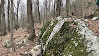
After splitting off Boulder ridge it crosses the white trail on the way up to the top of the ridge and then traverses the ridge for a little bit before dropping down to the shelf and then switch backing down the ridge to the bottom of thunder. The trail was hand cut by volunteers using the grade and rockiness of the ridge line to create an extremely challenging descent down the mountain. This section of trail utilizes elevation in the park in a manner which is not found elsewhere in the existing trail system.
Ride at your own risk, trail is for Highly Advanced riders with insane bike skill and safety gear. Learn the trail and it's features before attempting them.

| c1 | c2 | c3 | c4 |
|---|---|---|---|
January | February | March | April |
May | June | July | August |
September | October | November | December |

Service Road Atlas is a free to use, community-driven service for viewing and creating reports on the numerous back-country service roads around B.C. and Alberta.
Save the current map location and zoom level as your default home location whenever this page is loaded.
Save Rock Face
We hope you've been enjoying Trailforks!
Create a FREE account to view all trail reviews and much more.
You must enter a description before submitting.

