more stats
3,389 ft
Distance
507 ft
Climb
00:14:09
Avg time
507 ft
Altitude change
793 ft
Altitude min
1,300 ft
Altitude max
793 ft
Altitude start
1,299 ft
Altitude end
15%
Grade
2.1%
Grade max
40.5%
Grade min
3,389 ft
Distance climb
00:14:09
Avg time

Summit Details

  • Activities
    • Mountain Bike
    • E-Bike
  • Riding Area
  • Difficulty Rating
  • Local Popularity
    35 in Mountain Biking [+]
    • 90 in E-Biking
  • Global Ranking
    #149781 in Mountain Biking
  • Trail Type
    Singletrack
  • Physical Rating
    Hard
  • Dogs Allowed
    Yes
  • eBike Allowed
    Yes up to Class 1
  • TTFs on Trail
    Drop, Rock Face, Rock Garden
  • Lighting
    No

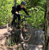
Summit trail is primarily hiking though bikes are allowed. Terrain is some of the most technical on the mountain, especially above the terminal for the triple chairlift. Additionally, rescue would be particularly difficult. Please ride safely and with respect for other trail users

Local Trail Association

Recent Activity on Trail

Past Week
  • 0 rides
  •  
6 Months
  • 4 rides
  • 5 miles avg distance
All
  • 41 rides
  • Last: Aug 29, 2026
update trails status or condition

Summit Trail Reports

statusdatedescription
Aug 13, 2026 @ 10:29am (America/Moncton)
Aug 13, 2026
Most of this was a walk, view from the Crows Nest was cool
May 7, 2025 @ 8:06am
May 7, 2025
Avoid braiding - ride through puddles
May 26, 2020 @ 1:18pm
May 26, 2020
reporter Dried out nicely and leaf cover is totally manageable. As always, remember that this is a multi-use trail and to control your speed on descent!
Apr 26, 2020 @ 3:55pm
Apr 26, 2020
reporter No trail crews have been on this yet for 2020. Likely high leaf cover, acorns, and tree debris. Also likely erosion issues up near the saddle....
Jun 7, 2019 @ 6:50am
Jun 7, 2019
reporter Rideable though needs some leaf blowing.
more »
Status:
on Aug 13, 2026
Variable
Avg: 4.13 (1 votes)
Your vote: 0

view (137)
close
      Directions to summit-160094 trailhead (44.211730, -69.141220)

      Photos

      1 more »
      mtb
      177 |
      Apr 17, 2021 @ 1:53pm
      Apr 17, 2021

      Videos

      no videos have been added for Summit yet, add a video.
      5.0
      1 Ratings
      5 100%
      4
      3
      2
      1

      3 Reviews & Comments

      bpaltiel
      Super fun enduro descent. Never too steep, but some fast off-camber slabs and derailleur-eating boulders keep it spicy.
      nmerksamer nmerksamer
      Worth the hike a bike. Great views and some cool slick rock, just be wary of the baby head garden around the top of the lift
      nmerksamer nmerksamer
      Worth the hike a bike. Great views and some awesome slick rock, just be wary of the baby heads

      We hope you've been enjoying Trailforks!

      Create a FREE account to view all trail reviews and much more.

      Frequently Asked Questions

      Where is Summit located?
      Summit is located in Camden Snow Bowl (Ragged Mountain Recreation Area), Camden, Maine, United States. It is part of the Camden Snow Bowl (Ragged Mountain Recreation Area) trail network. The trailhead is located at coordinates 44.21173, -69.14122.
      How hard is Summit?
      Summit is rated as Black Diamond difficulty. The physical rating is Hard. The average grade is 15%.
      What is the elevation gain for Summit?
      Summit has 507 ft of elevation gain. The elevation ranges from 793 ft to 1,300 ft.
      How long is Summit?
      Summit is 3,389 ft long. The trail type is singletrack.
      Are dogs allowed on Summit?
      Yes, dogs are allowed on Summit. Please keep dogs on a leash where required and clean up after them.
      How do I access Summit? Where is the closest parking trailhead?
      The closest parking and trailhead locations to Summit are: View all parking locations in the area.
      How long does it take to ride Summit?
      Based on recorded activities, it takes an average of 8 minutes to ride Summit. The trail is 3,389 ft long. Actual times will vary based on fitness level, conditions, and pace. View recent activity logs for more details.
      How busy is Summit?
      Summit is a less popular trail with lighter traffic. There have been 122 recorded activities on this trail. The trail has received 137 check-ins. View recent activity on this trail.

      Hit the Trail

      Open in App

      Get this trail on your phone instantly.

      open trail in app

      Download Trail

      Save to wishlist, Garmin & download.
      save the trail

      Find Related Routes

      Find routes and users activities that include this trail.
      find routes for this trail

      You must enter a description before submitting.