2,208 ft
Distance
33 ft
Climb
-186 ft
Descent
00:04:55
Avg time

Thrash & Crash Details

  • Activities
    • Mountain Bike
    • Hike
    • Trail Running
  • Riding Area
    Pidherny Recreation Site
    Prince George, British Columbia
  • Difficulty Rating
  • Voted Difficulty
    Blue (2 votes)
  • Trail Type
    Singletrack
  • Bike Type
    AM
  • Direction
    Downhill Only
    Popular direction shown
  • Dogs Allowed
    Yes
  • TTFs on Trail
    A-Frame, Berm
  • Global Ranking
    #98898 in Mountain Biking [+]
    • #88618 in Trail Running
  • Local Popularity
    65 in Mountain Biking [+]
    • 45 in Trail Running
    • 5 in Hiking

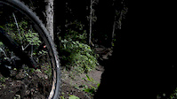
A moderately technical, mostly downhill, trail leading from the bottom of Ten Dollar down to Pidherny road. The trail continues (with some punchy climbs) to the bottom of Papa Woods DH and Dimeslot, but this section is currently dilapidated and will require some work to be rideable.

Local Trail Association
More Stats for Thrash & Crash mountain bike trail trail
  • Altitude change
    -153 ft
  • Altitude min
    2,292 ft
  • Altitude max
    2,445 ft
  • Altitude start
    2,445 ft
  • Altitude end
    2,293 ft
  • Grade
    -6.9%
  • Grade max
    -22%
  • Grade min
    18.4%
  • Distance climb
    440 ft
  • Distance down
    1,562 ft
  • Distance flat
    207 ft
  • Avg time
    00:04:55
  • Avg reverse time
    00:05:45
  • view trail stats
Status:
on May 8, 2025
Dry
Avg: 3.35 (5 votes)
Your vote: 0

view (867)
close
3D
Trail Conditions
  • Unknown
  • Snow Groomed
  • Snow Packed
  • Snow Covered
  • Snow Cover Partial
  • Freeze/thaw Cycle
  • Icy
  • Prevalent Mud
  • Wet
  • Variable
  • Ideal
  • Dry
  • Very Dry
Trail Flow (Ridden Direction)
Trailforks scans users ridelogs to determine the most popular direction each trail is ridden. A good flowing trail network will have most trails flowing in a single direction according to their intension.
The colour categories are based on what percentage of riders are riding a trail in its intended direction.
  • > 96%
  • > 90%
  • > 80%
  • > 70%
  • > 50%
  • < 50%
  • bi-directional trail
  • no data
Trail Last Ridden
Trailforks scans ridelogs to determine the last time a trail was ridden.
  • < 2 days
  • < 1 week
  • < 2 weeks
  • < 1 month
  • < 6 months
  • > 6 months
Trail Ridden Direction
The intended direction a trail should be ridden.
  • Downhill Only
  • Downhill Primary
  • Both Directions
  • Uphill Primary
  • Uphill Only
  • One Direction
Contribute Details
Colors indicate trail is missing specified detail.
  • Description
  • Photos
  • Description & Photos
  • Videos
Trail Popularity ?
Trailforks scans ridelogs to determine which trails are ridden the most in the last 9 months. Trails are compared with nearby trails in the same city region with a possible 25 colour shades. Think of this as a heatmap, more rides = more kinetic energy = warmer colors.
  • most popular
  • popular
  • less popular
  • not popular
ATV/ORV/OHV Filter
Max Vehicle Width
inches
US Cell Coverage
Legend
cell carrier legend

Radar Time
x Activity Recordings
Trailforks users anonymized public ridelogs from the past 6 months.
  • mountain biking recent
  • mountain biking (>6 month)
  • hiking (1 year)
  • moto (1 year)
Activity Recordings
Trailforks users anonymized public skilogs from the past 12 months.
  • Downhill Ski
  • Backcountry Ski
  • Nordic Ski
  • Snowmobile
Winter Trails
Warning A routing network for winter maps does not exist. Selecting trails using the winter trails layer has been disabled.
x Missing Trails
Most Popular
Least Popular
Trails are colored based on popularity. The more popular a trail is, the more red. Less popular trails trend towards green.
Jump Magnitude Heatmap
Heatmap of where riders jump on trails. Zoom in to see individual jumps, click circles to view jump details.
Trails Deemphasized
Trails are shown in grey.
disable
Only show trails with NO bikes.
enable

Save the current map location and zoom level as your default home location whenever this page is loaded.

Save
      Directions to thrash--crash trailhead (53.985890, -122.850480)
      update trails status or condition

      Thrash & Crash Trail Reports

      statusdatedescription
      May 8, 2025 @ 8:01pm
      May 8, 2025
      clear of trees, stump is removed, trail needs a rake
      May 6, 2025 @ 7:00pm
      May 6, 2025
      One partially uprooted stump along the trail at the bottom of the steep section, needs raking
      May 4, 2025 @ 6:47pm
      May 4, 2025
      Multiple trees down above road exit Needs raking
      May 14, 2024 @ 4:13pm
      May 14, 2024
      Has been raked
      Apr 27, 2024 @ 6:35pm
      Apr 27, 2024
      Dry, Clear of trees, still covered in debris from the winter
      view all reports »

      Recent Ridelog Activity on Trail

      Past Week
      • 0 rides
      •  
      6 Months
      • 2 rides
      • 9 miles avg distance
      All
      • 79 rides
      • Last: Jul 5, 2025

      Photos

      more »
      90 |
      Mar 3, 2022 @ 9:54am
      Mar 3, 2022
      41 |
      Nov 21, 2021 @ 12:48pm
      Nov 21, 2021
      112 |
      Jul 16, 2018 @ 2:35pm
      Jul 16, 2018
      122 |
      Jul 16, 2018 @ 2:35pm
      Jul 16, 2018

      Routes with this trail

      more »
      titledistance
      A Pidherny Half13 miles
      Lower Pidherny to Ridge Trail Lookout (Out & Back)8 miles
      Rustchucker 2018 race13 miles
      Rustchucker 2019 race14 miles

      Reviews / Comments

      No reviews yet, be the first to write a review or ask a question.
      Use trail reports to comment on trail conditions.


      We hope you've been enjoying Trailforks!

      Create a FREE account to view trail comments and much more.

      Videos

      more »
      Noah Windsor 'Thrash&Crash'
      0:49 | 850 | Aug 17, 2014 , Prince George
      • By cerebrosideTF Pro & contributors
      • #54349 - 1,780 views

      You must enter a description before submitting.