Details
-
Activities
- Mountain Bike
- E-Bike
- Horse
- Hike
- Trail Running
-
Riding AreaGalbraith
Bellingham, Washington -
Difficulty Rating
-
Trail TypeDirt/Gravel Road
-
Bike TypeRD, Adaptive MTB, Gravel
-
DirectionUphill PrimaryPopular direction shown
-
Climb DifficultyBlue
-
Physical RatingModerate
-
Trail VisibilityAlways easy to follow
-
Dogs AllowedYes
-
eBike Allowed
-
Ride in RainYes
-
Local Popularity70 in Mountain Biking [+]
- 65 in E-Biking
- 5 in Trail Running
- 30 in Hiking
- 5 in Horseback
Tower Road is also known on some trail maps/descriptions as RD 3000. The traditional access to this road has changed and is now accessed by "Gate and Switch" trail. There are three helpful landmarks for navigating this ascent:
• Blue Rock, which is the junction with RD 2000
• Red Rock, which is the junction with RD 4000
• Yellow Rock, which is the junction with RD 3200
Yes, there are actual colored rocks on the ground, between the forks in the road. They aren't as big and conspicuous as you might think. They paint might be fading or they could be covered with dirt. Look closely.
Local Trail Association
-
-
Please consider joining or donating to the local trail association to supportdonate to earn trail karma!
trail development & maintenance.
Traditionally Indigenous Territory
More Stats for Towers (South Side Approach) multi-use trail trail
-
Altitude change1,018 ft
-
Altitude min770 ft
-
Altitude max1,789 ft
-
Altitude start770 ft
-
Altitude end1,788 ft
-
Grade7.8%
-
Grade max1.9%
-
Grade min33.3%
-
Distance climb2 miles
-
Avg time00:31:45
-
Avg reverse time00:48:01
- view trail stats
-
Layers w
- Map Content
- More Layers
- Pro
- Pro
- Pro
- Pro
- Pro
- Pro
- Pro
- Pro
-
Upgrade to

- Unknown
- Snow Groomed
- Snow Packed
- Snow Covered
- Snow Cover Partial
- Freeze/thaw Cycle
- Icy
- Prevalent Mud
- Wet
- Variable
- Ideal
- Dry
- Very Dry
The colour categories are based on what percentage of riders are riding a trail in its intended direction.
- > 96%
- > 90%
- > 80%
- > 70%
- > 50%
- < 50%
- bi-directional trail
- no data
- < 2 days
- < 1 week
- < 2 weeks
- < 1 month
- < 6 months
- > 6 months
- Downhill Only
- Downhill Primary
- Both Directions
- Uphill Primary
- Uphill Only
- One Direction
- Description
- Photos
- Description & Photos
- Videos
- most popular
- popular
- less popular
- not popular

- mountain biking recent
- mountain biking (>6 month)
- hiking (1 year)
- moto (1 year)
- Downhill Ski
- Backcountry Ski
- Nordic Ski
- Snowmobile
Save the current map location and zoom level as your default home location whenever this page is loaded.
SaveTowers (South... Trail Reports
Recent Ridelog Activity on Trail
- 19 rides
- 16 miles avg distance
- 149 rides
- 17 miles avg distance
- 4,733 rides
- Last: May 17, 2024
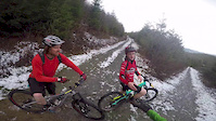
Photos
Routes with this trail
Trail Products
We hope you've been enjoying Trailforks!
Create a FREE account to view trail comments and much more.
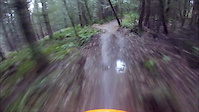
Videos
Nearby Trails
- Gate And Switch 125 ft
- Pipeline 741 ft
- Gate & Switch Cutoff 909 ft
- Rd 2100 1,667 ft
- Backcountry Connector 3,245 ft
- By kyleyoungtransition & contributors
- #9937 - 4,498 views
- follow/subscribe
- login to download gpx or kml files.
You must enter a description before submitting.