more stats
3,009 ft
Distance
-394 ft
Descent
00:05:41
Avg time
-395 ft
Altitude change
1,158 ft
Altitude min
1,553 ft
Altitude max
1,553 ft
Altitude start
1,158 ft
Altitude end
-13.1%
Grade
-37.6%
Grade max
-1.5%
Grade min
2,982 ft
Distance down
26 ft
Distance flat
00:05:41
Avg time

Tremblay Details

  • Activities
    • Mountain Bike
    • E-Bike
  • Riding Area
    Parc du Mont-Comi
    Mont-Joli, Quebec
  • Ref Number
    #9
  • Difficulty Rating
  • Voted Difficulty
    Blue (2 votes)
  • Local Popularity
    80 in Mountain Biking [+]
    • 5 in E-Biking
  • Global Ranking
    #22115 in Mountain Biking
  • Trail Type
    Singletrack
  • Bike Type
    AM
  • Physical Rating
    Moderate
  • Family Friendly
    Yes
  • eBike Allowed
    Yes up to Class 1
  • TTFs on Trail
    Berm, Rock Garden

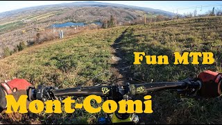
Un beau mélange de piste old school et moderne. Des beaux berms puissant et des sections de terre noire et roches. A ne pas manquer lors de votre visite.
Ce sentier fait référence à un joyeux producteur d'hydromel de la région qui tiens beaucoup a sa montagne À l'image de ce personnage, cette trail comporte des rondeurs flowy sur un terrain en apparence mou et terreux qui masque toute sa solidité comparable au rock !
Vous ne saurez vous en passer quand vous l'aurez rencontré...!

Access Info

Acces par La Donatienne au carrefour de demi montagne ou par La Monko a partir du sommet.

Bike Park

Local Trail Association
Traditionally Indigenous Territory

Recent Activity on Trail

Past Week
  • 0 rides
  •  
6 Months
  • 0 rides
  •  
All
  • 30 rides
  • Last: May 31, 2026
c1c2c3c4
January
February
March
April
May
June
July
August
September
October
November
December
Status:
on May 31, 2026
Variable
Avg: 4.39 (4 votes)
Your vote: 0

view (305)
close
3D
Trail Conditions
  • Unknown
  • Snow Groomed
  • Snow Packed
  • Snow Covered
  • Snow Cover Partial
  • Freeze/thaw Cycle
  • Icy
  • Prevalent Mud
  • Wet
  • Variable
  • Ideal
  • Dry
  • Very Dry
Trail Flow (Ridden Direction)
Trailforks scans users ridelogs to determine the most popular direction each trail is ridden. A good flowing trail network will have most trails flowing in a single direction according to their intension.
The colour categories are based on what percentage of riders are riding a trail in its intended direction.
  • > 96%
  • > 90%
  • > 80%
  • > 70%
  • > 50%
  • < 50%
  • bi-directional trail
  • no data
Trail Last Ridden
Trailforks scans ridelogs to determine the last time a trail was ridden.
  • < 2 days
  • < 1 week
  • < 2 weeks
  • < 1 month
  • < 6 months
  • > 6 months
Trail Ridden Direction
The intended direction a trail should be ridden.
  • Downhill Only
  • Downhill Primary
  • Both Directions
  • Uphill Primary
  • Uphill Only
  • One Direction
Contribute Details
Colors indicate trail is missing specified detail.
  • Description
  • Photos
  • Description & Photos
  • Videos
Trail Popularity ?
Trailforks scans ridelogs to determine which trails are ridden the most in the last 9 months. Trails are compared with nearby trails in the same city region with a possible 25 colour shades. Think of this as a heatmap, more rides = more kinetic energy = warmer colors.
  • most popular
  • popular
  • less popular
  • not popular
ATV/ORV/OHV Filter
Max Vehicle Width
inches
US Cell Coverage
Legend
cell carrier legend

Radar Time
Activity Recordings
Trailforks uses anonymized public activity data. ?
Activity Recordings
Trailforks uses anonymized public activity data. ?
Personal Heatmap
Activity Types
all / none
Options
2
Date range month
Winter Trails
Warning A routing network for winter maps does not exist. Selecting trails using the winter trails layer has been disabled.
Missing Trails
Most Popular
Least Popular
Trails are colored based on popularity. The more popular a trail is, the more red. Less popular trails trend towards green.
Jump Magnitude Heatmap
Heatmap of where riders jump on trails. Zoom in to see individual jumps, click circles to view jump details.
BC Backroad Status

Service Road Atlas is a free to use, community-driven service for viewing and creating reports on the numerous back-country service roads around B.C. and Alberta.

map legend
Slope Aspect
Direction the slope faces
Flat N NE E SE S SW W NW
Trails Deemphasized
Trails are shown in grey.
disable
Only show trails with no bike usage.
Enable
Suggested Layers
Based on selected activity type

    Save the current map location and zoom level as your default home location whenever this page is loaded.

    Save
        Directions to tremblay trailhead (48.461320, -68.203750)

        Photos

        10 more »
        152 |
        Aug 15, 2017 @ 6:19am
        Aug 15, 2017
        29 |
        Feb 26, 2026 @ 5:23pm
        Feb 26, 2026
        31 |
        Feb 26, 2026 @ 5:23pm
        Feb 26, 2026
        27 |
        Feb 26, 2026 @ 5:23pm
        Feb 26, 2026

        Videos

        1 more »
        De grandes nouveautées au Mont-Comi par FunMTB
        13:02 | 262 | Nov 18, 2021 , Mont-Joli

        2 Reviews & Comments


        We hope you've been enjoying Trailforks!

        Create a FREE account to view trail comments and much more.

        • By mikejonssantacruz & contributors
        • #97110 - 1,453 views

        Frequently Asked Questions About Tremblay

        Where is Tremblay located?
        Tremblay is located in Parc du Mont-Comi, Mont-Joli, Quebec, Canada. It is part of the Parc du Mont-Comi trail network. The trailhead is located at coordinates 48.46132, -68.20375.
        How hard is Tremblay?
        Tremblay is rated as Blue difficulty. The physical rating is Moderate. The average grade is 13.1%.
        What is the elevation gain for Tremblay?
        The trail has 394 ft of elevation descent. The elevation ranges from 1,158 ft to 1,553 ft.
        How long is Tremblay?
        Tremblay is 3,009 ft long. The trail type is singletrack.

        Hit the Trail

        Open in App

        Get this trail on your phone instantly.
        open trail in app

        Download Trail

        Save to wishlist, Garmin & download.
        save the trail

        Find Related Routes

        Find routes and users activities that include this trail.
        find routes for this trail

        You must enter a description before submitting.