
more stats
2,234 ft
Distance
54 ft
Climb
-33 ft
Descent
00:08:34
Avg time
21 ft
Altitude change
939 ft
Altitude min
968 ft
Altitude max
939 ft
Altitude start
961 ft
Altitude end
0.9%
Grade
-12.9%
Grade max
9.7%
Grade min
758 ft
Distance climb
476 ft
Distance down
984 ft
Distance flat
00:08:34
Avg time

Twister Details

  • Activities
    • Mountain Bike
    • E-Bike
    • Hike
    • Trail Running
  • Riding Area
    Hartland Mountain Bike Park
    Victoria, British Columbia
  • Difficulty Rating
  • Voted Difficulty
    Blue (3 votes)
  • Local Popularity
    90 in Mountain Biking heatmap [+]
    • 90 in E-Biking
    • 15 in Trail Running
    • 55 in Hiking
  • Global Ranking
    #56668 in Mountain Biking [+]
    • #17741 in E-Biking
    • #308093 in Trail Running
    • #147167 in Hiking
  • Provincial Ranking
    #2,755 in Mountain Biking · British Columbia [+]
    • #1,181 in E-Biking
    • #12,810 in Trail Running
    • #8,779 in Hiking
  • Hiking SAC Scale
    T2 Mountain Hiking
  • Trail Type
    Singletrack
  • Bike Type
    AM, XC
  • Direction
    Both Directions
    Popular Direction Shown
  • Climb Difficulty
    Blue
  • Physical Rating
    Moderate
  • Trail Visibility
    Always easy to follow
  • Dogs Allowed
    Yes
  • eBike Allowed
    Yes up to Class 1
  • TTFs on Trail
    Bridge, Rock Face, Rock Garden
  • Ride in Rain
    Yes
  • Land Owner
    Capital Regional District

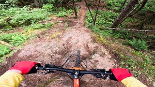
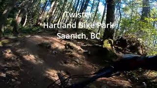
Twister turns back on itself several times linking Waterworks and Old Payoff. It features a few tricky rock rolls and optional drops.

Tags
BridgesDropsRock gardensRock slabs

Trail Supporters

  • SIMBS
    Maintainer
  • Original: Ken Sauer, Ian Scanlan
    Builder

Local Trail Association

Recent Activity on Trail

Past Week
  • 6 rides
  • 11.1 km average
6 Months
  • 377 rides
  • 12.8 km avg distance
All
  • 3,972 rides
  • Last: Nov 11, 2026
c1c2c3c4
January
February
March
April
May
June
July
August
September
October
November
December
Status:
on Sep 5, 2026
Dry
Avg: 3.91 (18 votes)
Your vote: 0

view (15,268)
close
      Directions to twister trailhead (48.534310, -123.471970)

      Photos

      18 more »
      mtb
      36 |
      Jun 19, 2026 @ 11:25am
      Jun 19, 2026
      mtb
      36 |
      Jun 19, 2026 @ 11:24am
      Jun 19, 2026
      mtb
      34 |
      Jun 19, 2026 @ 11:24am
      Jun 19, 2026
      mtb
      37 |
      Jun 19, 2026 @ 11:22am
      Jun 19, 2026

      Videos

      5 more »
      BCBR 2024 - Stage 1
      mtb
      1:9:43 | 289 | Jun 29, 2024 , Victoria
      Twister at Hartland Bike Park, Saanich, BC
      mtb
      5:52 | 181 | Nov 3, 2023 , Victoria
      210810 Twister
      mtb
      5:47 | 105 | Aug 14, 2021 , Victoria
      171202 Twister
      mtb
      2:54 | 125 | Dec 3, 2017 , Victoria

      Routes with this trail

      more »
      ★ 4.0 • 6 miles • 768 ft • 57 • Loop •
      55min loop back to parking lot. 30min cardio to top and 25min down.
      ★ 3.0 • 16 miles • 2,306 ft • 33 •
      Shorter track but deceivingly difficult terrain.
      ★ 1.0 • 6 miles • 1,110 ft • 17 •
      This loop suggestion is part of our Community Routes—a group of routes created by the community, for the...
      4.0 ★★★★★
      18 Ratings
      5 ★ 28%
      4 ★ 50%
      3 ★ 11%
      2 ★ 11%
      1 ★

      2 Reviews & Comments

      GregorytkL3JG
      Someone cut down 1 of the handlebar-grabbing trees towards the end of the trail. I assume it was dying, otherwise it's a shame since it was a fun needle to thread.
      eh-steve eh-steve
      Why did the root on the corner after twister roll get removed? That was a technical feature. You had to get your line right (especially in the rain). Now it's easy. Boo. This is supposed to be a black trail right?

      We hope you've been enjoying Trailforks!

      Create a FREE account to view all trail reviews and much more.

      • By KZ-Powned & contributors
      • #1150 - 3,808 views

      Frequently Asked Questions

      ▼ Where is Twister located?
      Twister is located in Hartland Mountain Bike Park, Victoria, British Columbia, Canada. It is part of the Hartland Mountain Bike Park trail network. The trailhead is located at coordinates 48.53431, -123.47197.
      ▼ How hard is Twister?
      Twister is rated as Black Diamond difficulty. The physical rating is Moderate. The average grade is 0.9%. The climb difficulty is rated Blue.
      ▼ What is the elevation gain for Twister?
      Twister has 54 ft of elevation gain. The trail has 33 ft of elevation descent. The elevation ranges from 939 ft to 968 ft.
      ▼ Is Twister a point to point trail?
      Twister is not a point to point trail. The direction is Both Directions. The trail type is singletrack.
      ▼ How long is Twister?
      Twister is 2,234 ft long. The trail type is singletrack.
      ▼ Are dogs allowed on Twister?
      Yes, dogs are allowed on Twister. Please keep dogs on a leash where required and clean up after them.
      ▼ When is the best time of year to ride Twister?
      Based on activity log data, the most popular months to ride Twister are:
      • July (216 activities)
      • September (202 activities)
      • June (194 activities)
      Check the reports page for current trail conditions.
      ▼ How do I access Twister? Where is the closest parking trailhead?
      The closest parking and trailhead locations to Twister are: View all parking locations in the area.
      ▼ How long does it take to ride Twister?
      Based on recorded activities, it takes an average of 9 minutes to ride Twister. The trail is 2,234 ft long. Actual times will vary based on fitness level, conditions, and pace. View recent activity logs for more details.
      ▼ How busy is Twister?
      Twister is a very popular trail. There have been 15,284 recorded activities on this trail. The trail has received 15,268 check-ins. View recent activity on this trail.

      Hit the Trail

      Open in App

      Get this trail on your phone instantly.

      open trail in app

      Download Trail

      Save to wishlist, Garmin & download.
      save the trail

      Find Related Routes

      Find routes and users activities that include this trail.
      find routes for this trail

      You must enter a description before submitting.