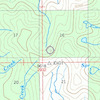
more stats
4,613 ft
Distance
80 ft
Climb
-89 ft
Descent
1 mile
High Point
-10 ft
Altitude change
7,223 ft
Altitude min
7,313 ft
Altitude start
7,303 ft
Altitude end
-0.2%
Grade
-6.2%
Grade max
8.2%
Grade min
2,283 ft
Distance climb
2,329 ft
Distance down

Unused Details

  • Activities
    • Horse
    • Mountain Bike
    • E-Bike
    • Gravel Bike
    • Hike
    • Trail Running
    • Dirtbike/Moto
  • Riding Area
    Madison Range
    Big Sky, Montana
  • Ref Number
    #6
  • Difficulty Rating
  • Local Popularity
    5 in Mountain Biking heatmap [+]
    • 5 in E-Biking
    • 5 in Trail Running
    • 5 in Hiking
    • 5 in Dirtbiking
    • 5 in Horseback
    • 5 in Gravel Biking
  • Hiking SAC Scale
    T1 Hiking
  • Trail Type
    Primitive
  • Climb Difficulty
    Blue
  • Physical Rating
    Hard
  • Trail Visibility
    No clear path
  • Dogs Allowed
    Yes
  • eBike Allowed
    Yes up to Class 1
  • Land Owner
    USFS

Mostly unused portion of Cinnamon-Buck #6 that avoids private land.

Tags
Faint trail

Trail Supporters

Local Trail Association

Traditionally Indigenous Territory

Recent Activity on Trail

Past Week
  • 0 rides
  •  
6 Months
  • 0 rides
  •  
All
  • 0 rides
  •  
update trails status or condition

Unused Trail Reports

no reports have been added for Unused yet, add a trail report.
Trail reports are used to indicate a trails current condition and inform builders and other users about any issues on a trail.
Status:
no votes yet
Your vote: 0

view (0)
close
      Directions to unused trailhead (45.122860, -111.300340)

      Photos

      No photos have been added for Unused yet, add a photo.

      Videos

      no videos have been added for Unused yet, add a video.

      Trail Products

      2 Reviews & Comments

      Coltencrowe
      Rode over Labor Day 2022 - lives up to its name, unused. Thigh deep brush for a majority of the trail, do not recommend
      loamwhisperer420 loamwhisperer420
      The trail as shown here trail doesn't exist in parts

      We hope you've been enjoying Trailforks!

      Create a FREE account to view all trail reviews and much more.

      • By evasiveTF Pro MBG & contributors
      • #64536 - 1,084 views

      Hit the Trail

      Open in App

      Get this trail on your phone instantly.

      open trail in app

      Download Trail

      Save to wishlist, Garmin & download.
      save the trail

      Find Related Routes

      Find routes and users activities that include this trail.
      find routes for this trail

      You must enter a description before submitting.