
more stats
2.2 miles
Distance
7 ft
Climb
-567 ft
Descent
00:24:55
Avg time
-560 ft
Altitude change
2,416 ft
Altitude min
2,978 ft
Altitude max
2,976 ft
Altitude start
2,415 ft
Altitude end
-4.7%
Grade
-47.8%
Grade max
3%
Grade min
817 ft
Distance climb
2 miles
Distance down
1,086 ft
Distance flat
00:24:55
Avg time

Upper Chiquito Details

  • Activities
    • Mountain Bike
    • Hike
    • Trail Running
  • Riding Area
    Cleveland National Forest
    Mission Viejo, California
  • Difficulty Rating
  • Local Popularity
    5 in Mountain Biking [+]
    • 5 in Trail Running
    • 5 in Hiking
  • Global Ranking
    #143322 in Mountain Biking [+]
    • #342859 in Trail Running
    • #330397 in Hiking
  • State Ranking
    #5,395 in Mountain Biking · California [+]
    • #13,961 in Trail Running
    • #14,141 in Hiking
  • Trail Type
    Singletrack
  • Bike Type
    AM, XC
  • Climb Difficulty
    Blue
  • Physical Rating
    Moderate
  • Season
    all year
  • Dogs Allowed
    Yes
  • TTFs on Trail
    Drop, Jump, Rock Face

nice mostly wooded single track with some moderate technical rock gardens. This trail can get very overgrown, with lots of poison oak just off the trail, so plan accordingly. also some optional rock jumps here and there.

Access Info

From blue jay camp ground: The Chiquita split off of upper san juan. The turn around point is the waterfall. You can continue on the more technical lower chiquita down to the ortega, or just climb back up what you just came down.

Tags
Trail Supporters
Local Trail Association
Traditionally Indigenous Territory

Recent Activity on Trail

Past Week
  • 0 rides
  •  
6 Months
  • 0 rides
  •  
All
  • 5 rides
  • Last: Mar 16, 2024
update trails status or condition

Upper Chiquito Trail Reports

statusdatedescription
Jun 3, 2026 @ 11:19am (America/Los_Angeles)
Jun 3, 2026
Just spoke with the ranger today, he told me it will remain closed for another year (Forest Service website saying closed until May 23, 2026 is...
Aug 26, 2025 @ 8:58pm
Aug 26, 2025
Trail is closed as a result of the September 8 2024 Airport Fire
Dec 5, 2024 @ 9:14pm
Dec 5, 2024
Mar 18, 2023 @ 10:43pm
Mar 18, 2023
Upper Chiquita is running pretty well overall. The overgrowth has been kept down and if anything this trail is running more clear than San Juan at...
Dec 17, 2021 @ 3:22pm
Dec 17, 2021
more »
Status:
on Jun 3, 2026
Avg: 3.99 (4 votes)
Your vote: 0

view (92)
close
      Directions to upper-chiquito trailhead (33.642280, -117.462630)

      Photos

      2 more »
      mtb
      66 |
      Mar 9, 2024 @ 5:52pm
      Mar 9, 2024
      mtb
      78 |
      Jan 11, 2021 @ 11:48pm
      Jan 11, 2021

      Videos

      1 more »
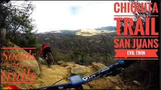
      youtuber Chiquita Trail ┼ Riding Socals Jankiest...
      mtb
      10:24 | 462 | Oct 5, 2020 , Mission Viejo

      Routes with this trail

      ★ 5.0 • 18 miles • 3,214 ft • 6 • Loop •
      San Juan is another classic. The climb can be a little brutal but the fun, flowy descent is worth it!...
      25 miles • 3,181 ft • 12 • Shuttled •
      A big Shuttle ride that combines Holy Jim , Trabuco Canyon, and San Juan.
      4.0 ★★★★★
      4 Ratings
      5 ★
      4 ★ 100%
      3 ★
      2 ★
      1 ★

      2 Reviews & Comments

      pizzaiolo
      Soooo many trees down. Worth it though because Lower Chiquita is running mint.
      pennylane8468 pennylane8468
      Currently lots of down trees and brush for first half. Almost impossible to ride with trail blockage every 500 feet.

      We hope you've been enjoying Trailforks!

      Create a FREE account to view all trail reviews and much more.

      • By iamenduro14 & contributors
      • #30409 - 2,800 views

      Frequently Asked Questions

      ▼ Where is Upper Chiquito located?
      Upper Chiquito is located in Cleveland National Forest, Mission Viejo, California, United States. It is part of the Cleveland National Forest trail network. The trailhead is located at coordinates 33.64228, -117.46263.
      ▼ How hard is Upper Chiquito?
      Upper Chiquito is rated as Blue difficulty. The physical rating is Moderate. The average grade is 4.7%. The climb difficulty is rated Blue.
      ▼ What is the elevation gain for Upper Chiquito?
      Upper Chiquito has 7 ft of elevation gain. The trail has 567 ft of elevation descent. The elevation ranges from 2,416 ft to 2,978 ft.
      ▼ How long is Upper Chiquito?
      Upper Chiquito is 2.2 miles long. The trail type is singletrack.
      ▼ Are dogs allowed on Upper Chiquito?
      Yes, dogs are allowed on Upper Chiquito. Please keep dogs on a leash where required and clean up after them.
      ▼ When is the best time of year to ride Upper Chiquito?
      Upper Chiquito is best visited during: all year.
      ▼ How do I access Upper Chiquito? Where is the closest parking trailhead?
      The closest parking and trailhead locations to Upper Chiquito are: View all parking locations in the area.
      ▼ How long does it take to ride Upper Chiquito?
      Based on recorded activities, it takes an average of 37 minutes to ride Upper Chiquito. The trail is 2.2 miles long. Actual times will vary based on fitness level, conditions, and pace. View recent activity logs for more details.
      ▼ How busy is Upper Chiquito?
      Upper Chiquito is a less popular trail with lighter traffic. There have been 84 recorded activities on this trail. The trail has received 92 check-ins. View recent activity on this trail.

      Hit the Trail

      Open in App

      Get this trail on your phone instantly.

      open trail in app

      Download Trail

      Save to wishlist, Garmin & download.
      save the trail

      Find Related Routes

      Find routes and users activities that include this trail.
      find routes for this trail

      You must enter a description before submitting.