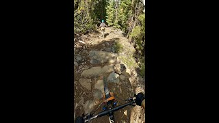



more stats
2.0 miles
Distance
160 ft
Climb
-855 ft
Descent
00:17:00
Avg time
-695 ft
Altitude change
5,046 ft
Altitude min
5,744 ft
Altitude max
5,741 ft
Altitude start
5,046 ft
Altitude end
-6.443%
Grade
-33.57%
Grade max
21.095%
Grade min
2,074 ft
Distance climb
2 miles
Distance down
430 ft
Distance flat
00:17:00
Avg time

Upper Hooligan Details

  • Activities
    • Mountain Bike
    • E-Bike
    • Hike
    • Trail Running
  • Riding Area
    Spence Mountain
    Klamath Falls, Oregon
  • Difficulty Rating
  • Local Popularity
    85 in Mountain Biking [+]
    • 70 in E-Biking
    • 5 in Trail Running
    • 55 in Hiking
  • Global Ranking
    #42402 in Mountain Biking [+]
    • #33598 in E-Biking
    • #298474 in Trail Running
    • #290206 in Hiking
  • State Ranking
    #433 in Mountain Biking · Oregon [+]
    • #250 in E-Biking
    • #3,611 in Trail Running
    • #3,513 in Hiking
  • Trail Type
    Singletrack
  • Bike Type
    DH, AM, XC, DJ
  • Direction
    Downhill Primary
    Popular Direction Shown
  • Physical Rating
    Moderate
  • Dogs Allowed
    Yes
  • eBike Allowed
  • TTFs on Trail
    Berm, Jump, Roller Coaster
  • Year Opened
    2016

Upper Hooligan will start as a fun "enduro" style DH trail with berms, rocks and jumps with similar features found throughout the entire length of trail. Use Upper Hooligan to connect to Lower Hooligan for 5 miles of exceptional downhill riding engineered by Dirt Mechanics out of Bend, OR

Access Info

Ride up on Spence Mountain South Ridge and stay right appx. 5 miles where the trail splits. Upper Hooligan starts with short, quick climbs thru some rocks and leads into jumps, berms and rock features. After several switchbacks you will be spit out onto the fire road and look for the trail to continue on the right. After another section of great downhill you will naturally be sent left on another fire road. Stay on the road until you see an obvious trail on the right. Continue on this until a third fire road where Lower Hooligan starts.

Tags
BermsJumpsRollers
Local Trail Association
Traditionally Indigenous Territory

Recent Activity on Trail

Past Week
  • 3 rides
  • 10 miles average
6 Months
  • 32 rides
  • 12 miles avg distance
All
  • 187 rides
  • Last: Oct 8, 2026
c1c2c3c4
January
February
March
April
May
June
July
August
September
October
November
December
update trails status or condition

Upper Hooligan Trail Reports

statusdatedescription
Jul 3, 2026 @ 4:11pm (America/Los_Angeles)
Jul 3, 2026
The trees aren’t too hard to carry the bike over.
Jun 27, 2026 @ 4:23pm (America/Los_Angeles)
Jun 27, 2026
tree still down at top. some brush encroaching trail too
Jun 25, 2026 @ 8:04am (America/Los_Angeles)
Jun 25, 2026
Downed trees near the beginning, otherwise clear
May 3, 2026 @ 7:01pm (America/Los_Angeles)
May 3, 2026
All clear
Nov 22, 2025 @ 2:42pm (America/Los_Angeles)
Nov 22, 2025
Still buried in snow up to 3-4 feet in some places.
more »
Status:
on Jul 3, 2026
Dry
Avg: 4.28 (10 votes)
Your vote: 0

view (884)
close
      Directions to upper-hooligan trailhead (42.361820, -121.972380)

      Photos

      8 more »
      mtb
      20 |
      Sep 20, 2026 @ 2:44pm
      Sep 20, 2026
      mtb
      25 |
      Sep 19, 2026 @ 1:12pm
      Sep 19, 2026
      mtb
      25 |
      Sep 19, 2026 @ 1:10pm
      Sep 19, 2026
      mtb
      46 |
      Apr 20, 2025 @ 6:29pm
      Apr 20, 2025

      Videos

      2 more »
      Spence Peak to Upper Hooligan
      mtb
      2:22 | 225 | Aug 19, 2023 , Klamath Falls
      Spence Mountain | Klamath Falls, OR
      mtb
      7:26 | 348 | Nov 6, 2021 , Klamath Falls

      Routes with this trail

      ★ 5.0 • 9 miles • 1,459 ft • 4 • Loop •
      This loop follows a fun climb up South Ridge for the full Hooligan experience.
      ★ 4.4 • 15 miles • 2,427 ft • 28 • Loop •
      A full value, singletrack only loop linking the best downhill sections (North Ridge & Lower Hooligan) with...
      ★ 1.0 • 15 miles • 2,300 ft • 14 • Loop •
      Challenging route on some of Spence Mountain's finest
      4.1 ★★★★★
      10 Ratings
      5 ★ 50%
      4 ★ 20%
      3 ★ 20%
      2 ★ 10%
      1 ★

      5 Reviews & Comments

      rotorooster rotorooster
      I invite you to be a bit careful on the upper, technical rocky section if like me you're a high intermediate/low advanced rider who likes speed. The trail invites you to go fast, but punishes for a lack of skill. I had a pretty scary death wobble landing (saved it!) after getting some air. The rocks they move! But if you like tech, this is totally worth it.
      bkxc bkxc
      The fun sections of this trail are ridiculously fun! Lots of fast and flowy - but still rocky - swoopage. But there's also a lot of flat-ish stuff where you can tell it was an old road, makes for a weird contrast.
      Matiasek Matiasek
      Great trail! But the signage on the ground indicates that it does not start this high.

      We hope you've been enjoying Trailforks!

      Create a FREE account to view all trail reviews and much more.

      Nearby Trails

      • By jsliderTF Pro & contributors
      • #55272 - 2,585 views

      Frequently Asked Questions

      ▼ Where is Upper Hooligan located?
      Upper Hooligan is located in Spence Mountain, Klamath Falls, Oregon, United States. It is part of the Spence Mountain trail network. The trailhead is located at coordinates 42.36182, -121.97238.
      ▼ How hard is Upper Hooligan?
      Upper Hooligan is rated as Blue difficulty. The physical rating is Moderate. The average grade is 6.443%.
      ▼ What is the elevation gain for Upper Hooligan?
      Upper Hooligan has 160 ft of elevation gain. The trail has 855 ft of elevation descent. The elevation ranges from 5,046 ft to 5,744 ft.
      ▼ Is Upper Hooligan a point to point trail?
      Upper Hooligan is not a point to point trail. The direction is Downhill Primary. The trail type is singletrack.
      ▼ How long is Upper Hooligan?
      Upper Hooligan is 2.0 miles long. The trail type is singletrack.
      ▼ Are dogs allowed on Upper Hooligan?
      Yes, dogs are allowed on Upper Hooligan. Please keep dogs on a leash where required and clean up after them.
      ▼ How do I access Upper Hooligan? Where is the closest parking trailhead?
      The closest parking and trailhead locations to Upper Hooligan are: View all parking locations in the area.
      ▼ How long does it take to ride Upper Hooligan?
      Based on recorded activities, it takes an average of 17 minutes to ride Upper Hooligan. The trail is 2.0 miles long. Actual times will vary based on fitness level, conditions, and pace. View recent activity logs for more details.
      ▼ How busy is Upper Hooligan?
      Upper Hooligan is a very popular trail. There have been 884 recorded activities on this trail. The trail has received 884 check-ins. View recent activity on this trail.

      Hit the Trail

      Open in App

      Get this trail on your phone instantly.

      open trail in app

      Download Trail

      Save to wishlist, Garmin & download.
      save the trail

      Find Related Routes

      Find routes and users activities that include this trail.
      find routes for this trail

      You must enter a description before submitting.