more stats
4,856 ft
Distance
134 ft
Climb
-183 ft
Descent
00:09:04
Avg time
-49 ft
Altitude change
1,046 ft
Altitude min
1,229 ft
Altitude max
1,191 ft
Altitude start
1,142 ft
Altitude end
-1%
Grade
-18.5%
Grade max
16.6%
Grade min
2,142 ft
Distance climb
2,395 ft
Distance down
318 ft
Distance flat
00:09:04
Avg time

Upper Shoofly Details

  • Activities
    • Mountain Bike
    • E-Bike
  • Riding Area
  • Difficulty Rating
  • Local Popularity
    75 in Mountain Biking [+]
    • 45 in E-Biking
  • Global Ranking
    #123676 in Mountain Biking [+]
    • #6183 in E-Biking
  • Trail Type
    Singletrack
  • Bike Type
    AM, XC
  • Climb Difficulty
    Blue
  • Physical Rating
    Hard
  • Trail Visibility
    Always easy to follow
  • Dogs Allowed
    Yes
  • eBike Allowed
    Yes up to Class 1
  • TTFs on Trail
    Berm, Bridge, Jump
  • Ride in Rain
    Yes
  • Lighting
    No
  • Year Opened
    2002
  • Land Owner
    Oregon Parks and Recreation Department

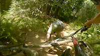
This is one of the oldest MTB specific single-track trails within Stub Stewart Park (first built in 2008, the original). Better than riding the Caddy Whomper fire road. Its a great loop if your parked at the Hilltop Parking Area. Fast, bermed out. Grinding steep climb out back up to North Caddy Whomper.

Access Info

Trail maker on your right, well marked.

Trail Supporters
Local Trail Association

Recent Activity on Trail

Past Week
  • 5 rides
  • 9 miles average
6 Months
  • 54 rides
  • 8 miles avg distance
All
  • 839 rides
  • Last: Jun 30, 2026
c1c2c3c4
January
February
March
April
May
June
July
August
September
October
November
December
update trails status or condition

Upper Shoofly Trail Reports

statusdatedescription
Apr 10, 2026 @ 1:25pm (America/Vancouver)
Apr 10, 2026
Feb 1, 2026 @ 1:50pm (America/Los_Angeles)
Feb 1, 2026
Open, with just the last bit of the far loop still needing some work
Nov 27, 2025 @ 9:53am (America/Los_Angeles)
Nov 27, 2025
Closed, but being restored
Feb 26, 2025 @ 8:53pm
Feb 26, 2025
Totally effed! Completely logged out and destroyed.
Aug 3, 2024 @ 9:53am
Aug 3, 2024
more »
Status:
on Apr 10, 2026
Ideal
Avg: 4.04 (17 votes)
Your vote: 0

view (4,166)
close
3D
Trail Conditions
  • Unknown
  • Snow Groomed
  • Snow Packed
  • Snow Covered
  • Snow Cover Partial
  • Freeze/thaw Cycle
  • Icy
  • Prevalent Mud
  • Wet
  • Variable
  • Ideal
  • Dry
  • Very Dry
Trail Flow (Ridden Direction)
Trailforks scans users ridelogs to determine the most popular direction each trail is ridden. A good flowing trail network will have most trails flowing in a single direction according to their intension.
The colour categories are based on what percentage of riders are riding a trail in its intended direction.
  • > 96%
  • > 90%
  • > 80%
  • > 70%
  • > 50%
  • < 50%
  • bi-directional trail
  • no data
Trail Last Ridden
Trailforks scans ridelogs to determine the last time a trail was ridden.
  • < 2 days
  • < 1 week
  • < 2 weeks
  • < 1 month
  • < 6 months
  • > 6 months
Trail Ridden Direction
The intended direction a trail should be ridden.
  • Downhill Only
  • Downhill Primary
  • Both Directions
  • Uphill Primary
  • Uphill Only
  • One Direction
Contribute Details
Colors indicate trail is missing specified detail.
  • Description
  • Photos
  • Description & Photos
  • Videos
Trail Popularity ?
Trailforks scans ridelogs to determine which trails are ridden the most in the last 9 months. Trails are compared with nearby trails in the same city region with a possible 25 colour shades. Think of this as a heatmap, more rides = more kinetic energy = warmer colors.
  • most popular
  • popular
  • less popular
  • not popular
ATV/ORV/OHV Filter
Max Vehicle Width
inches
US Cell Coverage
Legend
cell carrier legend

Radar Time
Activity Recordings
Trailforks uses anonymized public activity data. ?
Activity Recordings
Trailforks uses anonymized public activity data. ?
Personal Heatmap
Activity Types
all / none
Options
2
Date range month
Winter Trails
Warning A routing network for winter maps does not exist. Selecting trails using the winter trails layer has been disabled.
Missing Trails
Most Popular
Least Popular
Trails are colored based on popularity. The more popular a trail is, the more red. Less popular trails trend towards green.
Jump Magnitude Heatmap
Heatmap of where riders jump on trails. Zoom in to see individual jumps, click circles to view jump details.
BC Backroad Status

Service Road Atlas is a free to use, community-driven service for viewing and creating reports on the numerous back-country service roads around B.C. and Alberta.

map legend
Slope Aspect
Direction the slope faces
Flat N NE E SE S SW W NW
Trails Deemphasized
Trails are shown in grey.
disable
Only show trails with no bike usage.
Enable
Suggested Layers
Based on selected activity type

    Save the current map location and zoom level as your default home location whenever this page is loaded.

    Save
        Directions to upper-shoofly trailhead (45.745120, -123.177510)

        Photos

        51 more »
        105 |
        May 6, 2021 @ 7:49am
        May 6, 2021
        110 |
        May 6, 2021 @ 7:47am
        May 6, 2021
        82 |
        Mar 24, 2021 @ 9:20am
        Mar 24, 2021
        76 |
        Mar 24, 2021 @ 9:20am
        Mar 24, 2021

        Videos

        1 more »
        Too much fun
        0:26 | 530 | Sep 6, 2019 , Banks

        Routes with this trail

        6 miles 905 ft 6
        This is a simple trail route i use on my Friday rides for my friend Jeff.
        1.0 10 miles 1,949 ft 16 Loop
        Suggested MTB Loop ridden directly from the Campground. This loop hits all the highlights for an...

        3 Reviews & Comments


        We hope you've been enjoying Trailforks!

        Create a FREE account to view trail comments and much more.

        • By northwestdhdad EMBA-SW & contributors
        • #64472 - 4,022 views

        Frequently Asked Questions About Upper Shoofly

        Where is Upper Shoofly located?
        Upper Shoofly is located in LL Stub Stewart State Park, Banks, Oregon, United States. It is part of the LL Stub Stewart State Park trail network. The trailhead is located at coordinates 45.74512, -123.17751.
        How hard is Upper Shoofly?
        Upper Shoofly is rated as Blue difficulty. The physical rating is Hard. The average grade is 1%. The climb difficulty is rated Blue.
        What is the elevation gain for Upper Shoofly?
        Upper Shoofly has 134 ft of elevation gain. The trail has 183 ft of elevation descent. The elevation ranges from 1,046 ft to 1,229 ft.
        How long is Upper Shoofly?
        Upper Shoofly is 4,856 ft long. The trail type is singletrack.

        Hit the Trail

        Open in App

        Get this trail on your phone instantly.
        open trail in app

        Download Trail

        Save to wishlist, Garmin & download.
        save the trail

        Find Related Routes

        Find routes and users activities that include this trail.
        find routes for this trail

        You must enter a description before submitting.