


Open in App
Get this trail on your phone instantly.

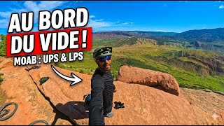
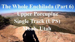
4th ride of the Whole Enchilada. Singletrack starts at a right fork off of the Kokopelli trail. Watch for the map sign. The double track, which is the Kokopelli, continues to the left and intersects the Sand Flats Road. Challenging singletrack over rock, roots, ledges, and dry washes. UPS generally follows the rim on sandstone and dirt thru the Pinyons & Junipers. It passes thru a primitive campground where you can bailout on another road to Sand Flats. Continuing on the singletrack leads you to the start of LPS.
| c1 | c2 | c3 | c4 |
|---|---|---|---|
January | February | March | April |
May | June | July | August |
September | October | November | December |

Service Road Atlas is a free to use, community-driven service for viewing and creating reports on the numerous back-country service roads around B.C. and Alberta.
Save the current map location and zoom level as your default home location whenever this page is loaded.
SaveWe hope you've been enjoying Trailforks!
Create a FREE account to view trail comments and much more.
You must enter a description before submitting.

