
more stats
3.2 miles
Distance
26 ft
Climb
-3,048 ft
Descent
01:03:28
Avg time
-3,024 ft
Altitude change
5,135 ft
Altitude min
8,159 ft
Altitude max
8,159 ft
Altitude start
5,135 ft
Altitude end
-17.9%
Grade
-127.7%
Grade max
11.5%
Grade min
594 ft
Distance climb
3 miles
Distance down
197 ft
Distance flat
01:03:28
Avg time

馬武霸山 Details

  • Activities
    • Mountain Bike
    • E-Bike
    • Hike
    • Trail Running
  • Riding Area
  • Difficulty Rating
  • Local Popularity
    5 in Mountain Biking heatmap [+]
    • 5 in E-Biking
    • 5 in Trail Running
    • 5 in Hiking
  • Global Ranking
    #136131 in Mountain Biking [+]
    • #136905 in E-Biking
    • #298275 in Trail Running
    • #206248 in Hiking
  • National Ranking
    #37 in Mountain Biking · Taiwan [+]
    • #46 in E-Biking
    • #187 in Trail Running
    • #267 in Hiking
  • Hiking SAC Scale
    T3 Demanding Mountain Hiking
  • Trail Type
    Singletrack
  • Bike Type
    AM
  • Direction
    Both Directions
  • Climb Difficulty
    Black Diamond
  • Physical Rating
    Extreme
  • Trail Visibility
    Always easy to follow
  • Alpine Trail
    Yes
  • Dogs Allowed
    Yes
  • eBike Allowed
    Yes up to Class 1
  • TTFs on Trail
    Rock Face, Rock Garden

Alpine hiking trail. Hard climb 1.5 hr for very fit rider. For average rider takes about 3-4 hrs hike/push bike up hill.
高海拔路線,由1600爬升至2450公尺,需攜帶充足食物與飲水,山頂通常風大,需準備防風外套。部分路段有長芒草,強烈建議穿長袖長指手套,並且配戴護目鏡以免割傷。

Tags
AlpineRock gardensRock slabs

Recent Activity on Trail

Past Week
  • 0 rides
  •  
6 Months
  • 0 rides
  •  
All
  • 1 rides
  • Last: Jul 5, 2025
update trails status or condition

馬武霸山 Trail Reports

statusdatedescription
Apr 2, 2020 @ 6:09am
Apr 2, 2020
Minor Water drainage issue, standing water on trail surface. Silver grass over groom in lower-mid section. Loose and steep slop from altitude...
more »
Status:
on Apr 2, 2020
Unknown
Avg: 4.13 (1 votes)
Your vote: 0

view (24)
close
      Directions to view-32432 trailhead (24.350450, 121.285080)

      Photos

      16 more »
      mtb
      54 |
      Jun 19, 2024 @ 10:33pm
      Jun 19, 2024
      report
      mtb
      170 |
      Apr 2, 2020 @ 6:45am
      Apr 2, 2020
      report
      mtb
      141 |
      Apr 2, 2020 @ 6:45am
      Apr 2, 2020
      report
      mtb
      168 |
      Apr 2, 2020 @ 6:45am
      Apr 2, 2020

      Videos

      1 more »
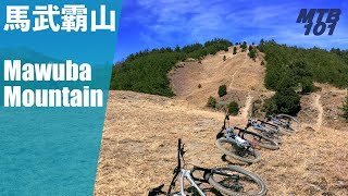
      推到不要不要的高海拔路線 —...
      mtb
      11:54 | 592 | Apr 26, 2021 , Taichung
      5.0 ★★★★★
      1 Ratings
      5 ★ 100%
      4 ★
      3 ★
      2 ★
      1 ★

      Reviews / Comments

      No reviews yet, be the first to write a review or ask a question.
      Use trail reports to comment on trail conditions.


      We hope you've been enjoying Trailforks!

      Create a FREE account to view all trail reviews and much more.

      • By hitoshiQ & contributors
      • #32432 - 1,676 views

      Frequently Asked Questions

      ▼ Where is 馬武霸山 located?
      馬武霸山 is located in Taichung, Taiwan. It is part of the Taichung trail network. The trailhead is located at coordinates 24.35045, 121.28508.
      ▼ How hard is 馬武霸山?
      馬武霸山 is rated as Blue difficulty. The physical rating is Extreme. The average grade is 17.9%. The climb difficulty is rated Black Diamond.
      ▼ What is the elevation gain for 馬武霸山?
      馬武霸山 has 26 ft of elevation gain. The trail has 3,048 ft of elevation descent. The elevation ranges from 5,135 ft to 8,159 ft.
      ▼ Is 馬武霸山 a point to point trail?
      馬武霸山 is not a point to point trail. The direction is Both Directions. The trail type is singletrack.
      ▼ How long is 馬武霸山?
      馬武霸山 is 3.2 miles long. The trail type is singletrack.
      ▼ Are dogs allowed on 馬武霸山?
      Yes, dogs are allowed on 馬武霸山. Please keep dogs on a leash where required and clean up after them.
      ▼ How long does it take to ride 馬武霸山?
      Based on recorded activities, it takes an average of 38 minutes to ride 馬武霸山. The trail is 3.2 miles long. Actual times will vary based on fitness level, conditions, and pace. View recent activity logs for more details.
      ▼ How busy is 馬武霸山?
      馬武霸山 is a less popular trail with lighter traffic. There have been 17 recorded activities on this trail. The trail has received 24 check-ins. View recent activity on this trail.

      Hit the Trail

      Open in App

      Get this trail on your phone instantly.

      open trail in app

      Download Trail

      Save to wishlist, Garmin & download.
      save the trail

      Find Related Routes

      Find routes and users activities that include this trail.
      find routes for this trail

      You must enter a description before submitting.

