
Open in App
Get this trail on your phone instantly.

Norsk (English below):
En av de aller beste stiene i Gol-området
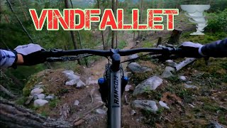
Hoveddelen av stien holder god fart, men du møter også noen tekniske partier underveis. Starten byr på tråkking og flyt før du krysser grusveien for første gang. Derfra blir terrenget litt mer teknisk, men farten holder seg høy.
Etter andre kryssing av grusveien blir det enda mer teknisk, med et par krevende crux-partier. Mot slutten åpner stien seg igjen og inviterer til høyere fart.
Når du kommer til slutten av stien har du to valg:
Kryss grusveien og ta stien foran deg videre ned til hovedveien.
Eller tråkk et stykke oppover Vindfallets tilkomstvei og kombiner turen med Skrotnissen. Avstanden mellom slutten av Vindfallet og starten på Skrotnissen er ca. 1 km og 12–15 minutter med sykling.
Adkomst:
Følg Vindfallets tilkomstvei opp til starten av stien. Du kan også komme til startpunktet ved å shuttle eller sykle opp fra Brenno eller Åsgardane.
English:
One of the absolute best trails in the Gol region!
The main part of the trail is pretty fast, but you’ll also encounter some technical sections. The start of the trail offers some pedaling and flowy parts before you cross the gravel road for the first time. After that, the terrain gets a bit more technical but still allows for good speed.
Access:
Follow the Vindfallet Access Road Climb to the start of the trail. You can also reach the start by shuttle or pedaling from Brenno or Åsgardane.
Once you cross the gravel road a second time, the trail becomes even more technical, with a couple of crux sections ahead. The final part opens up again and invites you to pick up some speed.
At the end of the trail, you have two options:
Cross the gravel road and follow the trail in front of you down to the main road.
Or pedal back up a section of the Vindfallet access road and combine the ride with Skrotnissen. The connection between the end of Vindfallet and the start of Skrotnissen is about 1 km and takes 12–15 minutes of pedaling.
| c1 | c2 | c3 | c4 |
|---|---|---|---|
January | February | March | April |
May | June | July | August |
September | October | November | December |

Service Road Atlas is a free to use, community-driven service for viewing and creating reports on the numerous back-country service roads around B.C. and Alberta.
Save the current map location and zoom level as your default home location whenever this page is loaded.
Save
No reviews yet, be the first to write a review or ask a question.
Use trail reports to comment on trail conditions.
We hope you've been enjoying Trailforks!
Create a FREE account to view trail comments and much more.
You must enter a description before submitting.

