more stats
1,781 ft
Distance
-130 ft
Descent
00:02:02
Avg time
-130 ft
Altitude change
1,613 ft
Altitude min
1,743 ft
Altitude max
1,743 ft
Altitude start
1,614 ft
Altitude end
-7.3%
Grade
-24.3%
Grade max
-0.4%
Grade min
1,706 ft
Distance down
79 ft
Distance flat
00:02:02
Avg time

Wasp Details

  • Activities
    • Mountain Bike
    • Hike
    • Trail Running
  • Riding Area
    Bear Mountain
    Mission, British Columbia
  • Difficulty Rating
  • Local Popularity
    100 in Mountain Biking [+]
    • 80 in Trail Running
    • 90 in Hiking
  • Global Ranking
    #31636 in Mountain Biking [+]
    • #61233 in Trail Running
    • #37152 in Hiking
  • Trail Type
    Singletrack
  • Bike Type
    DH
  • Dogs Allowed
    Yes
  • eBike Allowed
  • Land Owner
    Mission Forestry Tree Farm

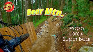
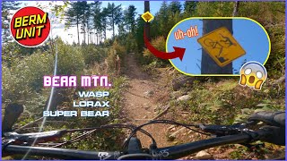
Wasp is shorter now but it is still a good fun trail. Good trail to climb to Lorax from the Tower trail and if coming down from the fire circle to Lorax it is fun techy winding with good flow.

Access Info

To access Wasp you will need to follow the directions to Bigguns but keep pedalling past the the stone piles to the end of the road.

Local Trail Association
Traditionally Indigenous Territory

Recent Activity on Trail

Past Week
  • 7 rides
  • 7 miles average
6 Months
  • 151 rides
  • 8 miles avg distance
All
  • 1,721 rides
  • Last: Jul 2, 2026
c1c2c3c4
January
February
March
April
May
June
July
August
September
October
November
December
Status:
on Jun 22, 2026
Ideal
Avg: 3.94 (28 votes)
Your vote: 0

view (7,028)
close
3D
Trail Conditions
  • Unknown
  • Snow Groomed
  • Snow Packed
  • Snow Covered
  • Snow Cover Partial
  • Freeze/thaw Cycle
  • Icy
  • Prevalent Mud
  • Wet
  • Variable
  • Ideal
  • Dry
  • Very Dry
Trail Flow (Ridden Direction)
Trailforks scans users ridelogs to determine the most popular direction each trail is ridden. A good flowing trail network will have most trails flowing in a single direction according to their intension.
The colour categories are based on what percentage of riders are riding a trail in its intended direction.
  • > 96%
  • > 90%
  • > 80%
  • > 70%
  • > 50%
  • < 50%
  • bi-directional trail
  • no data
Trail Last Ridden
Trailforks scans ridelogs to determine the last time a trail was ridden.
  • < 2 days
  • < 1 week
  • < 2 weeks
  • < 1 month
  • < 6 months
  • > 6 months
Trail Ridden Direction
The intended direction a trail should be ridden.
  • Downhill Only
  • Downhill Primary
  • Both Directions
  • Uphill Primary
  • Uphill Only
  • One Direction
Contribute Details
Colors indicate trail is missing specified detail.
  • Description
  • Photos
  • Description & Photos
  • Videos
Trail Popularity ?
Trailforks scans ridelogs to determine which trails are ridden the most in the last 9 months. Trails are compared with nearby trails in the same city region with a possible 25 colour shades. Think of this as a heatmap, more rides = more kinetic energy = warmer colors.
  • most popular
  • popular
  • less popular
  • not popular
ATV/ORV/OHV Filter
Max Vehicle Width
inches
US Cell Coverage
Legend
cell carrier legend

Radar Time
Activity Recordings
Trailforks uses anonymized public activity data. ?
Activity Recordings
Trailforks uses anonymized public activity data. ?
Personal Heatmap
Activity Types
all / none
Options
2
Date range month
Winter Trails
Warning A routing network for winter maps does not exist. Selecting trails using the winter trails layer has been disabled.
Missing Trails
Most Popular
Least Popular
Trails are colored based on popularity. The more popular a trail is, the more red. Less popular trails trend towards green.
Jump Magnitude Heatmap
Heatmap of where riders jump on trails. Zoom in to see individual jumps, click circles to view jump details.
BC Backroad Status

Service Road Atlas is a free to use, community-driven service for viewing and creating reports on the numerous back-country service roads around B.C. and Alberta.

map legend
Slope Aspect
Direction the slope faces
Flat N NE E SE S SW W NW
Trails Deemphasized
Trails are shown in grey.
disable
Only show trails with no bike usage.
Enable
Suggested Layers
Based on selected activity type

    Save the current map location and zoom level as your default home location whenever this page is loaded.

    Save
        Directions to wasp trailhead (49.192980, -122.297510)

        Photos

        38 more »
        46 |
        Dec 5, 2021 @ 10:19am
        Dec 5, 2021
        124 |
        Mar 30, 2021 @ 8:40pm
        Mar 30, 2021
        62 |
        Oct 10, 2018 @ 11:51am
        Oct 10, 2018
        86 |
        Sep 1, 2017 @ 5:04pm
        Sep 1, 2017

        Videos

        12 more »
        youtuber These Trails Are TIGHT
        16:54 | 70 | Aug 2, 2025 , Mission
        youtuber Hero Dirt Deep In The Valley?! - Bear Mtn.-...
        9:52 | 150 | May 16, 2025 , Mission
        youtuber Is It Worth The Risk? - Bear Mtn. - Mission,...
        10:02 | 448 | Oct 16, 2021 , Mission
        Wasp & Lorax - Bear Mountain - Mission, BC
        4:23 | 77 | Jan 30, 2025 , Mission

        Routes with this trail

        9 miles 2,216 ft 13
        Fraser Valley Bear Classic Fraser Valley Relive Your Ride For other ride suggestions for this and other...
        4 miles 1,036 ft 5
        Fraser Valley Bear Quickie Relive Your Ride For other ride suggestions for this and other areas. As well...
        12 miles 3,153 ft 14
        Fraser Valley Bear Epic Fraser Valley Relive Your Ride For other ride suggestions for this and other...

        Trail Products

        1 Review & Comments


        We hope you've been enjoying Trailforks!

        Create a FREE account to view trail comments and much more.

        Nearby Trails

        • By canadakaTF Pro Trailforks & contributors
        • #501 - 4,934 views

        Frequently Asked Questions About Wasp

        Where is Wasp located?
        Wasp is located in Bear Mountain, Mission, British Columbia, Canada. It is part of the Bear Mountain trail network. The trailhead is located at coordinates 49.19298, -122.29751.
        How hard is Wasp?
        Wasp is rated as Blue difficulty. The average grade is 7.3%.
        What is the elevation gain for Wasp?
        The trail has 130 ft of elevation descent. The elevation ranges from 1,613 ft to 1,743 ft.
        How long is Wasp?
        Wasp is 1,781 ft long. The trail type is singletrack.

        Hit the Trail

        Open in App

        Get this trail on your phone instantly.
        open trail in app

        Download Trail

        Save to wishlist, Garmin & download.
        save the trail

        Find Related Routes

        Find routes and users activities that include this trail.
        find routes for this trail

        You must enter a description before submitting.