

more stats
2.3 miles
Distance
292 ft
Climb
-302 ft
Descent
00:20:12
Avg time
-9 ft
Altitude change
749 ft
Altitude min
1,052 ft
Altitude max
1,052 ft
Altitude start
1,043 ft
Altitude end
-0.1%
Grade
-18.2%
Grade max
19.6%
Grade min
4,865 ft
Distance climb
1 mile
Distance down
669 ft
Distance flat
00:20:12
Avg time

WEEDPATCH Details

  • Activities
    • Mountain Bike
    • E-Bike
    • Hike
    • Trail Running
  • Riding Area
    Brown County State Park
    Nashville, Indiana
  • Ref Number
    (K)
  • AKA
    Weed Patch
  • Difficulty Rating
  • Voted Difficulty
    Blue (1 vote)
  • Local Popularity
    100 in Mountain Biking [+]
    • 100 in E-Biking
    • 65 in Trail Running
    • 85 in Hiking
  • Global Ranking
    #25088 in Mountain Biking [+]
    • #86316 in E-Biking
    • #129181 in Trail Running
    • #109216 in Hiking
  • State Ranking
    #52 in Mountain Biking · Indiana [+]
    • #153 in E-Biking
    • #333 in Trail Running
    • #362 in Hiking
  • Hiking SAC Scale
    T1 Hiking
  • Trail Exposure
    High Risk
  • Blaze Color
  • Trail Type
    Singletrack
  • Bike Type
    AM, XC, DJ, Adaptive MTB
  • Direction
    Downhill Only[+]
    • Downhill Only for E-Biking
    • Downhill Only for Trail Running
    • Downhill Only for Hiking
  • Climb Difficulty
    Blue
  • Physical Rating
    Moderate
  • Trail Visibility
    Always easy to follow
  • Season
    All seasons
  • Dogs Allowed
    Yes
  • eBike Allowed
    Yes up to Class 1
  • TTFs on Trail
    Berm, Bridge, Jump, Roller Coaster
  • Year Opened
    2019
  • Land Owner
    Brown County

This fun, fast, flow trail runs downhill from both entry points and can be started at either the fire tower or across the road from the east end of West Gate trail. Weedpatch is a two-way trail, so even though there are many flow features, be on the watch for climbing bikers. The downhills eventually level out into a creek valley and both directions require an uphill climb back out. Especially near the fire tower, beware of hikers who mistake Weedpatch for Trail 10.

Access Info

Weedpatch can be accessed either from the Fire tower or across the street from the east end of West Gate trail.

Adaptive Bike Info
aMTB Blue Rating: Intermediate features and steeper terrain.

Weedpatch is an intermediate trail for adaptive bikes. The trail is 36" or more throughout and has moderate off-camber or cross slope sections. There is one tree gate at 33" that can be ridden around and a few moderately banked switchbacks. There are a few small rock sections, and 2 stream crossings with steep approaches where traction may be an issue due to muddy conditions.

Tags
BermsBridgesFlowyJumpsRollers
Local Trail Association

Recent Activity on Trail

Past Week
  • 12 rides
  • 17 miles average
6 Months
  • 299 rides
  • 20 miles avg distance
All
  • 1,506 rides
  • Last: Oct 8, 2026
c1c2c3c4
January
February
March
April
May
June
July
August
September
October
November
December
Status:
on Oct 8, 2026
Dry
Avg: 4.33 (18 votes)
Your vote: 0

view (7,117)
close
      Directions to weedpatch-230533 trailhead (39.166620, -86.216240)

      Photos

      13 more »
      mtb
      110 |
      Nov 17, 2025 @ 10:38am
      Nov 17, 2025
      mtb
      199 |
      Aug 8, 2021 @ 8:48pm
      Aug 8, 2021
      mtb
      173 |
      Aug 6, 2021 @ 8:12pm
      Aug 6, 2021
      mtb
      166 |
      Aug 6, 2021 @ 7:56pm
      Aug 6, 2021

      Videos

      9 more »
      youtuber Is Brown County Better Than Bentonville?!
      mtb
      11:41 | 861 | Dec 5, 2019 , Nashville
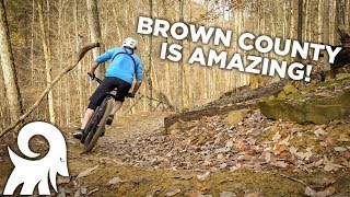
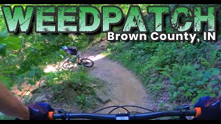
      Weedpatch Brown County, IN
      mtb
      6:00 | 274 | Jun 22, 2023 , Nashville
      youtuber Mountain Biking most of Brown County State...
      mtb
      28:47 | 147 | Sep 22, 2022 , Nashville
      youtuber Quick Look | A masterpiece of blue flow trail...
      mtb
      4:37 | 336 | Sep 11, 2022 , Nashville

      Routes with this trail

      ★ 5.0 • 20 miles • 2,133 ft • 12 • Loop •
      Brown County Mountain Biking Featured Route #5 Marked on trail signs with ORANGE stickers Limekiln is...
      ★ 5.0 • 30 miles • 2,538 ft • 12 • Out & Back •
      Brown County Mountain Biking Featured Route #6 Route not marked Limekiln is directional depending on day...
      ★ 5.0 • 30 miles • 2,529 ft • 12 • Out & Back •
      Brown County Mountain Biking Featured Route #6 Route not marked Limekiln is directional depending on day...
      4.5 ★★★★★
      18 Ratings
      5 ★ 61%
      4 ★ 28%
      3 ★ 6%
      2 ★ 6%
      1 ★

      7 Reviews & Comments

      roaming50 roaming50
      Currently impassable 6/20/25 due to downed trees from Wednesdays storm
      bkxc bkxc
      Tons of fun. I went out and came back so I got both descents. If I had more time I would have probably done it twice or three times, it was sweet!
      steelispossiblyreal steelispossiblyreal
      Weedpatch is a really lovely flow trail with similar DNA to Hobbs Hollow. It's a little bit slower and lower risk than Hobbs so I felt more comfortable charging it harder than Hobbs. Some locals told us it was best ridden from red to green, so that's what we did. The climb out is no joke so expect a nice workout.

      We hope you've been enjoying Trailforks!

      Create a FREE account to view all trail reviews and much more.

      • By CurranETF Pro & contributors
      • #230533 - 6,280 views

      Frequently Asked Questions

      ▼ Where is WEEDPATCH located?
      WEEDPATCH is located in Brown County State Park, Nashville, Indiana, United States. It is part of the Brown County State Park trail network. The trailhead is located at coordinates 39.16662, -86.21624.
      ▼ How hard is WEEDPATCH?
      WEEDPATCH is rated as Blue difficulty. The physical rating is Moderate. The average grade is 0.1%. The climb difficulty is rated Blue.
      ▼ What is the elevation gain for WEEDPATCH?
      WEEDPATCH has 292 ft of elevation gain. The trail has 302 ft of elevation descent. The elevation ranges from 749 ft to 1,052 ft.
      ▼ Is WEEDPATCH a point to point trail?
      Yes, WEEDPATCH is a point to point trail. The direction is Downhill Only. The trail type is singletrack.
      ▼ How long is WEEDPATCH?
      WEEDPATCH is 2.3 miles long. The trail type is singletrack.
      ▼ Are dogs allowed on WEEDPATCH?
      Yes, dogs are allowed on WEEDPATCH. Please keep dogs on a leash where required and clean up after them.
      ▼ When is the best time of year to ride WEEDPATCH?
      WEEDPATCH is best visited during: All seasons.
      ▼ How do I access WEEDPATCH? Where is the closest parking trailhead?
      The closest parking and trailhead locations to WEEDPATCH are: View all parking locations in the area.
      ▼ How long does it take to ride WEEDPATCH?
      Based on recorded activities, it takes an average of 20 minutes to ride WEEDPATCH. The trail is 2.3 miles long. Actual times will vary based on fitness level, conditions, and pace. View recent activity logs for more details.
      ▼ How busy is WEEDPATCH?
      WEEDPATCH is a very popular trail. There have been 6,183 recorded activities on this trail. The trail has received 7,117 check-ins. View recent activity on this trail.

      Hit the Trail

      Open in App

      Get this trail on your phone instantly.

      open trail in app

      Download Trail

      Save to wishlist, Garmin & download.
      save the trail

      Find Related Routes

      Find routes and users activities that include this trail.
      find routes for this trail

      You must enter a description before submitting.