

more stats
1,699 ft
Distance
-374 ft
Descent
00:02:45
Avg time
-374 ft
Altitude change
1,007 ft
Altitude min
1,381 ft
Altitude max
1,381 ft
Altitude start
1,007 ft
Altitude end
-22%
Grade
-49.7%
Grade max
-3.8%
Grade min
1,673 ft
Distance down
26 ft
Distance flat
00:02:45
Avg time

Whatsitsname Details

  • Activities
    • Mountain Bike
    • E-Bike
    • Hike
    • Trail Running
  • Riding Area
    Doumont
    Nanaimo, British Columbia
  • Difficulty Rating
  • Local Popularity
    60 in Mountain Biking heatmap [+]
    • 55 in E-Biking
    • 5 in Trail Running
    • 25 in Hiking
  • Global Ranking
    #97616 in Mountain Biking [+]
    • #54848 in E-Biking
    • #335685 in Trail Running
    • #158430 in Hiking
  • Provincial Ranking
    #4,980 in Mountain Biking · British Columbia [+]
    • #3,712 in E-Biking
    • #13,464 in Trail Running
    • #10,222 in Hiking
  • Trail Type
    Singletrack
  • Bike Type
    DH, AM
  • Direction
    Downhill Only[+]
    Popular Direction Shown
    • Downhill Only for E-Biking
    • Downhill Only for Trail Running
    • Downhill Only for Hiking
  • Dogs Allowed
    Yes
  • eBike Allowed
    Yes up to Class 1
  • Ride in Rain
    Yes

No community description for Whatsitsname trail has been added yet!

AI Generated Description

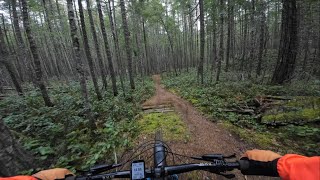
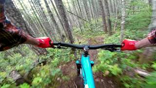
Whatsitsname is a 518 m moderately popular black diamond difficulty singletrack trail located near Nanaimo British Columbia. This mountain bike primary trail can be used downhill only. On average it takes 2 minutes to complete this trail.

This trail is unsanctioned.

Tags

Traditionally Indigenous Territory

Recent Activity on Trail

Past Week
  • 0 rides
  •  
6 Months
  • 25 rides
  • 7 miles avg distance
All
  • 181 rides
  • Last: Nov 15, 2026
c1c2c3c4
January
February
March
April
May
June
July
August
September
October
November
December
update trails status or condition

Whatsitsname Trail Reports

statusdatedescription
Nov 16, 2026 @ 9:38am (America/Vancouver)
6 hours
Three trees down on the trail. Two could use a hand saw. third will need a chainsaw
Feb 16, 2026 @ 9:57am (America/Vancouver)
Feb 16, 2026
Obstacles all cleared.
Sep 30, 2025 @ 1:03pm (America/Vancouver)
Sep 30, 2025
Trail is now fully raked. Small tree still down, but should be hoppable.
Sep 28, 2025 @ 4:59pm (America/Vancouver)
Sep 28, 2025
Raked the top 3/4 today. Will come back to finish another day. Didn’t have a saw for the small tree so I did the next best thing and added more...
Aug 29, 2025 @ 11:40am
Aug 29, 2025
There is still a small tree down. Trail is in desperate need of a good raking.
more »
Status:
on Nov 16, 2026
Wet
Avg: 3.94 (13 votes)
Your vote: 0

view (854)
close
      Directions to whatsitsname trailhead (49.189070, -124.107630)

      Photos

      6 more »
      mtb
      69 |
      Jun 24, 2023 @ 9:53pm
      Jun 24, 2023
      mtb
      61 |
      Jun 24, 2023 @ 9:52pm
      Jun 24, 2023
      mtb
      72 |
      Jun 24, 2023 @ 9:51pm
      Jun 24, 2023
      mtb
      130 |
      Jun 24, 2023 @ 9:51pm
      Jun 24, 2023

      Videos

      7 more »
      youtuber Epic Singletrack in Nanaimo - BC Mountain Biking
      mtb
      5:53 | 301 | Dec 14, 2025 , Nanaimo
      Doumont | Nanaimo, BC
      mtb
      8:30 | 249 | Mar 8, 2025 , Nanaimo
      Whatsitsname - Nanaimo - Doumont
      mtb
      2:23 | 798 | Jun 10, 2020 , Nanaimo
      WHATSITSNAME
      mtb
      3:09 | 547 | Jun 7, 2020 , Nanaimo

      Routes with this trail

      more »
      123 miles • 18,870 ft • 510 • Loop • Race •
      This event route is a fundraiser for Nanaimo Loaves and Fishes. Robin Dutton and Peter Sinclair will see...
      70 miles • 10,795 ft • 52 • Race •
      This ones for the Vancouver Island Health Authority. 120k in Nanaimo presented by Gorge Active Wellness
      3.9 ★★★★★
      13 Ratings
      5 ★ 23%
      4 ★ 54%
      3 ★ 15%
      2 ★ 8%
      1 ★

      3 Reviews & Comments

      kphjelholt kphjelholt
      Trails pretty blue. There is like two moves and one of them is right at the end you could just hike your bike up and hit it. Pay no attention to the person complaining about the trail design in regards to this move. They clearly are unfamiliar with the ‘look before you leap’ policy that you’re supposed to apply when you see a feature that might be outside of your ability to react to. Either brake and roll the ditch. Ride around it where the trail goes or drop it.
      Danny-sherbank Danny-sherbank
      at the very end there's a steep section and what looks like a rock you can drop at the end however if you drop it you'll go directly Into a ditch and go OTB. major design flaw
      darthhayder
      Fun techy single track, few steep sections

      We hope you've been enjoying Trailforks!

      Create a FREE account to view all trail reviews and much more.

      • #49643 - 3,633 views

      Frequently Asked Questions

      ▼ Where is Whatsitsname located?
      Whatsitsname is located in Doumont, Nanaimo, British Columbia, Canada. It is part of the Doumont trail network. The trailhead is located at coordinates 49.18907, -124.10763.
      ▼ How hard is Whatsitsname?
      Whatsitsname is rated as Black Diamond difficulty. The average grade is 22%.
      ▼ What is the elevation gain for Whatsitsname?
      The trail has 374 ft of elevation descent. The elevation ranges from 1,007 ft to 1,381 ft.
      ▼ Is Whatsitsname a point to point trail?
      Yes, Whatsitsname is a point to point trail. The direction is Downhill Only. The trail type is singletrack.
      ▼ How long is Whatsitsname?
      Whatsitsname is 1,699 ft long. The trail type is singletrack.
      ▼ Are dogs allowed on Whatsitsname?
      Yes, dogs are allowed on Whatsitsname. Please keep dogs on a leash where required and clean up after them.
      ▼ When is the best time of year to ride Whatsitsname?
      Based on activity log data, the most popular months to ride Whatsitsname are:
      • April (14 activities)
      • June (14 activities)
      • July (10 activities)
      Check the reports page for current trail conditions.
      ▼ How do I access Whatsitsname? Where is the closest parking trailhead?
      The closest parking and trailhead locations to Whatsitsname are: View all parking locations in the area.
      ▼ How long does it take to ride Whatsitsname?
      Based on recorded activities, it takes an average of 3 minutes to ride Whatsitsname. The trail is 1,699 ft long. Actual times will vary based on fitness level, conditions, and pace. View recent activity logs for more details.
      ▼ How busy is Whatsitsname?
      Whatsitsname is a moderately popular trail. There have been 877 recorded activities on this trail. The trail has received 854 check-ins. View recent activity on this trail.

      Hit the Trail

      Open in App

      Get this trail on your phone instantly.

      open trail in app

      Download Trail

      Save to wishlist, Garmin & download.
      save the trail

      Find Related Routes

      Find routes and users activities that include this trail.
      find routes for this trail

      You must enter a description before submitting.

