
Dirt Bike Trail Map & App
Trailforks is a dirt bike trail map and app with 36,100+ moto trails, 21,000+ ATV and OHV trails and 6,800+ moto trials trails, mapped by local riders and moto clubs. Use it to find dirt bike trails near you, from tight single track to dual sport loops, check which trails are open to motorized use, plan routes on the web map, and navigate offline in the app, on Apple Watch or on Garmin. Trail maps, trail reports, ride recording and offline trail data are free.
Trailforks started as a mountain bike app in 2013 and now maps trails for every trail sport. Moto trails show alongside hiking and mountain bike trails, so you can see who else uses a trail before you ride it.
Mapping Trails Since 2013
Trailforks has mapped trails since 2013. That is 13 years of riders, clubs and local trail admins naming, rating and reporting on trails. A full-time team builds it, and Outside backs it. Your ride history and the trails you map stay safe for years to come.
Unmatched Moto Data
Our dirtbike trails come from local riders and trail admins, not a scrape of free OpenStreetMap data. Each trail has its own difficulty rating, allowed uses, conditions, photos and ride history. Nobody can build that in a few weeks.
Built With Local Clubs
We work with moto clubs and associations across North America and beyond. Many manage their own trail networks on Trailforks, post trail status and closures, and share news with riders in their area. See the clubs.
Well-Mapped Dirt Bike Trail Networks
Riders and clubs have mapped moto networks in depth across British Columbia and the western US. A few favorites:
Most dirt bike trails by state and province: British Columbia (4,001), Idaho (2,900), Utah (1,764), California (1,660), Oregon (1,629)
Find the Most Popular
Dirt Bike Trails
See the trail popularity heatmap and activity recordings layer to always find the best dirt bike trails in the area.


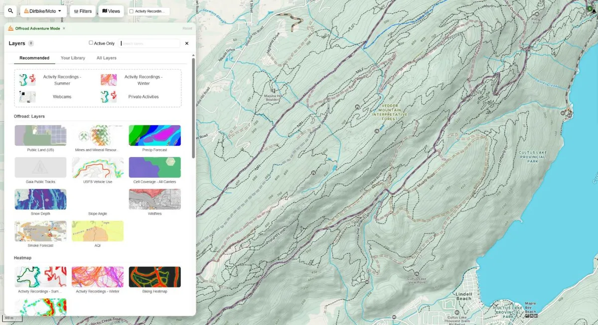
The New Trailforks Map
300+ Layers
The new Trailforks web map brings every map tool into one fullscreen map that never reloads. Choose from more than 300 layers and 60+ basemaps, including satellite, USGS, USFS, NRCan and historic USGS topos.
The full basemap and layer set from our sister app Gaia GPS is built in. Turn on Offroad mode to load the best moto basemap and layers in one click.
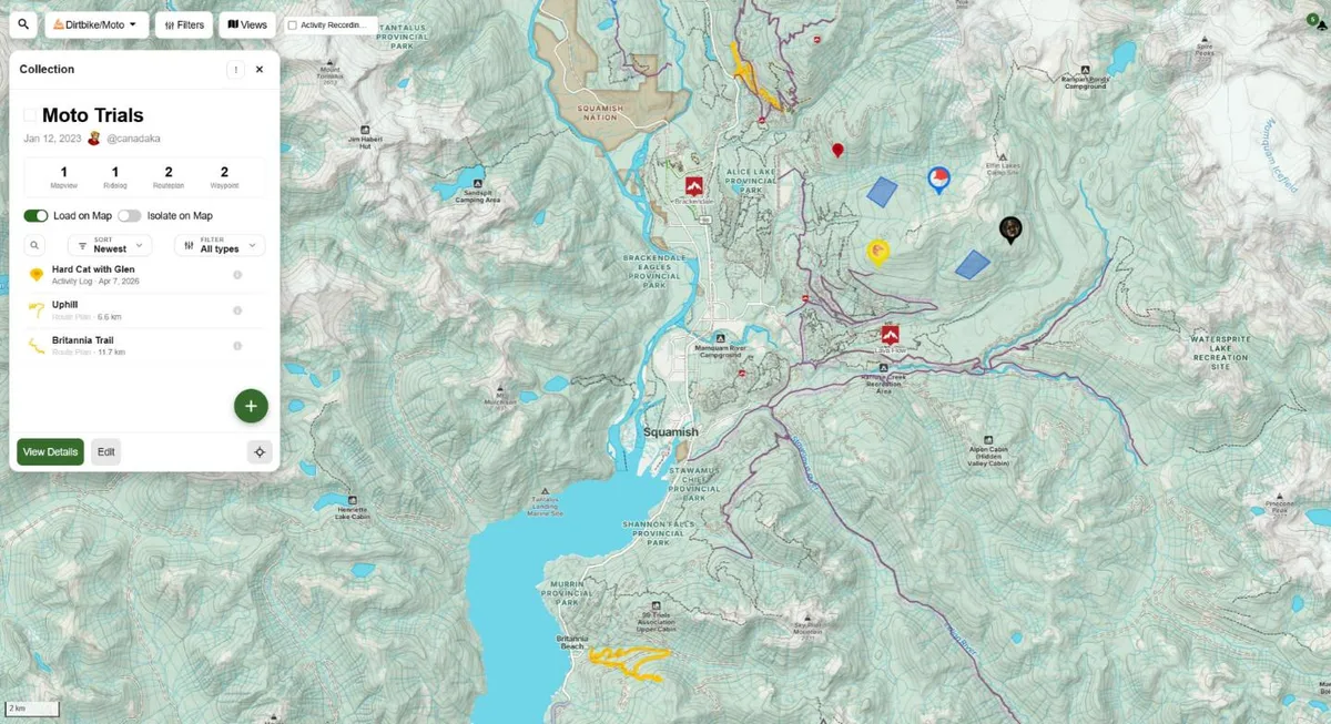
Build Your Own Moto Maps
Drop waypoints for camps, fuel and gates. Draw areas, plan colored dual sport routes and import GPX, KML or FIT files. Your own content sits on top of the trail network, current conditions and popularity data.
Sort it all into collections and share them with your riding crew. Everything syncs to the app for offline use.
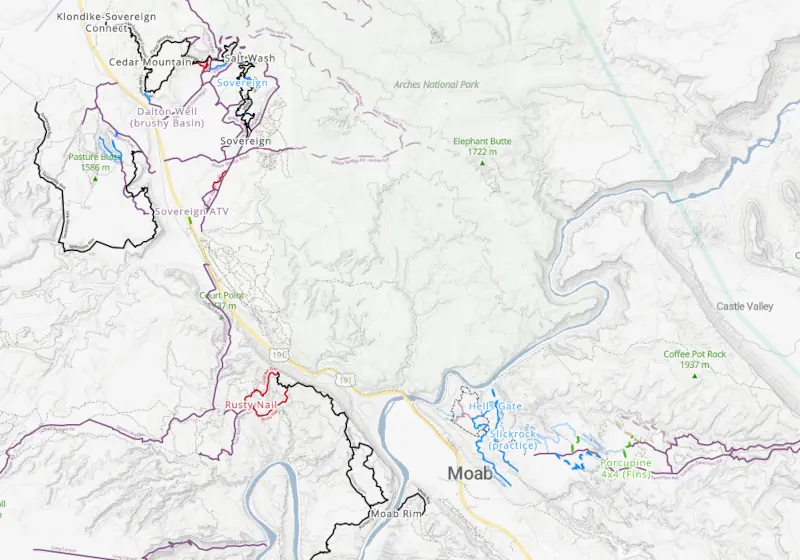
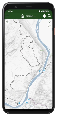
Plan Your Dirt Bike Ride
Our Dirtbike/Moto map highlights the most popular trails and routes in the area. Use our custom Route Planner to draw your route tracing over any of the toggleable layers and sync it to the app for offline use.
Know Where You Can
Legally Ride
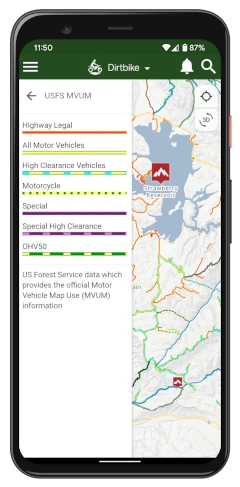
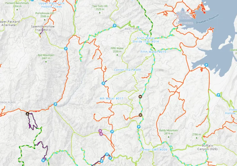
See US Forest Service data which provides the official Motor Vehicle Use Map (MVUM) for the area.
Add the public land and land ownership layers to see whose land you are on, and check BC Backroad Status and USFS roads before you head out.


Cell Phone Coverage
Our US Cell phone coverage layer will help you plan your ride and find areas with better cell service for breaks and check-ins.
Community Trail Reports
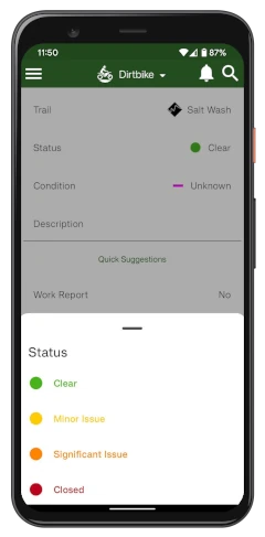
Check out the latest trail reports from other Trailforks users to see current trail conditions, status and photos.


Wildfires Map Layer
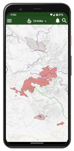
Make sure you stay safe out of the wildfire areas and watch for smoke and air quality forecast.
Discover Where
Riders Are Going
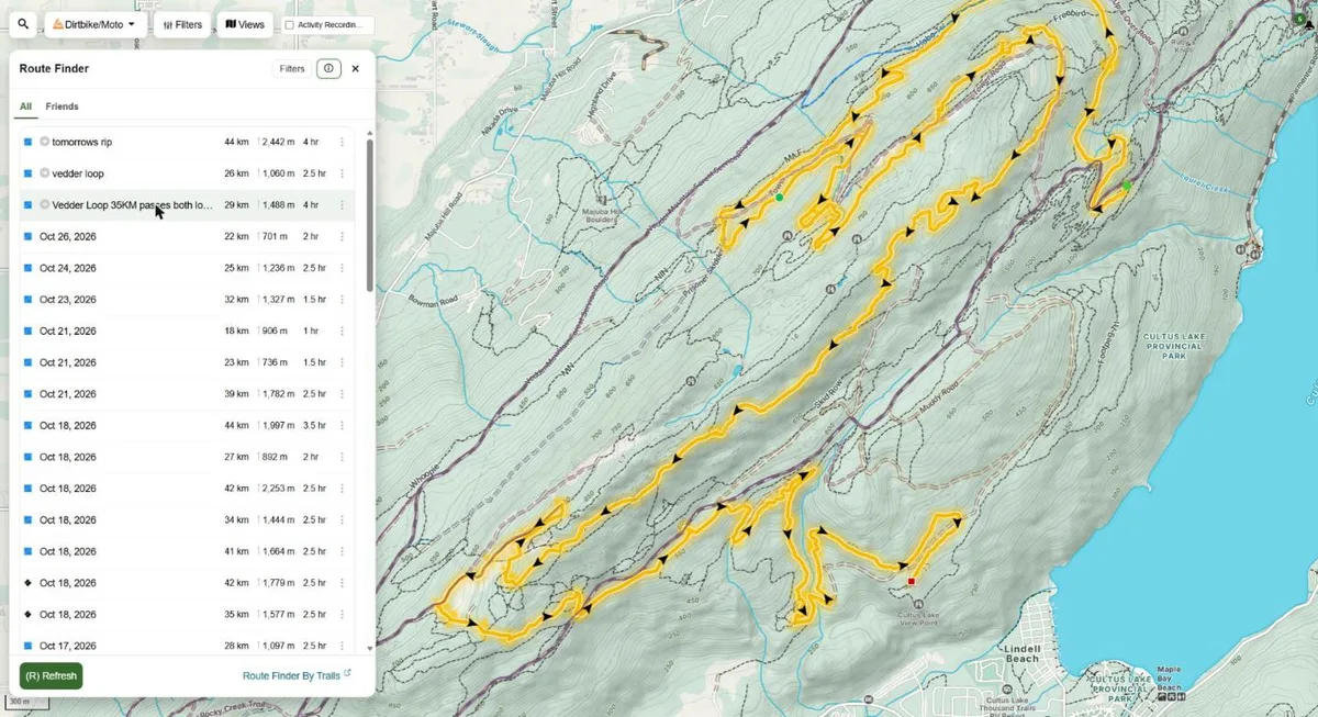
The Route Finder lists recent rides in the area you are looking at. Hover a ride to see its full track on the map, then filter by distance, climb and date to find your next loop.
Rides that leave the mapped trails show you where the unmapped riding is. Turn on the activity recordings heatmap to see every line riders take.
Plan Your Next Moto
Adventure
Track Your Service Intervals
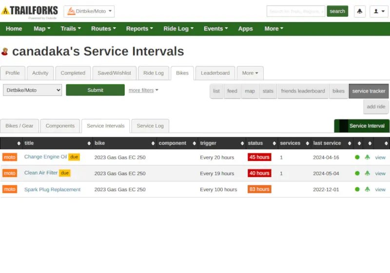
Trailforks Service Tracker allows you to track your dirtbike and gear usage, service and maintenance.
Never Miss an Oil Change
You can schedule reminders for upcoming services and record when a service has been completed. By tagging your dirtbike on your activities, update the odometer and hours of your gear automatically.
Map of Motocross Tracks
Trailforks has an extensive directory and map of dirtbike motocross parks and tracks around the world.
Search by Country, Province/State, nearby, or show them all on the map to see where you want to go next.

Plan on The Website
Use the App in the Backcountry!

Offline Maps
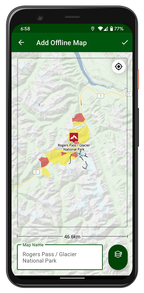
All the trails, POIs, polygons and your routes are stored offline. The GPS on your phone works offline, even with no network connection.
Offline Basemaps & Layers
Download the basemap tiles and some layers offline in the app.
Record Your Ride,
Even With No Signal
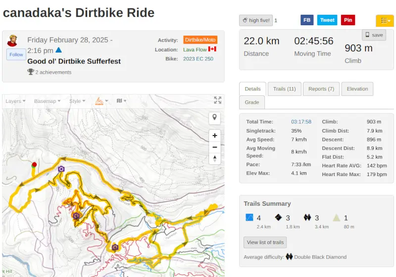
Record your ride with the Trailforks app or connect your Garmin account. The app draws a breadcrumb trail behind you, so you can always find your way back. Recording uses your phone's GPS and works fully offline, deep in the backcountry.
Privacy zones hide the start and end of your rides near home or camp. Every recording shows the trails you rode, your distance, climbing and time.
Share your adventures with your friends and the Trailforks community, or let them follow you in real time.

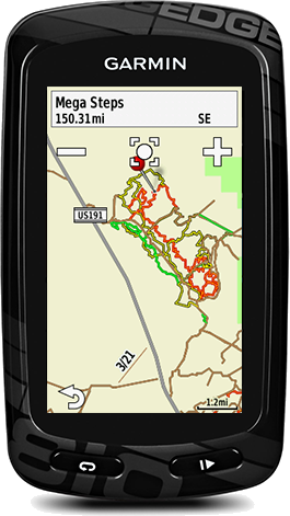
Apple Watch App
and Garmin Maps
Leave the phone in your jacket. The Trailforks Apple Watch app records your ride and shows the trail map, your loaded route and nearby trails on your wrist.
Through our Garmin partnership, record on your Garmin and sync rides to Trailforks automatically. Load Trailforks offline basemaps on your Garmin device.
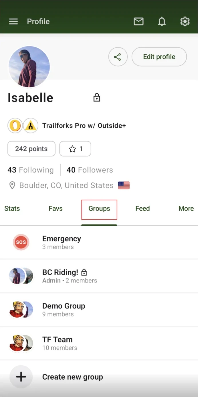
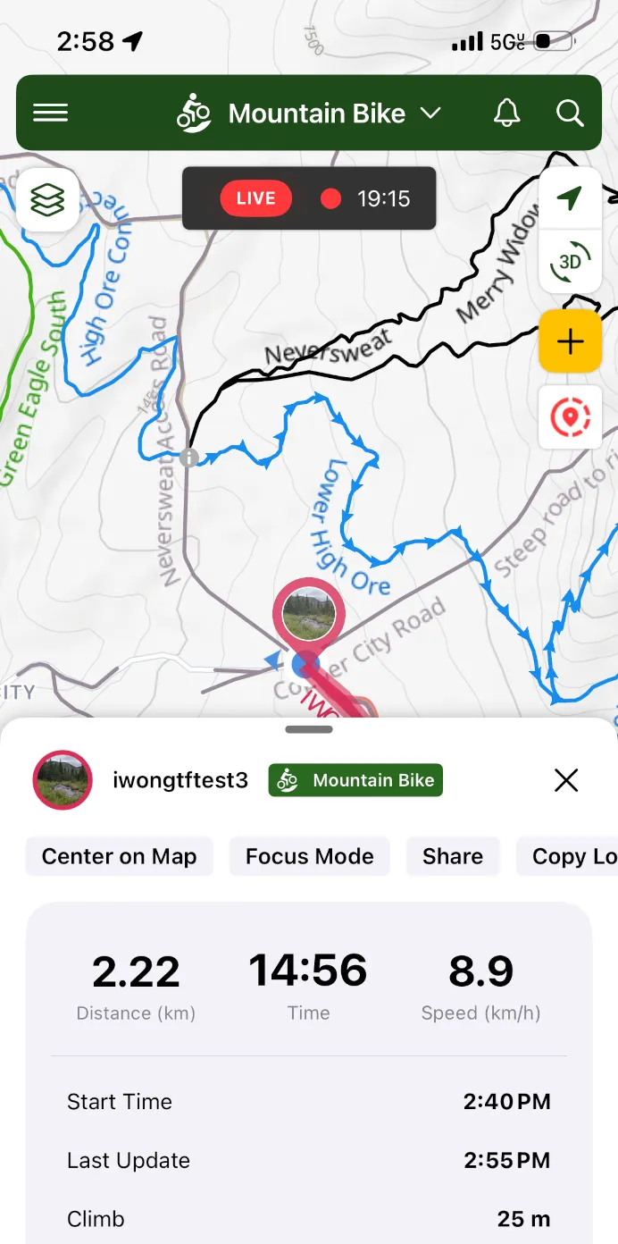
Group Location Sharing
Share your live location with your riding group or your family while you record. People join with an invite link or QR code, and can watch without sharing their own location.
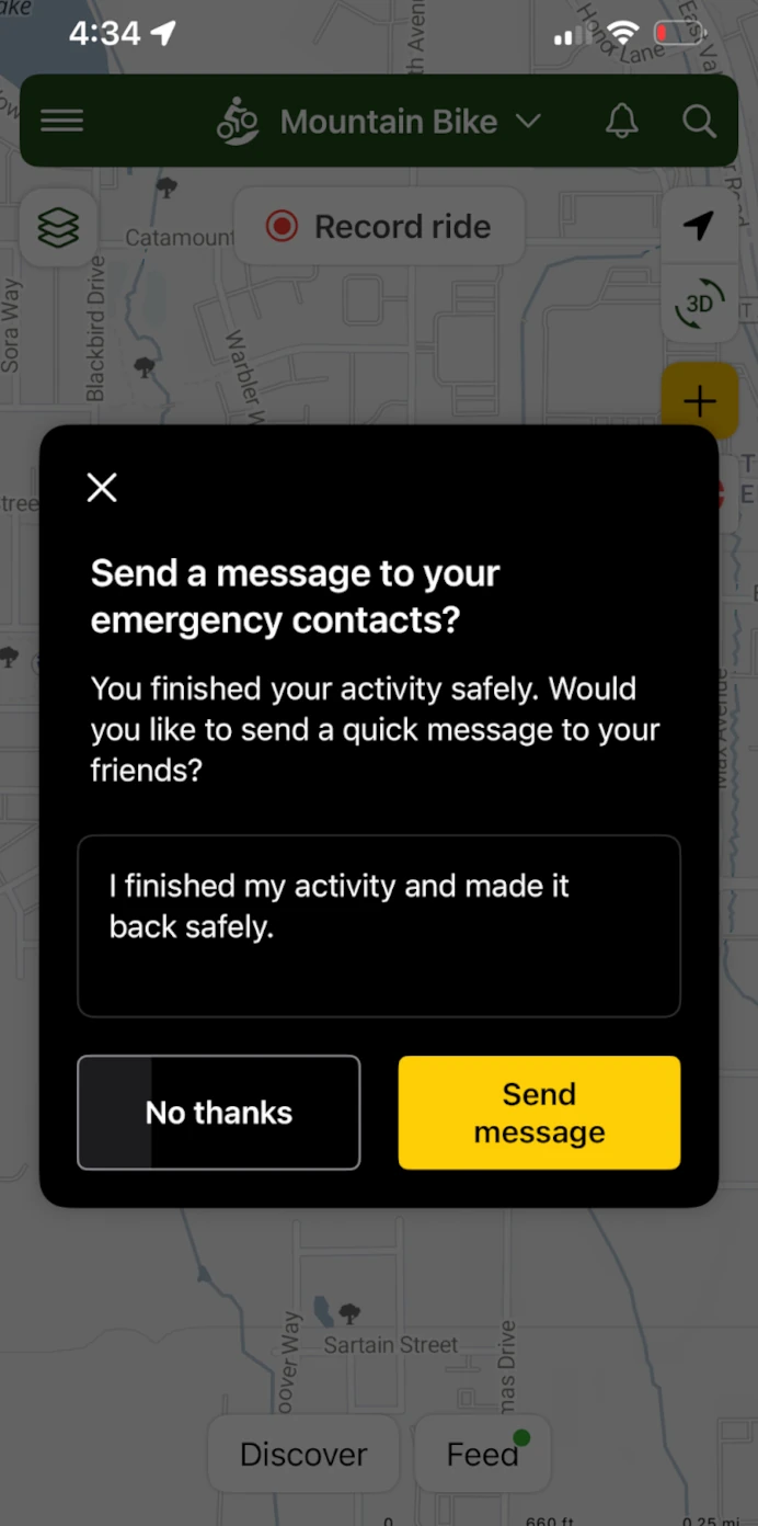
Setting up an emergency group is free. Pro adds safety alerts, an "all good" message when you finish, and live route sharing. Learn more about Group Location Sharing.
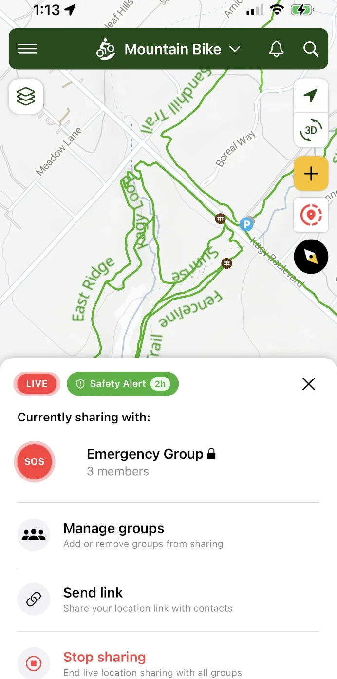
Safety Features for
Solo and Remote Rides
Riding alone or far from help? Add your emergency contacts to a free emergency group, and they can see your live location on the app or the web whenever you share it.
- Safety alerts: set an expected time for your ride. If you run past it, your emergency contacts get an alert.
- Alert from the trail: send a safety alert to your emergency contacts and groups if you get hurt or lost.
- "All good" message: let everyone watching know you made it back safely.
- Auto-share: share to your emergency group and chosen groups every time you start recording.
- See who is watching: check which people are following your location.
Safety alerts, "all good" messages, auto-share and extra emergency contacts come with Trailforks Pro.

Leaderboards, Badges
and Streaks
See how you stack up. Region and trail leaderboards rank riders by distance and climbing.
Earn badges for big rides, big climbs and new trails explored. Keep your riding streak alive with 30, 100 and 200 day streak badges.
Stay on Top of
Your Local Moto Trails
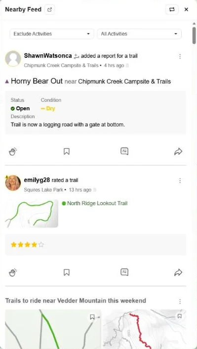
Your feed shows new trail reports, closures and condition updates for the areas you ride. See what your friends are riding and where they went.
Local clubs and associations post work days, events and trail news straight to the feed of riders nearby.
One Map for Every
Trail User
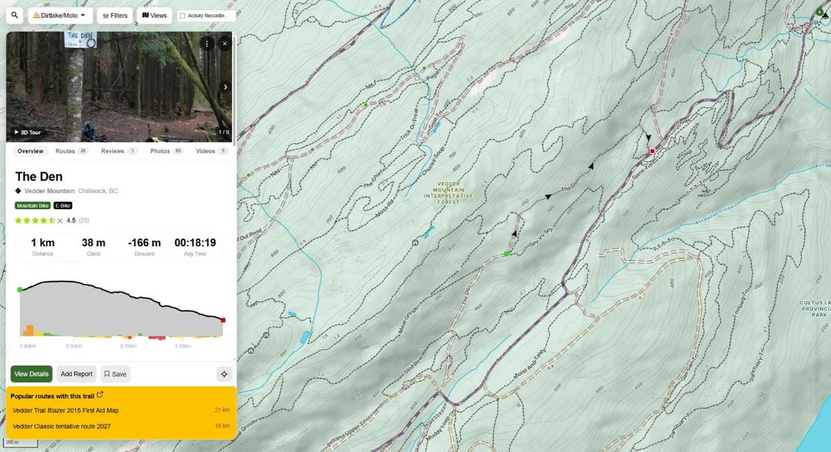
Trailforks maps every trail sport on one map: moto, ATV, mountain bike, hiking, horse and more. If you also ride a mountain bike, hike or ski, you keep one app, one account and one activity history.
The bigger benefit is context. With Dirtbike/Moto selected, trails closed to motorized use still show on the map. Tap any trail to see its allowed uses. You can see which trails are hiking or MTB only, where hikers and mountain bikers are likely to be, and where a moto trail crosses a busy MTB network.
A map with only moto trails leaves out everyone you share the forest with. Seeing the whole trail network helps you stay on legal trails, avoid conflicts and ride safer.

More Features
- View trail reports with status and conditions
- Discover popular routes
- List Routes for a specific trail
- Share a pin of your current location
- Personal Waypoints
- Compass Direction
- Motor Vehicle Use Map for moto access
- US Land Owner Overlay
- Trail photos and videos
Get More With Outside+
- All the Trailforks Pro functionality
- Gaia GPS Premium
- Unlimited access across the Outside Network
- Live Event Coverage, Films and Series
- Expert Tutorials, Travel Discounts

Popular Dirtbiking Destinations
Canada
Alberta
British Columbia
- Bear Creek OHV Trail System
- Cat Lake
- Chilliwack
- Cumberland Moto
- Eagle Mountain
- Hope
- Jordan River
- Kamloops
- Lava Flow
- Lytton
- Maple Ridge
- Nanaimo
- Pemberton
- Revelstoke
- Squamish
- Tamihi (Chilliwack River)
- Vedder Mountain
- Whiskey Creek OHV Rec-Site
United States
Arizona
California
Colorado
Idaho
Massachusetts
Montana
New Mexico
Oregon
Utah
- American Fork Canyon
- Eagle Mountain
- Green River
- Hurricane
- Kamas
- Moab
- St. George
- Tooele
- White Wash Sand Dunes OHV Area
Washington
Dirt Bike App FAQ
What is the best app for finding dirt bike trails?
Trailforks maps 36,100+ dirt bike trails, 21,000+ ATV and OHV trails and 6,800+ moto trials trails, each with difficulty, allowed uses, conditions and trail reports from local riders and moto clubs. It adds MVUM and public land layers, offline maps, route planning, Garmin and Apple Watch support, and group location sharing, and the core maps are free.
Is Trailforks free for dirt biking?
Yes. Dirt bike trail maps, trail reports, ride recording, offline trail data and emergency location sharing are free in the Trailforks app and on the website. Trailforks Pro adds premium features such as safety alerts, "all good" messages and the trail popularity heatmap.
How do I find dirt bike trails near me?
Open the Trailforks map at https://www.trailforks.com/map/ or in the app, and set the activity to Dirtbike/Moto. Turn on Offroad mode for the best moto basemap and layers, and use the Route Finder and activity recordings heatmap to see where other riders go.
Does Trailforks show where I can legally ride a dirt bike?
Every trail lists its allowed uses, so you can see which trails are open to motorized use. In the US you can turn on the USFS Motor Vehicle Use Map (MVUM) and public land layers. In British Columbia you can check BC Backroad status.
Does the Trailforks app work offline with no cell signal?
Yes. Trails, points of interest, areas and your routes are stored offline, and you can download basemaps to your phone. Your phone GPS records your ride and shows your location without a network connection.
Can I use Trailforks on an Apple Watch or Garmin?
Yes. The Trailforks Apple Watch app records your ride and shows the trail map on your wrist. You can record on a Garmin, sync rides to Trailforks automatically and load Trailforks offline basemaps on your Garmin device.
Can a moto club manage its trails on Trailforks?
Yes. Clubs and associations can manage their own trail network, update trail status and closures, and post news and events to the feed of riders in their area.