close
-
Layers w
- Weather Layers
- Pro
- Pro
- Pro
- Pro
- Pro
- Pro
- More Layers
- Pro
- Pro
- Pro
- Pro
-
Upgrade to

3D
Trail Conditions
- Unknown
- Snow Groomed
- Snow Packed
- Snow Covered
- Snow Cover Partial
- Freeze/thaw Cycle
- Icy
- Prevalent Mud
- Wet
- Variable
- Ideal
- Dry
- Very Dry
Trail Flow (Ridden Direction)
Trailforks scans users ridelogs to determine the most popular direction each trail is ridden. A good flowing trail network will have most trails flowing in a single direction according to their intension.
The colour categories are based on what percentage of riders are riding a trail in its intended direction.
The colour categories are based on what percentage of riders are riding a trail in its intended direction.
- > 96%
- > 90%
- > 80%
- > 70%
- > 50%
- < 50%
- bi-directional trail
- no data
Trail Last Ridden
Trailforks scans ridelogs to determine the last time a trail was ridden.
- < 2 days
- < 1 week
- < 2 weeks
- < 1 month
- < 6 months
- > 6 months
Trail Ridden Direction
The intended direction a trail should be ridden.
- Downhill Only
- Downhill Primary
- Both Directions
- Uphill Primary
- Uphill Only
- One Direction
Contribute Details
Colors indicate trail is missing specified detail.
- Description
- Photos
- Description & Photos
- Videos
Trail Popularity ?
Trailforks scans ridelogs to determine which trails are ridden the most in the last 9 months.
Trails are compared with nearby trails in the same city region with a possible 25 colour shades.
Think of this as a heatmap, more rides = more kinetic energy = warmer colors.
- most popular
- popular
- less popular
- not popular
ATV/ORV/OHV Filter
Max Vehicle Width
inches
US Cell Coverage
Legend

Radar Time
Activity Recordings
Trailforks uses anonymized public activity data.
?
Activity Recordings
Trailforks uses anonymized public activity data.
?
Personal Heatmap
▶
Activity Types
all
/
none
▶
Options
2
Date range
month
–
Winter Trails
Warning
A routing network for winter maps does not exist. Selecting trails using the winter trails layer has been disabled.
Missing Trails
Most Popular
Least Popular
Trails are colored based on popularity. The more popular a trail is, the more red. Less popular trails trend towards green.
Jump Magnitude Heatmap
Heatmap of where riders jump on trails. Zoom in to see individual jumps, click circles to view jump details.
BC Backroad Status
![map legend]()
Service Road Atlas is a free to use, community-driven service for viewing and creating reports on the numerous back-country service roads around B.C. and Alberta.

Slope Aspect
Direction the slope faces
Trails Deemphasized
Trails are shown in grey.
Only show trails with no bike usage.
Suggested Layers
Based on selected activity type
Save the current map location and zoom level as your default home location whenever this page is loaded.
SaveJust a short drive from Olympia, Capitol State Forest has trailheads, day-use areas, and campgrounds with access to the forest's hiking, mountain biking, horseback riding and off-road vehicle riding trail systems. From horseback riding at Mima Falls, to mountain biking and off-road-vehicle riding at Rock Candy, Capitol State Forest provides a variety of recreational opportunities. Horseback riding-oriented campgrounds, like the Margaret McKenny, offer corals and hitching posts, while off-road vehicle-oriented campgrounds, like the Middle Waddell, provide access to the forest's motorized trail system. Visitors should follow these rules to keep their trips safe and fun.
To access recreation sites on DNR-managed land with your vehicle, you'll need a Discover Pass, your ticket to Washington's great outdoors.
Campsites available first come, first served so there's no need to make a reservation.
Capitol Forest campgrounds are closed Dec. 1 - April 30 for the winter season.
Limit stay to 7 days per year. Camp only in designated campgrounds
Mountain bikers may bring unleashed dogs controlled by voice command.
NOTE: Off-road motorcycles and horseback riders can enjoy Capitol State Forest trails from May 1 to November 30 only.
Primary Trail Type: All-Mountain & Downhill
eBikes Allowed:
Yes
Shuttleable: YES
Land Status: State Forest
Land Manager: Washington Department Of Natural Resources
 google parking directions
Links
Region Supporters & Maintainers
Activities Click to view
- Mountain Bike
84 trails
- E-Bike
64 trails
- Horse
9 trails
- Hike
84 trails
- Trail Running
84 trails
- Dirtbike/Moto
34 trails
- Observed Trials
8 trails
- ATV/ORV/OHV
32 trails
Region Details
- 31
- 26
- 19
- 4
Region Status
Caution as of Jul 10, 2026Stats
- Avg Trail Rating
- Trails (view details)
- 82
- Trails Mountain Bike
- 84
- Trails E-Bike
- 64
- Trails Horse
- 9
- Trails Hike
- 84
- Trails Trail Running
- 84
- Trails Dirtbike/Moto
- 34
- Trails Observed Trials
- 8
- Trails ATV/ORV/OHV
- 32
- Total Distance
- 200 miles
- Total Descent
- 30,526 ft
- Total Vertical
- 2,582 ft
- Highest Trailhead
- 2,658 ft
- Reports
- 1,267
- Photos
- 420
- Ridden Counter
- 13,895
Popular Capitol Forest Mountain Biking Trails
• 95 ★ 4.3 • 6 miles • 1,453 ft • 916 •
Starting at Fall Creek Trailhead makes this a long climb that you can tie into Or all the way to .
• 100 ★ 4.5 • 2 miles • 127 ft • 877 •
The trail is a great trail for learning to do small, flowy jumps. It is a really fun trail, and most of the third section is a pump track. It mostly goes downhill, there are a few flatter spots, so if you are DH all day every day, you...
• 100 ★ 3.8 • 2 miles • 241 ft • 618 •
Popular green difficulty singletrack. This mountain bike primary trail can be used both directions and has a easy overall physical rating with a 241 ft green climb. On average it takes 14 minutes to complete this trail.
• 100 ★ 4.4 • 3 miles • 701 ft • 614 •
, a recent addition to trail network in the Fall Creek area. It serves as an alternative to climbing the road on the way to the top of Mountain and it is a good trail to practice skills building. It is a joyful beginner trail to ride in...
• 80 ★ 4.0 • 5 miles • 647 ft • 467 •
loop will tie in with Mima Falls West or .
• 90 ★ 3.9 • 5 miles • 1,261 ft • 464 •
Continuation From Mima Falls that takes you up and will link with or . Some steady climbing on this section and no technical downhill
Capitol Forest Mountain Bike Routes
★ 4.0 • 10 miles • 1,782 ft • 3 • Loop •
This is the poker ride route from the Capitol Forest Classic (also the beginner route for the XC race)....
★ 5.0 • 25 miles • 4,410 ft • 5 •
★ 4.0 • 7 miles • 1,069 ft • 6 • Loop •
Loop is a roughly 9 mile ride out of the Fall Creek TH. Debates rage about route, but most people ride...
★ 4.0 • 38 miles • 6,327 ft • 4 • Loop •
From the Mima Falls trailhead you can make several types of loops in a wide range of distances. The goal...
★ 4.0 • 11 miles • 1,724 ft • 6 • Loop •
This is the Peacock Loop, sometimes just called "The Peacock." Relatively easy, rolling loop out of the...
4 miles • 788 ft • 1 •
A route that shows total mileage for if you were to pedal the climb trail instead of shuttle.
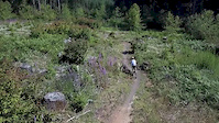
Photos of Capitol Forest Mountain Bike
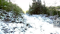
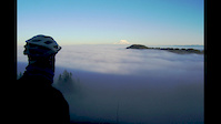
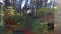
Videos of Capitol Forest Mountain Bike

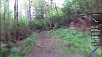
trail: Little Larch
0:14 |
|
Oct 10, 2022
trail: Level Up
0:24 |
490 |
Jul 6, 2019
trail: Porter Trail
3:04 |
125 |
Jan 29, 2017
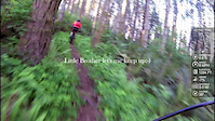
trail: Little Larch
6:38 |
569 |
Oct 8, 2016
trail: Porter Trail
4:40 |
301 |
Sep 24, 2016
trail: Porter Trail
0:39 |
132 |
May 13, 2016
trail: Porter Trail
4:26 |
217 |
May 7, 2016

trail: Greenline Trail
5:58 |
173 |
Mar 1, 2016
Recent Trail Reports
| status | trail | date | condition | info | user |
|---|---|---|---|---|---|
| McKenny Trail | Jul 10, 2026 @ 11:26am (America/Vancouver) Jul 10, 2026 | Dry | marebearrr | ||
| Campground Trail | Jul 10, 2026 @ 11:26am (America/Vancouver) Jul 10, 2026 | Dry | marebearrr | ||
| Greenline Tie | Jul 8, 2026 @ 10:21pm (America/Los_Angeles) Jul 8, 2026 | Unknown | LoamyDaniels | ||
| Forever Ferns | Jul 6, 2026 @ 10:43pm (America/Los_Angeles) Jul 6, 2026 | Ideal | Alspins | ||
| Little Larch | Jul 5, 2026 @ 9:22pm (America/Los_Angeles) Jul 5, 2026 | Ideal | Alspins | ||
| Wedekind Trail | Jun 29, 2026 @ 4:48pm (America/Los_Angeles) Jun 29, 2026 | Unknown | rlahiri1207 | ||
| Lower South Divide Trail | Jun 23, 2026 @ 8:26am (America/Los_Angeles) Jun 23, 2026 | Dry | TenaciousE | ||
| Twin Peaks Trail | Jun 23, 2026 @ 8:23am (America/Los_Angeles) Jun 23, 2026 | Very Dry | TenaciousE | ||
| Level Up | Jun 11, 2026 @ 12:22pm (America/Vancouver) Jun 11, 2026 | Ideal | marebearrr | ||
| Lost Valley | Jun 11, 2026 @ 12:22pm (America/Vancouver) Jun 11, 2026 | Variable | marebearrr |
Activity Feed
| username | action | type | title | date |
|---|---|---|---|---|
| erik4gXwKt | ridden | trail | activity #99579285 | Jul 19, 2026 @ 5:31pm 1 day |
| nichinc | comment | trail | activity #99575931 | Jul 19, 2026 @ 4:26pm 1 day |
| GravyTain | wishlist | trail | activity #99572684 | Jul 19, 2026 @ 3:22pm 1 day |
| gM1zC8 | wishlist | route | activity #99283116 and 4 more | Jul 15, 2026 @ 8:18pm Jul 15, 2026 |
| EricNJ4DIR | wishlist | route | activity #99267999 | Jul 15, 2026 @ 3:54pm Jul 15, 2026 |
Recent Comments
| username | type | title | comment | date |
|---|---|---|---|---|
| trail | Not great for MTB. Fat gravel, super slippy.... | Jul 19, 2026 @ 4:26pm 1 day | ||
| trail | Mistagged. It’s a moto trail. Take the fire... | May 9, 2026 @ 7:33pm May 9, 2026 | ||
| trail | This has quickly become one of my most-ridden... | Sep 20, 2025 @ 8:59am Sep 20, 2025 | ||
| trail | This trail rips. a very versatile green run.... | Sep 4, 2025 @ 2:28pm Sep 4, 2025 | ||
| trail | Rode it Saturday, super amazing trail. | Aug 11, 2025 @ 12:05pm Aug 11, 2025 |
Nearby Areas
| name | distance | ||||
|---|---|---|---|---|---|
| North Slope Trails | 4 | 7 | 7 | 4 | 8.1 km |
| Kennedy Summit Lake | 5 | 30 | 9.4 km | ||
| Millersylvania State Park | 14 | 9.7 km | |||
| Grass Lake Nature Park | 3 | 11.4 km | |||
| Heritage Park | 12.2 km |
Local Badges
-

Completionist0 awarded
Local Products
Activity Type Stats
| activitytype | trails | distance | descent | descent distance | total vertical | rating | global rank | state rank | photos | reports | routes | ridelogs |
|---|---|---|---|---|---|---|---|---|---|---|---|---|
| Mountain Bike | 84 | 189 miles | 30,082 ft | 84 miles | 2,582 ft | #663 | #251 | 419 | 1,267 | 41 | 16,317 | |
| E-Bike | 64 | 139 miles | 19,446 ft | 58 miles | 2,582 ft | #774 | #630 | 937 | 2 | 826 | ||
| Horse | 9 | 8 miles | 732 ft | 2 miles | 1,768 ft | #1,506 | #771 | 261 | 1 | |||
| Hike | 84 | 188 miles | 29,573 ft | 83 miles | 2,582 ft | #738 | #384 | 2 | 1,216 | 1 | 299 | |
| Trail Running | 84 | 188 miles | 29,573 ft | 83 miles | 2,582 ft | #357 | #155 | 1 | 1,216 | 1 | 365 | |
| Dirtbike/Moto | 34 | 64 miles | 9,498 ft | 25 miles | 2,549 ft | #107 | #56 | 315 | 1 | 139 | ||
| Observed Trials | 8 | 6 miles | 669 ft | 2 miles | 1,768 ft | #63 | #19 | 8 | 4 | |||
| ATV/ORV/OHV | 32 | 57 miles | 8,573 ft | 22 miles | 2,549 ft | #41 | #26 | 307 | 10 |
Frequently Asked Questions About Capitol Forest
▼
What are the highest rated mountain biking trails in Capitol Forest?
The highest rated mountain biking trails in Capitol Forest are:
- Forever Ferns (4.4/5)
- MnM (4.3/5)
- Little Larch (4.3/5)
- Lower MnM (4.3/5)
- Greenline Climb Trail (4.3/5)
▼
What is the best time of the year to ride in Capitol Forest?
Based on ride log data, the most popular months to ride in Capitol Forest are:
- August (215 activities)
- July (210 activities)
- May (174 activities)
▼
Where can I park to ride in Capitol Forest?
There are 9 parking locations listed in Capitol Forest. The most popular parking spots are: View all parking and trailhead locations on the map to plan your visit.
▼
What is the longest trail in Capitol Forest?
The longest trail in Capitol Forest is Porter Trail at 12.9 miles. View all trails sorted by distance.
Activities
Trails
- By superman601 & contributors
- Admins: FOCF, FOCF, WA DNR BHD, EMBA-C2S
- #5527 - 69,338 views
- capitol forest activity log | embed map of Capitol Forest mountain bike trails | capitol forest mountain biking points of interest
Downloading of trail gps tracks in kml & gpx formats is enabled for Capitol Forest.
You must login to download files.