All Trailforks Cypress Trails
- Mountain Bike
Login to see your progress towards riding all the trails and routes in this list.
Trails
| title | riding area | rating | distance | completed | |||
|---|---|---|---|---|---|---|---|
| 1 | Antagonizer | 3,100 ft | |||||
| 2 | Blind Skier | 4,199 ft | |||||
| 3 | Brutus | 174 ft | |||||
| 4 | Coiler | 3,045 ft | |||||
| 5 | Cypress Lower Connector (Quagmire) | 755 ft | |||||
| 6 | Dirty Harry | 2,182 ft | |||||
| 7 | Fern Trail | 1 mile | |||||
| 8 | Fire Hose | 2,372 ft | |||||
| 9 | Jersey Shore | 2,195 ft | |||||
| 10 | Jump Line Exit | 467 ft | |||||
| 11 | Lower Paul Hogan | 2,772 ft | |||||
| 12 | Lower Sex Boy | 2,001 ft | |||||
| 13 | Lower Shore Play | 1,743 ft | |||||
| 14 | Lower Tall Cans | 1,394 ft | |||||
| 15 | Meat Sweats | 4,537 ft | |||||
| 16 | Morgies | 1,407 ft | |||||
| 17 | Mystery DH | 2,182 ft | |||||
| 18 | Never Never Land | 653 ft | |||||
| 19 | Paul Hogan | 1,280 ft | |||||
| 20 | Pre-Reaper | 971 ft | |||||
| 21 | Pull Tab | 1,486 ft | |||||
| 22 | Reaper | 2,247 ft | |||||
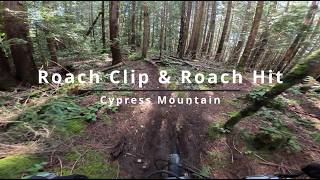
| 23 | Roach Clip | 1,575 ft | |||||
| 24 | S&M | 948 ft | |||||
| 25 | Sex Boy | 1,965 ft | |||||
| 26 | Sex Girl | 2,910 ft | |||||
| 27 | Sex Girl Connector | 453 ft | |||||
| 28 | Sexit | 453 ft | |||||
| 29 | SGS | 3,173 ft | |||||
| 30 | Shore Play | 2,280 ft | |||||
| 31 | Single Lane Traffic | 1,319 ft | |||||
| 32 | Slippery Alt | 928 ft | |||||
| 33 | Slippery Canoe | 820 ft | |||||
| 34 | SOB (Son of a Bitch) | 538 ft | |||||
| 35 | Stupid Grouse | 4,803 ft | |||||
| 36 | Trunk Monkey | 1,660 ft | |||||
| 37 | Upper Roach Hit | 1,493 ft | |||||
| 38 | Upper Tall Cans | 2,815 ft | |||||
| 39 | Wutang | 2,018 ft |
Displaying 39
Videos
youtuber
![Grab Your DH Bike, We are doing party laps...]()
26:22 |
111 |
Nov 25, 2025 , West Vancouver

4:54 |
22 |
Mar 9, 2026 , West Vancouver
4:54 |
47 |
Mar 9, 2026 , West Vancouver
Recent Trail Reports
| status | trail | date | condition | |
|---|---|---|---|---|
| S&M | Jun 3, 2026 @ 2:12pm (America/Vancouver) Jun 3, 2026 | view | ||
| Sex Girl | Jun 3, 2026 @ 2:08pm (America/Vancouver) Jun 3, 2026 | view | ||
| Morgies | Jun 1, 2026 @ 1:02pm (America/Vancouver) Jun 1, 2026 | view | ||
| SGS | Apr 26, 2026 @ 9:11pm (America/Vancouver) Apr 26, 2026 | view | ||
| Stupid Grouse | Apr 22, 2026 @ 12:37pm (America/Vancouver) Apr 22, 2026 | view |
Total Trails
39
Total Distance
15 miles
Total Descent
-15,201 ft
Total Climb
346 ft
close
-
Layers w
- Weather Layers
- Pro
- Pro
- Pro
- Pro
- Pro
- Pro
- More Layers
- Pro
- Pro
- Pro
- Pro
-
Upgrade to

3D
Trail Conditions
- Unknown
- Snow Groomed
- Snow Packed
- Snow Covered
- Snow Cover Partial
- Freeze/thaw Cycle
- Icy
- Prevalent Mud
- Wet
- Variable
- Ideal
- Dry
- Very Dry
Trail Flow (Ridden Direction)
Trailforks scans users ridelogs to determine the most popular direction each trail is ridden. A good flowing trail network will have most trails flowing in a single direction according to their intension.
The colour categories are based on what percentage of riders are riding a trail in its intended direction.
The colour categories are based on what percentage of riders are riding a trail in its intended direction.
- > 96%
- > 90%
- > 80%
- > 70%
- > 50%
- < 50%
- bi-directional trail
- no data
Trail Last Ridden
Trailforks scans ridelogs to determine the last time a trail was ridden.
- < 2 days
- < 1 week
- < 2 weeks
- < 1 month
- < 6 months
- > 6 months
Trail Ridden Direction
The intended direction a trail should be ridden.
- Downhill Only
- Downhill Primary
- Both Directions
- Uphill Primary
- Uphill Only
- One Direction
Contribute Details
Colors indicate trail is missing specified detail.
- Description
- Photos
- Description & Photos
- Videos
Trail Popularity ?
Trailforks scans ridelogs to determine which trails are ridden the most in the last 9 months.
Trails are compared with nearby trails in the same city region with a possible 25 colour shades.
Think of this as a heatmap, more rides = more kinetic energy = warmer colors.
- most popular
- popular
- less popular
- not popular
ATV/ORV/OHV Filter
Max Vehicle Width
inches
US Cell Coverage
Legend

Radar Time
Activity Recordings
Trailforks uses anonymized public activity data.
?
Activity Recordings
Trailforks uses anonymized public activity data.
?
Personal Heatmap
▶
Activity Types
all
/
none
▶
Options
2
Date range
month
–
Winter Trails
Warning
A routing network for winter maps does not exist. Selecting trails using the winter trails layer has been disabled.
Missing Trails
Most Popular
Least Popular
Trails are colored based on popularity. The more popular a trail is, the more red. Less popular trails trend towards green.
Jump Magnitude Heatmap
Heatmap of where riders jump on trails. Zoom in to see individual jumps, click circles to view jump details.
BC Backroad Status
![map legend]()
Service Road Atlas is a free to use, community-driven service for viewing and creating reports on the numerous back-country service roads around B.C. and Alberta.

Slope Aspect
Direction the slope faces
Trails Deemphasized
Trails are shown in grey.
Only show trails with no bike usage.
Suggested Layers
Based on selected activity type
Save the current map location and zoom level as your default home location whenever this page is loaded.
Save
Trail transparency
Average difficulty
Trails and Routes in List - Distance by Difficulty
Trails and Routes in List - Difficulty Totals
- By livinglegend87

- #192 - 2,457 views