close
-
Layers w
- Weather Layers
- Pro
- Pro
- Pro
- Pro
- Pro
- Pro
- More Layers
- Pro
- Pro
- Pro
- Pro
-
Upgrade to

3D
Trail Conditions
- Unknown
- Snow Groomed
- Snow Packed
- Snow Covered
- Snow Cover Partial
- Freeze/thaw Cycle
- Icy
- Prevalent Mud
- Wet
- Variable
- Ideal
- Dry
- Very Dry
Trail Flow (Ridden Direction)
Trailforks scans users ridelogs to determine the most popular direction each trail is ridden. A good flowing trail network will have most trails flowing in a single direction according to their intension.
The colour categories are based on what percentage of riders are riding a trail in its intended direction.
The colour categories are based on what percentage of riders are riding a trail in its intended direction.
- > 96%
- > 90%
- > 80%
- > 70%
- > 50%
- < 50%
- bi-directional trail
- no data
Trail Last Ridden
Trailforks scans ridelogs to determine the last time a trail was ridden.
- < 2 days
- < 1 week
- < 2 weeks
- < 1 month
- < 6 months
- > 6 months
Trail Ridden Direction
The intended direction a trail should be ridden.
- Downhill Only
- Downhill Primary
- Both Directions
- Uphill Primary
- Uphill Only
- One Direction
Contribute Details
Colors indicate trail is missing specified detail.
- Description
- Photos
- Description & Photos
- Videos
Trail Popularity ?
Trailforks scans ridelogs to determine which trails are ridden the most in the last 9 months.
Trails are compared with nearby trails in the same city region with a possible 25 colour shades.
Think of this as a heatmap, more rides = more kinetic energy = warmer colors.
- most popular
- popular
- less popular
- not popular
ATV/ORV/OHV Filter
Max Vehicle Width
inches
US Cell Coverage
Legend

Radar Time
Activity Recordings
Trailforks uses anonymized public activity data.
?
Activity Recordings
Trailforks uses anonymized public activity data.
?
Personal Heatmap
▶
Activity Types
all
/
none
▶
Options
2
Date range
month
–
Winter Trails
Warning
A routing network for winter maps does not exist. Selecting trails using the winter trails layer has been disabled.
Missing Trails
Most Popular
Least Popular
Trails are colored based on popularity. The more popular a trail is, the more red. Less popular trails trend towards green.
Jump Magnitude Heatmap
Heatmap of where riders jump on trails. Zoom in to see individual jumps, click circles to view jump details.
BC Backroad Status
![map legend]()
Service Road Atlas is a free to use, community-driven service for viewing and creating reports on the numerous back-country service roads around B.C. and Alberta.

Slope Aspect
Direction the slope faces
Trails Deemphasized
Trails are shown in grey.
Only show trails with no bike usage.
Suggested Layers
Based on selected activity type
Save the current map location and zoom level as your default home location whenever this page is loaded.
SaveThe ACT is quite rightly labelled as the singletrack capital of Australia. Whilst most of the trails have an XC feel there is something for everyone here.
Stromlo stands out as the jewel in the crown and has hosted World Cups. However there is plenty on offer - and new trail developments taking place - in plenty of other locations.
Stromlo stands out as the jewel in the crown and has hosted World Cups. However there is plenty on offer - and new trail developments taking place - in plenty of other locations.
eBikes Allowed:
No
AKA: ACT
Region Details
- 284
- 19
- 350
- 133
- 59
- 22
Stats
- Avg Trail Rating
- Trails (view details)
- 963
- Trails Mountain Bike
- 867
- Trails E-Bike
- 314
- Trails Gravel Bike
- 401
- Trails Adaptive Bike
- 115
- Trails Winter Fat Bike
- 9
- Trails Horse
- 31
- Trails Hike
- 756
- Trails Trail Running
- 782
- Total Distance
- 764 miles
- Total Descent
- 91,584 ft
- Total Vertical
- 4,537 ft
- Highest Trailhead
- 6,082 ft
- Reports
- 24,509
- Photos
- 939
- Ridden Counter
- 347,446
Articles

Video: Flying Down Rocky Trails in Canberra, Australia with Jackson Frew
Aug 12, 2019 from pinkbike.com
Flying down a few of the local trails around Australia's capital.
Popular Trail Networks
view all areas »Sub Regions
- Bruce (10)
- Canberra (720)
- Aranda Bushland Nature Reserve (12)
- Aranda Primary School (1)
- Black Mountain Nature Reserve (22)
- Bruce Ridge (54)
- Caroline Chisholm School Community Bike Track (3)
- Cotter Pines (22)
- East Kowen (120)
- Isaacs Ridge (10)
- Kowen Forest (12)
- Lower Cotter Catchment (17)
- Majura Pines (73)
- Molonglo Pines (Poo Pines) (27)
- Mount Ainslie Nature Reserve (22)
- Mount Majura Nature Reserve (4)
- Mount Taylor Nature Reserve (11)
- National Arboretum (29)
- Pine Island (7)
- Red Hill Nature Reserve (10)
- Rob Roy Nature Reserve (0)
- Sparrow Hill (82)
- Stromlo Forest Park (120)
- The Pinnacle Nature Reserve (0)
- Tidbinbilla Nature Reserve (1)
- Tuggeranong Hill Nature Reserve (6)
- Tuggeranong Pines (13)
- West Kowen (12)
- Zoo Pines (24)
- Chapman (5)
- Coree (27)
- Fadden (4)
- Gungahlin (13)
- Kambah (1)
- Queanbeyan (83)
- Captains Flat (5)
- Jerra Trails (71)
- Mount Jerrabomera (1)
- Tharwa (4)
Popular Australian Capital Territory (ACT) Trails
• 100 ★ 4.7 • 2,572 ft • 2 ft • 3,576 •
Take this trail almost any day in the hour before sunset and you'll be riding through kangaroos. They eat the grass that this track runs over. Maybe it should be renamed Kangaroo View? The trail itself has a couple of challenging...
• 100 ★ 3.9 • 2,172 ft • 43 ft • 3,398 •
Most of this trail is a firetrail in between the beginning and end singletrack portions. The fast run down the firetrail back into the trees often catches people out in too high a gear as they go into the trees and uphill. A couple of...
• 100 ★ 4.6 • 1,706 ft • 6 ft • 3,333 •
At low speed this is an incredibly benign beginner's descent. At high speeds there are numerous jumps where the key to a good time is catching perfect backside. Going straight ahead at the big left handed berm (yes, over the back of the...
• 100 ★ 4.6 • 4,147 ft • 37 ft • 3,201 •
is "the" main descending trail in the park. And it is green rated. As such, don't expect to have the space to go for a PR on a sunny Saturday arvo because you'll encounter kids and beginners galore. Most of the rocks and rollers become...
• 90 ★ 4.5 • 3,865 ft • 5 ft • 3,183 •
Named after the foot-first Olympic sliding sport, is a track that emulates its namesake in providing a gravity-fuelled fun ride. Lots of rollers that aren't quite jumps interspersed with nicely banked berms to provide loads of pumping...
• 100 ★ 4.2 • 1,280 ft • 48 ft • 3,001 •
One of the more interesting segments of the main Stromlo climb, there are numerous "choose your adventure" splits in the trail. The main one is a rock face very near the end which experienced riders cruise up and beginners don't even...
• 90 ★ 4.4 • 1,076 ft • 0 ft • 2,996 •
Highly rated popular green difficulty singletrack. This mountain bike primary trail can be used downhill only. On average it takes 1 minutes to complete this trail.
• 95 ★ 4.5 • 3,428 ft • 124 ft • 2,970 •
The first proper climbing done on the way up Stromlo, Cockatoo Switchbacks goes up the hill in a series of long traverses between switchback hairpin corners. Many corners on this trail have an inside A line and an outside, easier, B...
Mountain Bike Routes
Majura Pines Green Loop Featured
★ 5.0 • 3 miles • 291 ft • 11 •
If you have conquered and , why not try the longer, slightly harder Green Loop. Proceed through the...
K9 Featured
★ 5.0 • 5 miles • 563 ft • 15 • Loop •
The K9 Loop is approximately 9-10 klms long with the tracks generally rated between green and blue with...
Tour de Jerra Featured
★ 5.0 • 9 miles • 1,146 ft • 26 • Loop •
This is the common Tour de Jerra route which takes in approximately 15klms of the total 25-28klms at Jerra...
Majura Pines Blue Loop Featured
★ 3.0 • 6 miles • 753 ft • 25 •
The Blue Loop takes in a some of the best trails at Majura Pines, including two great descents; and . Ride...
Mystery Trail Featured
★ 4.0 • 1 mile • 146 ft • 3 • Point to Point •
Combination of fire trail, single track and man-made features including a balance beam, see-saw, bridges...
Photos of Australian Capital Territory (ACT) Mountain Bike
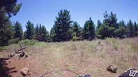
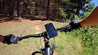
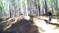
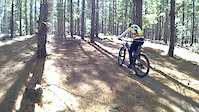
Videos of Australian Capital Territory (ACT) Mountain Bike
trail: Wallaby Run
0:11 |
27 |
May 24, 2026
trail: South Downhill Corridor
0:08 |
146 |
Mar 19, 2026
trail: Short & Sharp
2:34 |
130 |
Aug 2, 2025
trail: Trebuchet
4:26 |
73 |
Dec 14, 2024
trail: Double Jab
0:47 |
90 |
Dec 13, 2024
trail: Wakefield Park
3:30 |
80 |
Dec 13, 2024
trail: Waterside Way
0:47 |
18 |
Aug 4, 2023
trail: Waterside Way
0:08 |
10 |
Aug 4, 2023
Current Trail Warnings
| status | trail | date | condition | user | info |
|---|---|---|---|---|---|
| Tent Rent Molonglo Pines (Poo Pines) | Jun 9, 2026 @ 6:44am (Australia/Sydney) Jun 8, 2026 | Ideal | mty10 | Trail is getting very narrow/ Almost-gone... |
Recent Trail Reports
Activity Feed
| username | action | type | title | date |
|---|---|---|---|---|
| mty10 | add | report | activity #97456980 and 5 more | Jun 20, 2026 @ 11:13pm 6 hours |
| caseypyne | wishlist | trail | activity #97445860 and 3 more | Jun 20, 2026 @ 5:42pm 12 hours |
| powpowbenny2003 | wishlist | trail | activity #97307450 | Jun 19, 2026 @ 4:26am 2 days |
| b25moase | wishlist | region | activity #97243090 | Jun 18, 2026 @ 4:35am Jun 18, 2026 |
| ak0047 | ridden | trail | activity #97237304 | Jun 18, 2026 @ 12:56am Jun 18, 2026 |
Recent Comments
| username | type | title | comment | date |
|---|---|---|---|---|
| report | The | Jun 5, 2026 @ 6:36pm Jun 5, 2026 | ||
| report | Closed | Apr 27, 2026 @ 9:04pm Apr 27, 2026 | ||
| report | Closed due to logging | Apr 27, 2026 @ 9:03pm Apr 27, 2026 | ||
| trail | Obsolete trail due to logging | Apr 27, 2026 @ 9:00pm Apr 27, 2026 | ||
| trail | Obsolete trail due to logging | Apr 27, 2026 @ 9:00pm Apr 27, 2026 |
Local Badges
-

Epic Mountain Bike Climb 2k5 awarded -

Completionist0 awarded -
Epic Mountain Bike Climb 2k0 awarded -
Completionist2 awarded -

Climbing 10k Badge0 awarded -
Climbing 10k Badge0 awarded
Bike & Skill Parks
| name | type | city | rating |
|---|---|---|---|
| Stromlo Forest Park | bike park | Canberra | |
| Majura Pines Dirt Jumps (Majurassic Park) | skill park | Canberra | |
| Pump Track | skill park | Canberra | |
| Pump Track | skill park | Canberra | |
| Drop Off & Wallride | skill park | Canberra |
Local Trail Supporters
![]()
- Kowalski
![]()
- iconic
![]()
![]()
Activity Type Stats
| activitytype | trails | distance | descent | descent distance | total vertical | rating | global rank | state rank | photos | reports | routes | ridelogs |
|---|---|---|---|---|---|---|---|---|---|---|---|---|
| Mountain Bike | 867 | 611 miles | 72,402 ft | 259 miles | 2,848 ft | 890 | 24,469 | 154 | 263,013 | |||
| E-Bike | 314 | 274 miles | 30,804 ft | 118 miles | 2,621 ft | 43 | 18,382 | 34 | 23,354 | |||
| Gravel Bike | 401 | 478 miles | 53,081 ft | 193 miles | 4,537 ft | 3,041 | 11 | 1,977 | ||||
| Adaptive Bike | 115 | 112 miles | 10,778 ft | 47 miles | 1,119 ft | 3,919 | 1 | 2 | ||||
| Winter Fat Bike | 9 | 26 miles | 1,194 ft | 10 miles | 997 ft | 42 | 7 | |||||
| Horse | 31 | 37 miles | 3,307 ft | 19 miles | 584 ft | 12,311 | 1 | 4 | ||||
| Hike | 756 | 682 miles | 75,131 ft | 275 miles | 4,537 ft | 6 | 23,946 | 11 | 6,773 | |||
| Trail Running | 782 | 673 miles | 74,770 ft | 271 miles | 4,537 ft | 24,080 | 14 | 13,777 |
Activities
- Australian Capital Territory (ACT) Mountain Biking Trails
- Australian Capital Territory (ACT) E-Biking Trails
- Australian Capital Territory (ACT) Gravel Biking Trails
- Australian Capital Territory (ACT) Adaptive Biking Trails
- Australian Capital Territory (ACT) Winter Fat Biking Trails
- Australian Capital Territory (ACT) Horseback Trails
- Australian Capital Territory (ACT) Hiking Trails
- Australian Capital Territory (ACT) Trail Running Trails
Trails
- Hard trails in Australian Capital Territory (ACT)
- Easy trails in Australian Capital Territory (ACT)
- Favorite trails in Australian Capital Territory (ACT)
- Most ridden trails in Australian Capital Territory (ACT)
- Singletrack in Australian Capital Territory (ACT)
- Viewpoint trails in Australian Capital Territory (ACT)
- Trails with technical features in Australian Capital Territory (ACT)
- Race routes in Australian Capital Territory (ACT)
Points of Interest
- Mount Rob Roy Summit
- Belfry Rock Sight
- Honeysuckle Campground Camping
- Mount Tennent Summit
- Black Mountain Lookout Viewpoint
- Mount Ainslie Summit
- Marion Mahony Griffin Lookout Viewpoint
- Old Joe Hill Summit
- Brown Hill Summit
- McQuoids Hill Summit
- Tidbinbilla Mountain (5,266 ft)
- Tinderry Peak (5,223 ft)
- Tinderry Twin Peak (5,115 ft)
- By BELLMACHER & contributors
- Admins: Jake-Hannah, Addzz
- #5954 - 20,016 views
- australian capital territory (act) activity log | embed map of Australian Capital Territory (ACT) mountain bike trails | australian capital territory (act) mountain biking points of interest
Downloading of trail gps tracks in kml & gpx formats is enabled for Australian Capital Territory (ACT).
You must login to download files.