close
-
Layers w
- Weather Layers
- Pro
- Pro
- Pro
- Pro
- Pro
- Pro
- More Layers
- Pro
- Pro
- Pro
- Pro
-
Upgrade to

3D
Trail Conditions
- Unknown
- Snow Groomed
- Snow Packed
- Snow Covered
- Snow Cover Partial
- Freeze/thaw Cycle
- Icy
- Prevalent Mud
- Wet
- Variable
- Ideal
- Dry
- Very Dry
Trail Flow (Ridden Direction)
Trailforks scans users ridelogs to determine the most popular direction each trail is ridden. A good flowing trail network will have most trails flowing in a single direction according to their intension.
The colour categories are based on what percentage of riders are riding a trail in its intended direction.
The colour categories are based on what percentage of riders are riding a trail in its intended direction.
- > 96%
- > 90%
- > 80%
- > 70%
- > 50%
- < 50%
- bi-directional trail
- no data
Trail Last Ridden
Trailforks scans ridelogs to determine the last time a trail was ridden.
- < 2 days
- < 1 week
- < 2 weeks
- < 1 month
- < 6 months
- > 6 months
Trail Ridden Direction
The intended direction a trail should be ridden.
- Downhill Only
- Downhill Primary
- Both Directions
- Uphill Primary
- Uphill Only
- One Direction
Contribute Details
Colors indicate trail is missing specified detail.
- Description
- Photos
- Description & Photos
- Videos
Trail Popularity ?
Trailforks scans ridelogs to determine which trails are ridden the most in the last 9 months.
Trails are compared with nearby trails in the same city region with a possible 25 colour shades.
Think of this as a heatmap, more rides = more kinetic energy = warmer colors.
- most popular
- popular
- less popular
- not popular
ATV/ORV/OHV Filter
Max Vehicle Width
inches
US Cell Coverage
Legend

Radar Time
Activity Recordings
Trailforks uses anonymized public activity data.
?
Activity Recordings
Trailforks uses anonymized public activity data.
?
Personal Heatmap
▶
Activity Types
all
/
none
▶
Options
2
Date range
month
–
Winter Trails
Warning
A routing network for winter maps does not exist. Selecting trails using the winter trails layer has been disabled.
Missing Trails
Most Popular
Least Popular
Trails are colored based on popularity. The more popular a trail is, the more red. Less popular trails trend towards green.
Jump Magnitude Heatmap
Heatmap of where riders jump on trails. Zoom in to see individual jumps, click circles to view jump details.
BC Backroad Status
![map legend]()
Service Road Atlas is a free to use, community-driven service for viewing and creating reports on the numerous back-country service roads around B.C. and Alberta.

Slope Aspect
Direction the slope faces
Trails Deemphasized
Trails are shown in grey.
Only show trails with no bike usage.
Suggested Layers
Based on selected activity type
Save the current map location and zoom level as your default home location whenever this page is loaded.
Save
No description for Anmore has been added yet!
Login or register to submit one.
Activities Click to view
- Mountain Bike
27 trails
- E-Bike
10 trails
- Gravel Bike
0 trails
- Adaptive Bike
0 trails
- Winter Fat Bike
0 trails
- Hike
39 trails
- Trail Running
39 trails
Region Details
- 4
- 4
- 3
- 14
- 2
Region Status
Open as of Jun 28, 2026Stats
- Avg Trail Rating
- Trails (view details)
- 39
- Trails Mountain Bike
- 27
- Trails E-Bike
- 10
- Trails Hike
- 39
- Trails Trail Running
- 39
- Total Distance
- 44 miles
- Total Descent
- 16,833 ft
- Total Vertical
- 4,008 ft
- Highest Trailhead
- 4,259 ft
- Reports
- 236
- Photos
- 116
- Ridden Counter
- 7,233
Sub Regions
-
Buntzen Lake Recreation Area
- 4
- 3
- 13
- 2
Popular Anmore Mountain Biking Trails
• 100 ★ 0.0 • 2,653 ft • 33 ft • 179 •
Popular blue difficulty singletrack. This mountain bike primary trail. On average it takes 3 minutes to complete this trail.
• 70 ★ 3.5 • 1 mile • 358 ft • 118 •
Popular green difficulty singletrack. This mountain bike primary trail. On average it takes 17 minutes to complete this trail.
• 60 ★ 3.8 • 1 mile • 172 ft • 109 •
Ted's (Torture Trail) not fairly named but a fun older school cross country ride
• 60 ★ 3.0 • 1 mile • 323 ft • 93 •
This trail lets you bypass the boring Access Road to get to North Beach on Buntzen Lake. Aside from the climb at the beginning, this is a fairly wide and easy trail to ride. Be sure to begin this climb from the on the marked ascent for...
• 70 ★ 1.9 • 3 miles • 915 ft • 86 •
is an old multi-use trail intended for Horses, Hiking and Mountain Biking. The trail can be ridden in both directions and begins with a fairly steep, technical, long and switchbacked climb starting from either trailhead. The trail is...
• 30 ★ 2.0 • 4,649 ft • 599 ft • 82 •
Leading steeply up the mountainside into the cool, dark cedar and hemlock forests that blanket the slopes around , these trails form loops with Powerhouse Road and the and provide access to the and the trail to Sasamat Lake. Because of...
• 65 ★ 4.0 • 1,461 ft • 49 ft • 70 •
Moderately popular blue difficulty singletrack. This mountain bike primary trail. On average it takes 3 minutes to complete this trail.
Anmore Mountain Bike Routes
43 miles • 5,540 ft • 2 •
Indian Arm round trip - gravel bike. I have to find out how far it goes.
Photos of Anmore Mountain Bike
Videos of Anmore Mountain Bike
trail: Little Bear
3:38 |
160 |
Dec 25, 2016

trail: Little Bear
2:04 |
679 |
Nov 27, 2015

trail: Sugar Mountain Trail
0:15 |
754 |
Aug 10, 2015

trail: Academy Trail Climb
3:26 |
437 |
Sep 11, 2022 , Anmore
trail: Triple T
0:45 |
543 |
Feb 25, 2021 , Anmore
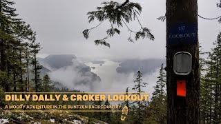
trail: Dilly Dally Trail
0:20 |
388 |
Jul 4, 2022 , Anmore
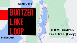
trail: Buntzen Lake Trail
7:49 |
430 |
Jan 19, 2022 , Anmore
Recent Trail Reports
| status | trail | date | condition | info | user |
|---|---|---|---|---|---|
| Academy Trail Climb | Jun 28, 2026 @ 3:52pm (America/Vancouver) Jun 28, 2026 | Unknown | mhoeth | ||
| Buntzen Foot Bridge Connector | May 1, 2026 @ 1:54pm (America/Vancouver) May 1, 2026 | Ideal | Ifripp | ||
| Saddle Ridge Trail | Nov 16, 2025 @ 6:57pm (America/Vancouver) Nov 16, 2025 | Unknown | sparkplug TORCA: Eagle | ||
| Triple T | Nov 16, 2025 @ 5:02pm (America/Vancouver) Nov 16, 2025 | Unknown | samdemo TORCA: Eagle | ||
| Pumphouse Service Road | Sep 21, 2025 @ 9:36am (America/Vancouver) Sep 21, 2025 | Wet | Sciencequeen | ||
| Buntzen Lake Trail | Sep 21, 2025 @ 9:36am (America/Vancouver) Sep 21, 2025 | Wet | Sciencequeen | ||
| Old Buntzen Lake Trail | Sep 21, 2025 @ 9:36am (America/Vancouver) Sep 21, 2025 | Wet | Sciencequeen | ||
| Diez Vistas Trail | Sep 21, 2025 @ 9:36am (America/Vancouver) Sep 21, 2025 | Wet | Sciencequeen | ||
| Buntzen Lake Trail | Sep 21, 2025 @ 9:36am (America/Vancouver) Sep 21, 2025 | Wet | Sciencequeen | ||
| The Dog Bypass | Sep 20, 2025 @ 2:22pm (America/Vancouver) Sep 20, 2025 | Very Dry | teeetw0 |
Activity Feed
| username | action | type | title | date |
|---|---|---|---|---|
| rqJbToaK | wishlist | trail | activity #99581918 | Jul 19, 2026 @ 6:29pm 2 days |
| lewisvacek | wishlist | trail | activity #98547010 | Jul 5, 2026 @ 5:17pm Jul 5, 2026 |
| mhoeth | comment | trail | activity #98031205 | Jun 28, 2026 @ 3:56pm Jun 28, 2026 |
| mhoeth | add | report | activity #98030890 and 1 more | Jun 28, 2026 @ 3:51pm Jun 28, 2026 |
| jesz514 | wishlist | trail | activity #97788798 | Jun 25, 2026 @ 1:09pm Jun 25, 2026 |
Recent Comments
| username | type | title | comment | date |
|---|---|---|---|---|
| trail | I attempted to ride this today. 90% of the... | Jun 28, 2026 @ 3:56pm Jun 28, 2026 | ||
| trail | this trail just sucks. it's like walking up a... | Jun 15, 2026 @ 1:07pm Jun 15, 2026 | ||
| report | Nice work! I wish more people would carry a... | Nov 16, 2025 @ 12:48pm Nov 16, 2025 | ||
| trail | Sign at the bottom of the trail has a no bikes... | Nov 11, 2025 @ 11:53am Nov 11, 2025 | ||
| trail | Is this trail actually open to MTBs? | Nov 11, 2025 @ 11:52am Nov 11, 2025 |
Local Badges
-

Epic Ride Climb 2k5 awarded -

Climbing 10k Badge4 awarded -

Climbing 100k Badge0 awarded -

Epic Ride Descent 2k10 awarded -

Descent 10k Badge4 awarded -

Descent 100k Badge0 awarded
Activity Type Stats
| activitytype | trails | distance | descent | descent distance | total vertical | rating | global rank | state rank | photos | reports | routes | ridelogs |
|---|---|---|---|---|---|---|---|---|---|---|---|---|
| Mountain Bike | 27 | 17 miles | 3,314 ft | 7 miles | 768 ft | #7,426 | #144 | 78 | 230 | 1 | 1,265 | |
| E-Bike | 10 | 2 miles | 135 ft | 3,045 ft | 289 ft | #8,836 | #139 | 178 | 122 | |||
| Hike | 39 | 44 miles | 16,834 ft | 20 miles | 4,009 ft | #906 | #51 | 38 | 235 | 2,246 | ||
| Trail Running | 39 | 44 miles | 16,834 ft | 20 miles | 4,009 ft | #3,443 | #87 | 235 | 1 | 2,686 |
Frequently Asked Questions About Anmore
▼
What are the best places to ride in Anmore?
Anmore has 1 areas to explore for mountain biking. The top rated areas are:
▼
What are the highest rated mountain biking trails in Anmore?
The highest rated mountain biking trails in Anmore are:
- Academy Singletrack Bypass (4/5)
- Triple T (3.9/5)
- Academy Trail Climb (3.8/5)
- Academy Trail (3.6/5)
- Bear Claw (3.5/5)
▼
What is the best time of the year to ride in Anmore?
Based on ride log data, the most popular months to ride in Anmore are:
- June (27 activities)
- August (23 activities)
- May (19 activities)
▼
Where can I park to ride in Anmore?
There are 3 parking locations listed in Anmore. The most popular parking spots are: View all parking and trailhead locations on the map to plan your visit.
Activities
Trails
- By vallee
 & contributors
 - Admins: TORCA, Taichibiker
- #23496 - 5,697 views
- anmore activity log | embed map of Anmore mountain bike trails | anmore mountain biking points of interest polygons
Downloading of trail gps tracks in kml & gpx formats is enabled for Anmore.
You must login to download files.