close
-
Layers w
- Weather Layers
- Pro
- Pro
- Pro
- Pro
- Pro
- Pro
- More Layers
- Pro
- Pro
- Pro
- Pro
-
Upgrade to

3D
Trail Conditions
- Unknown
- Snow Groomed
- Snow Packed
- Snow Covered
- Snow Cover Partial
- Freeze/thaw Cycle
- Icy
- Prevalent Mud
- Wet
- Variable
- Ideal
- Dry
- Very Dry
Trail Flow (Ridden Direction)
Trailforks scans users ridelogs to determine the most popular direction each trail is ridden. A good flowing trail network will have most trails flowing in a single direction according to their intension.
The colour categories are based on what percentage of riders are riding a trail in its intended direction.
The colour categories are based on what percentage of riders are riding a trail in its intended direction.
- > 96%
- > 90%
- > 80%
- > 70%
- > 50%
- < 50%
- bi-directional trail
- no data
Trail Last Ridden
Trailforks scans ridelogs to determine the last time a trail was ridden.
- < 2 days
- < 1 week
- < 2 weeks
- < 1 month
- < 6 months
- > 6 months
Trail Ridden Direction
The intended direction a trail should be ridden.
- Downhill Only
- Downhill Primary
- Both Directions
- Uphill Primary
- Uphill Only
- One Direction
Contribute Details
Colors indicate trail is missing specified detail.
- Description
- Photos
- Description & Photos
- Videos
Trail Popularity ?
Trailforks scans ridelogs to determine which trails are ridden the most in the last 9 months.
Trails are compared with nearby trails in the same city region with a possible 25 colour shades.
Think of this as a heatmap, more rides = more kinetic energy = warmer colors.
- most popular
- popular
- less popular
- not popular
ATV/ORV/OHV Filter
Max Vehicle Width
inches
US Cell Coverage
Legend

Radar Time
Activity Recordings
Trailforks uses anonymized public activity data.
?
Activity Recordings
Trailforks uses anonymized public activity data.
?
Personal Heatmap
▶
Activity Types
all
/
none
▶
Options
2
Date range
month
–
Winter Trails
Warning
A routing network for winter maps does not exist. Selecting trails using the winter trails layer has been disabled.
Missing Trails
Most Popular
Least Popular
Trails are colored based on popularity. The more popular a trail is, the more red. Less popular trails trend towards green.
Jump Magnitude Heatmap
Heatmap of where riders jump on trails. Zoom in to see individual jumps, click circles to view jump details.
BC Backroad Status
![map legend]()
Service Road Atlas is a free to use, community-driven service for viewing and creating reports on the numerous back-country service roads around B.C. and Alberta.

Slope Aspect
Direction the slope faces
Trails Deemphasized
Trails are shown in grey.
Only show trails with no bike usage.
Suggested Layers
Based on selected activity type
Save the current map location and zoom level as your default home location whenever this page is loaded.
Save
No description for Apache Junction has been added yet!
Login or register to submit one.
Activities Click to view
- Mountain Bike
294 trails
- E-Bike
107 trails
- Gravel Bike
0 trails
- Adaptive Bike
0 trails
- Winter Fat Bike
0 trails
- Horse
180 trails
- Hike
368 trails
- Trail Running
366 trails
- Dirtbike/Moto
11 trails
- ATV/ORV/OHV
11 trails
Region Details
- 40
- 102
- 77
- 47
- 13
Region Status
Open as of 2 daysLocal Trail Association
Stats
- Avg Trail Rating
- Trails (view details)
- 352
- Trails Mountain Bike
- 295
- Trails E-Bike
- 107
- Trails Horse
- 180
- Trails Hike
- 368
- Trails Trail Running
- 366
- Trails Dirtbike/Moto
- 11
- Trails ATV/ORV/OHV
- 11
- Total Distance
- 497 miles
- Total Descent
- 58,448 ft
- Total Vertical
- 4,398 ft
- Highest Trailhead
- 5,764 ft
- Reports
- 3,723
- Photos
- 1,356
- Ridden Counter
- 44,946
Sub Regions
-
Bulldog Canyon OHV Area
-
Goldfield Mountains
- 15
- 50
- 26
- 9
-
Lost Dutchman State Park
- 11
- 8
- 5
-
Silly Mountain Park
- 4
- 4
- 2
-
Superstition Wilderness
- 1
- 1
-
The Rolls OHV Area
- 1
-
Tonto NF - Apache Junction
- 2
- 1
- 2
-
Usery Mountains
- 22
- 10
- 9
- 3
Popular Apache Junction Mountain Biking Trails
• 100 ★ 4.1 • 3,327 ft • 0 ft • 1,490 •
Highly rated popular blue difficulty singletrack. This multi-use trail can be used both directions and has a moderate overall physical rating with a 0 ft blue climb. On average it takes 4 minutes to complete this trail.
• 100 ★ 4.1 • 2,612 ft • 0 ft • 1,475 •
Highly rated popular blue difficulty singletrack. This multi-use trail can be used both directions and has a moderate overall physical rating with a 0 ft blue climb. On average it takes 2 minutes to complete this trail.
• 100 ★ 2.6 • 5,259 ft • 0 ft • 1,318 •
Popular green difficulty singletrack. This multi-use trail can be used both directions and has a easy overall physical rating with a 0 ft green climb. On average it takes 5 minutes to complete this trail.
• 100 ★ 2.4 • 2 miles • 0 ft • 1,087 •
Popular green difficulty singletrack. This multi-use trail can be used downhill primary and has a easy overall physical rating with a 0 ft green climb. On average it takes 7 minutes to complete this trail.
• 100 ★ 4.0 • 5,180 ft • 0 ft • 1,025 •
Highly rated popular green difficulty singletrack. This multi-use trail can be used both directions and has a easy overall physical rating with a 0 ft green climb. On average it takes 5 minutes to complete this trail.
• 95 ★ 4.1 • 1 mile • 22 ft • 1,018 •
Fast, smooth, twisty "single-track" trail. Mostly downhill if ridden counter clockwise, but an easy ride in either direction. The trail is mostly free from rocks or bumps, very smooth. Lots of banked turns allow you to carry some speed...
Apache Junction Mountain Bike Routes
★ 3.8 • 11 miles • 1,137 ft • 14 • Loop •
Begin on fence line, turn onto hawes and ride up the big hill, affectionately known as cardiac to riders....
★ 4.7 • 111 miles • 13,425 ft • 6 • Loop •
This loop is best ridden in a CW direction. Start/Finish is a small parking pullout on First Water rd just...
★ 4.0 • 12 miles • 811 ft • 19 • Loop •
This is a good introduction to the wonders of the Goldfield Mtns. This is an intermediate ride with some...
16 miles • 1,324 ft • 10 • Loop •
This route takes you from Usery Mountain Regional Park up through the Usery Mountains on the East side of...
★ 4.0 • 9 miles • 900 ft • 6 • Loop •
This is a moderately difficult route due to a few short sections of rubble & hike-a-bike. These are...
Photos of Apache Junction Mountain Bike
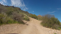
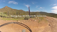
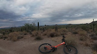
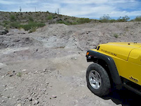
Videos of Apache Junction Mountain Bike
10:25 |
29 |
Mar 11, 2024
8:11 |
24 |
Mar 11, 2024
6:40 |
13 |
Mar 11, 2024
7:22 |
15 |
Mar 11, 2024
7:06 |
4 |
Mar 11, 2024
7:03 |
15 |
Mar 11, 2024
trail: Talon (North)
4:55 |
70 |
Jun 2, 2023
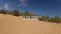
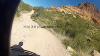
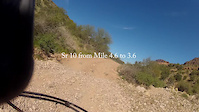
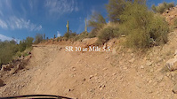
trail: Forest Service Road 10
0:17 |
489 |
Jul 20, 2014
Recent Trail Reports
| status | trail | date | condition | info | user |
|---|---|---|---|---|---|
| Ruidoso | Jun 22, 2026 @ 7:16am (America/Phoenix) 2 days | Very Dry | Daveygee | ||
| Moon Rock | Jun 22, 2026 @ 7:16am (America/Phoenix) 2 days | Ideal | Daveygee | ||
| Desert Hawk Trail | Jun 22, 2026 @ 7:16am (America/Phoenix) 2 days | Very Dry | Daveygee | ||
| Blevins | Jun 22, 2026 @ 7:16am (America/Phoenix) 2 days | Very Dry | Daveygee | ||
| County Line | Jun 22, 2026 @ 7:16am (America/Phoenix) 2 days | Very Dry | Daveygee | ||
| Quail Loop | Jun 15, 2026 @ 7:34am (America/Phoenix) Jun 15, 2026 | Dry | Daveygee | ||
| Vista Loop | Jun 15, 2026 @ 7:34am (America/Phoenix) Jun 15, 2026 | Dry | Daveygee | ||
| Treasure Loop Stairs | Jun 15, 2026 @ 7:34am (America/Phoenix) Jun 15, 2026 | Dry | Daveygee | ||
| Treasure Loop (Lost Dutchman SP acc) | Jun 15, 2026 @ 7:34am (America/Phoenix) Jun 15, 2026 | Dry | Daveygee | ||
| Jacob Cross Cut Conn | Jun 15, 2026 @ 7:34am (America/Phoenix) Jun 15, 2026 | Dry | Daveygee |
Activity Feed
| username | action | type | title | date |
|---|---|---|---|---|
| Daveygee | add | report | activity #97571894 and 4 more | Jun 22, 2026 @ 10:42am 2 days |
| schillingsworth | update | trail | activity #97493422 | Jun 21, 2026 @ 9:33am Jun 21, 2026 |
| schillingsworth | update | trail | activity #97492995 and 2 more | Jun 21, 2026 @ 9:28am Jun 21, 2026 |
| Daveygee | add | report | activity #97058686 and 4 more | Jun 15, 2026 @ 12:18pm Jun 15, 2026 |
| Daveygee | add | report | activity #97058684 | Jun 15, 2026 @ 12:18pm Jun 15, 2026 |
Recent Comments
| username | type | title | comment | date |
|---|---|---|---|---|
| report | Settle down. It's an automatic tag since the... | May 5, 2026 @ 6:51am May 5, 2026 | ||
| trail | This trail is no where near Usery Pass Road. ... | Feb 28, 2026 @ 7:33pm Feb 28, 2026 | ||
| trail | Route finding on near the Usery Pass Road... | Feb 5, 2026 @ 8:35am Feb 5, 2026 | ||
| trail | when I say "mostly" I should have said "all" | Feb 5, 2026 @ 8:29am Feb 5, 2026 | ||
| trail | ALL rideable non-round babyhead chunk. I say... | Feb 5, 2026 @ 8:28am Feb 5, 2026 |
Local Badges
-

Top 10 Trails0 awarded -

Descent 100k Badge4 awarded -

Big Ride 30k3,624 awarded -

Epic Ride 50k1,446 awarded -

Completionist0 awarded -

10 Expert Trails1 awarded
Activity Type Stats
| activitytype | trails | distance | descent | descent distance | total vertical | rating | global rank | state rank | photos | reports | routes | ridelogs |
|---|---|---|---|---|---|---|---|---|---|---|---|---|
| Mountain Bike | 294 | 289 miles | 23,845 ft | 115 miles | 4,400 ft | #323 | #119 | 1,023 | 3,769 | 34 | 41,179 | |
| E-Bike | 107 | 135 miles | 8,497 ft | 53 miles | 4,400 ft | #971 | #788 | 4 | 3,514 | 1 | 1,953 | |
| Horse | 180 | 261 miles | 26,211 ft | 103 miles | 4,367 ft | #9 | #306 | 4 | 380 | 5 | 787 | |
| Hike | 368 | 497 miles | 58,448 ft | 198 miles | 4,400 ft | #141 | #80 | 356 | 3,776 | 25 | 9,956 | |
| Trail Running | 366 | 494 miles | 58,228 ft | 198 miles | 4,400 ft | #151 | #67 | 3,775 | 14 | 4,204 | ||
| Dirtbike/Moto | 11 | 48 miles | 2,579 ft | 16 miles | 4,337 ft | #646 | #221 | 309 | 48 | |||
| ATV/ORV/OHV | 11 | 48 miles | 2,579 ft | 16 miles | 4,337 ft | #397 | #121 | 308 | 1 | 39 |
Frequently Asked Questions About Apache Junction
▼
What are the best places to ride in Apache Junction?
Apache Junction has 8 areas to explore for mountain biking. The top rated areas are:
▼
What are the highest rated mountain biking trails in Apache Junction?
The highest rated mountain biking trails in Apache Junction are:
- Lost Sheep Trail (4.4/5)
- Chainfruit Trail (4.3/5)
- Talon (South) (4.2/5)
- Jacob's Waltz (4.1/5)
- Bonanza (4.1/5)
▼
What is the best time of the year to ride in Apache Junction?
Based on ride log data, the most popular months to ride in Apache Junction are:
- November (459 activities)
- February (456 activities)
- April (449 activities)
▼
Where can I park to ride in Apache Junction?
There are 40 parking locations listed in Apache Junction. The most popular parking spots are: View all parking and trailhead locations on the map to plan your visit.
Activities
Trails
Points of Interest
- [Mine] Black Queen Mine Other
- High Point Summit
- Reavis Ranch Ruins Sight
- Reavis Saddle Sight
- Broadway Cave Sight
- Superstition Mountain Summit
- Petroglyphs Sight
- Fremont Saddle Sight
- Boulder Canyon Viewpoing Viewpoint
- The Flatiron Sight
- Mound Mountain (6,247 ft)
- White Mountain (6,050 ft)
- Iron Mountain (6,030 ft)
- By canadaka
 Trailforks & contributors
 - Admins: apply
- #5104 - 16,373 views
- apache junction activity log | embed map of Apache Junction mountain bike trails | apache junction mountain biking points of interest
Downloading of trail gps tracks in kml & gpx formats is enabled for Apache Junction.
You must login to download files.