
close
3D
Trail Conditions
- Unknown
- Snow Groomed
- Snow Packed
- Snow Covered
- Snow Cover Partial
- Freeze/thaw Cycle
- Icy
- Prevalent Mud
- Wet
- Variable
- Ideal
- Dry
- Very Dry
Trail Flow (Ridden Direction)
Trailforks scans users activity logs to determine the most popular direction each trail is ridden. A good flowing trail network will have most trails flowing in a single direction according to their intension.
The colour categories are based on what percentage of users are riding a trail in its intended direction.
The colour categories are based on what percentage of users are riding a trail in its intended direction.
- > 96%
- > 90%
- > 80%
- > 70%
- > 50%
- < 50%
- bi-directional trail
- no data
Trail Last Used
Trailforks scans activity logs to determine the last time a trail was ridden.
- < 2 days
- < 1 week
- < 2 weeks
- < 1 month
- < 6 months
- > 6 months
Trail Ridden Direction
The intended direction a trail should be ridden.
- Downhill Only
- Downhill Primary
- Both Directions
- Uphill Primary
- Uphill Only
- One Direction
Contribute Details
Colors indicate trail is missing specified detail.
- Description
- Photos
- Description & Photos
- Videos
Trail Popularity ?
Trailforks scans activity logs to determine which trails are ridden the most in the last 9 months.
Trails are compared with nearby trails in the same city region with a possible 25 colour shades.
Think of this as a heatmap, more activities = more kinetic energy = warmer colors.
- most popular
- popular
- less popular
- not popular
ATV/ORV/OHV Filter
Max Vehicle Width
inches
US Cell Coverage
Legend

Radar Time
Activity Recordings
Trailforks uses anonymized public activity data.
?
Activity Recordings
Trailforks uses anonymized public activity data.
?
Winter Trails
Warning
A routing network for winter maps does not exist. Selecting trails using the winter trails layer has been disabled.
Missing Trails
Most Popular
Least Popular
Trails are colored based on popularity. The more popular a trail is, the more red. Less popular trails trend towards green.
Jump Magnitude Heatmap
Heatmap of where users jump on trails. Zoom in to see individual jumps, click circles to view jump details.
BC Backroad Status
![map legend]()
Service Road Atlas is a free to use, community-driven service for viewing and creating reports on the numerous back-country service roads around B.C. and Alberta.

Slope Aspect
Direction the slope faces
Trails Deemphasized
Trails are shown in grey.
Only show trails with no bike usage.
Suggested Layers
Based on selected activity type
Save the current map location and zoom level as your default home location whenever this page is loaded.
Savewww.bikeinarvika.com
This region uses the Uk/Euro style trail grading system.
Trail info last updated
Activities Click to view
- Mountain Bike
384 trails
- E-Bike
47 trails
- Gravel Bike
111 trails
- Adaptive Bike
97 trails
- Winter Fat Bike
192 trails
- Hike
365 trails
- Trail Running
365 trails
- Nordic Ski
9 trails
Region Details
- 102
- 46
- 158
- 65
- 13
Region Status
Open as of Oct 1, 2026Local Trail Association

Stats
- Avg Trail Rating
- Trails (view details)
- 385
- Trails Mountain Bike
- 384
- Trails E-Bike
- 47
- Trails Gravel Bike
- 111
- Trails Adaptive Bike
- 97
- Trails Winter Fat Bike
- 192
- Trails Horse
- 3
- Trails Hike
- 365
- Trails Trail Running
- 365
- Trails Nordic Ski
- 9
- Total Distance
- 250 miles
- Total Descent
- 32,688 ft
- Total Vertical
- 918 ft
- Highest Trailhead
- 1,098 ft
- Reports
- 136
- Photos
- 172
- Completed Counter
- 7,380
Sub Regions
-
Gunnarskog
- 12
- 26
- 12
- 2
-
Ingestrandshöjden
- 5
- 8
- 8
-
Jössefors
- 3
- 9
- 5
-
Mangskog
- 1
- 11
-
Rackstadberget
- 8
- 35
- 20
- 11
-
Storkasberget
- 3
- 24
- 16
-
Vassvika
- 5
- 34
- 4
-
Vik
- 4
- 1
Popular Arvika Mountain Biking Trails
• 95 ★ 4.8 • 1 mile • 33 ft • 97 •
Ride this trail only anti-clockwise! Follow the signs "Sotarblixtleden" with help from orange marks on the trees. The descent is the best in Arvika if you are a technical rider and the opposite if you´re not. A must to try if you are a...
• 95 ★ 4.8 • 1,860 ft • 0 ft • 94 •
En fin stig. Har lite av varje med lite smådrop, mycket kurvor, små hällar samt ett rullbart hopp på slutet, Går på gammal vandringsled från toppen vid Gammeltrollet till starten på Tôrparn. Korsar sotarblixtleden på slutet...
• 95 ★ 4.0 • 390 ft • 0 ft • 92 •
Popular green difficulty singletrack. This mountain bike primary trail can be used both directions and has a easy overall physical rating with a 0 ft green climb. On average it takes minutes to complete this trail.
• 85 ★ 3.5 • 2,694 ft • 38 ft • 91 •
Stig som tar dig till Fågelmossen. Är lite småteknisk men trevlig.
• 80 ★ 5.0 • 2,254 ft • 0 ft • 86 •
En downhill-betonad led som är tänkt att vara lite svårare än de flesta andra stigarna i området. Innehåller en utmanande roller, två gap-hopp och ett enmetersdrop. Finns en hel del linjeval som är tänkta att utmana även den...
• 100 ★ 0.0 • 928 ft • 0 ft • 85 •
Popular green difficulty singletrack. This mountain bike primary trail can be used both directions. On average it takes 2 minutes to complete this trail.
• 70 ★ 4.0 • 1,788 ft • 6 ft • 84 •
Popular green difficulty singletrack. This mountain bike primary trail can be used both directions and has a moderate overall physical rating with a 6 ft blue climb. On average it takes 2 minutes to complete this trail.
• 5 ★ 5.0 • 2,113 ft • 0 ft • 84 •
Teknisk men böljande och underbar stig. Ett måste för den som gillar att köra på hällar. Den börjar i ett skogsparti för att sedan gå in i ett ganska teknisk område som över några berghällar. Stigen fortsätter sen...
Arvika Mountain Bike Routes
14 miles • 1,708 ft • 28 • Loop •
En kanonfin rundtur med mycket utförslöpor, eller enkla endurosträckor - stigcykling när den är som...
★ 5.0 • 1 mile • 2 ft • 2 • Point to Point •
First part is pure fun if you like a slightly technical descent. Perfect for the allmountain/enduro-rider....
★ 5.0 • 11 miles • 1,673 ft • 13 • Out & Back •
Enduro route including the best trails in Arvika.
★ 5.0 • 9 miles • 1,209 ft • 6 • Out & Back •
Nice and fun trial with a physical challenge. The trail has some technical features but most of it is...
9 miles • 1,076 ft • 7 • Loop •
En omväxlande XC slinga som tar dig runt Perserud. Efter 10 km passeras Gammelskogberget där det finns...
4 miles • 955 ft • 14 •
Bra tur om man vill få mycket utförskörning med så lite transport och på tid som möjligt. Man får...
Photos of Arvika Mountain Bike
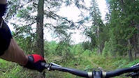
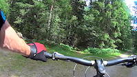
Videos of Arvika Mountain Bike




Recent Trail Reports
| status | trail | date | condition | info | user |
|---|---|---|---|---|---|
| Finnvägen S | Oct 1, 2026 @ 3:03pm (Europe/Oslo) Oct 1, 2026 | Variable | Caisa | ||
| Kulltorp | Sep 29, 2026 @ 4:33pm (Europe/Oslo) Sep 29, 2026 | Ideal | Caisa | ||
| Fågeltjärnet | Sep 29, 2026 @ 4:33pm (Europe/Oslo) Sep 29, 2026 | Ideal | Caisa | ||
| Kinnekullestigen | Jul 21, 2026 @ 11:03pm (Europe/Stockholm) Jul 21, 2026 | Wet | Winters3 | ||
| Kinnekullestigen Långsjön | Jul 21, 2026 @ 11:01pm (Europe/Stockholm) Jul 21, 2026 | Wet | Winters3 | ||
| Gallberget | Jun 12, 2026 @ 2:17pm (Europe/Oslo) Jun 12, 2026 | Wet | Alchemist887 | ||
| Sotar Blixt Uppfarten | Jun 12, 2026 @ 2:17pm (Europe/Oslo) Jun 12, 2026 | Wet | Alchemist887 | ||
| Gallberget Access | Jun 12, 2026 @ 5:56pm (Europe/Stockholm) Jun 12, 2026 | Wet | Alchemist887 | ||
| Jössestugan Shorty | Jun 12, 2026 @ 5:59pm (Europe/Stockholm) Jun 12, 2026 | Wet | Alchemist887 | ||
| Gallbergets Skoterled | Jun 12, 2026 @ 2:17pm (Europe/Oslo) Jun 12, 2026 | Wet | Alchemist887 |
Activity Feed
| username | action | type | title | date |
|---|---|---|---|---|
| Caisa | add | report | activity #105024149 | Oct 2, 2026 @ 12:54am Oct 2, 2026 |
| Caisa | add | report | activity #104846378 and 1 more | Sep 29, 2026 @ 9:07am Sep 29, 2026 |
| snowthrill | wishlist | route | activity #104403708 and 1 more | Sep 23, 2026 @ 12:04am Sep 23, 2026 |
| FredKarlstad | ridden | route | activity #103570258 | Sep 11, 2026 @ 3:09pm Sep 11, 2026 |
| OrjanX | update | trail | activity #103477748 | Sep 10, 2026 @ 8:23am Sep 10, 2026 |
Recent Comments
| username | type | title | comment | date |
|---|---|---|---|---|
| trail | Please make a Trail Report for current... | Apr 25, 2025 @ 4:45am Apr 25, 2025 | ||
| trail | Great partyline🥳🥳 | Apr 25, 2025 @ 12:50am Apr 25, 2025 | ||
| trail | Skriv gärna en stigrapport (Trail Report)... | Jun 22, 2022 @ 12:10am Jun 22, 2022 | ||
| trail | Skriv gärna en stigrapport (Trail Report)... | Jun 22, 2022 @ 12:09am Jun 22, 2022 | ||
| trail | Skriva gärna en stigrapport (Trail Report)... | Jun 22, 2022 @ 12:09am Jun 22, 2022 |
Local Badges
-
Arvika Enduro1 awarded -

Storkasberget6 awarded -

Rackstad Enduro9 awarded -
Sotar Blixt2 awarded -

Completionist0 awarded -
Completionist0 awarded
Bike & Skill Parks
| name | type | city | rating |
|---|---|---|---|
| Vik pump track | skill park | Arvika | |
| Charlottenberg | skill park | Arvika | |
| Arvika | skill park | Arvika |
Activity Type Stats
| activitytype | trails | distance | descent | descent distance | total vertical | rating | global rank | state rank | photos | reports | routes | activity logs |
|---|---|---|---|---|---|---|---|---|---|---|---|---|
| Mountain Bike | 384 | 250 miles | 32,674 ft | 121 miles | 919 ft | #366 | #30 | 167 | 136 | 28 | 3,834 | |
| E-Bike | 47 | 27 miles | 4,134 ft | 14 miles | 830 ft | #1,772 | #43 | 123 | 5 | 142 | ||
| Gravel Bike | 111 | 94 miles | 8,510 ft | 43 miles | 902 ft | #334 | #26 | 10 | 8 | |||
| Adaptive Bike | 97 | 85 miles | 7,979 ft | 39 miles | 902 ft | #184 | #20 | 17 | ||||
| Winter Fat Bike | 192 | 115 miles | 14,820 ft | 53 miles | 909 ft | #57 | #10 | 42 | ||||
| Horse | 3 | 2 miles | 75 ft | 2,799 ft | 164 ft | 57 | ||||||
| Hike | 365 | 241 miles | 29,469 ft | 114 miles | 912 ft | #510 | #36 | 2 | 134 | 5 | 259 | |
| Trail Running | 365 | 241 miles | 29,469 ft | 114 miles | 912 ft | #358 | #35 | 3 | 134 | 4 | 492 | |
| Nordic Ski | 9 | 7 miles | 554 ft | 3 miles | 889 ft | #394 | #41 | 150 |
Frequently Asked Questions
▼
What are the best places to ride in Arvika?
Arvika has 8 areas to explore for mountain biking. The top rated areas are:
▼
What are the highest rated mountain biking trails in Arvika?
The highest rated mountain biking trails in Arvika are:
- Highway To Häll (4.4/5)
- Rackstad Hardline (4.3/5)
- Älgstråket (4.3/5)
- Hällacopters (4.3/5)
- Ridgeline (4.3/5)
▼
What is the best time of the year to ride in Arvika?
Based on activity log data, the most popular months to ride in Arvika are:
- June (25 activities)
- July (21 activities)
- August (18 activities)
▼
Where can I park to ride in Arvika?
▼
What is the longest trail in Arvika?
The longest trail in Arvika is Fågeltjärnet at 2.7 miles. View all trails sorted by distance.
▼
What are the best & highest rated hiking trails in Arvika?
The best hiking trails in Arvika are: View all hiking trails sorted by popularity score.
▼
What are the best & highest rated trail running trails in Arvika?
The best trail running trails in Arvika are: View all trail running trails sorted by popularity score.
▼
How many trails are in Arvika?
Arvika has a total of 385 trails. Of those, 384 are designated for mountain biking. Browse top mountain biking trails in Arvika to find detailed information including difficulty ratings, distances, and trail conditions.
▼
Which trail has the most elevation gain in Arvika?
The trail with the most elevation gain in Arvika is Gallbergets Skoterled with 438 ft of elevation gain. View all trails sorted by elevation gain.
▼
Which trail has the most elevation descent in Arvika?
The trail with the most elevation descent in Arvika is Blanka Pannan - Sälboda with 609 ft of elevation descent. View all trails sorted by elevation descent.
▼
What activities are most popular in Arvika?
Arvika supports the following activities: Mountain Biking, E-Biking, Gravel Biking, Adaptive Biking, Winter Fat Biking, Hiking, Trail Running, Nordic Skiing.
▼
What bike services are there in Arvika?
The following bike services are available in Arvika:
- Trail Association (1)
▼
What are the steepest mountain biking trails in Arvika?
The steepest mountain biking trail in Arvika is Slalombacken with an average grade of 18.3%. View all trails sorted by grade.
▼
Are there any trails with scenic viewpoints in Arvika?
Yes, there are 8 scenic viewpoints marked along trails in Arvika. Some popular viewpoints include: Explore more points of interest to find trails with the best views.
▼
Are the trails open in Arvika?
The overall region status for Arvika is Clear / Green. Out of 83 trails:
- Clear / Green: 69
- Minor Issue / Yellow: 10
- Significant Issue / Amber: 3
- Closed: 1
▼
Can I ride an ebike in Arvika?
Yes, Arvika supports e-bike riding. There are 37 trails in Arvika that allow e-bikes. Check the e-bike trails listing for specific trail access details and any local regulations.
▼
What are the most popular mountain biking routes in Arvika?
The most popular mountain biking routes in Arvika are: View all mountain biking routes in Arvika.
▼
What type of bike is most common in Arvika?
Based on activity log data, the most common bike types used in Arvika are:
- AM (1 activities)
▼
What are the most popular Strava Segments in Arvika?
The most popular Strava segments in Arvika are:
- Långbacken (498 athletes)
- Långbacken V2 (488 athletes)
- Techy Tech (324 athletes)
▼
What are some popular technical trail features in Arvika?
There are 3 technical trail features (TTFs) in Arvika. Some popular features include: View all technical trail features in Arvika.
▼
What trails are closed in Arvika?
There are currently 1 closed trails in Arvika. The breakdown of all trail statuses is:
- Clear / Green: 69
- Minor Issue / Yellow: 10
- Significant Issue / Amber: 3
- Closed: 1
▼
Are there accessible or adaptive trails in Arvika?
Yes, there are 100 accessible/adaptive trails in Arvika. View all adaptive trails in Arvika for specific accessibility information.
▼
Are there local clubs or events in Arvika?
There are 1 local clubs or associations listed in the Arvika directory. Browse the local directory for details.
▼
What are the most popular mountain biking trails in Arvika?
The most popular mountain biking trails in Arvika are: View all mountain biking trails sorted by popularity.
▼
What are the best beginner ride trails in Arvika?
The best beginner mountain biking trails in Arvika are: View all beginner mountain biking trails in Arvika.
Activities
Trails
- By bikeinarvika
 Arvika & contributors
- Admins: ollesvenskonthetrail, JALLE, OrjanX, martinlindstr, Karlstad, Andersol, Arvika, Humlas
- #13440 - 11,343 views
- arvika activity log | embed map of Arvika mountain bike trails | arvika mountain biking points of interest polygons
Downloading of trail gps tracks in kml & gpx formats is enabled for Arvika.
You must login to download files.
