
close
3D
Trail Conditions
- Unknown
- Snow Groomed
- Snow Packed
- Snow Covered
- Snow Cover Partial
- Freeze/thaw Cycle
- Icy
- Prevalent Mud
- Wet
- Variable
- Ideal
- Dry
- Very Dry
Trail Flow (Ridden Direction)
Trailforks scans users activity logs to determine the most popular direction each trail is ridden. A good flowing trail network will have most trails flowing in a single direction according to their intension.
The colour categories are based on what percentage of users are riding a trail in its intended direction.
The colour categories are based on what percentage of users are riding a trail in its intended direction.
- > 96%
- > 90%
- > 80%
- > 70%
- > 50%
- < 50%
- bi-directional trail
- no data
Trail Last Used
Trailforks scans activity logs to determine the last time a trail was ridden.
- < 2 days
- < 1 week
- < 2 weeks
- < 1 month
- < 6 months
- > 6 months
Trail Ridden Direction
The intended direction a trail should be ridden.
- Downhill Only
- Downhill Primary
- Both Directions
- Uphill Primary
- Uphill Only
- One Direction
Contribute Details
Colors indicate trail is missing specified detail.
- Description
- Photos
- Description & Photos
- Videos
Trail Popularity ?
Trailforks scans activity logs to determine which trails are ridden the most in the last 9 months.
Trails are compared with nearby trails in the same city region with a possible 25 colour shades.
Think of this as a heatmap, more activities = more kinetic energy = warmer colors.
- most popular
- popular
- less popular
- not popular
ATV/ORV/OHV Filter
Max Vehicle Width
inches
US Cell Coverage
Legend

Radar Time
Activity Recordings
Trailforks uses anonymized public activity data.
?
Activity Recordings
Trailforks uses anonymized public activity data.
?
Winter Trails
Warning
A routing network for winter maps does not exist. Selecting trails using the winter trails layer has been disabled.
Missing Trails
Most Popular
Least Popular
Trails are colored based on popularity. The more popular a trail is, the more red. Less popular trails trend towards green.
Jump Magnitude Heatmap
Heatmap of where users jump on trails. Zoom in to see individual jumps, click circles to view jump details.
BC Backroad Status
![map legend]()
Service Road Atlas is a free to use, community-driven service for viewing and creating reports on the numerous back-country service roads around B.C. and Alberta.

Slope Aspect
Direction the slope faces
Trails Deemphasized
Trails are shown in grey.
Only show trails with no bike usage.
Suggested Layers
Based on selected activity type
Save the current map location and zoom level as your default home location whenever this page is loaded.
SavePopular Trail Networks
view all areas »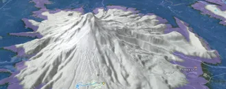
Snow & Rain 3D forecast Pro
See where it will snow, sleet or rain on Värmland hour by hour, on 3D terrain.
View 3D snow forecast
Värmland trails and routes are listed on Trailforks with interactive trail maps, difficulty ratings, photos, and user-reported trail conditions. The Trailforks community has mapped thousands of trails and shared hundreds of photos in this region. Supported activity types include Mountain Biking, Hiking, Trail Running, Winter Fat Biking, Gravel Biking, Adaptive Biking, Nordic Skiing, E-Biking, Skiing, Horseback, Backcountry Skiing, Dirtbiking, Snowmobiling and Observed Trials. Trails here are often faint trail, flowy and rooty. Scenery includes views, ridgelines and lakes. Common trail features include rock gardens, rock slabs and drops. Many trails are family friendly and lit for night riding. Amenities include picnic spots. Popular destinations include Karlskoga, Karlstad and Arvika.
This is an auto-generated description of Värmland.
Login or register to submit a custom description.
This region uses the Uk/Euro style trail grading system.
Trail info last updated
Stats
- Avg Trail Rating
- Trails (view details)
- 2,037
- Trails Mountain Bike
- 1,982
- Trails E-Bike
- 122
- Trails Gravel Bike
- 517
- Trails Adaptive Bike
- 233
- Trails Winter Fat Bike
- 570
- Trails Horse
- 24
- Trails Hike
- 1,931
- Trails Trail Running
- 1,929
- Trails Dirtbike/Moto
- 9
- Trails Observed Trials
- 1
- Trails Snowmobile
- 2
- Trails Downhill Ski
- 35
- Trails Backcountry Ski
- 13
- Trails Nordic Ski
- 208
- Total Distance
- 1,237 miles
- Total Descent
- 138,374 ft
- Total Vertical
- 1,953 ft
- Highest Trailhead
- 2,102 ft
- Reports
- 1,595
- Photos
- 522
- Completed Counter
- 24,071
Sub Regions
- Årjäng (26)
- Centrala Årjäng (16)
- Arvika (384)
- Gunnarskog (66)
- Ingestrandshöjden (27)
- Jössefors (27)
- Mangskog (16)
- Rackstadberget (107)
- Storkasberget (55)
- Vassvika (51)
- Vik (7)
- Degerfors (46)
- Eda (39)
- Filipstad (67)
- Brattforsheden (46)
- Kalhyttan (18)
- Persberg (0)
- Forshaga (25)
- Mölnbacka (5)
- Grums (8)
- Hagfors (61)
- Hammarö (19)
- Karlskoga (483)
- Angsjön (44)
- Båsberget (58)
- Bodalen - Linnebäck (141)
- Bregårdsskogen (80)
- Karlskoga MTB-bana (8)
- Smedstorp (36)
- Karlstad (468)
- Acksjön (7)
- Bergvik/Zakrisdal (33)
- Bryngfjordsbacken (4)
- I2 Skogen (114)
- Kronoparken (71)
- Lamberget (2)
- Molkom (18)
- Rud- och TYR-skogen (21)
- Segerstad (5)
- Skattkärr (17)
- Skutberget (26)
- Stockfallet (22)
- Svinbäcken (3)
- Ulleberg (8)
- Vålberg (60)
- Välsviken - Alster (32)
- Kil (32)
- Rennstad (3)
- Kristinehamn (53)
- A9-Skogen (16)
- Björkvallens Friluftsområde (4)
- Harberget-Sättra (10)
- Hult (4)
- Hultet (9)
- Kaffeberget (5)
- Sättra (3)
- Munkfors (8)
- Bliaberget (6)
- Säffle (48)
- Säffle Centralt (31)
- Svanskog (14)
- Storfors (14)
- Sunne (40)
- Centrala Sunne (7)
- Grinnberget (5)
- Sunne Ski & Bike (15)
- Tosseberg - Gullsby (12)
- Torsby (161)
- Branäs/Sysslebäck (58)
- Lekvattnet (4)
- Torsby Sportcenter (33)
- Vägsjöfors MTB Area (10)
- Värnäs (22)
Popular Värmland Mountain Biking Trails
• 100 ★ 3.8 • 2,516 ft • 17 ft • 136 •
Popular blue difficulty singletrack. This mountain bike primary trail can be used both directions. On average it takes 2 minutes to complete this trail.
• 100 ★ 5.0 • 4,491 ft • 0 ft • 122 •
Popular red difficulty machine groomed. This mountain bike primary trail and has a moderate overall physical rating with a 0 ft black diamond climb. It features berm, bridge, jump, gap jump, pump track, roller coaster and wallride. Trail visibility is always easy to follow. On average it takes 3 minutes to complete this trail.
• 100 ★ 0.0 • 571 ft • 0 ft • 118 •
Popular blue difficulty singletrack. This mountain bike primary trail can be used downhill primary and has a moderate overall physical rating with a 0 ft green climb. On average it takes minutes to complete this trail.
• 100 ★ 0.0 • 2,795 ft • 0 ft • 116 •
Följ orangea markeringen från startpunkten, som ligger längs slingan mellan Bergvik och Kil, som finns utmärkt.
• 100 ★ 4.6 • 2,884 ft • 23 ft • 114 •
Popular blue difficulty singletrack. This mountain bike primary trail can be used both directions and has a easy overall physical rating with a 23 ft green climb. On average it takes 7 minutes to complete this trail.
• 100 ★ 0.0 • 830 ft • 40 ft • 111 •
Popular blue difficulty singletrack. This mountain bike primary trail and has a moderate overall physical rating with a 40 ft black diamond climb. On average it takes 2 minutes to complete this trail.
• 100 ★ 0.0 • 538 ft • 5 ft • 108 •
Popular blue difficulty singletrack. This mountain bike primary trail can be used downhill primary and has a moderate overall physical rating with a 5 ft green climb. Trail visibility is sometimes hard to follow. On average it takes minutes to complete this trail.
Värmland Mountain Bike Routes
14 miles • 1,708 ft • 28 • Loop •
En kanonfin rundtur med mycket utförslöpor, eller enkla endurosträckor - stigcykling när den är som...
★ 5.0 • 1 mile • 2 ft • 2 • Point to Point •
First part is pure fun if you like a slightly technical descent. Perfect for the allmountain/enduro-rider....
★ 5.0 • 11 miles • 1,673 ft • 13 • Out & Back •
Enduro route including the best trails in Arvika.
★ 5.0 • 9 miles • 1,209 ft • 6 • Out & Back •
Nice and fun trial with a physical challenge. The trail has some technical features but most of it is...
7 miles • 334 ft • 1 • Loop •
“Sörmon runt” är en kvalitetsäkrad mountain bike-spår i Värmland, Sverige. Spåret är ca 17? km...
11 miles • 512 ft • 13 • Loop •
Alla Biking Värmland leder i I2 skogen (Sanna området). Den totala sträckan är på cirka 1,7 mil och...
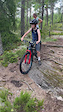
Photos of Värmland Mountain Bike
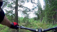
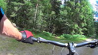
Videos of Värmland Mountain Bike



Current Trail Warnings
| status | trail | date | condition | user | info |
|---|---|---|---|---|---|
| Gräsbergsenduro Torsby | Nov 6, 2026 @ 2:05pm (Europe/Stockholm) Nov 6, 2026 | Unknown | n1kk333 | Kalhygge 300 meter | |
| Chuck Norris Torsby | Nov 6, 2026 @ 2:05pm (Europe/Stockholm) Nov 6, 2026 | Unknown | n1kk333 | Kalhygge 300 meter | |
| Anslutning Frödingleden 1 Kronoparken | Oct 24, 2026 @ 9:31am (Europe/Stockholm) Oct 24, 2026 | Wet | Alchemist887 | Flera stora träd över stigen. Stammar... |
Recent Trail Reports
Activity Feed
| username | action | type | title | date |
|---|---|---|---|---|
| n1kk333 | add | report | activity #107284142 and 1 more | Nov 6, 2026 @ 5:08am Nov 6, 2026 |
| Alchemist887 | update | trail | activity #106472002 | Oct 24, 2026 @ 1:30am Oct 24, 2026 |
| Alchemist887 | add | report | activity #106470341 and 1 more | Oct 24, 2026 @ 12:30am Oct 24, 2026 |
| Alchemist887 | add | report | activity #106440640 and 4 more | Oct 23, 2026 @ 9:48am Oct 23, 2026 |
| Alchemist887 | add | report | activity #106440639 and 6 more | Oct 23, 2026 @ 9:48am Oct 23, 2026 |
Recent Comments
| username | type | title | comment | date |
|---|---|---|---|---|
| trail | Jag fattar. Fixar det nu. | Sep 7, 2026 @ 9:59am Sep 7, 2026 | ||
| trail | Du borde stänga den permanent och arkivera den. | Sep 7, 2026 @ 7:39am Sep 7, 2026 | ||
| skillpark | Just nu är det torrt och dammigt. Var snäll... | Aug 15, 2026 @ 7:48am Aug 15, 2026 | ||
| trail | Gör gärna en stigrapport (Trail report)... | Jul 20, 2026 @ 11:33am Jul 20, 2026 | ||
| trail | Rolig bana att köra | Jul 20, 2026 @ 9:28am Jul 20, 2026 |
Local Badges
-

Rackstad Enduro9 awarded -

Storkasberget6 awarded -
Arvika Enduro1 awarded -
Sotar Blixt2 awarded -

Descent 100k Badge0 awarded -
Descent 100k Badge0 awarded
Bike & Skill Parks
| name | type | city | rating |
|---|---|---|---|
| Karlstad Mtb/Bmx inomhushall | skill park | Karlstad | |
| Norra Kroppkärrs Dirten | skill park | Karlstad | |
| Vik pump track | skill park | Arvika | |
| Örsholmsdirten | skill park | Karlstad | |
| Kristinehamns bikepark | skill park | Kristinehamn |


Activity Type Stats
| activitytype | trails | distance | descent | descent distance | total vertical | rating | global rank | state rank | photos | reports | routes | activity logs |
|---|---|---|---|---|---|---|---|---|---|---|---|---|
| Mountain Bike | 1,982 | 1,213 miles | 133,031 ft | 560 miles | 1,949 ft | 500 | 1,592 | 85 | 32,819 | |||
| E-Bike | 122 | 58 miles | 11,916 ft | 31 miles | 1,650 ft | 1,157 | 14 | 1,561 | ||||
| Gravel Bike | 517 | 420 miles | 32,113 ft | 181 miles | 1,814 ft | 79 | 3 | 122 | ||||
| Adaptive Bike | 233 | 206 miles | 16,427 ft | 92 miles | 1,122 ft | 89 | ||||||
| Winter Fat Bike | 570 | 367 miles | 44,026 ft | 178 miles | 1,877 ft | 321 | ||||||
| Horse | 24 | 13 miles | 1,266 ft | 6 miles | 584 ft | 238 | ||||||
| Hike | 1,931 | 1,192 miles | 122,959 ft | 544 miles | 1,952 ft | 15 | 1,558 | 24 | 1,728 | |||
| Trail Running | 1,929 | 1,191 miles | 122,769 ft | 544 miles | 1,952 ft | 4 | 1,559 | 23 | 4,584 | |||
| Dirtbike/Moto | 9 | 8 miles | 909 ft | 3 miles | 400 ft | 236 | 20 | |||||
| Observed Trials | 1 | 571 ft | 23 ft | 469 ft | 23 ft | |||||||
| Snowmobile | 2 | 1,565 ft | 7 ft | 328 ft | 10 ft | |||||||
| Downhill Ski | 35 | 7 miles | 3,950 ft | 6 miles | 1,430 ft | 18 | 559 | |||||
| Backcountry Ski | 13 | 11 miles | 761 ft | 4 miles | 1,490 ft | 1 | 66 | |||||
| Nordic Ski | 208 | 198 miles | 15,804 ft | 82 miles | 1,946 ft | 6 | 2,275 |
Activities
- Värmland Mountain Biking Trails
- Värmland E-Biking Trails
- Värmland Gravel Biking Trails
- Värmland Adaptive Biking Trails
- Värmland Winter Fat Biking Trails
- Värmland Horseback Trails
- Värmland Hiking Trails
- Värmland Trail Running Trails
- Värmland Dirtbiking Trails
- Värmland Skiing Trails
- Värmland Backcountry Skiing Trails
- Värmland Nordic Skiing Trails
Trails
Points of Interest
- Fågeltorn Alsters Strandängar Viewpoint
- Ørje Turistkontor Information
- Gylterudsgrottan Sight
- Centre Other
- Broen Bridge
- Rullbron Bridge
- Gångbrygga Akta Huvudet Boardwalk
- Walking bridge on poles
- Alstersnäs Rock TTF
- Fågeltorn Alstersnäs Viewpoint
- Granberget (2,234 ft)
- Mellersta knallen (2,215 ft)
- Södra knallen (2,182 ft)
- By brenthillier
 NSMBA TRAILFORKS & contributors
- Admins: ollesvenskonthetrail, JALLE, OrjanX, martinlindstr, Karlstad, Andersol
- #9834 - 22,884 views
- värmland activity log | embed map of Värmland mountain bike trails | värmland mountain biking points of interest polygons
Downloading of trail gps tracks in kml & gpx formats is enabled for Värmland.
You must login to download files.
