
close
3D
Trail Conditions
- Unknown
- Snow Groomed
- Snow Packed
- Snow Covered
- Snow Cover Partial
- Freeze/thaw Cycle
- Icy
- Prevalent Mud
- Wet
- Variable
- Ideal
- Dry
- Very Dry
Trail Flow (Ridden Direction)
Trailforks scans users activity logs to determine the most popular direction each trail is ridden. A good flowing trail network will have most trails flowing in a single direction according to their intension.
The colour categories are based on what percentage of users are riding a trail in its intended direction.
The colour categories are based on what percentage of users are riding a trail in its intended direction.
- > 96%
- > 90%
- > 80%
- > 70%
- > 50%
- < 50%
- bi-directional trail
- no data
Trail Last Used
Trailforks scans activity logs to determine the last time a trail was ridden.
- < 2 days
- < 1 week
- < 2 weeks
- < 1 month
- < 6 months
- > 6 months
Trail Ridden Direction
The intended direction a trail should be ridden.
- Downhill Only
- Downhill Primary
- Both Directions
- Uphill Primary
- Uphill Only
- One Direction
Contribute Details
Colors indicate trail is missing specified detail.
- Description
- Photos
- Description & Photos
- Videos
Trail Popularity ?
Trailforks scans activity logs to determine which trails are ridden the most in the last 9 months.
Trails are compared with nearby trails in the same city region with a possible 25 colour shades.
Think of this as a heatmap, more activities = more kinetic energy = warmer colors.
- most popular
- popular
- less popular
- not popular
ATV/ORV/OHV Filter
Max Vehicle Width
inches
US Cell Coverage
Legend

Radar Time
Activity Recordings
Trailforks uses anonymized public activity data.
?
Activity Recordings
Trailforks uses anonymized public activity data.
?
Winter Trails
Warning
A routing network for winter maps does not exist. Selecting trails using the winter trails layer has been disabled.
Missing Trails
Most Popular
Least Popular
Trails are colored based on popularity. The more popular a trail is, the more red. Less popular trails trend towards green.
Jump Magnitude Heatmap
Heatmap of where users jump on trails. Zoom in to see individual jumps, click circles to view jump details.
BC Backroad Status
![map legend]()
Service Road Atlas is a free to use, community-driven service for viewing and creating reports on the numerous back-country service roads around B.C. and Alberta.

Slope Aspect
Direction the slope faces
Trails Deemphasized
Trails are shown in grey.
Only show trails with no bike usage.
Suggested Layers
Based on selected activity type
Save the current map location and zoom level as your default home location whenever this page is loaded.
SaveBattle Ground trails and routes are listed on Trailforks with interactive trail maps, difficulty ratings, photos, and user-reported trail conditions. The Trailforks community has shared thousands of photos from this region. Supported activity types include Hiking, Trail Running, Mountain Biking, Gravel Biking, Horseback, Adaptive Biking and Winter Fat Biking. Trails here are often faint trail, rooty and flowy. Scenery includes creeks, views and meadows. Common trail features include bridges, berms and jumps. Amenities include shuttle access and picnic spots. Popular destinations include Yacolt Burn State Forest, Lauretta Norene Forest Preserve and Moulton and Lucia Falls.
This is an auto-generated description of Battle Ground.
Login or register to submit a custom description.
Trail info last updated
Activities Click to view
- Mountain Bike
69 trails
- Gravel Bike
31 trails
- Adaptive Bike
19 trails
- Winter Fat Bike
1 trails
- Horse
23 trails
- Hike
73 trails
- Trail Running
73 trails
Region Details
- 19
- 3
- 26
- 20
- 1
Region Status
Caution as of Nov 7, 2026

Stats
- Avg Trail Rating
- Trails (view details)
- 78
- Trails Mountain Bike
- 69
- Trails E-Bike
- 2
- Trails Gravel Bike
- 31
- Trails Adaptive Bike
- 19
- Trails Winter Fat Bike
- 1
- Trails Horse
- 23
- Trails Hike
- 73
- Trails Trail Running
- 73
- Trails Dirtbike/Moto
- 1
- Trails ATV/ORV/OHV
- 1
- Total Distance
- 92 miles
- Total Descent
- 15,607 ft
- Total Vertical
- 3,358 ft
- Highest Trailhead
- 3,500 ft
- Reports
- 1,488
- Photos
- 1,005
- Completed Counter
- 19,495
Sub Regions
-
Battle Ground Lake State Park
- 2
- 2
-
Lauretta Norene Forest Preserve
- 2
- 8
-
Lewisville Regional Park
- 1
-
Moulton and Lucia Falls
- 1
- 4
-
Salmon-Morgan Creeks Natural Area
- 2
- 2
-
Yacolt Burn State Forest
- 10
- 15
- 1
Popular Battle Ground Mountain Biking Trails
• 100 ★ 4.6 • 3 miles • 25 ft • 1,229 •
Sixth Sense has a little of everything and provides challenge to all skill levels of riders. It has sections that are moderately rocky and technical as well as some smooth flowy bits. It was designed and built by Evergreen Southwest for...
• 90 ★ 4.8 • 2 miles • 18 ft • 1,061 •
Thrillium is one of the Pacific Northwest's premier DH trails. It features high speed berms and many large tabled jumps that "intermediate" skilled riders can roll. It is a popular trail to shuttle, but the top can also be accessed from...
• 85 ★ 4.5 • 4 miles • 59 ft • 912 •
The Cold Creek trail is a section of the greater Tarbell Trail. Cold Creek has a sampling of several types of terrain ranging from carefully crafted berms and rollers to raw rooty and rocky sections. Roughly 5 1/2 miles from top to...
• 95 ★ 3.8 • 4,416 ft • 0 ft • 873 •
Upper Murphy's Grade is a bike-only intermediate jump line. It intersects with the Cold Creek section of the Tarbell at what is know as the toilet bowl.
• 100 ★ 5.0 • 1 mile • 439 ft • 775 •
This is a purpose built climbing trail designed by EMBA for mountain bikers, but shared with hikers and horses. The lower entrance is roughly 0.5 miles up Lower Murphy's grade. It climbs to the midpoint of the Sixth Sense crossing the...
• 90 ★ 4.0 • 1 mile • 0 ft • 530 •
Murphy's Grade is a multi-use trail that runs parallel to Cold Creek and intersects with it midway, The lower half is a converted railroad bed with a gentle 6% grade and can be used to loop the lower section of Cold Creek.
• 95 ★ 4.0 • 1,043 ft • 120 ft • 496 •
This shortcut is the preferred climbing line from Ross' grade to the Thrillium parking lot. The bottom of the trail is easy to miss as it is only a faint bench dug into a roadcut. After entering the woods, the trail is much more obvious...
Battle Ground Mountain Bike Routes
Tarbell Loop Featured
★ 3.5 • 23 miles • 4,332 ft • 5 •
The Tarbell loop is that actual continuous Tarbell trail. It's a varied route with lots of different types...
Climb from Lower to Upper Lot Featured
★ 5.0 • 4 miles • 1,553 ft • 2 • Point to Point •
This is the easiest route to climb from the Yacolt TH parking lot to the Larch Mountain TH parking.
★ 5.0 • 23 miles • 4,053 ft • 6 • Loop •
The counterclockwise way of running the Tarbell Loop. This route avoids going up Cold Creek or Murphy's...
★ 4.0 • 10 miles • 2,339 ft • 7 •
This is a route that gives you a relatively more approachable road climb up to the towers on the top of...
★ 5.0 • 45 miles • 9,258 ft • 12 • Loop •
This is a tough route that I experimented with, failing after the first day as it was dumping rain and our...
★ 5.0 • 13 miles • 2,891 ft • 5 •
Photos of Battle Ground Mountain Bike
Videos of Battle Ground Mountain Bike
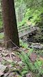



Recent Trail Reports
Activity Feed
| username | action | type | title | date |
|---|---|---|---|---|
| lmulq473 | wishlist | trail | activity #107494313 | Nov 9, 2026 @ 9:38am Nov 9, 2026 |
| askaustin | add | report | activity #107400568 and 1 more | Nov 7, 2026 @ 11:59pm Nov 7, 2026 |
| mrwtb | add | report | activity #107218017 and 4 more | Nov 4, 2026 @ 7:26pm Nov 4, 2026 |
| tfrasc | wishlist | trail | activity #107159346 and 1 more | Nov 3, 2026 @ 6:17pm Nov 3, 2026 |
| pxj022 | comment | trail | activity #107104087 | Nov 2, 2026 @ 7:22pm Nov 2, 2026 |
Recent Comments
| username | type | title | comment | date |
|---|---|---|---|---|
| trail | Such an awesome trail. Really something for... | Nov 2, 2026 @ 7:22pm Nov 2, 2026 | ||
| report | trail report | Aug 1, 2026 @ 8:47pm Aug 1, 2026 | ||
| trail | epic spicy blue, looks and feels identical to... | Jul 19, 2026 @ 3:34pm Jul 19, 2026 | ||
| trail | Ok | Jul 5, 2026 @ 11:38am Jul 5, 2026 | ||
| trail | Ripping blue flow trail top to bottom. It... | Jun 8, 2026 @ 12:01pm Jun 8, 2026 |
Local Badges
-

Murphy's Grade Evergreen SW Flash Membership8 awarded -

Sixth Sense Evergreen SW Flash Membership16 awarded -

Cold Creek Evergreen SW Flash Membership7 awarded -

Thrillium Evergreen SW Flash Membership7 awarded -

1070 Road Climb Evergreen SW Flash Membership22 awarded -

Top 10 Trails0 awarded
Local Mountain Biking Directory
-
Evergreen - Southwest ChapterTrail Association
![Evergreen - Southwest Chapter]()
Activity Type Stats
| activitytype | trails | distance | descent | descent distance | total vertical | rating | global rank | state rank | photos | reports | routes | activity logs |
|---|---|---|---|---|---|---|---|---|---|---|---|---|
| Mountain Bike | 69 | 90 miles | 15,427 ft | 37 miles | 3,360 ft | #1,612 | #36 | 975 | 1,487 | 32 | 17,466 | |
| E-Bike | 2 | 3 miles | 112 ft | 4,288 ft | 2,530 ft | 889 | 1 | 2,281 | ||||
| Gravel Bike | 31 | 31 miles | 1,939 ft | 7 miles | 3,228 ft | #1,806 | #41 | 90 | 43 | |||
| Adaptive Bike | 19 | 23 miles | 2,139 ft | 7 miles | 3,228 ft | #2,284 | #34 | 333 | 1 | |||
| Winter Fat Bike | 1 | 2 miles | 112 ft | 4,186 ft | 46 ft | #2,878 | #33 | 15 | ||||
| Horse | 23 | 52 miles | 9,869 ft | 22 miles | 3,100 ft | #1,023 | #36 | 464 | 4 | 2 | ||
| Hike | 73 | 85 miles | 13,488 ft | 34 miles | 3,360 ft | #1,710 | #47 | 24 | 1,394 | 14 | 750 | |
| Trail Running | 73 | 85 miles | 13,488 ft | 34 miles | 3,360 ft | #2,544 | #48 | 1 | 1,391 | 6 | 307 | |
| Dirtbike/Moto | 1 | 1 mile | 764 ft | 117 | 20 | |||||||
| ATV/ORV/OHV | 1 | 1 mile | 764 ft | 5 | 117 | 4 |
Frequently Asked Questions
▼
What are the best places to ride in Battle Ground?
Battle Ground has 7 areas to explore for mountain biking. The top rated areas are:
▼
What are the highest rated mountain biking trails in Battle Ground?
The highest rated mountain biking trails in Battle Ground are:
- Thrillium (4.7/5)
- Cold Creek (4.5/5)
- Sixth Sense (4.5/5)
- Vista Ridge (4.3/5)
- Beargrass (4.2/5)
▼
Where can I park to ride in Battle Ground?
There are 18 parking locations listed in Battle Ground. The most popular parking spots are:
- Yacolt Burn Trailhead Parking
- Bridge/Thrillium Shuttle Parking
- Larch Mountain Trailhead Parking Lot
- Parking
- Parking
▼
What is the longest trail in Battle Ground?
The longest trail in Battle Ground is Bells Mountain at 8.7 miles. View all trails sorted by distance.
▼
What are the best & highest rated hiking trails in Battle Ground?
The best hiking trails in Battle Ground are: View all hiking trails sorted by popularity score.
▼
What are the best & highest rated trail running trails in Battle Ground?
The best trail running trails in Battle Ground are: View all trail running trails sorted by popularity score.
▼
How many trails are in Battle Ground?
Battle Ground has a total of 78 trails. Of those, 69 are designated for mountain biking. Browse top mountain biking trails in Battle Ground to find detailed information including difficulty ratings, distances, and trail conditions.
▼
Which trail has the most elevation gain in Battle Ground?
The trail with the most elevation gain in Battle Ground is Appaloosa with 1,384 ft of elevation gain. View all trails sorted by elevation gain.
▼
Which trail has the most elevation descent in Battle Ground?
The trail with the most elevation descent in Battle Ground is Cold Creek with 1,931 ft of elevation descent. View all trails sorted by elevation descent.
▼
What activities are most popular in Battle Ground?
Battle Ground supports the following activities: Mountain Biking, Gravel Biking, Adaptive Biking, Winter Fat Biking, Horseback, Hiking, Trail Running.
▼
What bike services are there in Battle Ground?
The following bike services are available in Battle Ground:
- Trail Association (1)
▼
What are the steepest mountain biking trails in Battle Ground?
The steepest mountain biking trail in Battle Ground is Aaron's Climbing Trail with an average grade of 11.5%. View all trails sorted by grade.
▼
Are there any trails with scenic viewpoints in Battle Ground?
Yes, there are 1 scenic viewpoints marked along trails in Battle Ground. Some popular viewpoints include: Explore more points of interest to find trails with the best views.
▼
What trails have the biggest jumps in Battle Ground?
The trails with the biggest jumps in Battle Ground are: Browse all mountain bike trails to find trails with jumps and technical features.
▼
Are the trails open in Battle Ground?
The overall region status for Battle Ground is Minor Issue / Yellow. Out of 59 trails:
- Clear / Green: 47
- Minor Issue / Yellow: 8
- Significant Issue / Amber: 4
▼
What are the trail conditions in Battle Ground?
Based on trail reports from the past week in Battle Ground:
- Wet: 2 trails
▼
Can I ride an ebike in Battle Ground?
There are 2 trails in Battle Ground that allow e-bikes. Check the e-bike trails listing for specific trail access details and any local regulations.
▼
What are the most popular mountain biking routes in Battle Ground?
The most popular mountain biking routes in Battle Ground are: View all mountain biking routes in Battle Ground.
▼
What is the highest summit in Battle Ground?
The highest summit in Battle Ground is Bird Mountain at 5,696 ft elevation.
▼
What are the most popular Strava Segments in Battle Ground?
The most popular Strava segments in Battle Ground are:
- The Final Road Race (3,272 athletes)
- CC section 4 (3,209 athletes)
- Toilet Bowl down to the Road (3,209 athletes)
▼
Are there accessible or adaptive trails in Battle Ground?
Yes, there are 18 accessible/adaptive trails in Battle Ground. View all adaptive trails in Battle Ground for specific accessibility information.
▼
Are there local clubs or events in Battle Ground?
There are 1 local clubs or associations listed in the Battle Ground directory. Browse the local directory for details.
▼
What are the most popular mountain biking trails in Battle Ground?
The most popular mountain biking trails in Battle Ground are: View all mountain biking trails sorted by popularity.
▼
What are the best beginner ride trails in Battle Ground?
The best beginner mountain biking trails in Battle Ground are:
- Vista Ridge (5/5)
- Vista Ridge 2 (5/5)
- Aaron's Climbing Trail (4/5)
Activities
Trails
Points of Interest
- Radio Towers Other
- Janky Bridge
- Larch Mountain Summit
- Battle Ground Lake State Park Campground Camping
- Rock Creek Campground Camping
- 4 Corners Information
- 5 Corners Junction Information
- Grouse Creek Bridge
- Lunch Spot Viewpoint
- Steel Bridge
- Bird Mountain (5,696 ft)
- Gifford Peak (5,374 ft)
- Berry Mountain (5,016 ft)
- By northwestdhdad EMBA-SW & contributors
- Admins: EMBA-SW
- #3291 - 33,137 views
- battle ground activity log | embed map of Battle Ground mountain bike trails | battle ground mountain biking points of interest polygons
Downloading of trail gps tracks in kml & gpx formats is enabled for Battle Ground.
You must login to download files.
