
close
3D
Trail Conditions
- Unknown
- Snow Groomed
- Snow Packed
- Snow Covered
- Snow Cover Partial
- Freeze/thaw Cycle
- Icy
- Prevalent Mud
- Wet
- Variable
- Ideal
- Dry
- Very Dry
Trail Flow (Ridden Direction)
Trailforks scans users activity logs to determine the most popular direction each trail is ridden. A good flowing trail network will have most trails flowing in a single direction according to their intension.
The colour categories are based on what percentage of users are riding a trail in its intended direction.
The colour categories are based on what percentage of users are riding a trail in its intended direction.
- > 96%
- > 90%
- > 80%
- > 70%
- > 50%
- < 50%
- bi-directional trail
- no data
Trail Last Used
Trailforks scans activity logs to determine the last time a trail was ridden.
- < 2 days
- < 1 week
- < 2 weeks
- < 1 month
- < 6 months
- > 6 months
Trail Ridden Direction
The intended direction a trail should be ridden.
- Downhill Only
- Downhill Primary
- Both Directions
- Uphill Primary
- Uphill Only
- One Direction
Contribute Details
Colors indicate trail is missing specified detail.
- Description
- Photos
- Description & Photos
- Videos
Trail Popularity ?
Trailforks scans activity logs to determine which trails are ridden the most in the last 9 months.
Trails are compared with nearby trails in the same city region with a possible 25 colour shades.
Think of this as a heatmap, more activities = more kinetic energy = warmer colors.
- most popular
- popular
- less popular
- not popular
ATV/ORV/OHV Filter
Max Vehicle Width
inches
US Cell Coverage
Legend

Radar Time
Activity Recordings
Trailforks uses anonymized public activity data.
?
Activity Recordings
Trailforks uses anonymized public activity data.
?
Winter Trails
Warning
A routing network for winter maps does not exist. Selecting trails using the winter trails layer has been disabled.
Missing Trails
Most Popular
Least Popular
Trails are colored based on popularity. The more popular a trail is, the more red. Less popular trails trend towards green.
Jump Magnitude Heatmap
Heatmap of where users jump on trails. Zoom in to see individual jumps, click circles to view jump details.
BC Backroad Status
![map legend]()
Service Road Atlas is a free to use, community-driven service for viewing and creating reports on the numerous back-country service roads around B.C. and Alberta.

Slope Aspect
Direction the slope faces
Trails Deemphasized
Trails are shown in grey.
Only show trails with no bike usage.
Suggested Layers
Based on selected activity type
Save the current map location and zoom level as your default home location whenever this page is loaded.
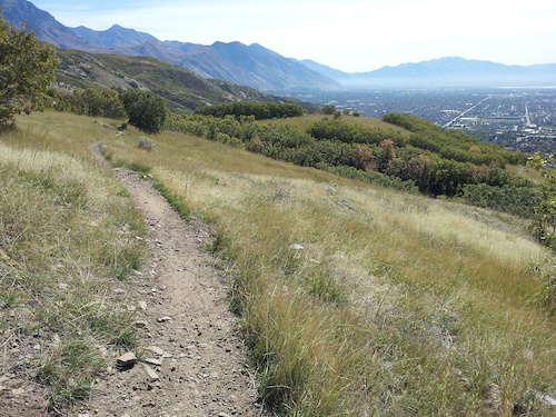
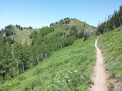
SaveBountiful trails and routes are listed on Trailforks with interactive trail maps, difficulty ratings, photos, and user-reported trail conditions. The Trailforks community has mapped hundreds of trails and shared hundreds of photos in this region. Supported activity types include Hiking, Trail Running, Mountain Biking, E-Biking, Gravel Biking, Adaptive Biking, Dirtbiking, ATVing/Offroading, Horseback, Snowshoeing and Winter Fat Biking. Trails here are often faint trail, rocky and flowy. Scenery includes creeks, canyons and ridgelines. Common trail features include berms, bridges and jumps. Many trails are family friendly. Popular destinations include Bountiful Peak and Mueller Park.
This is an auto-generated description of Bountiful.
Login or register to submit a custom description.
Trail info last updated
Activities Click to view
- Mountain Bike
91 trails
- E-Bike
29 trails
- Gravel Bike
26 trails
- Adaptive Bike
20 trails
- Winter Fat Bike
3 trails
- Horse
8 trails
- Hike
105 trails
- Trail Running
105 trails
- Dirtbike/Moto
11 trails
- ATV/ORV/OHV
9 trails
- Snowshoe
6 trails
Region Details
- 12
- 3
- 12
- 56
- 18
- 4
Region Status
Open as of 2 daysTrail Running Stats
- Global Ranking
- #996
- State Ranking
- #35
- Trails (view details)
- 105
- Trails Mountain Bike
- 91
- Trails E-Bike
- 29
- Trails Gravel Bike
- 26
- Trails Adaptive Bike
- 19
- Trails Winter Fat Bike
- 3
- Trails Horse
- 8
- Trails Hike
- 105
- Trails Trail Running
- 105
- Trails Dirtbike/Moto
- 11
- Trails ATV/ORV/OHV
- 9
- Trails Snowshoe
- 6
- Total Distance
- 158 miles
- Total Descent Distance
- 60 miles
- Total Descent
- 32,841 ft
- Total Vertical
- 5,200 ft
- Reports
- 1,480
- Photos
- 4
- Completed Counter
- 1,353
Sub Regions
-
Bountiful Peak
- 1
- 4
- 22
- 5
- 3
-
Mueller Park
- 7
Popular Bountiful Trail Running Trails
• 100 ★ 4.7 • 3 miles • 1,036 ft • 113 •
Mueller is probably Bountiful's most popular hiking/biking/trail running/equestrian trail. During the summer this trail sees a lot of traffic. If you're into early morning or nighttime rides there's a good chance you won't see many...
• 80 ★ 2.7 • 3 miles • 337 ft • 66 •
The ridge trail is tight and has a short section of fun single track, but quickly turns ugly as it goes straight down the ridge. Then there is really nowhere to go but to cut through \"No Tresspassing\" signs and find your way out on a...
• 95 ★ 4.0 • 2 miles • 607 ft • 63 •
North Canyon is a fun but challenging climb and descent. This side of Cave Peak doesn't see nearly as much traffic as Mueller Park so this might be a better option if you're wanting some speed and not wanting to stop for hiking traffic....
• 95 ★ 4.5 • 4 miles • 799 ft • 61 •
Bonneville Shoreline Trail connection between Mueller Park and North Canyon trails.
• 70 ★ 3.0 • 3 miles • 859 ft • 50 •
The middle of this trail is "green" and interesting but the ends are hiking at best. The north side is very thick trees and steep. There is no way to ride that section on a bike and it is very difficult to hike it due to overgrown...
• 95 ★ 4.3 • 3 miles • 889 ft • 45 •
Mueller is probably Bountiful's most popular hiking/biking/trail running/equestrian trail. During the summer this trail sees a lot of traffic. If you're into early morning or nighttime rides there's a good chance you won't see many...
• 65 ★ 2.8 • 6 miles • 1,772 ft • 45 •
Overgrown a bit, with very low traffic.
• 70 ★ 4.0 • 3 miles • 656 ft • 41 •
Arthur's Creek Cutoff is a remote single track trail running from the top of Skyline Drive to the Farmington Flats. This trail is often overgrown, and has a handful of sections that are very difficult to ride, and is generally primitive...
Bountiful Routes
★ 5.0 • 9 miles • 2,922 ft • 3 •
20 miles • 3,139 ft • 8 •
5 miles • 533 ft • 1 •
7 miles • 1,107 ft • 2 •
5 miles • 1,657 ft • 1 •
4 miles • 788 ft • 2 •
Photos of Bountiful
Videos of Bountiful




Current Trail Warnings
| status | trail | date | condition | user | info |
|---|---|---|---|---|---|
| Kinglet | Oct 21, 2026 @ 11:41am (America/Boise) Oct 21, 2026 | Ideal | Jodiraerod | E-Bike Not open yet |
Recent Trail Reports
| status | trail | date | condition | info | user |
|---|---|---|---|---|---|
| BST - Mueller Park to North Canyon | Oct 24, 2026 @ 11:12am (America/Denver) 2 days | Very Dry | Ammopuke | ||
| BST - Mueller Park | Oct 24, 2026 @ 11:12am (America/Denver) 2 days | Wet | Ammopuke | ||
| Mueller Park North BST Connector | Oct 24, 2026 @ 11:12am (America/Denver) 2 days | Ideal | Ammopuke | ||
| Maple Glow | Oct 22, 2026 @ 3:22pm (America/Denver) Oct 22, 2026 | Ideal | RockSteady33 | ||
| Perrigrine | Oct 21, 2026 @ 1:38pm (America/Boise) Oct 21, 2026 | Ideal | Savedcyclist | ||
| North Holbrook Route | Oct 21, 2026 @ 11:41am (America/Boise) Oct 21, 2026 | Ideal | Jodiraerod | ||
| North Canyon, Lower | Oct 21, 2026 @ 11:41am (America/Boise) Oct 21, 2026 | Ideal | Jodiraerod | ||
| North Canyon, Upper | Oct 21, 2026 @ 11:41am (America/Boise) Oct 21, 2026 | Ideal | Jodiraerod | ||
| Mueller Park, Upper | Oct 21, 2026 @ 11:41am (America/Boise) Oct 21, 2026 | Ideal | Jodiraerod | ||
| Mueller Park, Lower | Oct 21, 2026 @ 11:41am (America/Boise) Oct 21, 2026 | Ideal | Jodiraerod |
National Scenic Trails & Official Routes
-
Bonneville Shoreline Trail
- Mountain Bike
- E-Bike
- Horse
- Hike
- Trail Running
- Snowshoe
- Nordic Ski
-
Great Western Trail
- Mountain Bike
- E-Bike
- Horse
- Hike
- Trail Running
- Dirtbike/Moto
- ATV/ORV/OHV
Activity Feed
| username | action | type | title | date |
|---|---|---|---|---|
| Ammopuke | add | report | activity #106538788 and 2 more | Oct 24, 2026 @ 7:30pm 2 days |
| 8018038282 | add | photo | activity #106532797 and 1 more | Oct 24, 2026 @ 4:47pm 2 days |
| RockSteady33 | add | report | activity #106400652 | Oct 22, 2026 @ 2:26pm Oct 22, 2026 |
| Savedcyclist | add | report | activity #106351977 | Oct 21, 2026 @ 4:45pm Oct 21, 2026 |
| Jodiraerod | add | report | activity #106346174 and 10 more | Oct 21, 2026 @ 3:15pm Oct 21, 2026 |
Recent Comments
| username | type | title | comment | date |
|---|---|---|---|---|
| trail | Extremely overgrown. Cut my shins up a ton.... | Aug 9, 2026 @ 10:56am Aug 9, 2026 | ||
| trail | If Elephant DH is Little Rush this is Little... | Jul 29, 2026 @ 9:05pm Jul 29, 2026 | ||
| report | Pp lol mo P L L | Jul 18, 2026 @ 3:04pm Jul 18, 2026 | ||
| trail | This is good trail. Slightly more technical... | Jul 3, 2026 @ 9:33am Jul 3, 2026 | ||
| trail | 7000 NICA riders across the state that are not... | May 14, 2026 @ 12:55pm May 14, 2026 |
Local Badges
-

10 Blue Trails27 awarded -

Epic Trail Running Climb 2k31 awarded -

Climbing 10k Badge12 awarded -

Trail Running 100k Badge0 awarded -

Completionist0 awarded -

Big Trail Run 30k31 awarded
Activity Type Stats
| activitytype | trails | distance | descent | descent distance | total vertical | rating | global rank | state rank | photos | reports | routes | activity logs |
|---|---|---|---|---|---|---|---|---|---|---|---|---|
| Mountain Bike | 91 | 133 miles | 25,551 ft | 56 miles | 4,888 ft | #763 | #26 | 379 | 1,507 | 20 | 39,231 | |
| E-Bike | 29 | 74 miles | 9,072 ft | 29 miles | 4,888 ft | #419 | #9 | 15 | 1,413 | 4 | 3,554 | |
| Gravel Bike | 26 | 56 miles | 5,322 ft | 21 miles | 4,888 ft | #1,505 | #29 | 104 | 108 | |||
| Adaptive Bike | 20 | 41 miles | 3,812 ft | 17 miles | 3,442 ft | #1,791 | #17 | 308 | 2 | |||
| Winter Fat Bike | 3 | 3 miles | 810 ft | 2 miles | 1,768 ft | #3,226 | #35 | 3 | 3 | |||
| Horse | 8 | 18 miles | 4,997 ft | 8 miles | 4,029 ft | #1,070 | #40 | 6 | 180 | 24 | ||
| Hike | 105 | 158 miles | 32,841 ft | 60 miles | 5,200 ft | #691 | #38 | 9 | 1,480 | 13 | 4,162 | |
| Trail Running | 105 | 158 miles | 32,841 ft | 60 miles | 5,200 ft | #996 | #35 | 4 | 1,480 | 14 | 2,919 | |
| Dirtbike/Moto | 11 | 34 miles | 4,662 ft | 12 miles | 4,423 ft | #685 | #30 | 3 | 270 | 87 | ||
| ATV/ORV/OHV | 9 | 28 miles | 4,321 ft | 12 miles | 4,495 ft | #418 | #18 | 172 | 30 | |||
| Snowshoe | 6 | 8 miles | 784 ft | 2 miles | 4,272 ft | #1,034 | #23 | 5 | 9 | 25 |
Frequently Asked Questions
▼
What are the best places to run in Bountiful?
Bountiful has 2 areas to explore for trail running. The top rated areas are:
▼
What are the highest rated trail running trails in Bountiful?
The highest rated trail running trails in Bountiful are:
- Mill Creek Trail (0/5)
- Lookout Peak Summit (0/5)
- Dude Benchmark (0/5)
- North Holbrook Spur (0/5)
- Holbrook Canyon (0/5)
▼
Where can I park to run in Bountiful?
There are 10 parking locations listed in Bountiful. The most popular parking spots are:
- Mueller Park
- Main lower Parking Area
- Upper Parking Area -The Farm
- Farmington Canyon Road Parking
- North Canyon
▼
What is the longest trail in Bountiful?
The longest trail in Bountiful is Legacy Parkway at 13.1 miles. View all trails sorted by distance.
▼
What are the best & highest rated hiking trails in Bountiful?
The best hiking trails in Bountiful are: View all hiking trails sorted by popularity score.
▼
What are the best & highest rated dirtbiking trails in Bountiful?
The best dirtbiking trails in Bountiful are:
- North Canyon, Lower
- Mueller Park, Lower
- North Canyon, Upper
- Mueller Park, Upper
- GWT - Arthur's Creek Cutoff
▼
How many trails are in Bountiful?
Bountiful has a total of 109 trails. Of those, 105 are designated for trail running. Browse top trail running trails in Bountiful to find detailed information including difficulty ratings, distances, and trail conditions.
▼
Which trail has the most elevation gain in Bountiful?
The trail with the most elevation gain in Bountiful is Holbrook Canyon with 3,193 ft of elevation gain. View all trails sorted by elevation gain.
▼
Which trail has the most elevation descent in Bountiful?
The trail with the most elevation descent in Bountiful is North Holbrook Route with 3,512 ft of elevation descent. View all trails sorted by elevation descent.
▼
What activities are most popular in Bountiful?
Bountiful supports the following activities: Mountain Biking, E-Biking, Gravel Biking, Adaptive Biking, Winter Fat Biking, Horseback, Hiking, Trail Running, Dirtbiking, ATVing/Offroading, Snowshoeing.
▼
What are the steepest trail running trails in Bountiful?
The steepest trail running trail in Bountiful is Mill Creek Trail with an average grade of 40.3%. View all trails sorted by grade.
▼
Are the trails open in Bountiful?
The overall region status for Bountiful is Clear / Green. Out of 83 trails:
- Clear / Green: 67
- Minor Issue / Yellow: 9
- Significant Issue / Amber: 4
- Closed: 3
▼
What are the trail conditions in Bountiful?
Based on trail reports from the past week in Bountiful:
- Ideal: 17 trails
- Very Dry: 1 trail
- Wet: 1 trail
▼
What are the most popular trail running routes in Bountiful?
The most popular trail running routes in Bountiful are: View all trail running routes in Bountiful.
▼
What is the highest summit in Bountiful?
The highest summit in Bountiful is Sessions Mountain (west) at 9,242 ft elevation.
▼
What are the top sights to see in Bountiful?
There are 2 notable sights in Bountiful. Some of the top sights include: Explore all points of interest in Bountiful.
▼
What trails are closed in Bountiful?
There are currently 3 closed trails in Bountiful. The breakdown of all trail statuses is:
- Clear / Green: 67
- Minor Issue / Yellow: 9
- Significant Issue / Amber: 4
- Closed: 3
▼
Are there accessible or adaptive trails in Bountiful?
Yes, there are 20 accessible/adaptive trails in Bountiful. View all adaptive trails in Bountiful for specific accessibility information.
▼
What are the most popular trail running trails in Bountiful?
The most popular trail running trails in Bountiful are: View all trail running trails sorted by popularity.
▼
What are the best beginner trail run trails in Bountiful?
The best beginner trail running trails in Bountiful are:
- Farmington Creek (Lagoon) (0/5)
- Hornet (0/5)
- Mueller Park North BST Connector (0/5)
Activities
Trails
- By canadaka
 Trailforks & contributors
- Admins: apply
- #4870 - 13,778 views
- bountiful activity log | embed map of Bountiful mountain bike trails | bountiful mountain biking points of interest
Downloading of trail gps tracks in kml & gpx formats is enabled for Bountiful.
You must login to download files.
