A long trail through the Intermountain West (AZ, UT, ID, WY, MT) first designed in the 1990s. It is multi-use, with several sections open to biking and motorized vehicles (often with alternative motorized and non-motorized routes). It is mostly mountainous forest, but also includes sections of desert and some connections through towns and rural valleys. Connects to the Continental Divide Trail (CDT) in the north, and the Arizona Trail (AT) in the south. The Arizona segment of the GWT has largely been forgotten since the AT was created.
- Mountain Bike
- E-Bike
- Horse
- Hike
- Trail Running
- Dirtbike/Moto
- ATV/ORV/OHV
Login to see your progress towards riding all the trails and routes in this list.
Trails
Displaying 177
Videos
15:57 |
133 |
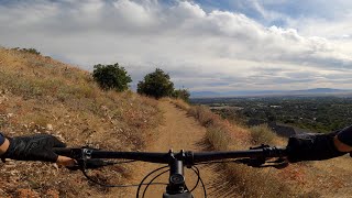
Feb 22, 2026 , Kaysville
23:43 |
69 |
Feb 22, 2026 , Kaysville
youtuber
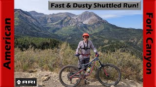
![Flying down American Fork Canyon in fall...]()
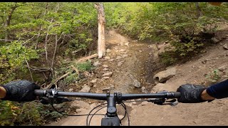
20:55 |
98 |
Oct 3, 2025 , Cedar Hills
Recent Trail Reports
| status | trail | date | condition | |
|---|---|---|---|---|
| Northern Skyline | Jul 24, 2026 @ 10:14pm (America/Denver) 2 days | view | ||
| Great Western Trail | Jul 24, 2026 @ 1:53pm (America/Denver) 3 days | view | ||
| Wasatch Crest (North) | Jul 24, 2026 @ 1:51pm (America/Denver) 3 days | view | ||
| GWT (Sessions Mtns) | Jul 24, 2026 @ 11:38am (America/Denver) 3 days | view | ||
| Ridgeline | Jul 24, 2026 @ 11:36am (America/Denver) 3 days | view |
Total Trails
177
Total Distance
866 miles
Total Descent
-143,603 ft
Total Climb
150,616 ft
close
-
Layers w
- Weather Layers
- Pro
- Pro
- Pro
- Pro
- Pro
- Pro
- More Layers
- Pro
- Pro
- Pro
- Pro
-
Upgrade to

3D
Trail Conditions
- Unknown
- Snow Groomed
- Snow Packed
- Snow Covered
- Snow Cover Partial
- Freeze/thaw Cycle
- Icy
- Prevalent Mud
- Wet
- Variable
- Ideal
- Dry
- Very Dry
Trail Flow (Ridden Direction)
Trailforks scans users activity logs to determine the most popular direction each trail is ridden. A good flowing trail network will have most trails flowing in a single direction according to their intension.
The colour categories are based on what percentage of users are riding a trail in its intended direction.
The colour categories are based on what percentage of users are riding a trail in its intended direction.
- > 96%
- > 90%
- > 80%
- > 70%
- > 50%
- < 50%
- bi-directional trail
- no data
Trail Last Ridden
Trailforks scans activity logs to determine the last time a trail was ridden.
- < 2 days
- < 1 week
- < 2 weeks
- < 1 month
- < 6 months
- > 6 months
Trail Ridden Direction
The intended direction a trail should be ridden.
- Downhill Only
- Downhill Primary
- Both Directions
- Uphill Primary
- Uphill Only
- One Direction
Contribute Details
Colors indicate trail is missing specified detail.
- Description
- Photos
- Description & Photos
- Videos
Trail Popularity ?
Trailforks scans activity logs to determine which trails are ridden the most in the last 9 months.
Trails are compared with nearby trails in the same city region with a possible 25 colour shades.
Think of this as a heatmap, more activities = more kinetic energy = warmer colors.
- most popular
- popular
- less popular
- not popular
ATV/ORV/OHV Filter
Max Vehicle Width
inches
US Cell Coverage
Legend

Radar Time
Activity Recordings
Trailforks uses anonymized public activity data.
?
Activity Recordings
Trailforks uses anonymized public activity data.
?
Personal Heatmap
▶
Activity Types
all
/
none
▶
Options
2
Date range
month
–
Winter Trails
Warning
A routing network for winter maps does not exist. Selecting trails using the winter trails layer has been disabled.
Missing Trails
Most Popular
Least Popular
Trails are colored based on popularity. The more popular a trail is, the more red. Less popular trails trend towards green.
Jump Magnitude Heatmap
Heatmap of where users jump on trails. Zoom in to see individual jumps, click circles to view jump details.
BC Backroad Status
![map legend]()
Service Road Atlas is a free to use, community-driven service for viewing and creating reports on the numerous back-country service roads around B.C. and Alberta.

Slope Aspect
Direction the slope faces
Trails Deemphasized
Trails are shown in grey.
Only show trails with no bike usage.
Suggested Layers
Based on selected activity type
Save the current map location and zoom level as your default home location whenever this page is loaded.
Save
Trail transparency
This official route list of trails is not complete
Average difficulty
Associated Route
Mountain Bike is not supported on all trail sections, see trails for more details.
Trails and Routes in List - Distance by Difficulty
Trails and Routes in List - Difficulty Totals
- By bplewe
 TRAILFORKS UVTA
 - #703 - 11,342 views