close
-
Layers w
- Map Content
- More Layers
- Pro
- Pro
- Pro
- Pro
- Pro
- Pro
- Pro
- Pro
-
Upgrade to

3D
Trail Conditions
- Unknown
- Snow Groomed
- Snow Packed
- Snow Covered
- Snow Cover Partial
- Freeze/thaw Cycle
- Icy
- Prevalent Mud
- Wet
- Variable
- Ideal
- Dry
- Very Dry
Trail Flow (Ridden Direction)
Trailforks scans users ridelogs to determine the most popular direction each trail is ridden. A good flowing trail network will have most trails flowing in a single direction according to their intension.
The colour categories are based on what percentage of riders are riding a trail in its intended direction.
The colour categories are based on what percentage of riders are riding a trail in its intended direction.
- > 96%
- > 90%
- > 80%
- > 70%
- > 50%
- < 50%
- bi-directional trail
- no data
Trail Last Ridden
Trailforks scans ridelogs to determine the last time a trail was ridden.
- < 2 days
- < 1 week
- < 2 weeks
- < 1 month
- < 6 months
- > 6 months
Trail Ridden Direction
The intended direction a trail should be ridden.
- Downhill Only
- Downhill Primary
- Both Directions
- Uphill Primary
- Uphill Only
- One Direction
Contribute Details
Colors indicate trail is missing specified detail.
- Description
- Photos
- Description & Photos
- Videos
Trail Popularity ?
Trailforks scans ridelogs to determine which trails are ridden the most in the last 9 months.
Trails are compared with nearby trails in the same city region with a possible 25 colour shades.
Think of this as a heatmap, more rides = more kinetic energy = warmer colors.
- most popular
- popular
- less popular
- not popular
ATV/ORV/OHV Filter
Max Vehicle Width
inches
US Cell Coverage
Legend

Radar Time
x
Activity Recordings
Trailforks users anonymized public ridelogs from the past 6 months.
- mountain biking recent
- mountain biking (>6 month)
- hiking (1 year)
- moto (1 year)
Activity Recordings
Trailforks users anonymized public skilogs from the past 12 months.
- Downhill Ski
- Backcountry Ski
- Nordic Ski
- Snowmobile
Winter Trails
Warning
A routing network for winter maps does not exist. Selecting trails using the winter trails layer has been disabled.
x
Missing Trails
Most Popular
Least Popular
Trails are colored based on popularity. The more popular a trail is, the more red. Less popular trails trend towards green.
Jump Magnitude Heatmap
Heatmap of where riders jump on trails. Zoom in to see individual jumps, click circles to view jump details.
Trails Deemphasized
Trails are shown in grey.
Only show trails with NO bikes.
Save the current map location and zoom level as your default home location whenever this page is loaded.
SaveBeginner and intermedia trails across 280 acres feature a variety of terrain, sweeping views, and lots of miles. Nestled in-between the city and county’s central park for outdoor sports, many of the trails recently underwent a massive reworking for improved drainage and bike flow.
Primary Trail Type: Cross-Country
Land Status: City Managed
 google parking directions
 Activities Click to view
- Mountain Bike
45 trails
- Hike
45 trails
- Trail Running
45 trails
Region Details
- 4
- 4
- 16
- 20
Region Status
Open as of 14 hoursStats
- Avg Trail Rating
- Trails (view details)
- 44
- Trails Mountain Bike
- 45
- Trails E-Bike
- 26
- Trails Horse
- 4
- Trails Hike
- 45
- Trails Trail Running
- 45
- Total Distance
- 31 miles
- Total Descent
- 2,324 ft
- Total Vertical
- 398 ft
- Highest Trailhead
- 5,541 ft
- Reports
- 1,293
- Photos
- 52
- Ridden Counter
- 17,333
Popular Brownlow / Pioneer Park Mountain Biking Trails
Brownlow / Pioneer Park Mountain Bike Routes
Photos of Brownlow / Pioneer Park Mountain Bike
trail: Pioneer Park
19 |
Sep 10, 2021 @ 3:44pm
Sep 10, 2021
trail: Moving Pictures
220 |
May 1, 2021 @ 5:16pm
May 1, 2021
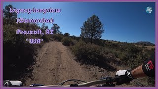
trail: Legacy
96 | | 1 comments
May 1, 2021 @ 5:13pm
May 1, 2021
trail: Moving Pictures
314 |
May 30, 2020 @ 2:38pm
May 30, 2020
trail: Moving Pictures
320 |
May 30, 2020 @ 2:38pm
May 30, 2020
trail: Longview Trail
117 |
Oct 31, 2015 @ 2:38pm
Oct 31, 2015
trail: Longview Trail
153 |
Oct 31, 2015 @ 2:37pm
Oct 31, 2015
trail: Longview Trail
123 |
Oct 31, 2015 @ 2:36pm
Oct 31, 2015Videos of Brownlow / Pioneer Park Mountain Bike

trail: Legacy
0:37 |
378 |
Nov 23, 2010
trail: Pct
5:29 |
213 |
Nov 2, 2020 , Prescott
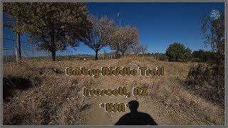
trail: Pioneer Trail
166 |
Sep 17, 2020 , Prescott
trail: Pioneer Trail
194 |
Sep 17, 2020 , Prescott

trail: Legacy
9:55 |
469 |
May 29, 2020 , Prescott

trail: Longview Trail
11:09 |
372 |
May 22, 2020 , Prescott
11:43 |
390 |
May 13, 2020 , Prescott
Recent Trail Reports
| status | trail | date | condition | info | user |
|---|---|---|---|---|---|
| Speed Chute | May 20, 2024 @ 3:14am 14 hours | Dry | jeff-blanton | ||
| Red-Green Switchbacks | May 20, 2024 @ 3:14am 14 hours | Dry | jeff-blanton | ||
| Upper Red Loop | May 20, 2024 @ 3:14am 14 hours | Dry | jeff-blanton | ||
| Legacy | May 20, 2024 @ 3:14am 14 hours | Dry | jeff-blanton | ||
| Legacy | May 20, 2024 @ 3:14am 14 hours | Dry | jeff-blanton | ||
| Pct | May 20, 2024 @ 3:14am 14 hours | Dry | jeff-blanton | ||
| Jacob's Ladder | May 20, 2024 @ 3:14am 14 hours | Dry | jeff-blanton | ||
| Pioneer Park | May 20, 2024 @ 3:14am 14 hours | Dry | jeff-blanton | ||
| Longview Trail | May 20, 2024 @ 3:14am 14 hours | Dry | jeff-blanton | ||
| Chris Cross | May 20, 2024 @ 3:14am 14 hours | Dry | jeff-blanton |
Activity Feed
| username | action | type | title | date |
|---|---|---|---|---|
| jeff-blanton | add | report | activity #52897933 and 13 more | May 20, 2024 @ 1:52pm 3 hours |
| Emccue | ridden | trail | activity #52668044 | May 15, 2024 @ 10:37pm May 15, 2024 |
| BradD3aIbk | wishlist | route | activity #52432812 | May 11, 2024 @ 12:21pm May 11, 2024 |
| racefitarizona | add | route | activity #52151234 | May 5, 2024 @ 8:54pm May 5, 2024 |
| rowbearto-Prescott | add | report | activity #52122126 and 8 more | May 5, 2024 @ 4:47am May 5, 2024 |
Recent Comments
| username | type | title | comment | date |
|---|---|---|---|---|
| report | Damage to Gunnery, Green Loop, Roller Coaster,... | Feb 26, 2024 @ 12:41pm Feb 26, 2024 | ||
| trail | Go to Wells Fargo | May 3, 2023 @ 10:16am May 3, 2023 | ||
| trail | Couple of wet areas in the AM.. other then... | Aug 10, 2022 @ 10:02am Aug 10, 2022 | ||
| trail | Fantastic flow in the downhill direction with... | Apr 12, 2021 @ 5:41pm Apr 12, 2021 | ||
| report | L | Apr 2, 2021 @ 10:26am Apr 2, 2021 |
Nearby Areas
| name | distance | ||||
|---|---|---|---|---|---|
| Constellation trails | 3 | 10 | 2.8 km | ||
| Granite Gardens | 1 | 3.3 km | |||
| Granite Dells | 6 | 5 | 13 | 8 | 3.4 km |
| Granite Basin | 8 | 22 | 3 | 3.7 km | |
| Storm Trails | 3 | 3 | 17 | 2 | 4.2 km |
Local Badges
-

Completionist11 awarded
Local Mountain Biking Directory
-
Prescott Mountain Bike Alliance
![Prescott Mountain Bike Alliance]()
-
Soul Ride
![Soul Ride]()
-
Chain Events
![Chain Events]()
-
Bikesmith Cycle & FitnessBike Shop
-
High Gear Bike ShopBike Shop
![High Gear Bike Shop]()
-
Ironclad BicyclesBike Shop
![Ironclad Bicycles]()
Local Products
Activity Type Stats
| activitytype | trails | distance | descent | descent distance | total vertical | rating | global rank | state rank | photos | reports | routes | ridelogs |
|---|---|---|---|---|---|---|---|---|---|---|---|---|
| Mountain Bike | 45 | 31 miles | 2,323 ft | 13 miles | 397 ft | #279 | #136 | 50 | 1,294 | 36 | 6,824 | |
| E-Bike | 26 | 18 miles | 1,224 ft | 8 miles | 397 ft | 2 | 1,273 | 1 | 115 | |||
| Horse | 4 | 2 miles | 125 ft | 3,760 ft | 203 ft | 109 | 2 | |||||
| Hike | 45 | 31 miles | 2,323 ft | 13 miles | 397 ft | #178 | #100 | 1,293 | 167 | |||
| Trail Running | 45 | 31 miles | 2,323 ft | 13 miles | 397 ft | #176 | #99 | 1,294 | 1 | 532 |
- By rwinkster PMBA & contributors
- Admins: PMBA, UMC-s, rowbearto-Prescott
- #10912 - 10,790 views
- brownlow / pioneer park activity log | embed map of Brownlow / Pioneer Park mountain bike trails | brownlow / pioneer park mountain biking points of interest
Downloading of trail gps tracks in kml & gpx formats is enabled for Brownlow / Pioneer Park.
You must login to download files.