close
-
Layers w
- Weather Layers
- Pro
- Pro
- Pro
- Pro
- Pro
- Pro
- More Layers
- Pro
- Pro
- Pro
- Pro
-
Upgrade to

3D
Trail Conditions
- Unknown
- Snow Groomed
- Snow Packed
- Snow Covered
- Snow Cover Partial
- Freeze/thaw Cycle
- Icy
- Prevalent Mud
- Wet
- Variable
- Ideal
- Dry
- Very Dry
Trail Flow (Ridden Direction)
Trailforks scans users ridelogs to determine the most popular direction each trail is ridden. A good flowing trail network will have most trails flowing in a single direction according to their intension.
The colour categories are based on what percentage of riders are riding a trail in its intended direction.
The colour categories are based on what percentage of riders are riding a trail in its intended direction.
- > 96%
- > 90%
- > 80%
- > 70%
- > 50%
- < 50%
- bi-directional trail
- no data
Trail Last Ridden
Trailforks scans ridelogs to determine the last time a trail was ridden.
- < 2 days
- < 1 week
- < 2 weeks
- < 1 month
- < 6 months
- > 6 months
Trail Ridden Direction
The intended direction a trail should be ridden.
- Downhill Only
- Downhill Primary
- Both Directions
- Uphill Primary
- Uphill Only
- One Direction
Contribute Details
Colors indicate trail is missing specified detail.
- Description
- Photos
- Description & Photos
- Videos
Trail Popularity ?
Trailforks scans ridelogs to determine which trails are ridden the most in the last 9 months.
Trails are compared with nearby trails in the same city region with a possible 25 colour shades.
Think of this as a heatmap, more rides = more kinetic energy = warmer colors.
- most popular
- popular
- less popular
- not popular
ATV/ORV/OHV Filter
Max Vehicle Width
inches
US Cell Coverage
Legend

Radar Time
Activity Recordings
Trailforks uses anonymized public activity data.
?
Activity Recordings
Trailforks uses anonymized public activity data.
?
Personal Heatmap
▶
Activity Types
all
/
none
▶
Options
2
Date range
month
–
Winter Trails
Warning
A routing network for winter maps does not exist. Selecting trails using the winter trails layer has been disabled.
Missing Trails
Most Popular
Least Popular
Trails are colored based on popularity. The more popular a trail is, the more red. Less popular trails trend towards green.
Jump Magnitude Heatmap
Heatmap of where riders jump on trails. Zoom in to see individual jumps, click circles to view jump details.
BC Backroad Status
![map legend]()
Service Road Atlas is a free to use, community-driven service for viewing and creating reports on the numerous back-country service roads around B.C. and Alberta.

Slope Aspect
Direction the slope faces
Trails Deemphasized
Trails are shown in grey.
Only show trails with no bike usage.
Suggested Layers
Based on selected activity type
Save the current map location and zoom level as your default home location whenever this page is loaded.
Save
No description for Cable has been added yet!
Login or register to submit one.

IMBA Ride Center
Chequamegon Area
Activities Click to view
- Mountain Bike
71 trails
- E-Bike
36 trails
- Gravel Bike
0 trails
- Adaptive Bike
0 trails
- Winter Fat Bike
0 trails
- Hike
47 trails
- Trail Running
47 trails
- Snowmobile
2 trails
- Snowshoe
35 trails
- Nordic Ski
34 trails
Region Details
- 23
- 16
- 16
- 12
- 1
Region Status
Caution as of 12 hoursLocal Trail Association
Stats
- Avg Trail Rating
- Trails (view details)
- 93
- Trails Mountain Bike
- 71
- Trails E-Bike
- 36
- Trails Horse
- 1
- Trails Hike
- 47
- Trails Trail Running
- 47
- Trails Dirtbike/Moto
- 2
- Trails ATV/ORV/OHV
- 2
- Trails Snowmobile
- 2
- Trails Snowshoe
- 35
- Trails Nordic Ski
- 34
- Total Distance
- 155 miles
- Total Descent Distance
- 63 miles
- Total Descent
- 9,113 ft
- Total Vertical
- 481 ft
- Highest Trailhead
- 1,704 ft
- Reports
- 1,473
- Photos
- 353
- Ridden Counter
- 15,685
Sub Regions
-
CAMBA Cable Cluster
- 1
- 4
- 5
-
CAMBA Namakagon Cluster
- 8
- 3
- 3
- 1
-
Mt. Telemark Village
- 6
- 9
- 4
Popular Cable Mountain Biking Trails
• 80 ★ 5.0 • 2 miles • 258 ft • 504 •
Highly rated popular blue difficulty singletrack. This mountain bike primary trail can be used both directions and has a moderate overall physical rating with a 258 ft blue climb. Winter use: Backcountry snow grooming. Trail visibility is always easy to follow. On average it takes 14 minutes to complete this trail.
• 100 ★ 4.2 • 1 mile • 14 ft • 461 •
Intermediate XC style connector trail from to the top of Telemark Mt.
• 100 ★ 5.0 • 4,147 ft • 179 ft • 426 •
This is the climbing route to get up to the first hub on the mountain and to the front side gravity trails.
• 90 ★ 4.7 • 2 miles • 183 ft • 398 •
A blue, bike park style trail. Mild climb, wide and smooth at the top and middle sections. On the down, everything has a ride around. Optional table tops, one medium sized drop that is rollable but requires full trail speed if you want...
• 90 ★ 3.7 • 3,015 ft • 0 ft • 336 •
Green flowwy downhill traill. All features are rollable, no mandatory jumps.
• 95 ★ 5.0 • 3,399 ft • 0 ft • 305 •
Blue Intermediate downhill only trail. Many jumps and huge berms. All jumps have a ride around or can be rolled. But still, Ride, Re-ride, Freeride recommended.
• 80 ★ 5.0 • 3 miles • 181 ft • 296 •
Popular blue difficulty doubletrack. This multi-use trail can be used both directions and has a easy overall physical rating with a 181 ft green climb. Winter use: Backcountry snow grooming. Trail visibility is always easy to follow. On average it takes 12 minutes to complete this trail.
Cable Mountain Bike Routes
★ 4.0 • 27 miles • 1,048 ft • 8 •
8 miles • 239 ft • 1 • Loop •
This is the route of CAMBA's 2024 Festival of Trails Revival. 4 Stamps will be hidden along this route...
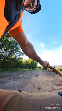
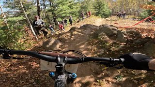
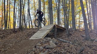
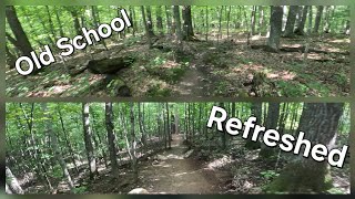
Photos of Cable Mountain Bike
Videos of Cable Mountain Bike
trail: JUMPTIMUS PRIME
0:10 |
74 |
Oct 17, 2023

trail: Ojibwe
6:05 |
80 |
May 3, 2026 , Cable

trail: STORMOEN
10:40 |
79 |
Nov 10, 2025 , Cable
trail: RENDAL
10:40 |
62 |
Nov 10, 2025 , Cable

trail: CHARLIE GIRL
10:40 |
67 |
Nov 10, 2025 , Cable

trail: OH-G's
10:40 |
70 |
Nov 10, 2025 , Cable
trail: Ojibwe
0:32 |
55 |
Oct 13, 2025 , Cable
trail: Ojibwe
9:35 |
64 |
Sep 21, 2025 , Cable
Current Trail Warnings
| status | trail | date | condition | user | info |
|---|---|---|---|---|---|
| Namakagon Trail | Jun 20, 2026 @ 4:33pm (America/Chicago) 12 hours | Unknown | MPBorman | 12” diameter tree down at end of... |
Recent Trail Reports
| status | trail | date | condition | info | user |
|---|---|---|---|---|---|
| Dirt Candy | Jun 20, 2026 @ 2:43pm (America/Chicago) 14 hours | Unknown | MPBorman | ||
| WISENUP | Jun 18, 2026 @ 3:44pm (America/Chicago) 3 days | Ideal | teleturn2 | ||
| Valkyrie | Jun 18, 2026 @ 3:44pm (America/Chicago) 3 days | Ideal | teleturn2 | ||
| Valhalla | Jun 18, 2026 @ 3:44pm (America/Chicago) 3 days | Ideal | teleturn2 | ||
| Tapley | Jun 18, 2026 @ 3:44pm (America/Chicago) 3 days | Ideal | teleturn2 | ||
| STORMOEN | Jun 18, 2026 @ 3:44pm (America/Chicago) 3 days | Ideal | teleturn2 | ||
| School's Out | Jun 18, 2026 @ 3:44pm (America/Chicago) 3 days | Ideal | teleturn2 | ||
| Rumble Bee | Jun 18, 2026 @ 3:44pm (America/Chicago) 3 days | Ideal | teleturn2 | ||
| RENDAL | Jun 18, 2026 @ 3:44pm (America/Chicago) 3 days | Ideal | teleturn2 | ||
| Recess | Jun 18, 2026 @ 3:44pm (America/Chicago) 3 days | Ideal | teleturn2 |
Activity Feed
| username | action | type | title | date |
|---|---|---|---|---|
| MPBorman | add | report | activity #97424236 and 1 more | Jun 20, 2026 @ 12:43pm 14 hours |
| MPBorman | add | report | activity #97424082 and 1 more | Jun 20, 2026 @ 12:42pm 14 hours |
| teleturn2 | add | report | activity #97274050 and 20 more | Jun 18, 2026 @ 1:44pm 3 days |
| StevegduXJr | ridden | trail | activity #97053503 | Jun 15, 2026 @ 11:02am Jun 15, 2026 |
| hibby11 | vote | trail | activity #96888447 | Jun 13, 2026 @ 9:38am Jun 13, 2026 |
Recent Comments
| username | type | title | comment | date |
|---|---|---|---|---|
| trail | A great fun trail with really neat berms,... | Jun 8, 2026 @ 11:16am Jun 8, 2026 | ||
| report | Danky Dank west end is cleared, C12 to N38... | May 11, 2026 @ 4:04pm May 11, 2026 | ||
| report | The downed logs were cleared today. Esker is... | May 11, 2026 @ 4:01pm May 11, 2026 | ||
| trail | You took the words out of my mouth. Not... | May 3, 2026 @ 2:52pm May 3, 2026 | ||
| trail | CAMBA has wrecked another classic handout... | Aug 24, 2025 @ 4:01pm Aug 24, 2025 |
Local Badges
-

Completionist0 awarded -

10 Black Trails22 awarded -

10 Blue Trails120 awarded -

10 Green Trails52 awarded -

Epic Mountain Bike Climb 2k17 awarded -

Climbing 10k Badge21 awarded
Bike & Skill Parks
| name | type | city | rating |
|---|---|---|---|
| Cable Bike Park | skill park | Cable |
Upcoming Local Events
Activity Type Stats
| activitytype | trails | distance | descent | descent distance | total vertical | rating | global rank | state rank | photos | reports | routes | ridelogs |
|---|---|---|---|---|---|---|---|---|---|---|---|---|
| Mountain Bike | 71 | 134 miles | 7,572 ft | 55 miles | 482 ft | #1,208 | #469 | 322 | 1,474 | 21 | 12,832 | |
| E-Bike | 36 | 78 miles | 4,327 ft | 34 miles | 482 ft | #2,298 | #972 | 603 | 2 | 316 | ||
| Horse | 1 | 3 miles | 66 ft | 5,108 ft | 43 ft | 108 | 7 | |||||
| Hike | 47 | 112 miles | 5,568 ft | 45 miles | 443 ft | #2,560 | #1,001 | 8 | 1,372 | 2 | 558 | |
| Trail Running | 47 | 112 miles | 5,568 ft | 45 miles | 443 ft | #2,088 | #666 | 1 | 1,372 | 3 | 189 | |
| Dirtbike/Moto | 2 | 12 miles | 489 ft | 5 miles | 249 ft | 96 | ||||||
| ATV/ORV/OHV | 2 | 12 miles | 489 ft | 5 miles | 249 ft | 14 | 92 | 6 | ||||
| Snowmobile | 2 | 12 miles | 489 ft | 5 miles | 249 ft | #236 | #111 | 1 | 2 | |||
| Snowshoe | 35 | 65 miles | 3,484 ft | 24 miles | 282 ft | #329 | #86 | 2 | 345 | 110 | ||
| Nordic Ski | 34 | 78 miles | 4,705 ft | 29 miles | 305 ft | #301 | #82 | 171 | 1 | 1,230 |
Frequently Asked Questions About Cable
▼
What are the best places to ride in Cable?
Cable has 4 areas to explore for mountain biking. The top rated areas are:
▼
What are the highest rated mountain biking trails in Cable?
The highest rated mountain biking trails in Cable are:
- Dirt Candy (4.5/5)
- STORMOEN (4.4/5)
- EVENFLOW (4.3/5)
- JUMPTIMUS PRIME (4.2/5)
- KRUSEN (4.2/5)
▼
What is the best time of the year to ride in Cable?
Based on ride log data, the most popular months to ride in Cable are:
- September (192 activities)
- July (149 activities)
- August (103 activities)
▼
Where can I park to ride in Cable?
There are 11 parking locations listed in Cable. The most popular parking spots are: View all parking and trailhead locations on the map to plan your visit.
Activities
Trails
- By brenthillier
 NSMBA TRAILFORKS & contributors
 - Admins: Birkie, jvfish1, CAMBA, CORBA
- #3574 - 16,787 views
- cable activity log | embed map of Cable mountain bike trails | cable mountain biking points of interest polygons
Downloading of trail gps tracks in kml & gpx formats is enabled for Cable.
You must login to download files.