close
-
Layers w
- Weather Layers
- Pro
- Pro
- Pro
- Pro
- Pro
- Pro
- More Layers
- Pro
- Pro
- Pro
- Pro
-
Upgrade to

3D
Trail Conditions
- Unknown
- Snow Groomed
- Snow Packed
- Snow Covered
- Snow Cover Partial
- Freeze/thaw Cycle
- Icy
- Prevalent Mud
- Wet
- Variable
- Ideal
- Dry
- Very Dry
Trail Flow (Ridden Direction)
Trailforks scans users ridelogs to determine the most popular direction each trail is ridden. A good flowing trail network will have most trails flowing in a single direction according to their intension.
The colour categories are based on what percentage of riders are riding a trail in its intended direction.
The colour categories are based on what percentage of riders are riding a trail in its intended direction.
- > 96%
- > 90%
- > 80%
- > 70%
- > 50%
- < 50%
- bi-directional trail
- no data
Trail Last Ridden
Trailforks scans ridelogs to determine the last time a trail was ridden.
- < 2 days
- < 1 week
- < 2 weeks
- < 1 month
- < 6 months
- > 6 months
Trail Ridden Direction
The intended direction a trail should be ridden.
- Downhill Only
- Downhill Primary
- Both Directions
- Uphill Primary
- Uphill Only
- One Direction
Contribute Details
Colors indicate trail is missing specified detail.
- Description
- Photos
- Description & Photos
- Videos
Trail Popularity ?
Trailforks scans ridelogs to determine which trails are ridden the most in the last 9 months.
Trails are compared with nearby trails in the same city region with a possible 25 colour shades.
Think of this as a heatmap, more rides = more kinetic energy = warmer colors.
- most popular
- popular
- less popular
- not popular
ATV/ORV/OHV Filter
Max Vehicle Width
inches
US Cell Coverage
Legend

Radar Time
Activity Recordings
Trailforks uses anonymized public activity data.
?
Activity Recordings
Trailforks uses anonymized public activity data.
?
Personal Heatmap
▶
Activity Types
all
/
none
▶
Options
2
Date range
month
–
Winter Trails
Warning
A routing network for winter maps does not exist. Selecting trails using the winter trails layer has been disabled.
Missing Trails
Most Popular
Least Popular
Trails are colored based on popularity. The more popular a trail is, the more red. Less popular trails trend towards green.
Jump Magnitude Heatmap
Heatmap of where riders jump on trails. Zoom in to see individual jumps, click circles to view jump details.
BC Backroad Status
![map legend]()
Service Road Atlas is a free to use, community-driven service for viewing and creating reports on the numerous back-country service roads around B.C. and Alberta.

Slope Aspect
Direction the slope faces
Trails Deemphasized
Trails are shown in grey.
Only show trails with no bike usage.
Suggested Layers
Based on selected activity type
Save the current map location and zoom level as your default home location whenever this page is loaded.
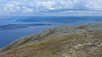
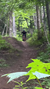
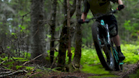
SaveOnce described as alpine trails and flow, with sea-level accessibility. The West Coast of Newfoundland is riddled with spectacular scenery and exceptional trail riding. These hidden gems are ideal for a lunchtime spin, or longer backcountry adventure — whichever you need to clear your mind and purge your soul.
Activities Click to view
- Mountain Bike
179 trails
- E-Bike
80 trails
- Gravel Bike
2 trails
- Adaptive Bike
1 trails
- Winter Fat Bike
1 trails
- Horse
43 trails
- Hike
162 trails
- Trail Running
161 trails
- Dirtbike/Moto
87 trails
- ATV/ORV/OHV
54 trails
- Snowmobile
48 trails
- Snowshoe
85 trails
- Downhill Ski
57 trails
- Backcountry Ski
15 trails
- Nordic Ski
39 trails
Region Details
- 52
- 1
- 66
- 47
- 8
- 4
Region Status
Open as of 1 hoursStats
- Avg Trail Rating
- Trails (view details)
- 272
- Trails Mountain Bike
- 179
- Trails E-Bike
- 80
- Trails Gravel Bike
- 2
- Trails Adaptive Bike
- 2
- Trails Winter Fat Bike
- 1
- Trails Horse
- 43
- Trails Hike
- 162
- Trails Trail Running
- 161
- Trails Dirtbike/Moto
- 87
- Trails Observed Trials
- 2
- Trails ATV/ORV/OHV
- 54
- Trails Snowmobile
- 48
- Trails Snowshoe
- 85
- Trails Downhill Ski
- 58
- Trails Backcountry Ski
- 15
- Trails Nordic Ski
- 39
- Total Distance
- 334 miles
- Total Descent
- 55,731 ft
- Total Vertical
- 2,102 ft
- Highest Trailhead
- 2,109 ft
- Reports
- 615
- Photos
- 476
- Ridden Counter
- 13,031
Articles
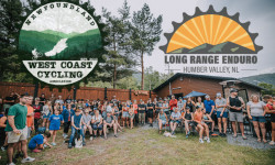
Long Range Enduro Announces 2025 Event Details
Mar 19, 2025 from pinkbike.com
Prior to 2022, the LRE was part of the St. John's Enduro series until it grew large enough to stand on its own.
Sub Regions
-
Corner Brook Gorge
- 2
- 5
- 2
-
Cub Mountain
- 13
- 17
- 2
- 1
-
Duncan's Gulch
- 2
- 2
- 1
- 2
-
Lady Slipper
- 4
- 11
- 2
-
Prince Edward Park
Popular Corner Brook Mountain Biking Trails
• 100 ★ 4.4 • 2,343 ft • 0 ft • 217 •
Popular blue difficulty singletrack. This mountain bike primary trail and has a easy overall physical rating with a 0 ft blue climb. It features drop and jump. Trail visibility is always easy to follow. On average it takes 9 minutes to complete this trail.
• 100 ★ 4.5 • 1,713 ft • 0 ft • 217 •
The trail is composed of some pretty flowy berms and hard pack singletrack. It's a short but pretty awesome descent and can be ridden bidirectionally to complete the entire network which totals about 6km.
• 90 ★ 4.1 • 1 mile • 128 ft • 202 •
is a biking-primary multi-use trail designed for the beginner to advanced rider. The trail has several narrow sections and steep switchbacks near the end that can make a challenging climb for the beginner rider.
• 90 ★ 4.4 • 1,873 ft • 3 ft • 188 •
Popular blue difficulty singletrack. This mountain bike primary trail and has a moderate overall physical rating with a 3 ft blue climb. On average it takes 3 minutes to complete this trail.
• 95 ★ 3.8 • 1,424 ft • 0 ft • 170 •
Short single track to the water supply.
• 90 ★ 4.9 • 2 miles • 483 ft • 161 •
is a steady climb to the top over some pretty awesome single track. The descent is fast with a couple small jumps and some pretty flowy berms and singletrack.
• 95 ★ 4.9 • 1 mile • 30 ft • 158 •
is a new downhill mountain bike trail that passes through Duncan's Gulch. It starts at the transmission line, and enters Duncan's Gulch through a series of tight switchbacks and out through some old growth forest. The trail has several...
Corner Brook Mountain Bike Routes
7 miles • 1,122 ft • 4 •
Ready to see what the West Coast Cycling Association has been building? Come explore the route for our...
23 miles • 4,512 ft • 13 • Loop •
Looking to bag a big one in Humber Valley? This spicy local classic hits all six major descents in the...
40 miles • 5,310 ft • 34 •
The longest ride on the longest day! This ride aims to tackle all of the trails within the Corner Brook...
★ 5.0 • 16 miles • 2,157 ft • 10 • Race •
This race course represents the Long Range Enduro (LRE) 2025 Sport event. The race route is as follows:...
20 miles • 3,208 ft • 13 • Race •
This race course represents the Long Range Enduro (LRE) 2025 Expert event. The race route is as follows:...
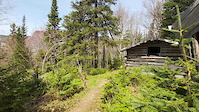
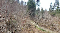
Photos of Corner Brook Mountain Bike
Videos of Corner Brook Mountain Bike
trail: Moose Knuckle
0:12 |
307 |
Jun 7, 2022
trail: Moose Knuckle
0:15 |
213 |
Jun 7, 2022
trail: Coppermine DH
0:18 |
70 |
Jun 7, 2022
trail: Goldmine
0:06 |
272 |
Jun 7, 2022
trail: Ginger Route
0:09 |
162 |
Jun 7, 2022
trail: Axemate
0:21 |
622 |
Apr 21, 2022
trail: Mercury Hill
0:47 |
165 |
Sep 10, 2020
trail: Goldmine
3:49 |
532 |
Jul 9, 2018
Current Trail Warnings
| status | trail | date | condition | user | info |
|---|---|---|---|---|---|
| Goldmine | Jun 17, 2026 @ 8:50am (America/St_Johns) 1 hours | Dry | DruKennedy | Wind fall down on the lower section of... | |
| Mercury Hill | May 28, 2026 @ 4:16pm (America/Miquelon) May 28, 2026 | Snow Cover Partial | Josho91 | ||
| Mudslide | May 28, 2026 @ 4:16pm (America/Miquelon) May 28, 2026 | Snow Cover Partial | Josho91 |
Recent Trail Reports
| status | trail | date | condition | info | user |
|---|---|---|---|---|---|
| Where It All Began | May 28, 2026 @ 4:16pm (America/Miquelon) May 28, 2026 | Variable | Josho91 | ||
| Powerline | May 28, 2026 @ 4:16pm (America/Miquelon) May 28, 2026 | Wet | Josho91 | ||
| Sub-station road | May 28, 2026 @ 4:16pm (America/Miquelon) May 28, 2026 | Dry | Josho91 | ||
| The Way She Goes | May 24, 2026 @ 2:55pm (America/St_Johns) May 24, 2026 | Dry | grandynl | ||
| TNT | May 23, 2026 @ 9:27am (America/Miquelon) May 23, 2026 | Snow Cover Partial | krashleigh | ||
| White Lakes | May 23, 2026 @ 9:27am (America/Miquelon) May 23, 2026 | Snow Cover Partial | krashleigh | ||
| That | May 23, 2026 @ 9:27am (America/Miquelon) May 23, 2026 | Snow Cover Partial | krashleigh | ||
| Prince Edward Park Loop | May 9, 2026 @ 3:22pm (America/St_Johns) May 9, 2026 | Dry | grandynl | ||
| Doug's Trail | May 9, 2026 @ 3:00pm (America/St_Johns) May 9, 2026 | Variable | grandynl | ||
| Connector Trail | Mar 6, 2026 @ 2:54pm (America/St_Johns) Mar 6, 2026 | Unknown | viewsofjdr WCCA |
Activity Feed
| username | action | type | title | date |
|---|---|---|---|---|
| DruKennedy | add | report | activity #97173308 | Jun 17, 2026 @ 4:20am 1 hours |
| brodythebiker77 | ridden | trail | activity #97135969 and 1 more | Jun 16, 2026 @ 1:49pm 16 hours |
| brodythebiker77 | ridden | trail | activity #97135937 and 1 more | Jun 16, 2026 @ 1:49pm 16 hours |
| scote23 | wishlist | route | activity #97050038 | Jun 15, 2026 @ 10:13am 2 days |
| sawyerthebiker | ridden | trail | activity #96528973 | Jun 8, 2026 @ 3:42am Jun 8, 2026 |
Recent Comments
| username | type | title | comment | date |
|---|---|---|---|---|
| trail | You have to hike a bike through cutovers to... | Mar 18, 2026 @ 3:05pm Mar 18, 2026 | ||
| trail | I’m excited for black draft it will be... | Mar 18, 2026 @ 2:56pm Mar 18, 2026 | ||
| trail | This trail should not be rated as a blue, as... | Jul 29, 2025 @ 5:41pm Jul 29, 2025 | ||
| report | 2 days ago... genuinely wondering how many... | Jul 17, 2025 @ 8:30am Jul 17, 2025 | ||
| report | These reports are essentially identical to... | Jul 17, 2025 @ 8:29am Jul 17, 2025 |
Local Badges
-

10 Green Trails72 awarded -

10 Blue Trails127 awarded -

Epic Ride Climb 2k37 awarded -

Climbing 10k Badge57 awarded -

Climbing 100k Badge6 awarded -

Epic Ride Descent 2k46 awarded
Bike & Skill Parks
| name | type | city | rating |
|---|---|---|---|
| The Bowl | skill park | Corner Brook |
Local Trail Supporters
![]()
![]()
- Doug Miller
Activity Type Stats
| activitytype | trails | distance | descent | descent distance | total vertical | rating | global rank | state rank | photos | reports | routes | ridelogs |
|---|---|---|---|---|---|---|---|---|---|---|---|---|
| Mountain Bike | 179 | 269 miles | 33,789 ft | 136 miles | 2,093 ft | #567 | #2 | 413 | 609 | 13 | 16,968 | |
| E-Bike | 80 | 175 miles | 18,914 ft | 88 miles | 1,512 ft | #760 | #4 | 400 | 5 | 520 | ||
| Gravel Bike | 2 | #349 | #5 | 4 | 1 | 30 | ||||||
| Adaptive Bike | 1 | #271 | #10 | 1 | ||||||||
| Winter Fat Bike | 1 | #213 | #8 | 3 | 3 | |||||||
| Horse | 43 | 178 miles | 18,287 ft | 92 miles | 1,572 ft | #145 | #1 | 115 | ||||
| Hike | 162 | 271 miles | 33,507 ft | 133 miles | 2,103 ft | #435 | #1 | 33 | 533 | 4 | 1,685 | |
| Trail Running | 161 | 270 miles | 33,438 ft | 133 miles | 2,103 ft | #436 | #1 | 2 | 526 | 7 | 1,804 | |
| Dirtbike/Moto | 87 | 237 miles | 24,905 ft | 119 miles | 1,572 ft | #60 | #1 | 12 | 129 | 96 | ||
| Observed Trials | 2 | 13 miles | 1,302 ft | 5 miles | 961 ft | 7 | 1 | |||||
| ATV/ORV/OHV | 54 | 210 miles | 22,379 ft | 108 miles | 1,572 ft | #43 | #1 | 120 | 20 | |||
| Snowmobile | 48 | 205 miles | 21,339 ft | 106 miles | 1,572 ft | #26 | #3 | 18 | 15 | |||
| Snowshoe | 85 | 223 miles | 22,982 ft | 108 miles | 1,581 ft | #34 | #1 | 27 | 2 | 527 | ||
| Downhill Ski | 57 | 21 miles | 15,341 ft | 18 miles | 1,470 ft | #281 | #1 | 5 | 681 | |||
| Backcountry Ski | 15 | 52 miles | 5,203 ft | 24 miles | 1,115 ft | #315 | #1 | 8 | 226 | |||
| Nordic Ski | 39 | 64 miles | 5,594 ft | 36 miles | 1,194 ft | #174 | #1 | 5 | 4 | 2,352 |
Frequently Asked Questions About Corner Brook
▼
What are the best places to ride in Corner Brook?
Corner Brook has 7 areas to explore for mountain biking. The top rated areas are:
▼
What are the highest rated mountain biking trails in Corner Brook?
The highest rated mountain biking trails in Corner Brook are:
- Goldmine (4.7/5)
- Moose Knuckle (4.6/5)
- Curry Climb (4.5/5)
- Axemate (4.4/5)
- Duncan's Multi-Directional Trail (4.4/5)
▼
What is the best time of the year to ride in Corner Brook?
Based on ride log data, the most popular months to ride in Corner Brook are:
- July (99 activities)
- June (76 activities)
- August (67 activities)
▼
Where can I park to ride in Corner Brook?
There are 25 parking locations listed in Corner Brook. The most popular parking spots are:
- Burned Out House
- Tippings Pond Parking
- T'Railway Parking
- Parking Area
- Corner Brook Stream Trail Network Parking Lot
Activities
- Corner Brook Mountain Biking Trails
- Corner Brook E-Biking Trails
- Corner Brook Horseback Trails
- Corner Brook Hiking Trails
- Corner Brook Trail Running Trails
- Corner Brook Dirtbiking Trails
- Corner Brook ATVing/Offroading Trails
- Corner Brook Snowmobiling Trails
- Corner Brook Snowshoeing Trails
- Corner Brook Skiing Trails
- Corner Brook Backcountry Skiing Trails
- Corner Brook Nordic Skiing Trails
Trails
Points of Interest
- By adrianricketts
 & contributors
 - Admins: adrianricketts, wbruce, WCCA
- #5600 - 36,098 views
- corner brook activity log | embed map of Corner Brook mountain bike trails | corner brook mountain biking points of interest
Downloading of trail gps tracks in kml & gpx formats is enabled for Corner Brook.
You must login to download files.