close
-
Layers w
- Weather Layers
- Pro
- Pro
- Pro
- Pro
- Pro
- Pro
- More Layers
- Pro
- Pro
- Pro
- Pro
-
Upgrade to

3D
Trail Conditions
- Unknown
- Snow Groomed
- Snow Packed
- Snow Covered
- Snow Cover Partial
- Freeze/thaw Cycle
- Icy
- Prevalent Mud
- Wet
- Variable
- Ideal
- Dry
- Very Dry
Trail Flow (Ridden Direction)
Trailforks scans users ridelogs to determine the most popular direction each trail is ridden. A good flowing trail network will have most trails flowing in a single direction according to their intension.
The colour categories are based on what percentage of riders are riding a trail in its intended direction.
The colour categories are based on what percentage of riders are riding a trail in its intended direction.
- > 96%
- > 90%
- > 80%
- > 70%
- > 50%
- < 50%
- bi-directional trail
- no data
Trail Last Ridden
Trailforks scans ridelogs to determine the last time a trail was ridden.
- < 2 days
- < 1 week
- < 2 weeks
- < 1 month
- < 6 months
- > 6 months
Trail Ridden Direction
The intended direction a trail should be ridden.
- Downhill Only
- Downhill Primary
- Both Directions
- Uphill Primary
- Uphill Only
- One Direction
Contribute Details
Colors indicate trail is missing specified detail.
- Description
- Photos
- Description & Photos
- Videos
Trail Popularity ?
Trailforks scans ridelogs to determine which trails are ridden the most in the last 9 months.
Trails are compared with nearby trails in the same city region with a possible 25 colour shades.
Think of this as a heatmap, more rides = more kinetic energy = warmer colors.
- most popular
- popular
- less popular
- not popular
ATV/ORV/OHV Filter
Max Vehicle Width
inches
US Cell Coverage
Legend

Radar Time
Activity Recordings
Trailforks uses anonymized public activity data.
?
Activity Recordings
Trailforks uses anonymized public activity data.
?
Personal Heatmap
▶
Activity Types
all
/
none
▶
Options
2
Date range
month
–
Winter Trails
Warning
A routing network for winter maps does not exist. Selecting trails using the winter trails layer has been disabled.
Missing Trails
Most Popular
Least Popular
Trails are colored based on popularity. The more popular a trail is, the more red. Less popular trails trend towards green.
Jump Magnitude Heatmap
Heatmap of where riders jump on trails. Zoom in to see individual jumps, click circles to view jump details.
BC Backroad Status
![map legend]()
Service Road Atlas is a free to use, community-driven service for viewing and creating reports on the numerous back-country service roads around B.C. and Alberta.

Slope Aspect
Direction the slope faces
Trails Deemphasized
Trails are shown in grey.
Only show trails with no bike usage.
Suggested Layers
Based on selected activity type
Save the current map location and zoom level as your default home location whenever this page is loaded.
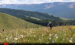
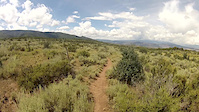
SaveFeeling like a million bucks is easy on Eagle’s world-class mountain bike trails Our trail system is unique, with over 100 miles of singletrack mountain biking. Built with all levels of riders in mind, your journey will take you over a variety of winding singletrack through high desert, aspen groves and dense, fragrant evergreen forests. Being the banana belt of the Rockies has its advantage too. Our town-owned open space trails are open April 15-December 15 every year, yielding about 4 more months of riding then our mountain town neighbors. BLM trails such as Boneyard, Redneck Ridge and the first 2 loops of the Haymaker Trail stay open year-round. The descent of Pool & Ice rink is closed but lower pool and ice rink is open up to the BLM Gate.
Eagle is located directly off I-70, so staying and riding with us is easy and affordable!
Eagle is located directly off I-70, so staying and riding with us is easy and affordable!
Links
Activities Click to view
- Mountain Bike
108 trails
- E-Bike
44 trails
- Gravel Bike
0 trails
- Adaptive Bike
0 trails
- Horse
70 trails
- Hike
129 trails
- Trail Running
129 trails
- Dirtbike/Moto
39 trails
- Observed Trials
2 trails
- ATV/ORV/OHV
17 trails
- Snowmobile
4 trails
- Snowshoe
12 trails
- Backcountry Ski
6 trails
- Nordic Ski
7 trails
Region Details
- 33
- 5
- 11
- 35
- 17
- 1
Region Status
Open as of Jun 2, 2026Stats
- Avg Trail Rating
- Trails (view details)
- 113
- Trails Mountain Bike
- 115
- Trails E-Bike
- 44
- Trails Horse
- 70
- Trails Hike
- 129
- Trails Trail Running
- 129
- Trails Dirtbike/Moto
- 39
- Trails Observed Trials
- 2
- Trails ATV/ORV/OHV
- 17
- Trails Snowmobile
- 4
- Trails Snowshoe
- 12
- Trails Downhill Ski
- 2
- Trails Backcountry Ski
- 6
- Trails Nordic Ski
- 7
- Total Distance
- 282 miles
- Total Descent
- 45,608 ft
- Total Vertical
- 5,851 ft
- Highest Trailhead
- 12,024 ft
- Reports
- 3,146
- Photos
- 526
- Ridden Counter
- 27,630
Articles
Race Report: A Backcountry Epic in Eagle for the Revolution Enduro Round 3
Aug 6, 2019 from pinkbike.com
Racers were served four stages of fun, fast, and rowdy trail selections that delivered stoke and high-fives for the new race venue
Sub Regions
-
Eagle Ranch
- 2
- 9
-
East Eagle
- 3
- 6
- 2
-
South Eagle
-
West Eagle
- 1
- 4
- 17
- 9
- 1
Popular Eagle Mountain Biking Trails
• 95 ★ 4.3 • 3 miles • 960 ft • 1,297 •
Highly rated popular blue difficulty singletrack. This mountain bike primary trail can be used uphill primary and has a moderate overall physical rating with a 960 ft blue climb. It features rock garden. Trail visibility is always easy to follow. On average it takes 36 minutes to complete this trail.
• 95 ★ 4.3 • 3 miles • 111 ft • 1,255 •
Fun non-tech machined corkscrewy bermed generally downhill trail down a steep ridge. Definitely worth the climb up. Rolls a bit at the bottom over to its namesake complex (where there's a really nice bike park btw). Some have described...
• 90 ★ 4.0 • 3 miles • 391 ft • 651 •
Haymaker starts at the base of some chalky hills near the local bmx race track and pool & ice rink. The trail heads east to the back side of the hills, then gradually climbs upwards. Once you reach the top, the trail descends...
• 80 ★ 4.5 • 1 mile • 0 ft • 572 •
Branch off connector from to World's Greatest. A fast straight away with mild turns. It's not advised to climb this trail. It's a very fast down hill with blind turns and head on accidents have happened a number of times. Please use...
• 80 ★ 4.4 • 2 miles • 29 ft • 524 •
A super fun, fast descent. Expect more rock and chunk compared to most of the trails in Eagle. *Closed to bikes Dec 1 - Apr 15 each year to protect deer/elk populations
• 95 ★ 4.3 • 4,698 ft • 21 ft • 510 •
A small loop next to Haymaker. The trail is hard pack and has lots of big rollers. One sizable drop but is easily ridden without airtime. The is closed to all users Dec 1 - Apr 15 each year to protect deer/elk populations
Eagle Mountain Bike Routes
★ 4.0 • 7 miles • 1,099 ft • 2 •
Singletrack Up, Pool & Ice Down is a classic Eagle Ride. Dries fast after rain
★ 4.5 • 9 miles • 1,436 ft • 9 • Point to Point •
A new mostly lower elevation loop that includes our brand new 2017 trail, the LOV Connection, that...
★ 5.0 • 5 miles • 741 ft • 6 • Point to Point •
Try out the brand new Trail. This Route takes you from the Arroyo Drive Parking Lot trailhead, up , across...
★ 5.0 • 9 miles • 1,422 ft • 7 • Point to Point •
Start/End trailhead off of Abrams Road and Lone Spur Cul-de-sac. to & , then back down
Photos of Eagle Mountain Bike
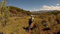
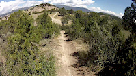
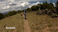
Videos of Eagle Mountain Bike
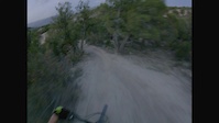
trail: Worlds Greatest
0:48 |
104 |
Sep 30, 2021
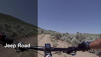
trail: Jeep Road
2:22 |
37 |
Oct 15, 2017
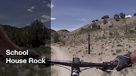
trail: School House Rock
2:13 |
91 |
Oct 15, 2017
trail: Haymaker (1st & 2nd Loops)
0:17 |
100 |
Oct 15, 2017
trail: Wolverton Spring
0:09 |
55 |
Oct 15, 2017
trail: Tick Alley
0:10 |
106 |
Oct 15, 2017
trail: Abrams Gulch Connector
0:11 |
57 |
Oct 15, 2017
trail: Itch
0:04 |
35 |
Oct 15, 2017
Current Trail Warnings
| status | trail | date | condition | user | info |
|---|---|---|---|---|---|
| Sawmill | May 16, 2026 @ 2:19pm (America/Denver) May 16, 2026 | Snow Cover Partial | poleczechy | Two tree down along the traverse, and one... | |
| 3 Sisters | May 14, 2026 @ 5:33pm (America/Denver) May 14, 2026 | Dry | Austinmacey | still closed do not enter there are... |
Recent Trail Reports
| status | trail | date | condition | info | user |
|---|---|---|---|---|---|
| Abrams Gulch Connector | Jun 2, 2026 @ 3:27pm (America/Denver) Jun 2, 2026 | Very Dry | maynardco | ||
| LOV Connection | Jun 2, 2026 @ 3:27pm (America/Denver) Jun 2, 2026 | Very Dry | maynardco | ||
| Turniphead | May 31, 2026 @ 10:15am (America/Denver) May 31, 2026 | Dry | maynardco | ||
| Riddle | May 31, 2026 @ 10:15am (America/Denver) May 31, 2026 | Very Dry | maynardco | ||
| Wall | May 31, 2026 @ 10:15am (America/Denver) May 31, 2026 | Very Dry | maynardco | ||
| Mayer Gulch | May 31, 2026 @ 10:15am (America/Denver) May 31, 2026 | Very Dry | maynardco | ||
| Cat Walk | May 27, 2026 @ 10:00pm (America/Denver) May 27, 2026 | Unknown | RidetoShredPow270Jmirj | ||
| Mikes Night Out | May 27, 2026 @ 10:00pm (America/Denver) May 27, 2026 | Unknown | RidetoShredPow270Jmirj | ||
| Brush Creek Park | May 23, 2026 @ 12:54pm (America/Denver) May 23, 2026 | Ideal | maynardco | ||
| Wall Street Bike Path | May 23, 2026 @ 12:54pm (America/Denver) May 23, 2026 | Ideal | maynardco |
Activity Feed
| username | action | type | title | date |
|---|---|---|---|---|
| ajriding | vote | trail | activity #96324011 and 5 more | Jun 5, 2026 @ 3:12pm 1 hours |
| ajriding | comment | trail | activity #96324005 and 6 more | Jun 5, 2026 @ 3:12pm 1 hours |
| ajriding | comment | trail | activity #96323806 and 1 more | Jun 5, 2026 @ 3:08pm 1 hours |
| ajriding | vote | trail | activity #96265581 | Jun 4, 2026 @ 5:49pm 23 hours |
| ajriding | comment | trail | activity #96265553 and 4 more | Jun 4, 2026 @ 5:48pm 23 hours |
Recent Comments
| username | type | title | comment | date |
|---|---|---|---|---|
| trail | Fun trail. Its all clay but swoopy n fun.... | Jun 5, 2026 @ 3:26pm 1 hours | ||
| trail | Decent lil trail. Nutun special. There was a... | Jun 5, 2026 @ 3:25pm 1 hours | ||
| trail | I was hoping was not a moto trail. Either... | Jun 5, 2026 @ 3:23pm 1 hours | ||
| trail | Easy to miss a turn. It gets super steep,... | Jun 5, 2026 @ 3:20pm 1 hours | ||
| trail | Beautiful views at top. I rode up the bad rd... | Jun 5, 2026 @ 3:18pm 1 hours |
Local Badges
-

10 Green Trails177 awarded -

10 Blue Trails367 awarded -

Epic Ride Climb 2k141 awarded -

Climbing 10k Badge140 awarded -

Climbing 100k Badge13 awarded -

Epic Ride Descent 2k168 awarded
Bike & Skill Parks
| name | type | city | rating |
|---|---|---|---|
| Eagle County BMX | skill park | Eagle | |
| Eagle Bike Park | skill park | Eagle |
Local Products
Activity Type Stats
| activitytype | trails | distance | descent | descent distance | total vertical | rating | global rank | state rank | photos | reports | routes | ridelogs |
|---|---|---|---|---|---|---|---|---|---|---|---|---|
| Mountain Bike | 108 | 230 miles | 36,683 ft | 102 miles | 5,030 ft | #485 | #177 | 477 | 3,366 | 33 | 29,516 | |
| E-Bike | 44 | 133 miles | 14,262 ft | 51 miles | 4,610 ft | #1,115 | #813 | 2,667 | 1 | 480 | ||
| Horse | 70 | 200 miles | 34,262 ft | 81 miles | 5,850 ft | #116 | #377 | 2,171 | 1 | 7 | ||
| Hike | 129 | 282 miles | 45,607 ft | 124 miles | 5,850 ft | #461 | #212 | 58 | 3,327 | 2 | 1,518 | |
| Trail Running | 129 | 282 miles | 45,607 ft | 124 miles | 5,850 ft | #424 | #169 | 1 | 3,336 | 2 | 2,339 | |
| Dirtbike/Moto | 39 | 117 miles | 13,018 ft | 37 miles | 4,610 ft | #189 | #114 | 1,877 | 1 | 38 | ||
| Observed Trials | 2 | 7 miles | 295 ft | 1 mile | 2,425 ft | #145 | #26 | 422 | 2 | |||
| ATV/ORV/OHV | 17 | 83 miles | 5,728 ft | 19 miles | 4,534 ft | #70 | #42 | 1,841 | 1 | 2 | ||
| Snowmobile | 4 | 47 miles | 3,625 ft | 18 miles | 4,459 ft | #96 | #54 | 382 | 1 | 2 | ||
| Snowshoe | 12 | 76 miles | 11,335 ft | 33 miles | 4,531 ft | #283 | #72 | 402 | 1 | 41 | ||
| Downhill Ski | 2 | 8 miles | 2,671 ft | 5 miles | 2,612 ft | 139 | 3 | |||||
| Backcountry Ski | 6 | 29 miles | 5,801 ft | 12 miles | 3,205 ft | #346 | #67 | 388 | 1 | 432 | ||
| Nordic Ski | 7 | 60 miles | 6,325 ft | 23 miles | 4,459 ft | #411 | #113 | 396 | 1 | 372 |
Frequently Asked Questions About Eagle
▼
What are the best places to ride in Eagle?
Eagle has 4 areas to explore for mountain biking. The top rated areas are:
▼
What are the highest rated mountain biking trails in Eagle?
The highest rated mountain biking trails in Eagle are:
- 3 Sisters (4.7/5)
- Abrams Gulch (4.7/5)
- Adam's Way (4.6/5)
- Mikes Night Out (4.5/5)
- Abrams to Firebox Road (461) Connector (4.5/5)
▼
What is the best time of the year to ride in Eagle?
Based on ride log data, the most popular months to ride in Eagle are:
- July (261 activities)
- May (246 activities)
- June (232 activities)
▼
Where can I park to ride in Eagle?
There are 20 parking locations listed in Eagle. The most popular parking spots are:
- Boneyard
- Haymaker Pool & Ice Trailhead Parking
- Arroyo Trailhead Parking
- Alkali Creek
- Parking - Eagle Valley Trail
Activities
Trails
- By canadaka
 Trailforks & contributors
 - Admins: VVMTA, HTC, EagleOutside, VVMTA
- #4957 - 28,145 views
- eagle activity log | embed map of Eagle mountain bike trails | eagle mountain biking points of interest
Downloading of trail gps tracks in kml & gpx formats is enabled for Eagle.
You must login to download files.