
close
3D
Trail Conditions
- Unknown
- Snow Groomed
- Snow Packed
- Snow Covered
- Snow Cover Partial
- Freeze/thaw Cycle
- Icy
- Prevalent Mud
- Wet
- Variable
- Ideal
- Dry
- Very Dry
Trail Flow (Ridden Direction)
Trailforks scans users activity logs to determine the most popular direction each trail is ridden. A good flowing trail network will have most trails flowing in a single direction according to their intension.
The colour categories are based on what percentage of users are riding a trail in its intended direction.
The colour categories are based on what percentage of users are riding a trail in its intended direction.
- > 96%
- > 90%
- > 80%
- > 70%
- > 50%
- < 50%
- bi-directional trail
- no data
Trail Last Used
Trailforks scans activity logs to determine the last time a trail was ridden.
- < 2 days
- < 1 week
- < 2 weeks
- < 1 month
- < 6 months
- > 6 months
Trail Ridden Direction
The intended direction a trail should be ridden.
- Downhill Only
- Downhill Primary
- Both Directions
- Uphill Primary
- Uphill Only
- One Direction
Contribute Details
Colors indicate trail is missing specified detail.
- Description
- Photos
- Description & Photos
- Videos
Trail Popularity ?
Trailforks scans activity logs to determine which trails are ridden the most in the last 9 months.
Trails are compared with nearby trails in the same city region with a possible 25 colour shades.
Think of this as a heatmap, more activities = more kinetic energy = warmer colors.
- most popular
- popular
- less popular
- not popular
ATV/ORV/OHV Filter
Max Vehicle Width
inches
US Cell Coverage
Legend

Radar Time
Activity Recordings
Trailforks uses anonymized public activity data.
?
Activity Recordings
Trailforks uses anonymized public activity data.
?
Winter Trails
Warning
A routing network for winter maps does not exist. Selecting trails using the winter trails layer has been disabled.
Missing Trails
Most Popular
Least Popular
Trails are colored based on popularity. The more popular a trail is, the more red. Less popular trails trend towards green.
Jump Magnitude Heatmap
Heatmap of where users jump on trails. Zoom in to see individual jumps, click circles to view jump details.
BC Backroad Status
![map legend]()
Service Road Atlas is a free to use, community-driven service for viewing and creating reports on the numerous back-country service roads around B.C. and Alberta.

Slope Aspect
Direction the slope faces
Trails Deemphasized
Trails are shown in grey.
Only show trails with no bike usage.
Suggested Layers
Based on selected activity type
Save the current map location and zoom level as your default home location whenever this page is loaded.
SavePopular Trail Networks
view all areas »Florianópolis trails and routes are listed on Trailforks with interactive trail maps, difficulty ratings, photos, and user-reported trail conditions. The Trailforks community has mapped hundreds of trails and shared thousands of photos in this region. Supported activity types include Hiking, Trail Running, Mountain Biking, E-Biking, Gravel Biking, Adaptive Biking, Winter Fat Biking and Horseback. Trails here are often faint trail. Scenery includes views and beaches. Common trail features include rock gardens, drops and rock slabs. Many trails are family friendly. Amenities include water sources. Popular destinations include Região Norte de Florianópolis, Região Central de Florianópolis and Parque Estadual do Rio Vermelho.
This is an auto-generated description of Florianópolis.
Login or register to submit a custom description.
Trail info last updated
Activities Click to view
- Mountain Bike
151 trails
- E-Bike
109 trails
- Gravel Bike
58 trails
- Adaptive Bike
42 trails
- Winter Fat Bike
35 trails
- Horse
19 trails
- Hike
178 trails
- Trail Running
175 trails
Region Details
- 32
- 3
- 34
- 47
- 31
- 4
Region Status
Caution as of Jun 3, 2026Local Trail Association

Stats
- Avg Trail Rating
- Trails (view details)
- 184
- Trails Mountain Bike
- 151
- Trails E-Bike
- 109
- Trails Gravel Bike
- 58
- Trails Adaptive Bike
- 42
- Trails Winter Fat Bike
- 35
- Trails Horse
- 19
- Trails Hike
- 178
- Trails Trail Running
- 175
- Trails Dirtbike/Moto
- 2
- Trails Observed Trials
- 1
- Total Distance
- 187 miles
- Total Descent
- 46,979 ft
- Total Vertical
- 3,364 ft
- Highest Trailhead
- 3,365 ft
- Reports
- 972
- Photos
- 1,448
- Completed Counter
- 8,193
Sub Regions
-
Monumento Natural Municipal da Galheta
- 1
- 1
-
Monumento Natural Municipal da Lagoa do Peri
- 3
- 2
- 2
-
Pacuca
-
Parque Estadual da Serra do Tabuleiro
- 1
- 1
- 3
- 1
-
Parque Estadual do Rio Vermelho
- 2
- 7
- 1
-
Parque Natural Municipal da Lagoa do Jacaré das Dunas do Santinho
- 1
-
Parque Natural Municipal da Lagoinha do Leste
-
Parque Natural Municipal das Dunas da Lagoa da Conceição
- 3
-
Parque Natural Municipal do Maciço da Costeira
- 1
- 5
- 2
- 1
-
Pedrita
- 2
- 1
- 3
-
Refúgio da Vida Silvestre Municipal Meiembipe
- 2
- 4
- 3
-
Região Central de Florianópolis
- 7
- 6
- 1
- 1
-
Região Leste de Florianópolis
- 1
-
Região Norte de Florianópolis
- 1
- 1
- 15
- 3
- 1
-
Região Sul de Florianópolis
- 1
- 3
-
Trilhas do JP
- 1
- 2
- 3
Popular Florianópolis Mountain Biking Trails
• 100 ★ 4.9 • 2,270 ft • 83 ft • 190 •
A Trilha do Abacaxi, que leva esse nome pelo formato e por um planta similar ao abacaxi que foi encontrada no local é a trilha de entrada ao circuito do JP, ela também é o segmento mais fácil do circuito, começando com uma descida...
• 95 ★ 4.8 • 2 miles • 1,255 ft • 179 •
Essa trilha possui nível de dificuldade intermediário, é uma subida que dá acesso ao topo do morro em que está localizada a antena de comunicação. O caminho é realizado boa parte em uma estrada em chão batido utilizado por...
• 95 ★ 4.9 • 3,579 ft • 15 ft • 172 •
Primeira descida do sistema de trilhas do Colinas, atualmente conhecida com a descida Clássica do Colinas, é uma trilha super fluida e com pequenos saltos de terra, rollers, Berm's (paredes) e alguns pequenos rock gardens, é uma...
• 90 ★ 5.0 • 3 miles • 195 ft • 167 •
A Trilha do Maciço da Costeira é uma trilha histórica, existem registros dos ciclistas usando ela nos anos 90 e desde 2005 ela é frequentemente usada por ciclistas de montanha, ela se encontra dentro do Parque Natural Municipal do...
• 90 ★ 5.0 • 1,496 ft • 80 ft • 158 •
Essa trilha faz a conexão entre as trilhas do Maciço da Costeira, Canto da Lagoa e as trilhas do Colinas. No sentido Maciço-Colinas tem alguma subidas íngremes que exigem um pouco de esforço para subir.
• 90 ★ 5.0 • 2 miles • 0 ft • 140 •
A Trilha do Berne é uma descida rápida, com varios drops e dois saltos duplos divertidos mas também perigosos. O acesso é feito pelo bairro pantanal, subindo pela estrada de manutenção da antena no topo do Maciço da Costeira....
• 100 ★ 5.0 • 3,363 ft • 13 ft • 137 •
Trilha fluida e com vários obstáculos divertidos, além do visual incrível do Ratones e da Praia da Daniela.
Florianópolis Mountain Bike Routes
★ 5.0 • 15 miles • 3,010 ft • 5 • Point to Point •
Clássico desafio da Tríplice Coroa envolve fazer na sequencio Berne, Antena e Colinas. Esta Rota foi o...
★ 5.0 • 16 miles • 4,318 ft • 5 • Point to Point •
Rota que acumula as 5 primeiras trilhas adotadas pelo Ciclotrilhas: 1 - Berne 2 - Maciço 3 - Colinas 4 -...
★ 5.0 • 5 miles • 398 ft • 3 • Loop •
Rota para pedalar pela Trilha do Caminho da Cruz, saindo e voltando para o mesmo local onde pode ser...
9 miles • 1,774 ft • 4 • Point to Point •
Rota tradicional do ciclismo de montanha na Ilha de Santa Catarina, existem registros de ciclistas desde...
12 miles • 2,658 ft • 6 • Out & Back •
O Trio Black do Maciço começa no Posto Ipiranga Sulcar subindo a estrada que leve até a antena,...
8 miles • 996 ft • 4 • Loop •
Acesso a Trilha do JP saindo e voltando do Posto Ipiranga Ilha Bela, por dentro do bairro do João Paulo....
Photos of Florianópolis Mountain Bike
Videos of Florianópolis Mountain Bike
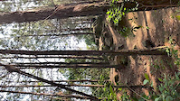
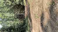
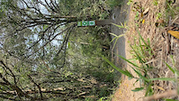




Recent Trail Reports
| status | trail | date | condition | info | user |
|---|---|---|---|---|---|
| Praia do Campeche à Praia da Joaquina | May 15, 2026 @ 1:01pm (America/Sao_Paulo) May 15, 2026 | Unknown | Genovez | ||
| Berne (Sertão do Pantanal) | May 15, 2026 @ 1:01pm (America/Sao_Paulo) May 15, 2026 | Unknown | Genovez | ||
| Antena | May 15, 2026 @ 1:01pm (America/Sao_Paulo) May 15, 2026 | Unknown | Genovez | ||
| Maciço da Costeira | May 15, 2026 @ 1:00pm (America/Sao_Paulo) May 15, 2026 | Unknown | Genovez | ||
| Caminho do Travessão | May 15, 2026 @ 1:00pm (America/Sao_Paulo) May 15, 2026 | Unknown | Genovez | ||
| Saquinho | May 15, 2026 @ 1:00pm (America/Sao_Paulo) May 15, 2026 | Unknown | Genovez | ||
| Trilha do Celular | May 15, 2026 @ 12:59pm (America/Sao_Paulo) May 15, 2026 | Unknown | Genovez | ||
| Telefone | May 15, 2026 @ 12:59pm (America/Sao_Paulo) May 15, 2026 | Unknown | Genovez | ||
| Loop Mea Mea | May 15, 2026 @ 12:59pm (America/Sao_Paulo) May 15, 2026 | Unknown | Genovez | ||
| VGVP até Mea Mea | May 15, 2026 @ 12:59pm (America/Sao_Paulo) May 15, 2026 | Unknown | Genovez |
Activity Feed
| username | action | type | title | date |
|---|---|---|---|---|
| Guilherme1OYnVy | wishlist | trail | activity #103519061 | Sep 10, 2026 @ 7:42pm Sep 10, 2026 |
| LeandroII6ky3 | like | directory | activity #101543224 | Aug 15, 2026 @ 9:40am Aug 15, 2026 |
| QuinC54 | wishlist | route | activity #100708337 | Aug 4, 2026 @ 4:02am Aug 4, 2026 |
| leoOze | wishlist | trail | activity #100255865 | Jul 29, 2026 @ 1:09am Jul 29, 2026 |
| MarcosRippel | wishlist | trail | activity #98592057 | Jul 6, 2026 @ 12:18pm Jul 6, 2026 |
Recent Comments
| username | type | title | comment | date |
|---|---|---|---|---|
| report | Salve Julio! estou com um circuito de XCO pra... | Mar 26, 2026 @ 11:36am Mar 26, 2026 | ||
| trail | Cercaram a entrada da trilha e colocaram uns bois. | Sep 27, 2025 @ 5:44pm Sep 27, 2025 | ||
| trail | A trilha ainda está aberta? | Mar 19, 2025 @ 5:47am Mar 19, 2025 | ||
| trail | Trilha está limpa e bem demarcada, trecho... | Oct 14, 2024 @ 4:57am Oct 14, 2024 | ||
| trail | Hoje 04/08, quase foi possível realizar a... | Aug 4, 2024 @ 4:31pm Aug 4, 2024 |
Local Badges
-

Top 10 Trails0 awarded -

Descent 100k Badge39 awarded -

Big Ride 30k10,908 awarded -

Epic Ride 50k4,482 awarded -

Descent 10k Badge120 awarded -

Completionist0 awarded
Bike & Skill Parks
| name | type | city | rating |
|---|---|---|---|
| Pedrita | skill park | Florianópolis | |
| Trilha do JP | skill park | Florianópolis | |
| Colinas | skill park | Florianópolis |






Activity Type Stats
| activitytype | trails | distance | descent | descent distance | total vertical | rating | global rank | state rank | photos | reports | routes | activity logs |
|---|---|---|---|---|---|---|---|---|---|---|---|---|
| Mountain Bike | 151 | 157 miles | 40,863 ft | 73 miles | 3,363 ft | #500 | #4 | 1,363 | 958 | 16 | 47,600 | |
| E-Bike | 109 | 114 miles | 31,864 ft | 57 miles | 3,363 ft | #377 | #10 | 24 | 847 | 10 | 2,738 | |
| Gravel Bike | 58 | 57 miles | 11,125 ft | 24 miles | 3,356 ft | #343 | #10 | 3 | 177 | 1 | 82 | |
| Adaptive Bike | 42 | 50 miles | 9,741 ft | 22 miles | 3,356 ft | #139 | #14 | 261 | 1 | |||
| Winter Fat Bike | 35 | 29 miles | 3,842 ft | 10 miles | 1,447 ft | #135 | #4 | 317 | ||||
| Horse | 19 | 16 miles | 3,914 ft | 7 miles | 1,444 ft | #323 | #5 | 225 | ||||
| Hike | 178 | 174 miles | 46,529 ft | 80 miles | 3,363 ft | #390 | #16 | 39 | 964 | 6 | 1,308 | |
| Trail Running | 175 | 172 miles | 46,407 ft | 80 miles | 3,363 ft | #330 | #17 | 19 | 959 | 6 | 1,525 | |
| Dirtbike/Moto | 2 | 2 miles | 315 ft | 1 mile | 469 ft | 204 | 1 | |||||
| Observed Trials | 1 | 2 miles | 279 ft | 2,608 ft | 955 ft | 5 | 21 |
Frequently Asked Questions
▼
What are the best places to ride in Florianópolis?
Florianópolis has 20 areas to explore for mountain biking. The top rated areas are:
▼
What are the highest rated mountain biking trails in Florianópolis?
The highest rated mountain biking trails in Florianópolis are:
- Colinas (4.6/5)
- Berne (Sertão do Pantanal) (4.6/5)
- Maciço da Costeira (4.6/5)
- Antena (4.5/5)
- Abacaxi (4.5/5)
▼
What is the best time of the year to ride in Florianópolis?
Based on activity log data, the most popular months to ride in Florianópolis are:
- March (115 activities)
- October (99 activities)
- May (78 activities)
▼
Where can I park to ride in Florianópolis?
There are 31 parking locations listed in Florianópolis. The most popular parking spots are: View all parking and trailhead locations on the map to plan your visit.
▼
What is the longest trail in Florianópolis?
The longest trail in Florianópolis is Serra da Garganta at 10.9 miles. View all trails sorted by distance.
▼
What are the best & highest rated hiking trails in Florianópolis?
▼
What are the best & highest rated trail running trails in Florianópolis?
The best trail running trails in Florianópolis are:
- Trilha de Acesso ao Caminho Guarani
- Descampado Alto
- Desvio Caminho Guarani
- Caminho Guarani
- Trilha do Quirino
▼
How many trails are in Florianópolis?
Florianópolis has a total of 184 trails. Of those, 151 are designated for mountain biking. Browse top mountain biking trails in Florianópolis to find detailed information including difficulty ratings, distances, and trail conditions.
▼
Which trail has the most elevation gain in Florianópolis?
The trail with the most elevation gain in Florianópolis is Serra da Garganta with 3,651 ft of elevation gain. View all trails sorted by elevation gain.
▼
Which trail has the most elevation descent in Florianópolis?
The trail with the most elevation descent in Florianópolis is Serra da Garganta with 3,386 ft of elevation descent. View all trails sorted by elevation descent.
▼
What activities are most popular in Florianópolis?
Florianópolis supports the following activities: Mountain Biking, E-Biking, Gravel Biking, Adaptive Biking, Winter Fat Biking, Horseback, Hiking, Trail Running.
▼
What bike services are there in Florianópolis?
The following bike services are available in Florianópolis:
- Bike Shop (19)
- Club (2)
- Trail Association (1)
- Trail Builders (1)
- Guides & Tours (1)
▼
What are the steepest mountain biking trails in Florianópolis?
The steepest mountain biking trail in Florianópolis is Acesso Trilha do Rapa with an average grade of 14.4%. View all trails sorted by grade.
▼
Are there any trails with scenic viewpoints in Florianópolis?
Yes, there are 37 scenic viewpoints marked along trails in Florianópolis. Some popular viewpoints include: Explore more points of interest to find trails with the best views.
▼
What trails have the biggest jumps in Florianópolis?
The trails with the biggest jumps in Florianópolis are: Browse all mountain bike trails to find trails with jumps and technical features.
▼
Are the trails open in Florianópolis?
The overall region status for Florianópolis is Minor Issue / Yellow. Out of 107 trails:
- Clear / Green: 73
- Minor Issue / Yellow: 22
- Significant Issue / Amber: 12
▼
Can I ride an ebike in Florianópolis?
Yes, Florianópolis supports e-bike riding. There are 102 trails in Florianópolis that allow e-bikes. Check the e-bike trails listing for specific trail access details and any local regulations.
▼
What are the most popular mountain biking routes in Florianópolis?
The most popular mountain biking routes in Florianópolis are: View all mountain biking routes in Florianópolis.
▼
What type of bike is most common in Florianópolis?
Based on activity log data, the most common bike types used in Florianópolis are:
- AM (215 activities)
- Trials (1 activities)
▼
What is the highest summit in Florianópolis?
The highest summit in Florianópolis is Serra do Tabuleiro at 4,167 ft elevation.
▼
What are the most popular Strava Segments in Florianópolis?
The most popular Strava segments in Florianópolis are:
- Subida Floripa Shopping - Sentido Sul (15,334 athletes)
- Morro da Lagoa - Completo (14,118 athletes)
- Single trek Jurere (7,173 athletes)
▼
What are some popular technical trail features in Florianópolis?
There are 3 technical trail features (TTFs) in Florianópolis. Some popular features include: View all technical trail features in Florianópolis.
▼
Are there accessible or adaptive trails in Florianópolis?
Yes, there are 42 accessible/adaptive trails in Florianópolis. View all adaptive trails in Florianópolis for specific accessibility information.
▼
Are there local clubs or events in Florianópolis?
There are 4 local clubs or associations listed in the Florianópolis directory. Browse the local directory for details.
▼
Are there any mountain biking guiding or tour operators in Florianópolis?
Yes, there are mountain biking guiding and tour operators in Florianópolis: Browse all guiding and tour operators in Florianópolis.
▼
What are the most popular mountain biking trails in Florianópolis?
The most popular mountain biking trails in Florianópolis are: View all mountain biking trails sorted by popularity.
▼
What are the best beginner ride trails in Florianópolis?
The best beginner mountain biking trails in Florianópolis are:
- Rio Vermelho Leste 3 (5/5)
- Abacaxi (4.9/5)
- Conexão Maciço (5/5)
Activities
Trails
Points of Interest
- Ponta da Laje Viewpoint
- Mirante Natural da Trilha do Saco Grande Viewpoint
- Mirante Natural da Costa da Lagoa Viewpoint
- Mirante Viewpoint
- Mirante do Paredão Viewpoint
- Mirante natural Viewpoint
- Mirante da Pedrita (Cova Funda) Viewpoint
- Gap do Berne TTF
- Pedra do Urubu Viewpoint
- Mirante do Saco Grande Viewpoint
- Serra do Tabuleiro (4,167 ft)
- Morro do Massiambu (4,114 ft)
- Cambirela (3,419 ft)
- By Nithzen & contributors
- Admins: CicloTrilhas, NataGiacomozzi, felipepimpao, NataGiacomozzi
- #6110 - 18,114 views
- florianópolis activity log | embed map of Florianópolis mountain bike trails | florianópolis mountain biking points of interest
Downloading of trail gps tracks in kml & gpx formats is enabled for Florianópolis.
You must login to download files.
