close
-
Layers w
- Weather Layers
- Pro
- Pro
- Pro
- Pro
- Pro
- Pro
- More Layers
- Pro
- Pro
- Pro
- Pro
-
Upgrade to

3D
Trail Conditions
- Unknown
- Snow Groomed
- Snow Packed
- Snow Covered
- Snow Cover Partial
- Freeze/thaw Cycle
- Icy
- Prevalent Mud
- Wet
- Variable
- Ideal
- Dry
- Very Dry
Trail Flow (Ridden Direction)
Trailforks scans users ridelogs to determine the most popular direction each trail is ridden. A good flowing trail network will have most trails flowing in a single direction according to their intension.
The colour categories are based on what percentage of riders are riding a trail in its intended direction.
The colour categories are based on what percentage of riders are riding a trail in its intended direction.
- > 96%
- > 90%
- > 80%
- > 70%
- > 50%
- < 50%
- bi-directional trail
- no data
Trail Last Ridden
Trailforks scans ridelogs to determine the last time a trail was ridden.
- < 2 days
- < 1 week
- < 2 weeks
- < 1 month
- < 6 months
- > 6 months
Trail Ridden Direction
The intended direction a trail should be ridden.
- Downhill Only
- Downhill Primary
- Both Directions
- Uphill Primary
- Uphill Only
- One Direction
Contribute Details
Colors indicate trail is missing specified detail.
- Description
- Photos
- Description & Photos
- Videos
Trail Popularity ?
Trailforks scans ridelogs to determine which trails are ridden the most in the last 9 months.
Trails are compared with nearby trails in the same city region with a possible 25 colour shades.
Think of this as a heatmap, more rides = more kinetic energy = warmer colors.
- most popular
- popular
- less popular
- not popular
ATV/ORV/OHV Filter
Max Vehicle Width
inches
US Cell Coverage
Legend

Radar Time
Activity Recordings
Trailforks uses anonymized public activity data.
?
Activity Recordings
Trailforks uses anonymized public activity data.
?
Personal Heatmap
▶
Activity Types
all
/
none
▶
Options
2
Date range
month
–
Winter Trails
Warning
A routing network for winter maps does not exist. Selecting trails using the winter trails layer has been disabled.
Missing Trails
Most Popular
Least Popular
Trails are colored based on popularity. The more popular a trail is, the more red. Less popular trails trend towards green.
Jump Magnitude Heatmap
Heatmap of where riders jump on trails. Zoom in to see individual jumps, click circles to view jump details.
BC Backroad Status
![map legend]()
Service Road Atlas is a free to use, community-driven service for viewing and creating reports on the numerous back-country service roads around B.C. and Alberta.

Slope Aspect
Direction the slope faces
Trails Deemphasized
Trails are shown in grey.
Only show trails with no bike usage.
Suggested Layers
Based on selected activity type
Save the current map location and zoom level as your default home location whenever this page is loaded.
Save
No description for Globe has been added yet!
Login or register to submit one.
Activities Click to view
- Mountain Bike
39 trails
- E-Bike
9 trails
- Gravel Bike
2 trails
- Adaptive Bike
1 trails
- Horse
27 trails
- Hike
39 trails
- Trail Running
38 trails
- Dirtbike/Moto
12 trails
- ATV/ORV/OHV
12 trails
Region Details
- 16
- 4
- 7
- 7
- 1
Region Status
Caution as of Jun 14, 2026Stats
- Avg Trail Rating
- Trails (view details)
- 37
- Trails Mountain Bike
- 39
- Trails E-Bike
- 9
- Trails Gravel Bike
- 2
- Trails Adaptive Bike
- 1
- Trails Horse
- 27
- Trails Hike
- 39
- Trails Trail Running
- 38
- Trails Dirtbike/Moto
- 12
- Trails Observed Trials
- 1
- Trails ATV/ORV/OHV
- 12
- Trails Snowmobile
- 1
- Trails Snowshoe
- 1
- Trails Backcountry Ski
- 1
- Trails Nordic Ski
- 1
- Total Distance
- 92 miles
- Total Descent Distance
- 54 miles
- Total Descent
- 24,282 ft
- Total Vertical
- 5,350 ft
- Highest Trailhead
- 7,793 ft
- Reports
- 260
- Photos
- 557
- Ridden Counter
- 1,255
Sub Regions
-
Pinal Mountain Trail System
- 4
- 7
- 7
- 1
Popular Globe Mountain Biking Trails
• 95 ★ 4.0 • 5 miles • 308 ft • 145 •
is a popular trail within the Pinal Mountains. Located on Pinal Mountain 1-1.5hr to the East of Phoenix. Gravity junkies and riders seeking a road less traveled experience have been traveling here for decades. Most shuttle this trail...
• 95 ★ 3.8 • 3,471 ft • 40 ft • 120 •
This short fast and fun trail on Pinal Peak is a great way to add 300ft of elevation loss to your ride with only a slight climb as you near Ferndale lot and Sixshooter trail. Some people like to run laps on it when they camp up top.
• 95 ★ 3.0 • 1 mile • 103 ft • 111 •
This is the bottom part of used mainly in the cooler months to get a full Run in. Most still prefer to take Forest Road 112 down to the shuttle pickup. While most of this is blue the beginning bit to creek crossing is black mainly due...
• 85 ★ 3.8 • 4 miles • 129 ft • 85 •
is another popular multi-use trail within the Pinal Mountains. Located on Pinal Mountain 1-1.5hr to the East of Phoenix. Gravity junkies and riders seeking a road less traveled experience have been traveling here for decades. The 2017...
• 85 ★ 3.8 • 2 miles • 106 ft • 68 •
This section of has much higher use as it provides single track from the bottom of Icehouse down to Icehouse CCC. This is the preferred route to end your Icehouse DH run vs. the rutted out admin road. This fun section of will surely...
• 90 ★ 3.3 • 2 miles • 22 ft • 68 •
Icehouse is a popular trail within the Pinal Mountains. Located on Pinal Mountain 1-1.5hr to the East of Phoenix. Gravity junkies and riders seeking a road less traveled experience have been traveling here for decades. The 2017 and 2021...
• 70 ★ 4.0 • 2,365 ft • 0 ft • 31 •
Use this combination of two track and single track to get to Icehouse CCC. Once overgrown it has been opened up to provide a non-two track route ,
• 70 ★ 3.8 • 3 miles • 250 ft • 24 •
The upper portion of the Has been restored. This is one of the more mellow sections of trail on the mountain. The majority of the top section is in a Pine Forest and survived the Telegraph Fire without major burns. This trail has a...
Globe Mountain Bike Routes
7 miles • 366 ft • 3 • Shuttled •
If you are looking for the most miles and full Pinal Mountain Experience then this is the route for you....
★ 5.0 • 7 miles • 279 ft • 4 • Shuttled •
This is the longest single track route on the mountain! Ferndale is fun and flowy. Top of Six Shooter is a...
6 miles • 390 ft • 2 • Shuttled •
This is the what is considered the full Shuttle Run to Icehouse CCC Parking Lot
4 miles • 52 ft • 1 • Shuttled •
This is Icehouse DH to Lower to alternate shuttle pickup. This adds more trail and less two track to your...
10 miles • 2,828 ft • 4 • Loop •
This Provides another loop option for those seeking to pedal up Pinal Mountain. and Upper provide nice...
5 miles • 36 ft • 1 • Shuttled •
Use this route for quickest way to alternate shuttle pickup. This is done as a shuttle. Don't have buddies...
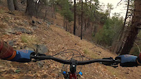
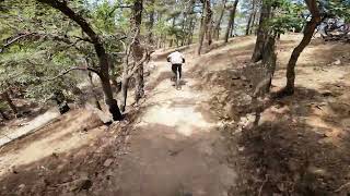
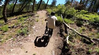
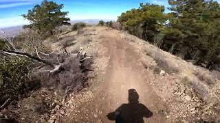
Photos of Globe Mountain Bike
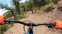
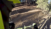
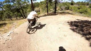
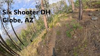
Videos of Globe Mountain Bike
trail: Six Shooter Trail
0:10 |
190 |
Jan 28, 2021
trail: Six Shooter Trail
0:00 |
417 |
Aug 8, 2019
trail: Kellner Canyon Trail
7:34 |
358 |
Jan 16, 2018
trail: Pinal Vista Loop (Southside)
5:30 |
35 |
May 25, 2026 , Globe
trail: Pinal Vista Loop (Northside)
3:07 |
25 |
May 25, 2026 , Globe
trail: Pinal Vista Loop (Southside)
4:28 |
32 |
May 25, 2026 , Globe
trail: Six Shooter Trail
17:45 |
66 |
May 16, 2026 , Globe
trail: Pinal Vista Loop (Southside)
4:45 |
106 |
Mar 8, 2026 , Globe
Current Trail Warnings
| status | trail | date | condition | user | info |
|---|---|---|---|---|---|
| Pioneer Trail | Jun 6, 2026 @ 7:47am (America/Phoenix) Jun 6, 2026 | Dry | gravityjunkiepr | Overgrown vegetation, unsafe to venture... | |
| Kellner Canyon Trail | Jun 6, 2026 @ 7:46am (America/Phoenix) Jun 6, 2026 | Dry | gravityjunkiepr | Quite eroded and vegetation making... | |
| Six Shooter Trail | Jun 6, 2026 @ 7:43am (America/Phoenix) Jun 6, 2026 | Unknown | gravityjunkiepr | Blocked trail with big tree 5 minutes... |
Recent Trail Reports
Activity Feed
| username | action | type | title | date |
|---|---|---|---|---|
| Sheepdog590 | ridden | trail | activity #98135525 | Jun 30, 2026 @ 9:11am 4 hours |
| 7SQTCwWN | wishlist | region | activity #97829488 | Jun 26, 2026 @ 6:21am Jun 26, 2026 |
| mrkaz | wishlist | trail | activity #97659151 | Jun 23, 2026 @ 4:30pm Jun 23, 2026 |
| Daileyr7 | ridden | route | activity #97580358 | Jun 22, 2026 @ 12:53pm Jun 22, 2026 |
| pkscott4 | wishlist | route | activity #97246137 | Jun 18, 2026 @ 5:54am Jun 18, 2026 |
Recent Comments
| username | type | title | comment | date |
|---|---|---|---|---|
| trail | Will be good with some trail work. Hiked up... | Apr 4, 2026 @ 9:04am Apr 4, 2026 | ||
| trail | Fun trail. Worth doing a loop on. | Mar 28, 2026 @ 4:34pm Mar 28, 2026 | ||
| report | you most likely missed the turn on lower... | Jan 7, 2026 @ 6:37pm Jan 7, 2026 | ||
| trail | Rode it as an out and back. I usually eat... | Jun 14, 2025 @ 12:33pm Jun 14, 2025 | ||
| report | trail is running good. just one tree down | May 18, 2025 @ 11:48am May 18, 2025 |
Local Badges
-

Epic Ride Climb 2k21 awarded -

Climbing 10k Badge4 awarded -

Climbing 100k Badge0 awarded -

Epic Ride Descent 2k46 awarded -

Descent 10k Badge8 awarded -

Descent 100k Badge0 awarded
Activity Type Stats
| activitytype | trails | distance | descent | descent distance | total vertical | rating | global rank | state rank | photos | reports | routes | ridelogs |
|---|---|---|---|---|---|---|---|---|---|---|---|---|
| Mountain Bike | 39 | 86 miles | 24,098 ft | 52 miles | 5,351 ft | #3,502 | #1,199 | 565 | 259 | 15 | 1,781 | |
| E-Bike | 9 | 21 miles | 3,232 ft | 13 miles | 1,877 ft | #5,274 | #1,638 | 41 | 1 | 120 | ||
| Gravel Bike | 2 | #713 | #1,193 | 1 | 1 | 1 | ||||||
| Adaptive Bike | 1 | #688 | #1,911 | 2 | ||||||||
| Horse | 27 | 54 miles | 17,822 ft | 31 miles | 3,455 ft | #1,077 | #694 | 178 | 1 | |||
| Hike | 39 | 88 miles | 23,543 ft | 50 miles | 5,351 ft | #3,330 | #1,172 | 263 | 2 | 326 | ||
| Trail Running | 38 | 83 miles | 23,383 ft | 49 miles | 5,351 ft | #2,961 | #861 | 263 | 2 | 12 | ||
| Dirtbike/Moto | 12 | 28 miles | 3,625 ft | 13 miles | 4,213 ft | #841 | #304 | 15 | 1 | 4 | ||
| Observed Trials | 1 | 1 | ||||||||||
| ATV/ORV/OHV | 12 | 28 miles | 3,625 ft | 13 miles | 4,213 ft | #599 | #232 | 15 | 1 | 2 | ||
| Snowmobile | 1 | |||||||||||
| Snowshoe | 1 | 1 | ||||||||||
| Backcountry Ski | 1 | |||||||||||
| Nordic Ski | 1 |
Frequently Asked Questions About Globe
▼
What are the best places to ride in Globe?
Globe has 1 areas to explore for mountain biking. The top rated areas are:
▼
What are the highest rated mountain biking trails in Globe?
The highest rated mountain biking trails in Globe are:
- Pioneer Trail (4.3/5)
- Lower Telephone Trail (4.2/5)
- Pinal Vista Loop (Northside) (4.1/5)
- Pinal Vista Loop (Southside) (4.1/5)
- Ferndell Trail (4.1/5)
▼
What is the best time of the year to ride in Globe?
Based on ride log data, the most popular months to ride in Globe are:
- June (21 activities)
- May (20 activities)
- April (11 activities)
▼
Where can I park to ride in Globe?
There are 3 parking locations listed in Globe. The most popular parking spots are: View all parking and trailhead locations on the map to plan your visit.
Activities
Trails
Points of Interest
- Cibeque Falls Sight
- Second Campground Camping
- Salt Bank Campground Camping
- Ladder Rock (view point) Viewpoint
- Pinal and Upper Pinal Campground Camping
- Big expansive south views Viewpoint
- Sunset Viewpoint
- Views Viewpoint
- Views into Globe Viewpoint
- Pinal Mountains (7,838 ft)
- Pinal Peak (7,838 ft)
- Signal Peak (7,812 ft)
- By schillingsworth
 TRAILFORKS HTA & contributors
 - Admins: AZT, chainslapAZ, schillingsworth, jeffgicklhorn, jpmcghee, msmcfate, cemoorelife, Schwinnshralper26
- #6019 - 9,849 views
- globe activity log | embed map of Globe mountain bike trails | globe mountain biking points of interest
Downloading of trail gps tracks in kml & gpx formats is enabled for Globe.
You must login to download files.