
close
3D
Trail Conditions
- Unknown
- Snow Groomed
- Snow Packed
- Snow Covered
- Snow Cover Partial
- Freeze/thaw Cycle
- Icy
- Prevalent Mud
- Wet
- Variable
- Ideal
- Dry
- Very Dry
Trail Flow (Ridden Direction)
Trailforks scans users activity logs to determine the most popular direction each trail is ridden. A good flowing trail network will have most trails flowing in a single direction according to their intension.
The colour categories are based on what percentage of users are riding a trail in its intended direction.
The colour categories are based on what percentage of users are riding a trail in its intended direction.
- > 96%
- > 90%
- > 80%
- > 70%
- > 50%
- < 50%
- bi-directional trail
- no data
Trail Last Used
Trailforks scans activity logs to determine the last time a trail was ridden.
- < 2 days
- < 1 week
- < 2 weeks
- < 1 month
- < 6 months
- > 6 months
Trail Ridden Direction
The intended direction a trail should be ridden.
- Downhill Only
- Downhill Primary
- Both Directions
- Uphill Primary
- Uphill Only
- One Direction
Contribute Details
Colors indicate trail is missing specified detail.
- Description
- Photos
- Description & Photos
- Videos
Trail Popularity ?
Trailforks scans activity logs to determine which trails are ridden the most in the last 9 months.
Trails are compared with nearby trails in the same city region with a possible 25 colour shades.
Think of this as a heatmap, more activities = more kinetic energy = warmer colors.
- most popular
- popular
- less popular
- not popular
ATV/ORV/OHV Filter
Max Vehicle Width
inches
US Cell Coverage
Legend

Radar Time
Activity Recordings
Trailforks uses anonymized public activity data.
?
Activity Recordings
Trailforks uses anonymized public activity data.
?
Winter Trails
Warning
A routing network for winter maps does not exist. Selecting trails using the winter trails layer has been disabled.
Missing Trails
Most Popular
Least Popular
Trails are colored based on popularity. The more popular a trail is, the more red. Less popular trails trend towards green.
Jump Magnitude Heatmap
Heatmap of where users jump on trails. Zoom in to see individual jumps, click circles to view jump details.
BC Backroad Status
![map legend]()
Service Road Atlas is a free to use, community-driven service for viewing and creating reports on the numerous back-country service roads around B.C. and Alberta.

Slope Aspect
Direction the slope faces
Trails Deemphasized
Trails are shown in grey.
Only show trails with no bike usage.
Suggested Layers
Based on selected activity type
Save the current map location and zoom level as your default home location whenever this page is loaded.
Save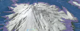
Snow & Rain 3D forecast Pro
See where it will snow, sleet or rain on Greenwater hour by hour, on 3D terrain.
View 3D snow forecast
USFS trail system along highway 410, ranging from flattish trails (Skookum, White River) to big climb/descents. The higher trails are generally a summer through fall thing. The lower trails are sometimes rideable near year round, depending on how snow levels.
Trail info last updated
Activities Click to view
- Mountain Bike
91 trails
- E-Bike
45 trails
- Gravel Bike
51 trails
- Adaptive Bike
15 trails
- Winter Fat Bike
10 trails
- Horse
15 trails
- Hike
128 trails
- Trail Running
128 trails
- Dirtbike/Moto
7 trails
- Downhill Ski
170 trails
- Backcountry Ski
89 trails
- Nordic Ski
0 trails
Region Details
- 50
- 7
- 22
- 12
Region Status
Caution as of Oct 25, 2026Local Trail Association

Stats
- Avg Trail Rating
- Trails (view details)
- 299
- Trails Mountain Bike
- 91
- Trails E-Bike
- 45
- Trails Gravel Bike
- 51
- Trails Adaptive Bike
- 15
- Trails Winter Fat Bike
- 10
- Trails Horse
- 15
- Trails Hike
- 128
- Trails Trail Running
- 128
- Trails Dirtbike/Moto
- 7
- Trails ATV/ORV/OHV
- 3
- Trails Downhill Ski
- 170
- Trails Backcountry Ski
- 89
- Total Distance
- 380 miles
- Total Descent
- 108,399 ft
- Total Vertical
- 5,533 ft
- Highest Trailhead
- 6,980 ft
- Reports
- 721
- Photos
- 816
- Completed Counter
- 43,737
Articles

Seattle, WA: Norse Peak via Bullion Basin
Sep 19, 2013 from backpacker.com
Trek through a wildflower-filled basin to the summit of Norse Peak on this 8.3-mile Cascades dayhike with front-row views of Mount Rainier.
Sub Regions
-
410 / Mount Rainier North
- 3
- 14
- 7
-
Crystal Mountain Resort
- 3
- 4
- 2
-
Federation Forest State Park
Popular Greenwater Mountain Biking Trails
• 95 ★ 4.4 • 6 miles • 2,880 ft • 520 •
This trail has got it all. It's a great technical downhill and a challenging climb. There is some hike-a-bike involved on the steepest sections. Creeks, waterfalls, and the incredible views from the cliffs make this trip extra...
• 95 ★ 4.4 • 4 miles • 2,425 ft • 428 •
Ranger Creek is a great trail to ride. Fairly technical singletrack with exposure, beautiful forests, good climbing, fun descents, technical sections and crazy switchbacks that will challenge the most advanced riders. Ranger Creek can...
• 85 ★ 4.3 • 8 miles • 896 ft • 416 •
Suntop view provides an excellent view of Mt. Rainier that can only be equaled or surpassed by only a few trails open to bikes. A marvelous view from the top, the trail is fairly groomed and straight. Nice forest with open fast easier...
• 100 ★ 4.2 • 2 miles • 562 ft • 351 •
Relatively flat trail with lots of roots to make it a strong beginner/easy intermediate ride. Less forgiving when wet and slippery. An easy addition to Skookum Flats to make a loop ride. Some trail intersections - just keep contouring...
• 95 ★ 4.5 • 1 mile • 93 ft • 321 •
This short trail goes from the Noble Knob/Dalles Ridge junction to the Dalles Ridge/Ranger Creek trail. This left turn is easy to miss as you zip along this trail. If you pop out on the road you went a mile too far.
• 100 ★ 4.4 • 5 miles • 211 ft • 297 •
Skookum Flats Trail is one of the showcase river trails in the PNW. It includes old growth, great viewpoints and challenging riding. Lots of ups and downs, roots, a few rock gardens, punchy climbs, a creek crossing, and skinny...
• 95 ★ 4.0 • 3 miles • 373 ft • 285 •
This trail starts at the Corral Pass parking lot and goes across the ridge to intersect with the Noble Knob Trail. Lots of short climbs and descents most on single track and some on old double track. Incredible views of Rainier most of...
• 90 ★ 3.8 • 2 miles • 424 ft • 247 •
This is a more difficult extension to the White River Trail. Punchy climbs, a few rock gardens, and exposed contouring on a sometimes skinny trail. Ranger Creek to the Corral Pass Rd. White River Trail 1199 This is a nice year-round...
Greenwater Mountain Bike Routes
★ 5.0 • 13 miles • 2,851 ft • 3 • Loop •
This is a commonly ridden loop. Park near the White River Trail. Then ride the loop counterclockwise:...
★ 4.0 • 13 miles • 3,106 ft • 2 • Loop •
Loop around the Crystal Mountain property with challenging climbs, beautiful lakes and meadows, epic...
★ 2.8 • 21 miles • 4,618 ft • 5 • Loop •
Park at parking lot at Buck Creek turnoff, just across bridge from 410. Cross hwy 410 and go left 30...
21 miles • 4,618 ft • 5 • Loop •
Park at parking lot at Buck Creek turnoff, just across bridge from 410. Cross hwy 410 and go left 30...
24 miles • 4,105 ft • 4 • Loop •
A more pleasant route avoiding riding the Skookum flats trail. Warm up on the White River trail before...
★ 5.0 • 50 miles • 9,668 ft • 36 •
Photos of Greenwater Mountain Bike
Videos of Greenwater Mountain Bike



Current Trail Warnings
| status | trail | date | condition | user | info |
|---|---|---|---|---|---|
| Huckleberry Creek Road | Oct 25, 2026 @ 11:00am (America/Vancouver) Oct 25, 2026 | Wet | brucmc | Boring gravel road which gets you to the... |
Recent Trail Reports
Activity Feed
| username | action | type | title | date |
|---|---|---|---|---|
| JakeArch | wishlist | trail | activity #107893733 | Nov 16, 2026 @ 9:55am Nov 16, 2026 |
| AVWenning | wishlist | trail | activity #106788824 | Oct 28, 2026 @ 11:05pm Oct 28, 2026 |
| brucmc | add | report | activity #106630937 | Oct 26, 2026 @ 8:09am Oct 26, 2026 |
| brucmc | add | report | activity #106630935 and 3 more | Oct 26, 2026 @ 8:09am Oct 26, 2026 |
| cindit | wishlist | trail | activity #106457024 | Oct 23, 2026 @ 4:34pm Oct 23, 2026 |
Recent Comments
| username | type | title | comment | date |
|---|---|---|---|---|
| trail | I now see ALL the comments about how bad this... | Oct 3, 2026 @ 11:43pm Oct 3, 2026 | ||
| trail | This trail should be marked as closed. It’s... | Oct 3, 2026 @ 11:32pm Oct 3, 2026 | ||
| trail | The trail was riding great today, started at... | Sep 27, 2026 @ 4:58pm Sep 27, 2026 | ||
| report | [email protected] [email protected] | Sep 18, 2026 @ 6:05pm Sep 18, 2026 | ||
| report | Wouldn’t take full on caltrops to make them... | Sep 18, 2026 @ 12:05pm Sep 18, 2026 |
Local Badges
-
10 Blue Trails49 awarded -

Epic Ride Climb 2k275 awarded -

Climbing 10k Badge43 awarded -

Climbing 100k Badge1 awarded -

Epic Ride Descent 2k390 awarded -

Descent 10k Badge60 awarded
Bike & Skill Parks
| name | type | city | rating |
|---|---|---|---|
| Crystal Mountain Resort | bike park | Greenwater |
Activity Type Stats
| activitytype | trails | distance | descent | descent distance | total vertical | rating | global rank | state rank | photos | reports | routes | activity logs |
|---|---|---|---|---|---|---|---|---|---|---|---|---|
| Mountain Bike | 91 | 254 miles | 38,560 ft | 89 miles | 5,371 ft | #986 | #28 | 785 | 716 | 10 | 4,989 | |
| E-Bike | 45 | 162 miles | 19,121 ft | 50 miles | 4,777 ft | #1,169 | #30 | 334 | 2 | 379 | ||
| Gravel Bike | 51 | 170 miles | 17,526 ft | 50 miles | 5,292 ft | #404 | #14 | 63 | 9 | |||
| Adaptive Bike | 15 | 51 miles | 4,281 ft | 11 miles | 4,911 ft | #1,570 | #21 | 38 | ||||
| Winter Fat Bike | 10 | 15 miles | 5,932 ft | 11 miles | 4,895 ft | #1,817 | #13 | 74 | ||||
| Horse | 15 | 82 miles | 16,624 ft | 37 miles | 5,371 ft | #812 | #29 | 146 | ||||
| Hike | 128 | 330 miles | 54,911 ft | 126 miles | 5,531 ft | #243 | #14 | 27 | 716 | 5 | 2,215 | |
| Trail Running | 128 | 330 miles | 54,911 ft | 126 miles | 5,531 ft | #399 | #17 | 716 | 3 | 574 | ||
| Dirtbike/Moto | 7 | 41 miles | 4,997 ft | 11 miles | 3,606 ft | #727 | #22 | 2 | 157 | 29 | ||
| ATV/ORV/OHV | 3 | 31 miles | 2,205 ft | 6 miles | 2,979 ft | 118 | 9 | |||||
| Downhill Ski | 170 | 50 miles | 52,549 ft | 40 miles | 2,756 ft | #80 | #3 | 4 | 10,227 | |||
| Backcountry Ski | 89 | 21 miles | 26,516 ft | 15 miles | 3,038 ft | #214 | #5 | 4 | 1,576 |
Frequently Asked Questions
▼
What are the best places to ride in Greenwater?
Greenwater has 4 areas to explore for mountain biking. The top rated areas are:
▼
What are the highest rated mountain biking trails in Greenwater?
The highest rated mountain biking trails in Greenwater are:
- Suntop (4.3/5)
- Ranger Creek (4.3/5)
- Palisades (4.3/5)
- Skookum Flats (4.3/5)
- Northway (4.3/5)
▼
What is the best time of the year to ride in Greenwater?
Based on activity log data, the most popular months to ride in Greenwater are:
- July (108 activities)
- August (100 activities)
- September (96 activities)
▼
Where can I park to ride in Greenwater?
▼
What is the longest trail in Greenwater?
The longest trail in Greenwater is Divide Trail at 13.1 km. View all trails sorted by distance.
▼
What are the best & highest rated hiking trails in Greenwater?
The best hiking trails in Greenwater are: View all hiking trails sorted by popularity score.
▼
What are the best & highest rated trail running trails in Greenwater?
The best trail running trails in Greenwater are: View all trail running trails sorted by popularity score.
▼
What are the best & highest rated dirtbiking trails in Greenwater?
The best dirtbiking trails in Greenwater are: View all dirtbiking trails sorted by popularity score.
▼
How many trails are in Greenwater?
Greenwater has a total of 299 trails. Of those, 91 are designated for mountain biking. Browse top mountain biking trails in Greenwater to find detailed information including difficulty ratings, distances, and trail conditions.
▼
Which trail has the most elevation gain in Greenwater?
The trail with the most elevation gain in Greenwater is Palisades with 878 m of elevation gain. View all trails sorted by elevation gain.
▼
Which trail has the most elevation descent in Greenwater?
The trail with the most elevation descent in Greenwater is Suntop with 1,082 m of elevation descent. View all trails sorted by elevation descent.
▼
What activities are most popular in Greenwater?
Greenwater supports the following activities: Mountain Biking, E-Biking, Gravel Biking, Adaptive Biking, Winter Fat Biking, Horseback, Hiking, Trail Running, Dirtbiking, Skiing, Backcountry Skiing, Nordic Skiing.
▼
What are the steepest mountain biking trails in Greenwater?
The steepest mountain biking trail in Greenwater is Crystal Mountain Trail Bypass with an average grade of 14.8%. View all trails sorted by grade.
▼
Are there any trails with scenic viewpoints in Greenwater?
Yes, there are 5 scenic viewpoints marked along trails in Greenwater. Some popular viewpoints include: Explore more points of interest to find trails with the best views.
▼
Are the trails open in Greenwater?
The overall region status for Greenwater is Minor Issue / Yellow. Out of 52 trails:
- Clear / Green: 33
- Minor Issue / Yellow: 13
- Significant Issue / Amber: 5
- Closed: 1
▼
Can I ride an ebike in Greenwater?
Yes, Greenwater supports e-bike riding. There are 41 trails in Greenwater that allow e-bikes. Check the e-bike trails listing for specific trail access details and any local regulations.
▼
What are the most popular mountain biking routes in Greenwater?
The most popular mountain biking routes in Greenwater are: View all mountain biking routes in Greenwater.
▼
What type of bike is most common in Greenwater?
Based on activity log data, the most common bike types used in Greenwater are:
- AM (53 activities)
- XC (13 activities)
- DH (1 activities)
- Gravel (1 activities)
▼
What is the highest summit in Greenwater?
The highest summit in Greenwater is Silver King at 2,130 m elevation.
▼
What are the top sights to see in Greenwater?
There are 4 notable sights in Greenwater. Some of the top sights include: Explore all points of interest in Greenwater.
▼
What are the most popular Strava Segments in Greenwater?
The most popular Strava segments in Greenwater are:
- Suntop Road X'ing to Buck Creek Cutout (1,711 athletes)
- OLD VERSION - OLD VERSION - Suntop Downhill 1 (1,644 athletes)
- First Bowl (1,631 athletes)
▼
What trails are closed in Greenwater?
There are currently 1 closed trails in Greenwater. The breakdown of all trail statuses is:
- Clear / Green: 33
- Minor Issue / Yellow: 13
- Significant Issue / Amber: 5
- Closed: 1
▼
Are there accessible or adaptive trails in Greenwater?
Yes, there are 15 accessible/adaptive trails in Greenwater. View all adaptive trails in Greenwater for specific accessibility information.
▼
What are the most popular mountain biking trails in Greenwater?
The most popular mountain biking trails in Greenwater are: View all mountain biking trails sorted by popularity.
▼
What are the best beginner ride trails in Greenwater?
The best beginner mountain biking trails in Greenwater are:
- The Dalles Campground Trail (3/5)
- Marsh Row (0/5)
- Access Trail (0/5)
Activities
- Greenwater Mountain Biking Trails
- Greenwater E-Biking Trails
- Greenwater Gravel Biking Trails
- Greenwater Adaptive Biking Trails
- Greenwater Winter Fat Biking Trails
- Greenwater Horseback Trails
- Greenwater Hiking Trails
- Greenwater Trail Running Trails
- Greenwater Dirtbiking Trails
- Greenwater Skiing Trails
- Greenwater Backcountry Skiing Trails
Trails
Points of Interest
- Midway Yurt Lodge
- Summit House Lodge
- Kelly Butte Summit
- Suntop Lookout Tower Viewpoint
- Brown Peak Summit
- Little Ranger Peak Summit
- Corral Pass Campground Camping
- Crystal Mountain Top Takeout and Restaurant Lodge
- Crystal Mountain Summit
- Buck Creek Campground Camping
- Silver King (2,130 m)
- Crystal Mountain (2,127 m)
- Chinook Peak (2,102 m)
- By enilson & contributors
- Admins: EMBA-C2S, EMBA SOSO, EMBA-C2S
- #5841 - 10,952 views
- greenwater activity log | embed map of Greenwater mountain bike trails | greenwater mountain biking points of interest
Downloading of trail gps tracks in kml & gpx formats is enabled for Greenwater.
You must login to download files.
