close
-
Layers w
- Weather Layers
- Pro
- Pro
- Pro
- Pro
- Pro
- Pro
- More Layers
- Pro
- Pro
- Pro
- Pro
-
Upgrade to

3D
Trail Conditions
- Unknown
- Snow Groomed
- Snow Packed
- Snow Covered
- Snow Cover Partial
- Freeze/thaw Cycle
- Icy
- Prevalent Mud
- Wet
- Variable
- Ideal
- Dry
- Very Dry
Trail Flow (Ridden Direction)
Trailforks scans users ridelogs to determine the most popular direction each trail is ridden. A good flowing trail network will have most trails flowing in a single direction according to their intension.
The colour categories are based on what percentage of riders are riding a trail in its intended direction.
The colour categories are based on what percentage of riders are riding a trail in its intended direction.
- > 96%
- > 90%
- > 80%
- > 70%
- > 50%
- < 50%
- bi-directional trail
- no data
Trail Last Ridden
Trailforks scans ridelogs to determine the last time a trail was ridden.
- < 2 days
- < 1 week
- < 2 weeks
- < 1 month
- < 6 months
- > 6 months
Trail Ridden Direction
The intended direction a trail should be ridden.
- Downhill Only
- Downhill Primary
- Both Directions
- Uphill Primary
- Uphill Only
- One Direction
Contribute Details
Colors indicate trail is missing specified detail.
- Description
- Photos
- Description & Photos
- Videos
Trail Popularity ?
Trailforks scans ridelogs to determine which trails are ridden the most in the last 9 months.
Trails are compared with nearby trails in the same city region with a possible 25 colour shades.
Think of this as a heatmap, more rides = more kinetic energy = warmer colors.
- most popular
- popular
- less popular
- not popular
ATV/ORV/OHV Filter
Max Vehicle Width
inches
US Cell Coverage
Legend

Radar Time
Activity Recordings
Trailforks uses anonymized public activity data.
?
Activity Recordings
Trailforks uses anonymized public activity data.
?
Personal Heatmap
▶
Activity Types
all
/
none
▶
Options
2
Date range
month
–
Winter Trails
Warning
A routing network for winter maps does not exist. Selecting trails using the winter trails layer has been disabled.
Missing Trails
Most Popular
Least Popular
Trails are colored based on popularity. The more popular a trail is, the more red. Less popular trails trend towards green.
Jump Magnitude Heatmap
Heatmap of where riders jump on trails. Zoom in to see individual jumps, click circles to view jump details.
BC Backroad Status
![map legend]()
Service Road Atlas is a free to use, community-driven service for viewing and creating reports on the numerous back-country service roads around B.C. and Alberta.

Slope Aspect
Direction the slope faces
Trails Deemphasized
Trails are shown in grey.
Only show trails with no bike usage.
Suggested Layers
Based on selected activity type
Save the current map location and zoom level as your default home location whenever this page is loaded.
Save
No description for Jasper has been added yet!
Login or register to submit one.
Region Supporters & Maintainers
- Sponsor
Activities Click to view
- Mountain Bike
184 trails
- E-Bike
180 trails
- Gravel Bike
25 trails
- Adaptive Bike
0 trails
- Horse
221 trails
- Hike
323 trails
- Trail Running
313 trails
- Snowshoe
180 trails
- Downhill Ski
162 trails
- Backcountry Ski
49 trails
- Nordic Ski
31 trails
Region Details
- 22
- 2
- 42
- 71
- 44
- 3
Region Status
Open as of May 25, 2026Stats
- Avg Trail Rating
- Trails (view details)
- 503
- Trails Mountain Bike
- 184
- Trails E-Bike
- 180
- Trails Gravel Bike
- 25
- Trails Winter Fat Bike
- 1
- Trails Horse
- 221
- Trails Hike
- 323
- Trails Trail Running
- 313
- Trails Snowshoe
- 180
- Trails Downhill Ski
- 162
- Trails Backcountry Ski
- 49
- Trails Nordic Ski
- 31
- Total Distance
- 784 miles
- Total Descent
- 113,908 ft
- Total Vertical
- 7,884 ft
- Highest Trailhead
- 11,214 ft
- Reports
- 2,031
- Photos
- 896
- Ridden Counter
- 63,105
Articles
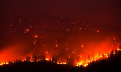
Wildfire Forces Evacuations in Jasper National Park
Jul 25, 2024 from backpacker.com
The 4,700 residents of Jasper, Alberta Canada were forced to flee their homes due to encroaching wildfires on July 22.
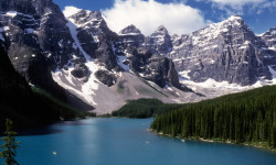
The 10 Most Beautiful National Parks in Canada
Jun 17, 2024 from outsideonline.com
Spectacular mountains and deep fjords, powder-blue lakes and sea stacks: here’s your bucket list of national parks to visit up north
Sub Regions
-
Jasper National Park
- 10
- 10
- 8
-
Maligne Canyon and Jasper Park Lodge
- 2
- 20
- 4
- 6
-
Old Fort Point / Valley of the Five Lakes
- 2
- 3
- 8
-
Pyramid Bench
- 4
- 48
- 17
- 1
-
Whistlers Bench
- 6
- 5
- 5
- 2
Popular Jasper Mountain Biking Trails
• 100 ★ 3.2 • 2,691 ft • 0 ft • 585 •
A wide open minimally technical trail connects the Jasper townsite and Old Fort point. From Old Fort Point you can continue to follow the signs along the paved to Jasper Park Lodge if you choose.
• 100 ★ 4.2 • 4 miles • 104 ft • 511 •
The is a Jasper classic. From Maligne Canyon 6th bridge things start out wide open and pretty mellow through open forest, this progresses into a tighter track along the river and then into open grasslands. Minimally technical for the...
• 95 ★ 3.3 • 2,056 ft • 0 ft • 457 •
This relatively flat trail with some technical rocky bits along the plateau offers fantastic views of the Athabasca and Miette Rivers and is a good alternative to if you're looking for a bit more of a challenge.
• 100 ★ 4.5 • 4,634 ft • 15 ft • 452 •
A fun downhill with some cool fall lines, natural rock features and lower section improvements by the Jasper Trail Alliance featuring some twisty berms, hidden hits and rock huck/drop at the end.
• 100 ★ 3.6 • 4,682 ft • 220 ft • 436 •
A popular route to access the trails of the Pyramid Bench commonly refered to as "The Church Climb", it is the easiest way onto the bench from unless you take Pyramid Lake road to access . A fairly sustained climb right from the parking...
• 90 ★ 4.0 • 1 mile • 0 ft • 422 •
Open sandy trail with several rooty and rocky sections follows the Athabasca river
• 90 ★ 4.0 • 2 miles • 69 ft • 412 •
Open sandy trail with several rooty and rocky sections follows the Athabasca river
• 90 ★ 2.8 • 2 miles • 0 ft • 377 •
Sandy, soft and popular with young bikers for the bumps and jumps that break up an otherwise flat, meandering path. Splendid, turquoise views of Lac Beauvert are shared with hikers. Look for eth osprey nest on the power pole beside the...
Jasper Mountain Bike Routes
★ 5.0 • 18 miles • 1,311 ft • 3 • Out & Back •
Start at Parking Lot 8 - Maligne Canyon 6th Bridge The Overlander starts out with flowy single track...
★ 5.0 • 5 miles • 664 ft • 3 • Loop •
All-around intermediate riding with flowy and technical sections. Beautiful open views throughout this...
★ 4.0 • 8 miles • 233 ft • 2 • Out & Back •
Start at Parking Lot 8 - Maligne Canyon 6th Bridge The trail starts out with flowy single track through...
★ 5.0 • 16 miles • 1,856 ft • 6 • Loop •
Beautiful riding through the valley gets you to the base of Andretti's, where the climbing grunt begins....
★ 4.0 • 6 miles • 655 ft • 3 • Loop •
Quintessential Jasper riding. Moderate climbing all the way up, and pure fun all the way down. is Jasper's...
★ 4.5 • 5 miles • 727 ft • 3 • Loop •
Starting from at the Jasper Activity Centre this route starts with a leg burning steep but non technical...
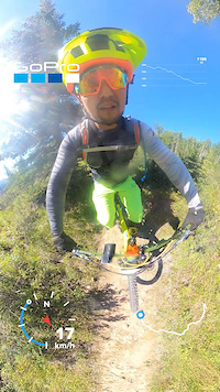
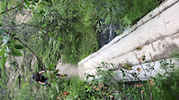
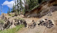
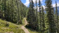
Photos of Jasper Mountain Bike
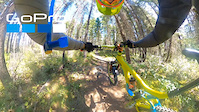
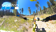
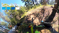
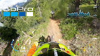
Videos of Jasper Mountain Bike
trail: Razorback
19:43 |
205 |
Sep 2, 2020
trail: Trail 8 (Mina Lake)
10:01 |
126 |
Aug 18, 2020
trail: Town Trail
3:36 |
56 |
Aug 17, 2020
trail: Razorback - South Fork
3:13 |
96 |
Aug 17, 2020
trail: Trail 9
0:05 |
|
Aug 15, 2020
trail: Trail 10b
0:15 |
66 |
Jul 28, 2020
0:59 |
122 |
Jul 26, 2020
0:20 |
112 |
Jul 25, 2020
Current Trail Warnings
| status | trail | date | condition | user | info |
|---|---|---|---|---|---|
| Trail 9 | May 26, 2026 @ 12:21am (America/Edmonton) May 25, 2026 | Dry | Abra-Kona | Trail 9 between the first lake and... | |
| Trail 8 (Cottonwood Slough) | May 12, 2026 @ 6:55pm (America/Edmonton) May 12, 2026 | Prevalent Mud | andrewfromjasper VARDA | ||
| Trail 2d | May 10, 2026 @ 4:26pm (America/Edmonton) May 10, 2026 | Variable | andrewfromjasper VARDA | Trail is in bad shape from winter power... |
Recent Trail Reports
Activity Feed
| username | action | type | title | date |
|---|---|---|---|---|
| gustavosouza | wishlist | route | activity #96151293 | Jun 3, 2026 @ 6:39am 2 days |
| RJ1980 | wishlist | route | activity #95901641 | May 30, 2026 @ 5:59pm May 30, 2026 |
| healygan | wishlist | trail | activity #95744596 | May 28, 2026 @ 5:24pm May 28, 2026 |
| Abra-Kona | add | report | activity #95545164 and 3 more | May 25, 2026 @ 11:08pm May 25, 2026 |
| Abra-Kona | add | photo | activity #95544828 and 8 more | May 25, 2026 @ 10:57pm May 25, 2026 |
Recent Comments
| username | type | title | comment | date |
|---|---|---|---|---|
| trail | Park in town by the pool and ride up trail 2 | May 6, 2026 @ 6:37am May 6, 2026 | ||
| trail | I was living there | May 6, 2026 @ 4:51am May 6, 2026 | ||
| trail | where did you park your car? | May 6, 2026 @ 4:21am May 6, 2026 | ||
| trail | Nice classic XC trail. Trail was dry and in... | Sep 9, 2025 @ 7:01pm Sep 9, 2025 | ||
| trail | Not good. Overgrown | Sep 1, 2025 @ 10:01am Sep 1, 2025 |
Local Badges
-

Completionist0 awarded -

Big Ride 30k1,772 awarded -

Epic Ride 50k763 awarded -

Top 10 Trails2 awarded -
Completionist0 awarded -
Completionist0 awarded
Bike & Skill Parks
| name | type | city | rating |
|---|---|---|---|
| Jasper Bike Park | skill park | Jasper | |
| Terrain Park | skill park | Jasper | |
| Mini Rail Park | skill park | Jasper |
Local Trail Supporters
- Jasper Trails Alliance
Activity Type Stats
| activitytype | trails | distance | descent | descent distance | total vertical | rating | global rank | state rank | photos | reports | routes | ridelogs |
|---|---|---|---|---|---|---|---|---|---|---|---|---|
| Mountain Bike | 184 | 290 miles | 26,939 ft | 93 miles | 3,845 ft | #472 | #5 | 590 | 1,972 | 14 | 17,686 | |
| E-Bike | 180 | 286 miles | 26,749 ft | 92 miles | 3,307 ft | #277 | #8 | 7 | 1,915 | 4 | 588 | |
| Gravel Bike | 25 | 54 miles | 2,638 ft | 10 miles | 3,271 ft | #65 | #26 | 212 | 83 | |||
| Winter Fat Bike | 1 | #330 | #5 | 1 | 4 | |||||||
| Horse | 221 | 479 miles | 42,031 ft | 171 miles | 4,872 ft | #14 | #4 | 767 | ||||
| Hike | 323 | 692 miles | 60,174 ft | 232 miles | 7,884 ft | #50 | #3 | 278 | 1,977 | 7,222 | ||
| Trail Running | 313 | 677 miles | 59,921 ft | 231 miles | 7,884 ft | #87 | #3 | 3 | 1,971 | 2,421 | ||
| Snowshoe | 180 | 262 miles | 26,178 ft | 76 miles | 7,867 ft | #23 | #2 | 287 | 150 | |||
| Downhill Ski | 162 | 52 miles | 51,250 ft | 45 miles | 4,672 ft | #26 | #3 | 17 | 52 | 3,121 | ||
| Backcountry Ski | 49 | 93 miles | 8,100 ft | 18 miles | 7,812 ft | #120 | #1 | 1 | 16 | 543 | ||
| Nordic Ski | 31 | 59 miles | 2,313 ft | 14 miles | 7,667 ft | #191 | #8 | 15 | 904 |
Frequently Asked Questions About Jasper
▼
What are the best places to ride in Jasper?
Jasper has 6 areas to explore for mountain biking. The top rated areas are:
▼
What are the highest rated mountain biking trails in Jasper?
The highest rated mountain biking trails in Jasper are:
- Water Tower (4.5/5)
- Trail 9a (5th Lake) (4.4/5)
- Fire Escape (4.4/5)
- Razorback (4.3/5)
- Trail 9a (1st Lake) (4.3/5)
▼
What is the best time of the year to ride in Jasper?
Based on ride log data, the most popular months to ride in Jasper are:
- July (559 activities)
- August (388 activities)
- June (258 activities)
▼
Where can I park to ride in Jasper?
There are 75 parking locations listed in Jasper. The most popular parking spots are:
- Parking Lot 4 - Cottonwood Slough
- Parking Lot 1 - Old Fort Point
- Parking Lot 3 - Jasper Activity Centre
- Beauty Creek / Stanley Falls Parking
- Parking Lot 18 - Lac Beauvert
Activities
Trails
Points of Interest
- Molly's (cliff) TTF
- Little Heaven Campground (Backcountry #83) Camping
- Spruce Tree Campground (Backcountry #85) Camping
- Ancient Wall Campground (Backcountry Horse #86) Camping
- Viewpoint - Mary Schäffer Loop
- High Lakes Viewpoint
- Marmot 2 Summit
- Marmot Basin Lower Chalet Lodge
- Marmot Peak Summit
- Ticket Booth / Information
- North Twin Peak (3,641 m)
- Mount Alberta (3,543 m)
- South Twin Peak (3,496 m)
- By caliber-410 & contributors
- Admins: AEF, Canadmos, warrenmacdonald, JPCA, andrewfromjasper
- #3136 - 66,273 views
- jasper activity log | embed map of Jasper mountain bike trails | jasper mountain biking points of interest polygons
Downloading of trail gps tracks in kml & gpx formats is enabled for Jasper.
You must login to download files.