close
-
Layers w
- Weather Layers
- Pro
- Pro
- Pro
- Pro
- Pro
- Pro
- More Layers
- Pro
- Pro
- Pro
- Pro
-
Upgrade to

3D
Trail Conditions
- Unknown
- Snow Groomed
- Snow Packed
- Snow Covered
- Snow Cover Partial
- Freeze/thaw Cycle
- Icy
- Prevalent Mud
- Wet
- Variable
- Ideal
- Dry
- Very Dry
Trail Flow (Ridden Direction)
Trailforks scans users activity logs to determine the most popular direction each trail is ridden. A good flowing trail network will have most trails flowing in a single direction according to their intension.
The colour categories are based on what percentage of users are riding a trail in its intended direction.
The colour categories are based on what percentage of users are riding a trail in its intended direction.
- > 96%
- > 90%
- > 80%
- > 70%
- > 50%
- < 50%
- bi-directional trail
- no data
Trail Last Ridden
Trailforks scans activity logs to determine the last time a trail was ridden.
- < 2 days
- < 1 week
- < 2 weeks
- < 1 month
- < 6 months
- > 6 months
Trail Ridden Direction
The intended direction a trail should be ridden.
- Downhill Only
- Downhill Primary
- Both Directions
- Uphill Primary
- Uphill Only
- One Direction
Contribute Details
Colors indicate trail is missing specified detail.
- Description
- Photos
- Description & Photos
- Videos
Trail Popularity ?
Trailforks scans activity logs to determine which trails are ridden the most in the last 9 months.
Trails are compared with nearby trails in the same city region with a possible 25 colour shades.
Think of this as a heatmap, more activities = more kinetic energy = warmer colors.
- most popular
- popular
- less popular
- not popular
ATV/ORV/OHV Filter
Max Vehicle Width
inches
US Cell Coverage
Legend

Radar Time
Activity Recordings
Trailforks uses anonymized public activity data.
?
Activity Recordings
Trailforks uses anonymized public activity data.
?
Personal Heatmap
▶
Activity Types
all
/
none
▶
Options
2
Date range
month
–
Winter Trails
Warning
A routing network for winter maps does not exist. Selecting trails using the winter trails layer has been disabled.
Missing Trails
Most Popular
Least Popular
Trails are colored based on popularity. The more popular a trail is, the more red. Less popular trails trend towards green.
Jump Magnitude Heatmap
Heatmap of where users jump on trails. Zoom in to see individual jumps, click circles to view jump details.
BC Backroad Status
![map legend]()
Service Road Atlas is a free to use, community-driven service for viewing and creating reports on the numerous back-country service roads around B.C. and Alberta.

Slope Aspect
Direction the slope faces
Trails Deemphasized
Trails are shown in grey.
Only show trails with no bike usage.
Suggested Layers
Based on selected activity type
Save the current map location and zoom level as your default home location whenever this page is loaded.
Save
No description for Langley has been added yet!
Login or register to submit one.
Activities Click to view
- Mountain Bike
38 trails
- Gravel Bike
1 trails
- Adaptive Bike
0 trails
- Horse
5 trails
- Hike
74 trails
- Trail Running
74 trails
Region Details
- 16
- 4
- 16
- 1
- 1
Region Status
Caution as of Jul 19, 2026Stats
- Avg Trail Rating
- Trails (view details)
- 73
- Trails Mountain Bike
- 38
- Trails E-Bike
- 1
- Trails Gravel Bike
- 1
- Trails Horse
- 5
- Trails Hike
- 74
- Trails Trail Running
- 74
- Total Distance
- 43 miles
- Total Descent
- 1,900 ft
- Total Vertical
- 336 ft
- Highest Trailhead
- 346 ft
- Reports
- 66
- Photos
- 57
- Completed Counter
- 3,329
Sub Regions
-
Campbell Valley Regional Park
- 8
-
Hi-Knoll Park
- 3
- 1
- 1
-
Latimer Park
- 3
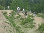
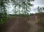
Popular Langley Mountain Biking Trails
• 95 ★ 0.0 • 1 mile • 19 ft • 359 •
Popular white difficulty gravel path. This multi-use trail can be used both directions. On average it takes 4 minutes to complete this trail.
• 100 ★ 0.0 • 2 miles • 10 ft • 232 •
Popular white difficulty gravel path. This multi-use trail can be used both directions. On average it takes 11 minutes to complete this trail.
• 90 ★ 0.0 • 863 ft • 0 ft • 192 •
Popular white difficulty gravel path. This multi-use trail can be used both directions. On average it takes minutes to complete this trail.
• 80 ★ 4.0 • 259 ft • 0 ft • 83 •
this trail is the third- hardest trail in the park. it also has an optional jump on the end
• 90 ★ 5.0 • 294 ft • 0 ft • 80 •
as the 2nd hardest trail at panzer park, this trail has quite a few jumps.
• 80 ★ 5.0 • 281 ft • 0 ft • 77 •
this is the easiest of the 7 trails in panzer park
• 55 ★ 2.7 • 1 mile • 61 ft • 57 •
This is a nice little length of single track that runs alongside 196th Ave and the Little Campbell river. Mostly smooth but with enough roots and hills to make things interesting. There are 3 small creek crossings, but they are all...
• 65 ★ 1.0 • 1 mile • 3 ft • 55 •
Moderately popular white difficulty gravel path. This mountain bike primary trail can be used both directions. On average it takes 9 minutes to complete this trail.
Langley Mountain Bike Routes
17 miles • 258 ft • 0 • Loop •
Just a quick road biking loop around Barnston Island. Perfect as a morning exercise ride.
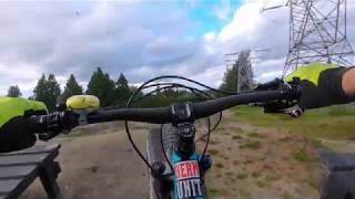
Photos of Langley Mountain Bike
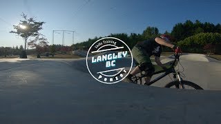
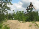
Videos of Langley Mountain Bike

0:12 |
928 |
Oct 5, 2011
youtuber
![Penzer Park Session]()
3:26 |
602 |
Aug 29, 2019
7:11 |
423 |
Aug 8, 2019
2:16 |
1035 |
Jul 27, 2008
6:28 |
274 |
Jun 30, 2008
2:39 |
572 |
Jun 18, 2008
0:06 |
252 |
Jun 7, 2008
0:07 |
67 |
Jun 7, 2008
Recent Trail Reports
| status | trail | date | condition | info | user |
|---|---|---|---|---|---|
| Golden Ears Greenway | Jul 19, 2026 @ 4:32pm (America/Vancouver) Jul 19, 2026 | Ideal | AlexanderSh | ||
| Canyon to Coast Trail | Aug 31, 2025 @ 2:26pm Aug 31, 2025 | Ideal | B-Bob | ||
| Canyon to Coast Trail | May 21, 2025 @ 5:48am May 21, 2025 | Variable | rapocalypse | ||
| Grumpy Gardens | Oct 1, 2023 @ 8:16pm Oct 1, 2023 | Ideal | bcrider02 | ||
| penzer park green trail | Jul 21, 2022 @ 9:13pm Jul 21, 2022 | Dry | bcrider02 | ||
| penzer park blue trail | Jul 21, 2022 @ 9:10pm Jul 21, 2022 | Dry | bcrider02 | ||
| Nathan Creek Dyke | Jun 24, 2022 @ 2:52pm Jun 24, 2022 | Ideal | canamemo | ||
| Campbell Jr. | Apr 19, 2021 @ 12:35pm Apr 19, 2021 | Dry | islandace | ||
| penzer park trail 02 | Mar 27, 2021 @ 4:09pm Mar 27, 2021 | Dry | jaredpalfrey | ||
| Canyon to Coast Trail | Nov 14, 2020 @ 1:38pm Nov 14, 2020 | Ideal | CraigHinCA |
Activity Feed
| username | action | type | title | date |
|---|---|---|---|---|
| AlexanderSh | add | report | activity #99588381 | Jul 19, 2026 @ 10:06pm Jul 19, 2026 |
| snokarver | wishlist | skillpark | activity #98307366 | Jul 2, 2026 @ 6:53pm Jul 2, 2026 |
| otad19 | add | skillpark | activity #97692311 | Jun 24, 2026 @ 6:21am Jun 24, 2026 |
| myles_1 | ridden | trail | activity #91393755 | Mar 27, 2026 @ 1:41pm Mar 27, 2026 |
| Kade17 | wishlist | skillpark | activity #90781531 | Mar 17, 2026 @ 10:27pm Mar 17, 2026 |
Recent Comments
| username | type | title | comment | date |
|---|---|---|---|---|
| trail | Jumps are gone. Only landings left now | Sep 8, 2025 @ 4:32pm Sep 8, 2025 | ||
| trail | Good warm up. Great jumps for less... | Jul 21, 2022 @ 9:10pm Jul 21, 2022 | ||
| report | Dic | Mar 17, 2021 @ 5:33pm Mar 17, 2021 | ||
| trail | Fywgyxwfjhwdjvgcdjwyvdfhshgcdceefdcge no... | Mar 17, 2021 @ 5:33pm Mar 17, 2021 | ||
| trail | Been here once, nice little spot | Sep 13, 2020 @ 11:27am Sep 13, 2020 |
Local Badges
-

Epic Ride Climb 2k6 awarded -

Climbing 10k Badge27 awarded -

Climbing 100k Badge1 awarded -

Epic Ride Descent 2k6 awarded -

Descent 10k Badge25 awarded -

Descent 100k Badge2 awarded
Bike & Skill Parks
| name | type | city | rating |
|---|---|---|---|
| Willoughby Bike Park | skill park | Langley | |
| Penzer Park | skill park | Langley | |
| West Langley Bike Park | skill park | Langley | |
| Langley BMX Track | skill park | Langley | |
| Yorkson Pump Track | skill park | Langley |
Activity Type Stats
| activitytype | trails | distance | descent | descent distance | total vertical | rating | global rank | state rank | photos | reports | routes | activity logs |
|---|---|---|---|---|---|---|---|---|---|---|---|---|
| Mountain Bike | 38 | 25 miles | 1,056 ft | 10 miles | 292 ft | #4,174 | #99 | 57 | 66 | 1 | 11,186 | |
| E-Bike | 1 | 3 miles | 190 ft | 2 miles | 194 ft | 46 | 1 | 232 | ||||
| Gravel Bike | 1 | 1,217 ft | 36 ft | #469 | #94 | 29 | ||||||
| Horse | 5 | 7 miles | 344 ft | 3 miles | 151 ft | #1,355 | #50 | 14 | 2 | |||
| Hike | 74 | 43 miles | 1,900 ft | 17 miles | 338 ft | #3,375 | #95 | 66 | 369 | |||
| Trail Running | 74 | 43 miles | 1,900 ft | 17 miles | 338 ft | #3,063 | #83 | 66 | 827 |
Frequently Asked Questions About Langley
▼
What are the best places to ride in Langley?
Langley has 3 areas to explore for mountain biking. The top rated areas are:
▼
What are the highest rated mountain biking trails in Langley?
The highest rated mountain biking trails in Langley are:
- penzer park inner loop (4.1/5)
- penzer park green trail (4.1/5)
- penzer park single black trail (4.1/5)
- penzer park trail 02 (4.1/5)
- penzer park blue trail (4/5)
▼
What is the best time of the year to ride in Langley?
Based on activity log data, the most popular months to ride in Langley are:
- July (61 activities)
- August (36 activities)
- June (35 activities)
▼
Where can I park to ride in Langley?
Activities
- By radek
 Trailforks SDBA & contributors
 - Admins: FVMBA - ADMIN, lee5986, meghanjackson, Graham-Macaulay
- #3562 - 20,168 views
- langley activity log | embed map of Langley mountain bike trails | langley mountain biking points of interest
Downloading of trail gps tracks in kml & gpx formats is enabled for Langley.
You must login to download files.