
close
3D
Trail Conditions
- Unknown
- Snow Groomed
- Snow Packed
- Snow Covered
- Snow Cover Partial
- Freeze/thaw Cycle
- Icy
- Prevalent Mud
- Wet
- Variable
- Ideal
- Dry
- Very Dry
Trail Flow (Ridden Direction)
Trailforks scans users activity logs to determine the most popular direction each trail is ridden. A good flowing trail network will have most trails flowing in a single direction according to their intension.
The colour categories are based on what percentage of users are riding a trail in its intended direction.
The colour categories are based on what percentage of users are riding a trail in its intended direction.
- > 96%
- > 90%
- > 80%
- > 70%
- > 50%
- < 50%
- bi-directional trail
- no data
Trail Last Used
Trailforks scans activity logs to determine the last time a trail was ridden.
- < 2 days
- < 1 week
- < 2 weeks
- < 1 month
- < 6 months
- > 6 months
Trail Ridden Direction
The intended direction a trail should be ridden.
- Downhill Only
- Downhill Primary
- Both Directions
- Uphill Primary
- Uphill Only
- One Direction
Contribute Details
Colors indicate trail is missing specified detail.
- Description
- Photos
- Description & Photos
- Videos
Trail Popularity ?
Trailforks scans activity logs to determine which trails are ridden the most in the last 9 months.
Trails are compared with nearby trails in the same city region with a possible 25 colour shades.
Think of this as a heatmap, more activities = more kinetic energy = warmer colors.
- most popular
- popular
- less popular
- not popular
ATV/ORV/OHV Filter
Max Vehicle Width
inches
US Cell Coverage
Legend

Radar Time
Activity Recordings
Trailforks uses anonymized public activity data.
?
Activity Recordings
Trailforks uses anonymized public activity data.
?
Winter Trails
Warning
A routing network for winter maps does not exist. Selecting trails using the winter trails layer has been disabled.
Missing Trails
Most Popular
Least Popular
Trails are colored based on popularity. The more popular a trail is, the more red. Less popular trails trend towards green.
Jump Magnitude Heatmap
Heatmap of where users jump on trails. Zoom in to see individual jumps, click circles to view jump details.
BC Backroad Status
![map legend]()
Service Road Atlas is a free to use, community-driven service for viewing and creating reports on the numerous back-country service roads around B.C. and Alberta.

Slope Aspect
Direction the slope faces
Trails Deemphasized
Trails are shown in grey.
Only show trails with no bike usage.
Suggested Layers
Based on selected activity type
Save the current map location and zoom level as your default home location whenever this page is loaded.
SaveThis region is Unsanctioned, Ride at your own Risk!
THIS NETWORK IS UNSANCTIONED. RIDE AT YOUR OWN RISK.
The land on which these trails are built is owned by several different private property owners and if you use these trails you may be considered to be trespassing.
The land on which these trails are built is owned by several different private property owners and if you use these trails you may be considered to be trespassing.
Primary Trail Type: All-Mountain & Downhill
eBikes Allowed:
Yes
AKA: Mckee Peak
Land Status: Private Property
 google parking directions plan a road trip here
Trail info last updated
Activities Click to view
- Mountain Bike
111 trails
- E-Bike
111 trails
- Hike
94 trails
- Trail Running
95 trails
Region Details
- 20
- 2
- 24
- 39
- 20
- 6
Region Status
Caution as of 6 hoursE-Bike Stats
- Global Ranking
- #1,067
- State Ranking
- #64
- Trails (view details)
- 111
- Trails Mountain Bike
- 111
- Trails E-Bike
- 111
- Trails Gravel Bike
- 27
- Trails Adaptive Bike
- 21
- Trails Winter Fat Bike
- 32
- Trails Hike
- 94
- Trails Trail Running
- 95
- Total Distance
- 40 miles
- Total Descent Distance
- 20 miles
- Total Descent
- 14,505 ft
- Total Vertical
- 1,506 ft
- Reports
- 5,513
- Photos
- 4
- Completed Counter
- 1,725
Popular Ledgeview E-Biking Trails
• 100 ★ 3.8 • 656 ft • 67 ft • 52 •
The final section of climbing single track from the North/West sides ("Tree Farm" hill grind not withstanding)
• 95 ★ 3.5 • 1,270 ft • 0 ft • 46 •
Popular blue difficulty singletrack. This mountain bike primary trail can be used downhill primary. On average it takes 1 minutes to complete this trail.
• 100 ★ 3.5 • 1,109 ft • 0 ft • 41 •
Easiest way down from the tower (excluding the climb).
• 100 ★ 4.4 • 3,796 ft • 3 ft • 41 •
A bit of a smashed potatoe. A little pedally in spots but with gravity ambitions. A handful of optional features from annexed The Big Rock wall ride (yet to be rebuilt) to a couple small old school skinnies and mild tech rock rolls and...
• 100 ★ 4.0 • 679 ft • 42 ft • 39 •
A connector to allow for complete single track climbing from both parking areas up to the "tree farm"
• 100 ★ 4.5 • 1,785 ft • 180 ft • 37 •
Built as an Up trail, but downhill friendly.
• 95 ★ 4.4 • 3,451 ft • 55 ft • 37 •
Some of the stunts on this trail are double black, but can easily be ridden as a blue trail. All jumps are gaps, so look before you leap.
• 100 ★ 4.7 • 1,742 ft • 202 ft • 35 •
A direct extension to Total Sanity (Beginning). While also climb primary but not closed to downhill traffic, the tighter switchback corners will limit speed in that direction. There is one very short, but mandatory skinny immediately...
Ledgeview Routes
12 miles • 2,270 ft • 5 • Loop •
Complete the Route in July to be entered in a draw for a prize from Independent Cycles. Be sure to record...
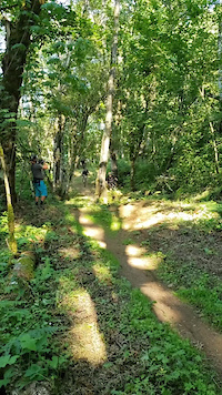
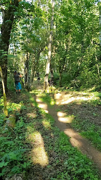
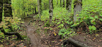
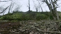
Photos of Ledgeview
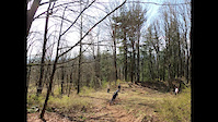
Videos of Ledgeview
Current Trail Warnings
| status | trail | date | condition | user | info |
|---|---|---|---|---|---|
| Junkyard Zombie | Nov 9, 2026 @ 10:40am (America/Vancouver) 2 days | Unknown | k-bo99 | trees |
Recent Trail Reports
| status | trail | date | condition | info | user |
|---|---|---|---|---|---|
| Flintstones | Nov 11, 2026 @ 2:48pm (America/Vancouver) 6 hours | Unknown | abbyRM FVMBA - WEST | ||
| Mr. Uppity (lower) | Nov 9, 2026 @ 6:08pm (America/Vancouver) 2 days | Variable | ryanharris12 | ||
| Berm Donor | Nov 9, 2026 @ 6:06pm (America/Vancouver) 2 days | Variable | ryanharris12 | ||
| Noodley Appendage | Nov 9, 2026 @ 3:47pm (America/Vancouver) 2 days | Unknown | abbyRM FVMBA - WEST | ||
| Upper Da Plow | Nov 9, 2026 @ 12:52pm (America/Vancouver) 2 days | Unknown | abbyRM FVMBA - WEST | ||
| Cakes and Pies | Nov 8, 2026 @ 5:23pm (America/Vancouver) Nov 8, 2026 | Unknown | bobalong | ||
| Grampa's Eyebrows | Nov 4, 2026 @ 3:42pm (America/Vancouver) Nov 4, 2026 | Unknown | abbyRM FVMBA - WEST | ||
| Guava Jelly | Nov 1, 2026 @ 9:01am (America/Vancouver) Nov 1, 2026 | Unknown | GandolftheWhite | ||
| J.Z. Jr. | Oct 26, 2026 @ 2:50pm (America/Vancouver) Oct 26, 2026 | Unknown | abbyRM FVMBA - WEST | ||
| The Way of the Noodle | Oct 19, 2026 @ 4:25pm (America/Vancouver) Oct 19, 2026 | Ideal | gsallenbach |
Activity Feed
| username | action | type | title | date |
|---|---|---|---|---|
| Kgc6778 | wishlist | trail | activity #107634836 | Nov 11, 2026 @ 5:19pm 2 hours |
| abbyRM | add | report | activity #107621400 | Nov 11, 2026 @ 1:48pm 6 hours |
| jenniemt | comment | report | activity #107519675 | Nov 9, 2026 @ 6:11pm 2 days |
| ryanharris12 | add | report | activity #107517478 and 1 more | Nov 9, 2026 @ 5:06pm 2 days |
| abbyRM | comment | report | activity #107505034 and 1 more | Nov 9, 2026 @ 12:58pm 2 days |
Recent Comments
| username | type | title | comment | date |
|---|---|---|---|---|
| report | Thanks for clearing it. | Nov 9, 2026 @ 6:11pm 2 days | ||
| report | clear now. please include the location in your... | Nov 9, 2026 @ 2:14pm 2 days | ||
| report | clear now | Nov 9, 2026 @ 12:58pm 2 days | ||
| report | clear now | Nov 4, 2026 @ 4:42pm Nov 4, 2026 | ||
| report | clear now | Nov 3, 2026 @ 6:57pm Nov 3, 2026 |
Nearby Areas
| name | distance | ||||
|---|---|---|---|---|---|
| Sumas Mountain | 15 | 10 | 4.2 km | ||
| Downes Bowl / McLure Hillside | 11 | 4 | 4.7 km | ||
| The Great Trail / Matsqui Dyke | 5.7 km | ||||
| Bear Mountain | 5 | 27 | 7 | 8.9 km | |
| Vedder River | 16 | 9.6 km |

Activity Type Stats
| activitytype | trails | distance | descent | descent distance | total vertical | rating | global rank | state rank | photos | reports | routes | activity logs |
|---|---|---|---|---|---|---|---|---|---|---|---|---|
| Mountain Bike | 111 | 40 miles | 14,505 ft | 20 miles | 1,506 ft | #84 | #12 | 2,179 | 7,000 | 20 | 40,994 | |
| E-Bike | 111 | 40 miles | 14,505 ft | 20 miles | 1,506 ft | #1,067 | #64 | 4 | 5,513 | 1 | 2,456 | |
| Gravel Bike | 27 | 13 miles | 2,142 ft | 4 miles | 1,499 ft | #62 | #11 | 840 | 97 | |||
| Adaptive Bike | 21 | 9 miles | 725 ft | 2 miles | 1,378 ft | #62 | #11 | 626 | 4 | |||
| Winter Fat Bike | 32 | 16 miles | 5,472 ft | 8 miles | 1,385 ft | #62 | #11 | 2,617 | 5 | |||
| Hike | 94 | 35 miles | 11,335 ft | 17 miles | 1,506 ft | #1,178 | #76 | 50 | 6,755 | 2 | 3,812 | |
| Trail Running | 95 | 35 miles | 11,516 ft | 17 miles | 1,506 ft | #1,508 | #54 | 3 | 6,762 | 3 | 3,993 |
Frequently Asked Questions
▼
What are the highest rated e-biking trails in Ledgeview?
The highest rated e-biking trails in Ledgeview are:
- Flintstones (3.7/5)
- Guava Jelly (0/5)
- Paper Route (0/5)
- Berm Donor (0/5)
- Just the Top (0/5)
▼
Where can I park to ride in Ledgeview?
There are 5 parking locations listed in Ledgeview. The most popular parking spots are: View all parking and trailhead locations on the map to plan your visit.
▼
What is the longest trail in Ledgeview?
The longest trail in Ledgeview is Noodley Appendage at 1.9 miles. View all trails sorted by distance.
▼
What are the best & highest rated hiking trails in Ledgeview?
The best hiking trails in Ledgeview are: View all hiking trails sorted by popularity score.
▼
What are the best & highest rated trail running trails in Ledgeview?
The best trail running trails in Ledgeview are: View all trail running trails sorted by popularity score.
▼
How many trails are in Ledgeview?
Ledgeview has a total of 111 trails. Browse top e-biking trails in Ledgeview to find detailed information including difficulty ratings, distances, and trail conditions.
▼
Which trail has the most elevation gain in Ledgeview?
The trail with the most elevation gain in Ledgeview is Noodley Appendage with 364 ft of elevation gain. View all trails sorted by elevation gain.
▼
Which trail has the most elevation descent in Ledgeview?
The trail with the most elevation descent in Ledgeview is Noodley Appendage with 943 ft of elevation descent. View all trails sorted by elevation descent.
▼
What activities are most popular in Ledgeview?
Ledgeview supports the following activities: Mountain Biking, E-Biking, Hiking, Trail Running.
▼
What are the steepest e-biking trails in Ledgeview?
The steepest e-biking trail in Ledgeview is Access2 with an average grade of 26.1%. View all trails sorted by grade.
▼
Are there any trails with scenic viewpoints in Ledgeview?
Yes, there are 2 scenic viewpoints marked along trails in Ledgeview. Some popular viewpoints include: Explore more points of interest to find trails with the best views.
▼
Are there any trails with waterfalls in Ledgeview?
Yes, there are 1 waterfall locations noted along trails in Ledgeview. View the points of interest map to discover trails near waterfalls.
▼
What trails have the biggest jumps in Ledgeview?
The trails with the biggest jumps in Ledgeview are: Browse all mountain bike trails to find trails with jumps and technical features.
▼
Are the trails open in Ledgeview?
The overall region status for Ledgeview is Minor Issue / Yellow. Out of 105 trails:
- Clear / Green: 84
- Minor Issue / Yellow: 6
- Significant Issue / Amber: 4
- Closed: 11
▼
What are the trail conditions in Ledgeview?
Based on trail reports from the past week in Ledgeview:
- Variable: 2 trails
▼
Can I ride an ebike in Ledgeview?
Yes, Ledgeview supports e-bike riding. There are 118 trails in Ledgeview that allow e-bikes. Check the e-bike trails listing for specific trail access details and any local regulations.
▼
What are the most popular e-biking routes in Ledgeview?
The most popular e-biking routes in Ledgeview are: View all e-biking routes in Ledgeview.
▼
What are the most popular Strava Segments in Ledgeview?
The most popular Strava segments in Ledgeview are:
- Guava Jelly (1,300 athletes)
- T.S.2 (1,232 athletes)
- T.S.3 (1,199 athletes)
▼
What trails are closed in Ledgeview?
There are currently 11 closed trails in Ledgeview. The breakdown of all trail statuses is:
- Clear / Green: 84
- Minor Issue / Yellow: 6
- Significant Issue / Amber: 4
- Closed: 11
▼
What are the most popular e-biking trails in Ledgeview?
The most popular e-biking trails in Ledgeview are: View all e-biking trails sorted by popularity.
▼
What are the best beginner ride trails in Ledgeview?
The best beginner e-biking trails in Ledgeview are:
- After Berm (0/5)
- Noodley Appendage (less) (0/5)
- Afterburn Trail (0/5)
Activities
Trails
- By dutch & contributors
- Admins: lostlunchbox, yoshia, FVMBA - ADMIN, lee5986, meghanjackson, Graham-Macaulay, FVMBA - WEST, cfriesen, Wesmacaulay
- #337 - 81,180 views
- ledgeview activity log | embed map of Ledgeview mountain bike trails | ledgeview mountain biking points of interest
Downloading of trail gps tracks in kml & gpx formats is enabled for Ledgeview.
You must login to download files.
