close
-
Layers w
- Weather Layers
- Pro
- Pro
- Pro
- Pro
- Pro
- Pro
- More Layers
- Pro
- Pro
- Pro
- Pro
-
Upgrade to

3D
Trail Conditions
- Unknown
- Snow Groomed
- Snow Packed
- Snow Covered
- Snow Cover Partial
- Freeze/thaw Cycle
- Icy
- Prevalent Mud
- Wet
- Variable
- Ideal
- Dry
- Very Dry
Trail Flow (Ridden Direction)
Trailforks scans users ridelogs to determine the most popular direction each trail is ridden. A good flowing trail network will have most trails flowing in a single direction according to their intension.
The colour categories are based on what percentage of riders are riding a trail in its intended direction.
The colour categories are based on what percentage of riders are riding a trail in its intended direction.
- > 96%
- > 90%
- > 80%
- > 70%
- > 50%
- < 50%
- bi-directional trail
- no data
Trail Last Ridden
Trailforks scans ridelogs to determine the last time a trail was ridden.
- < 2 days
- < 1 week
- < 2 weeks
- < 1 month
- < 6 months
- > 6 months
Trail Ridden Direction
The intended direction a trail should be ridden.
- Downhill Only
- Downhill Primary
- Both Directions
- Uphill Primary
- Uphill Only
- One Direction
Contribute Details
Colors indicate trail is missing specified detail.
- Description
- Photos
- Description & Photos
- Videos
Trail Popularity ?
Trailforks scans ridelogs to determine which trails are ridden the most in the last 9 months.
Trails are compared with nearby trails in the same city region with a possible 25 colour shades.
Think of this as a heatmap, more rides = more kinetic energy = warmer colors.
- most popular
- popular
- less popular
- not popular
ATV/ORV/OHV Filter
Max Vehicle Width
inches
US Cell Coverage
Legend

Radar Time
Activity Recordings
Trailforks uses anonymized public activity data.
?
Activity Recordings
Trailforks uses anonymized public activity data.
?
Personal Heatmap
▶
Activity Types
all
/
none
▶
Options
2
Date range
month
–
Winter Trails
Warning
A routing network for winter maps does not exist. Selecting trails using the winter trails layer has been disabled.
Missing Trails
Most Popular
Least Popular
Trails are colored based on popularity. The more popular a trail is, the more red. Less popular trails trend towards green.
Jump Magnitude Heatmap
Heatmap of where riders jump on trails. Zoom in to see individual jumps, click circles to view jump details.
BC Backroad Status
![map legend]()
Service Road Atlas is a free to use, community-driven service for viewing and creating reports on the numerous back-country service roads around B.C. and Alberta.

Slope Aspect
Direction the slope faces
Trails Deemphasized
Trails are shown in grey.
Only show trails with no bike usage.
Suggested Layers
Based on selected activity type
Save the current map location and zoom level as your default home location whenever this page is loaded.
Save
No description for Magic Valley has been added yet!
Login or register to submit one.
Region Details
- 121
- 3
- 59
- 97
- 25
- 1
Local Trail Association
Stats
- Avg Trail Rating
- Trails (view details)
- 415
- Trails Mountain Bike
- 309
- Trails E-Bike
- 281
- Trails Gravel Bike
- 4
- Trails Adaptive Bike
- 4
- Trails Horse
- 235
- Trails Hike
- 326
- Trails Trail Running
- 320
- Trails Dirtbike/Moto
- 240
- Trails Observed Trials
- 131
- Trails ATV/ORV/OHV
- 167
- Trails Snowshoe
- 4
- Trails Downhill Ski
- 80
- Trails Backcountry Ski
- 1
- Trails Nordic Ski
- 5
- Total Distance
- 961 miles
- Total Descent
- 146,723 ft
- Total Vertical
- 6,686 ft
- Highest Trailhead
- 9,702 ft
- Reports
- 1,047
- Photos
- 365
- Ridden Counter
- 9,996
Sub Regions
- Cassia County (43)
- Albion (8)
- Declo (6)
- Oakley (31)
- Castle Rocks (9)
- City of Rocks (14)
- Twin Falls (265)
- Auger Falls (36)
- Indian Springs (42)
- Magic Mountain (137)
- Hagerman Pipeline (0)
Popular Magic Valley Mountain Biking Trails
• 100 ★ 4.5 • 3,688 ft • 38 ft • 373 •
Highly rated popular blue difficulty singletrack. This mountain bike primary trail can be used both directions and has a moderate overall physical rating with a 38 ft blue climb. On average it takes 6 minutes to complete this trail.
• 100 ★ 1.0 • 397 ft • 10 ft • 282 •
Popular green difficulty singletrack. This mountain bike primary trail can be used both directions. Trail visibility is always easy to follow. On average it takes minutes to complete this trail.
• 95 ★ 3.5 • 2,992 ft • 34 ft • 273 •
Popular green difficulty singletrack. This mountain bike primary trail can be used both directions and has a easy overall physical rating with a 34 ft green climb. Trail visibility is always easy to follow. On average it takes 5 minutes to complete this trail.
• 100 ★ 3.0 • 2,516 ft • 30 ft • 266 •
Popular blue difficulty singletrack. This mountain bike primary trail can be used both directions and has a moderate overall physical rating with a 30 ft blue climb. Trail visibility is always easy to follow. On average it takes 2 minutes to complete this trail.
• 100 ★ 3.0 • 3,323 ft • 107 ft • 247 •
Popular blue difficulty singletrack. This mountain bike primary trail can be used both directions and has a moderate overall physical rating with a 107 ft blue climb. Trail visibility is always easy to follow. On average it takes 5 minutes to complete this trail.
• 100 ★ 4.4 • 5,253 ft • 23 ft • 223 •
Popular blue difficulty singletrack. This mountain bike primary trail can be used both directions and has a moderate overall physical rating with a 23 ft green climb. Trail visibility is always easy to follow. On average it takes 7 minutes to complete this trail.
• 100 ★ 3.5 • 1,529 ft • 9 ft • 222 •
Popular green difficulty singletrack. This mountain bike primary trail can be used both directions. On average it takes 1 minutes to complete this trail.
• 100 ★ 4.0 • 3 miles • 344 ft • 221 •
Popular green difficulty singletrack. This mountain bike primary trail can be used both directions with a 344 ft green climb. Trail visibility is always easy to follow. On average it takes 23 minutes to complete this trail.
Magic Valley Mountain Bike Routes
Trapper Peak Loop Featured
★ 5.0 • 12 miles • 1,758 ft • 6 • Loop •
A great loop for beginners the begins at the Porcupine Campground and follows the Oakley-Rogerson Rd until...
★ 5.0 • 21 miles • 3,179 ft • 4 • Loop •
Great mixed terrain trail. Can be overgrown in areas, increasing the difficulty slightly.
3 miles • 1,509 ft • 0 • Out & Back •
Enjoy this 7.7-mile out-and-back trail near Albion, Idaho. Generally considered a moderately challenging...
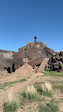
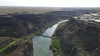
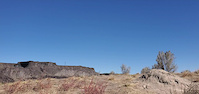
Photos of Magic Valley Mountain Bike
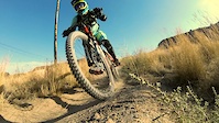
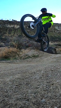
Videos of Magic Valley Mountain Bike
trail: Fevre Skills Park
0:20 |
21 |
Nov 26, 2024
trail: Tristan's Flow
0:09 |
35 |
Dec 22, 2023
trail: Tristan's Flow
0:56 |
42 |
Nov 28, 2023
trail: Fevre Skills Park
0:34 |
27 |
Nov 28, 2023
trail: Tristan's Flow
0:05 |
174 |
Sep 13, 2022
trail: Tristan's Flow
0:39 |
29 |
Sep 13, 2022
trail: Tristan's Flow
2:55 |
38 |
Sep 12, 2022
trail: Auger Falls
0:04 |
86 |
Dec 16, 2021
Recent Trail Reports
Activity Feed
| username | action | type | title | date |
|---|---|---|---|---|
| Joseph1r8ne | wishlist | trail | activity #98313791 | Jul 2, 2026 @ 9:58pm Jul 2, 2026 |
| hlkwentus | wishlist | skillpark | activity #97648675 | Jun 23, 2026 @ 1:18pm Jun 23, 2026 |
| Kadesm | wishlist | trail | activity #97604083 | Jun 22, 2026 @ 9:26pm Jun 22, 2026 |
| RobertLB88Fs | wishlist | trail | activity #97277376 and 1 more | Jun 18, 2026 @ 2:51pm Jun 18, 2026 |
| Drafthorse2 | add | report | activity #97211498 | Jun 17, 2026 @ 3:05pm Jun 17, 2026 |
Recent Comments
| username | type | title | comment | date |
|---|---|---|---|---|
| trail | dead fall is cleared within a mile of the... | Jun 17, 2026 @ 3:01pm Jun 17, 2026 | ||
| report | That "trail" has been like this since the late... | Jun 15, 2026 @ 3:32pm Jun 15, 2026 | ||
| trail | I rode the last 3rd of this trail and had a... | May 31, 2026 @ 9:29pm May 31, 2026 | ||
| trail | Very steep and loose rocky surface. Descending... | May 31, 2026 @ 9:27pm May 31, 2026 | ||
| trail | Road has been repaired as of Fall 2025 | Mar 29, 2026 @ 1:02pm Mar 29, 2026 |
Local Badges
-

Descent 10k Badge0 awarded -

Epic Mountain Bike Climb 2k0 awarded -

Completionist0 awarded -

Descent 100k Badge0 awarded -

Climbing 10k Badge0 awarded -

Epic Ride Descent 2k0 awarded
Bike & Skill Parks
| name | type | city | rating |
|---|---|---|---|
| Pomerelle Mountain Resort | bike park | Albion | |
| Magic Mountain Resort | bike park | Twin Falls | |
| Rock Creek Race Track | skill park | Twin Falls | |
| Rupert MX | skill park | Declo | |
| Fevre Skills Park | skill park | Twin Falls |
Activity Type Stats
| activitytype | trails | distance | descent | descent distance | total vertical | rating | global rank | state rank | photos | reports | routes | ridelogs |
|---|---|---|---|---|---|---|---|---|---|---|---|---|
| Mountain Bike | 309 | 894 miles | 123,041 ft | 406 miles | 6,686 ft | 297 | 1,016 | 6 | 15,745 | |||
| E-Bike | 281 | 841 miles | 112,064 ft | 380 miles | 5,164 ft | 17 | 989 | 2 | 896 | |||
| Gravel Bike | 4 | 32 | 1 | 13 | ||||||||
| Adaptive Bike | 4 | 2 | ||||||||||
| Horse | 235 | 794 miles | 108,707 ft | 362 miles | 5,558 ft | 375 | 4 | 26 | ||||
| Hike | 325 | 898 miles | 121,519 ft | 403 miles | 6,686 ft | 6 | 988 | 3 | 1,766 | |||
| Trail Running | 320 | 896 miles | 121,178 ft | 402 miles | 6,686 ft | 1 | 989 | 4 | 401 | |||
| Dirtbike/Moto | 240 | 797 miles | 110,846 ft | 363 miles | 4,800 ft | 42 | 410 | 4 | 104 | |||
| Observed Trials | 131 | 438 miles | 67,231 ft | 227 miles | 3,852 ft | 124 | 1 | |||||
| ATV/ORV/OHV | 167 | 598 miles | 88,094 ft | 294 miles | 4,800 ft | 1 | 334 | 1 | 10 | |||
| Snowshoe | 4 | 3 miles | 1,263 ft | 3 miles | 1,145 ft | 30 | 12 | |||||
| Downhill Ski | 77 | 19 miles | 13,301 ft | 17 miles | 1,870 ft | 86 | 398 | |||||
| Backcountry Ski | 1 | 2 miles | 1,145 ft | 2 miles | 1,145 ft | 30 | 88 | |||||
| Nordic Ski | 5 | 2 miles | 200 ft | 1 mile | 164 ft | 31 | 28 |
Activities
- Magic Valley Mountain Biking Trails
- Magic Valley E-Biking Trails
- Magic Valley Horseback Trails
- Magic Valley Hiking Trails
- Magic Valley Trail Running Trails
- Magic Valley Dirtbiking Trails
- Magic Valley Observed Trials Trails
- Magic Valley ATVing/Offroading Trails
- Magic Valley Skiing Trails
- Magic Valley Nordic Skiing Trails
Trails
Points of Interest
- The Box Top Sight
- Stripe Rock Sight
- Map Information
- Map Information
- Map Information
- Slide Creek Campground Camping
- Pike Mountain Overlook Viewpoint
- Bread Loaves Group Campground Camping
- Steinfall's Dome Summit
- Camp Rock Summit
- Matterhorn (10,663 ft)
- Marys River Peak (10,568 ft)
- Cougar Peak (10,541 ft)
- By chuktA
 TRAILFORKS NFTA & contributors
 - Admins: chuktA, IdahoEnduroSeries, macgyver96
- #14019 - 3,911 views
- magic valley activity log | embed map of Magic Valley mountain bike trails | magic valley mountain biking points of interest polygons
Downloading of trail gps tracks in kml & gpx formats is enabled for Magic Valley.
You must login to download files.